
This morning I got up around 5:30 AM and began getting packed up. I probably should’ve gotten up a little bit earlier, just to give myself more time to pack and also eat breakfast. But of course I stayed up a little late last night, so I was tired this morning. It can never be enough rest. Even if I took multiple days off, I swear I would still be tired at the end of it. I’m pretty far right now for the year, so I think this will probably be a theme for the remainder of this hike.
Once I was packed up, I headed over to the continental breakfast. I made a mocha and contemplated eating something. It definitely wasn’t the best spread though. Which was a little surprising because the hotel was pretty nice. But most of the breakfast items were prepackaged or microwave type stuff. I wound up sitting and getting everything uploaded for the day. Then talked to a hiker who I had met yesterday and the day before. He’s with the larger group of about five or so hikers who I ran into by the 549 trail magic, and then saw in the lobby of the hotel after I checked in.
Right after 6:30 AM Jay Go arrived to bring me back to the trail. It was so incredibly nice of him to offer to take me back. Being able to hit the trail around 7 AM after spending the night in town is definitely ideal. That’s something that I’ve been managing very well this year. Even when I stay in town, I always hit the trail early the next day. On prior hikes, it can be tempting to stay at the room until checkout. But you wind up having to hike so late into the evening that it really throws your entire schedule off. It’s never fun leaving the hotel first thing in the morning. But in the long run, it’s incredibly helpful.
Making my way up the first climb of the day! Coming up from the highway after leaving Tehachapi.
The ride back to the trailhead was short and sweet. Then I discussed some plans and things with Jay. His friend Mike is the one who’s going to be picking me up in a few days at Kennedy Meadows to take me to LAX. Jay has these really cool PCT sun hoodies that he distributes to hikers and Trail Angel‘s. So it looks like he’s going to leave one for me at Kennedy Meadows. Which would be nice because there’s a really good chance I won’t have time to shower or do laundry before getting on my flight. Anything is possible if I arrive there early enough. But I’m not banking on it. So it would be really nice to have at least a clean shirt to put on so that I don’t torture the people on the play next to me.

The weather was absolutely perfect as I set out this morning. I’m so glad I got a nice early start.
In a few weeks, I’ll probably reach out to Jay when I’m coming back out to California. Last night when I was discussing my plans and trying to coordinate with Mike, Jay had said that if for some reason Mike couldn’t take me to the airport on Monday, then Jay would be willing to do so. Which was really nice of him. The logistics of coordinating stuff like this can be pretty daunting. We’re talking about getting picked up in the middle of nowhere and driven 3–4 hours south to an airport. Typically when people flip and travel into this area, they wind up having to take at least one or two buses. Then get picked up from a bus station by a Trail Angel or Shuttle Driver. I really lucked out by crossing paths with Mike, who just happens to be off work the day I need to get to the airport.
Just after 7 AM I was back on the trail, beginning the long but gradual climb up from the road. It would go on for at least a couple of hours. I just tried to zone out a little and occupy my mind with some of the various logistics and things that I’ve been considering. It’s definitely a little stressful making the choice to flip back out east. Just like it was stressful to make the choice to come out here. Obviously weather and things like that are always in the flux, so you never know if it will be the perfect decision.

Passing by some more wind farms over the course of the day.
I had some people reach out suggesting that I go up to Oregon or Washington instead. But it’s actually a record snow year up there so there’s a good chance that even after I finish the East Coast and all of the PCT miles up until there, I still might be dealing with some snow in Oregon. Some people also recommended that I go out to New Mexico instead. But New Mexico is the only state left over for the calendar year triple crown which I’ll be able to hike in the month of November. Pretty much all other aspects of the trail that remains will not be safe to hike during that time. So I really need to try to complete the portions of trail that our weather dependent first. Also, it won’t be long before it’s way too hot in New Mexico to hike across it. I definitely thought about going out there. But if I can scrape together the miles which I can’t hike later in the year because of the cold and snow, then I’ll be in a good position. Saving New Mexico for last is really the most safe and reasonable option.

Apparently this year isn’t a super bloom. But even still, the trail has been so colorful and lush.
Sure, it would probably be better to go out in a couple weeks to the East Coast instead. But it’s kind of a shit shoot at this point. If I continue north on the PCT, I’ll be a slogging through a ton of snow. And I’ll probably wind up going so fast that I’ll get to Oregon before that snow is melted out. Which might mean I would have to flip out to the East Coast around that time either way. It just seems like the best decision in the long run to go and finish New Hampshire and Maine, and then come back out here after the Sierra have had a couple weeks to melt out.

The trail weaving down the ridge, with a wind turbine off in the distance.
A lot of the hikers who were a couple weeks behind me on the Appalachian Trail are just now getting into Vermont or finishing Vermont. At least the hikers who were on more of a time constraint and moving faster. I know there are a couple people doing the calendar year triple crown who should be getting to New Hampshire any day now. So it seems like the timing is pretty solid. And a contact of mine has said that Baxter State Park released a memo that they plan on opening Katahdin and the surrounding trails sometime in May.

Beautiful views off in the distance from a high point.
Either way, it’s tough to make these decisions. There’s some bad weather rolling in this weekend in the Sierra. And looking at the weather in New Hampshire I can see that there’s some rain and storms forecast for next week as well. There’s always going to be something. And in my experience, you will probably always have to take a day off somewhere in New Hampshire because of weather. It doesn’t matter if that’s in the winter or the middle of the summer, dangerous weather can roll through any time of year in that area. I just have to look at the mileage and try to plan around that and attempt to maybe get to a road or something if there is bad weather rolling in next week.
I was surprised that those first two hours of the day went by really quickly. I didn’t wind up seeing another hiker until I was up toward the top of that first climb. Then the trail leveled out a lot and I sort of just rode along small hills for the next couple of hours. I would have another two or so climbs to do at some point over the course of the day. But other than that, the rest of the day was going to be pretty chill. I went past a lot more wind farms once I got up to the top of that climb. I ate some snacks and drank as much water as I could. Pretty soon I would be coming to the first water source of the day, which was about 17 miles in from the road.
It was around 12:30 PM when I came to that next water source. I remembered getting here in 2022 and being pretty nervous about my ability to get water. It snowed all day and the temperature was very low. So I was genuinely concerned that the slight trickle of the stream could be frozen. I know a source I passed earlier in the day wasn’t accessible because of snow. But I believe I was able to get water at this next piped spring back then.

A surprisingly green and lush section of the trail, even with some trees!
When I arrived today, there were a handful of hikers taking a break and getting water. The piped spring didn’t have the most gushing flow, but it would certainly work. The next water source that’s right near the trail is 20 miles from here. And halfway between here and there is another water source. But that water source was just 10 miles away is a cumulative 1.8 mile side trail. It’s almost an entire mile down and an entire mile back. There’s just absolutely no way that I can add that mileage to my day. I totally understand how some people will have to go to that source. But being able to do almost 40 miles in a day definitely makes the water situation a lot easier for me.
Because of that I plan to just carry out 3.5 L of water from this source, which will probably be overkill for the next 20 miles. But it would give me a little bit of comfort just in case for some reason I have to set up camp before that next source. It’s funny that even though I’m doing 35–40 miles every single day, I still try to make thoughtful decisions and not rely on that mileage. I won’t book rooms in town or things like that until I’m closer, just because a lot can happen. Banking on the ability to do such big mileage could pose problems if anything goes awry. That’s why I haven’t bought my plane ticket yet to fly back to Boston. I know I’m going to do 37 miles today and probably 40 miles the following two days. There’s really not a doubt in my mind that I’ll be able to manage that mileage. I’ve been managing it for weeks. But even still, I try to wait until I’m a couple days into a section before making concrete plans of any kind. Just like I try to carry extra water just in case of an emergency, even though there likely won’t be one.

The sun briefly dipping off behind clouds in the distance, darkening the sky.
I just don’t like to put myself in a situation where I have to be uncomfortable or make a tough decision because I wasn’t completely prepared. It’s easy to get over confident after spending so much time in the back country. Especially once such huge mileage becomes your comfort zone. So I try to never get too comfortable, because that’s when issues arise.
After I filled up water, I continued along the trail. It would be pretty level with hardly any elevation gain for the next 10 or so miles. Then toward the end of the day, there would be a gradual tiered climb with a few different humps to go up and over. I saw a bunch more people over the course of the day. But overall, the trail was a lot more quiet than I expected. I imagine there are a lot of people somewhere up ahead of me. Just based on how many signatures there were in the logbook this morning.
When I walked through this section of trail, I reminisced a lot about 2022. Somewhere about 20–30 miles north of here is where I camped for the night before a snowstorm. I woke up in the middle of the night to go pee and found there were inches of snow on the ground already. I remember going back to bed and being pretty anxious that the snow would obstruct visibility on the trail and make it difficult to follow the path. Fortunately, this section of trail is pretty well groomed and marked. But there were a ton of downed trees through this area. Even still today there were lots of downed trees to go over.
In 2022 it was very difficult to find my way back to the trail when I would go up and around those trees. No one else was on trail. I had absolutely no footprints to follow. But all of a sudden when I was hiking a funny thing happened. I started noticing some tracks up ahead in the snow. Except they were bear tracks! The bear was following a path of least resistance around the blown down trees, providing me with a fantastic route to follow. I wound up following that bears tracks for miles through the area with all of the downed trees. Which was incredibly helpful and very unexpected.
This section of trail is so crazy well manicured. It’s nice to be back and able to enjoy the trail, rather than struggling through inches of snow and brutal cold. It wound up snowing on me for most of the day in 2022. Then eventually I made camp and the following day I got into Tehachapi. This time around is so incredibly different than that.

I crossed over the 600 mile marker a little ways before my camp site for the night.
After a few hours, I wound up passing by that next water source, which was very far off trail. Right before I got there I passed by two hikers who recognized me. Their names were Super Tramp and Granola, and they’re both really nice. They couldn’t fathom how I’ve already made it so far along the trail. I talked to them for a few minutes and then just continued on with my day.
I imagined there would be a lot of people at the next water source, just because the mileage spread is too much for most people to manage. A 37 mile day is not very reasonable by any means. There were about 10 hikers set up near the junction for the night. I assume they all set up camp and then walked down to get water without their backpacks on. Which is a very smart move. But I just kept pushing past there with another 10 miles to go for the day. Maybe a little bit less.
Over the next hour or so a pretty gradual climb would begin. I only had to go uphill for a mile or so before the trail leveled out again. Then I spent another mile doing some relatively flat trail and downhill, before going up the next moderately short climb. The cycle repeated itself a few times before the end of the day. Over the next couple hours I passed by a few more hikers. They must’ve just grabbed water and then pushed on to dry camp. Which makes sense because the next water source will be close for them to hit it pretty early tomorrow morning.
Eventually I made my way up the last time of the day, which was exciting. I passed a few hikers who were sitting and taking a break right around 7 PM. It was nice to see some people hanging out who weren’t set up for the night. I asked them where they were headed and they said they were going to push on a few more miles to the next water source. Which meant we would be camping together for the night! How exciting to hear. It’s lovely to know that at least someone will be set up there. Though I assume a few people will be for sure, either way. Those two hikers were named Stag, Cherry, and Isabella. Stag recognized me and asked my name to confirm who I was. And I told him I was excited to camp together and that I would see them there. Then I continued on with only another hour to go for the day.

Lovely views as the sun slowly began to set on the day.
The next climb wasn’t too bad. I was just excited to be done for the day though. My body is feeling good, I’m just pretty sleepy today. I don’t know exactly why. But ever since the middle of the day when I passed out first water source my eyes are just so tired. I wound up going really slow for those next couple of hours. When I checked my watch, I was pretty shocked to see that I wasn’t even going 3 mph for a while. But it was just one of those days.
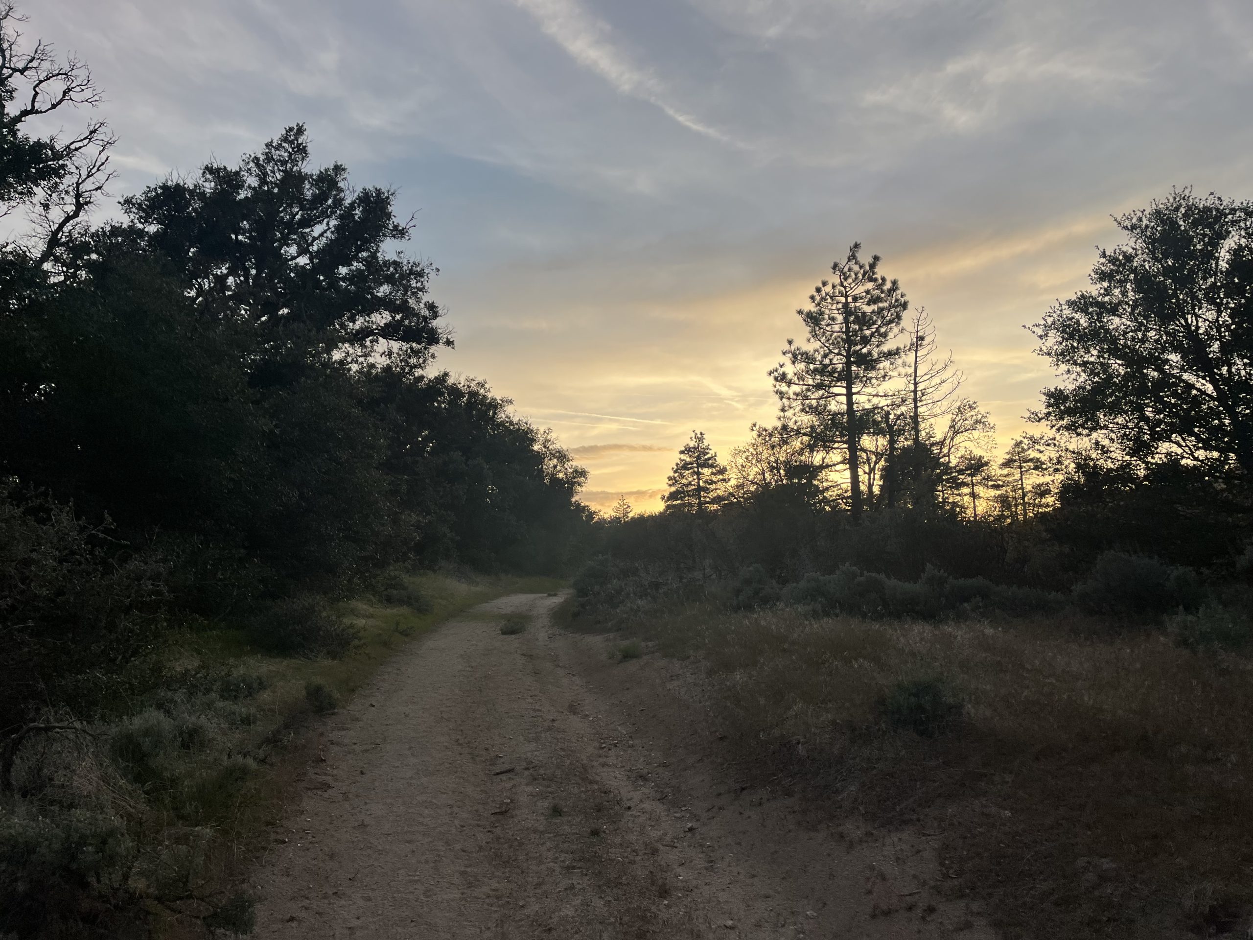
It wasn’t too shabby ending the day with a bit of dirt road walking.
As I got closer to the water source, I watched a beautiful sunset. The sky was so lit up and the trail was high enough to get some great views. For a mile or so I followed along a dirt road. Then got back onto some actual trail just before the water source. The spring is down a side trail, but only 100 feet or so. It was a super short walk to get there. And it also wasn’t really optional either way. Tomorrow morning my next water source that I’m banking on is about 13 miles into the day. Though it looks like there are some seasonal streams prior to that.

Lovely pink skies as the sun set. Just before I arrived at my tent site for the night.
There were a few tents set up in the area surrounding the water source. But I tried to pick a spot that would enable the other three hikers behind me to also set up comfortably. I always feel bad setting up my tent right by another tent when it’s later in the evening. But it was only just after 8 PM.
I got my tent up and then got everything situated inside. Then grabbed water and filtered some for tonight and tomorrow. After that, I just ate something and laid in my quilt. I didn’t really have much energy to get writing done. Luckily though the trail has been so nice and easy lately, that it’s been enabling me to get a lot of work done throughout the day. I didn’t wind up rolling over until sometime after 9:30 PM, but then called it at night.
If you enjoyed this blog and would like to support my hike by buying me a soda or a snack along the way, there is a “Tip the Author” button below! It links directly to my Venmo. Any and all support is incredibly appreciated!


