
The Fishermen’s Trail (Trilho dos Pescadores) traces the rugged Atlantic coastline of Portugal — a 140-mile (226 km) journey from São Torpes in the Alentejo to Lagos in the Algarve. The scenery is breathtaking: jagged cliffs, secluded coves, and the ocean shimmering in every shade of blue. Storks soar overhead, nesting on wind-battered rock spires above the crashing waves. And along the steep coastal paths, I keep crossing paths with fishermen casting their lines from the traditional pesqueiros — places where sea and people have met for generations.
Trail Overview of the Fishermen’s Trail (Trilho dos Pescadores)
The Fishermen’s Trail is part of the larger Rota Vicentina network, but it is distinguished by its purely coastal route.
Location: Portugal (Alentejo & Algarve coast)
Distance: ~140 miles / 226 km
Time: 7 – 12 days
Start/End: São Torpes → Lagos, Portugal
Total Elevation Gain: ~16,500 feet
Highlights: Wild Atlantic cliffs, stork nests on sea stacks, hidden beaches, charming fishing villages
Best season: October to April (avoid crowds in peak season)
Camping: Wild camping possible but unofficial
Navigation: Well-marked with green and blue trailblazers
Difficulty: Easy
Getting There
Before hitting the trail, I spent five days in Espinho, near Porto. I had planned to surf and relax, but instead found myself battling a stubborn cold. Still, I managed a couple of short 6-mile warm-up hikes along the coast — enough to shake off the rust.
Day one doesn’t start by the ocean, but with a goodbye. A friend drops me off at the train station, where I step into the first leg of a new adventure. My destination: the Fishermen’s Trail in southern Portugal. But first, I have to navigate the urban jungle of Porto — starting with the quest for a working bathroom in the bus terminal. It feels like the setup for a bad joke: the first restroom is for employees only, the second is men’s only, the third has an endless line — all in a terminal packed with hundreds of people. Eventually, I find relief.
Boarding the long-distance bus, my anxiety kicks in. Do people actually follow assigned seat numbers? Sometimes yes, sometimes no. Here, apparently yes. I can’t find my seat — the number is hidden somewhere — and others look just as confused. People blocking the aisle, who don’t budge an inch, leave me feeling like some invisible intruder. But eventually, I’m in my seat. Deep breath.
Three hours to Lisbon, then another bus headed south, two hours toward Sines.
After spending five days in Northern Portugal, I head South to start the Fishermen’s Trail
Day 1: Starting the Fishermen’s Trail in São Torpes
São Torpes – Porto Covo
6.2 miles / 330 ft elevation gain / 2.5 hours
After arriving in Sines, I order an Uber to São Torpes, the official starting point of the Fishermen’s Trail. There is no bus to get here, and it’s too late to walk the additional 3 miles along the busy road to get there. It’s hotter than expected — much warmer than up north in Esphino — so I quickly swap leggings for shorts and throw on my sun hoody. Backpack on, and off I go. It’s already 5 pm when I start hiking.

Start of the Fishermen’s Trail
The first few miles follow the coast. The industrial port of Sines soon fades behind me, though the massive cranes are still visible far in the distance. Looking south, the view is already more promising: blooming ice plants line the trail, the Atlantic sparkles in vivid turquoise, and a narrow sandy path winds its way along reddish cliffs. The salty scent of the sea is ever-present.
Even this early in the hike, I spot plenty of great wild camping spots — sheltered hollows above the surf, soft dune crests, hidden coves. But tonight I’ve booked a hostel. I wasn’t sure if my health would allow me to hike, so today’s 6 miles are a trial run. I’ll see how it goes from here.
Along the way: vanlife dreams and surfers. I forgot to fill up on water — not ideal, but I’ll manage for a couple of hours.

Van-Lifers living the dream in Portugal
Most hikers actually start in Porto Covo. The stretch from São Torpes is said to be less scenic. I’d strongly disagree — I already love it. Dunes, cliffs, sandy beaches, and a vibrant bloom of wildflowers: white and yellow or bright pink ice plants, red-yellow blanket flowers, white rockroses, and the sweet scent of rosemary and thyme. The closer I get to Porto Covo, the more dramatic the coast becomes. Craggy cliffs, sea stacks rising from the ocean, tiny coves, and crystal-clear water. Some parts look like they’ve been painted.

The hostel in Porto Covo is one of those hipster spots full of muggles and loud music, but it’s right on the coast, with a perfect sunset viewpoint just steps away. I sit on a cliff bathed in golden light, the Atlantic glowing orange below me.

Sunset in Porto Covo
My dorm seems to be filled with fellow hikers. I spot a pair of Altras, though mostly I see heavy leather boots. Who hikes on the beach in those? They practically scream blisters ahead.
The night is far from restful. For some reason, the dorm door won’t close, it’s noisy outside, and someone snores like a freight train. Even earplugs don’t help much. Tomorrow I’ll camp wild — I sleep better that way.
Day 2: Heat, Sand, and the Big Blackout
Porto Covo – Ponta das Barcas – Vila Nova de Milfontes – Praia da Angra do Cozinhadouro
16.6 miles / 1,250 ft elevation gain / 7 hours
The day starts like something out of a zombie movie: hundreds of people on the trail, an endless stream trudging through the dunes like a slow-moving horde. I try to dodge them, taking side paths, lingering to notice the details — but I can’t truly escape. And where the people go, trash follows. White flowers of toilet paper bloom behind every bush. I don’t get it — how hard is it to pack out your waste? This is why I hike trails that span thousands of miles: to get away from all this.

The bitter reality behind the pretty photos of today
Eventually, I find my own little path down to the beach, far from the masses. Finally, I can breathe. The noise fades. The wind carries the scent of salt and silence. I find fascinating rock formations and shells clinging to them. Some of the stones are covered in mossy, fibrous algae, flowing like soft green fur over their surfaces — as if someone had combed the landscape. The colors are striking: bright green algae on pale sand, next to rusty red slabs of rock and the deep blue of the Atlantic.

Fort of Ilha do Pessegueiro with some cool algae rocks
I pass the 16th-century Fort of Ilha do Pessegueiro almost absentmindedly. It’s impressive, but the crowd has me overstimulated. Only later in the morning does it quiet down. I start to understand the rhythm: most hikers leave the towns at 8 am and hike to the next one, arriving mid-afternoon. If I avoid staying in towns, it might get better.
Later, I sit in the sand watching surfers and sampling Portuguese supermarket snacks:
- Snack #1: “Fruit & Form, wild berry flavor” – surprisingly good! Fruity, not too sweet. 9/10
- Snack #2: Pistachio protein bar – Dry, tastes like plastic, barely edible. 1/10

Watching surfers from the Fishermen’s Trail
Then the midday heat hits — and it hits hard. No shade anywhere. For me, it feels worse than Southern California on the PCT or New Mexico on the CDT. The sandy paths make walking exhausting. I’m sweating like crazy and, of course, I didn’t bring enough water. I trudge along orange-red cliffs glowing in the sun while waves crash on the rocks below. Sweat drips from my face. I finally collapse under the only bush I can find — at least it’s some shade.

My favorite view of the day
In the packed café at Ponta das Barcas, I try to order Coke and water, but the line moves slowly thanks to unnecessary debates and no concept of personal space. I edge farther and farther back, nearly fusing with the wall — but no matter how much I retreat, people just keep closing in. I switch tactics and plant my hands on my hips to create a 8 inch buffer zone. There are no seats left, so I settle on a bench outside. No shade, but at least it’s quiet.

My second favorite view of the day
Here, I learn that there’s a nationwide power outage. No signal, no internet, no further information. When I reach Vila Nova de Milfontes, the restaurants and stores are closed. I refill my water and move on. The ferry across the wide Rio Mira isn’t running, so I walk the bridge instead — 2.5 extra miles in the heat. At least there’s some shade in between trees on the other side. And finally: solitude. No other hikers in sight. Most really do seem to go only town to town.
My shorts start chafing my thighs — for the first time ever. It must be the heat and the sweat. My shoes are full of sand. For the first time, I wish I had gaiters. I’m exhausted, overheated, dehydrated, and — surprise — not eating enough. It makes me too anxious to go to a restaurant, and the supermarkets were closed due to the blackout. At least I have a pack of emergency instant noodles I can cold-soak.

Cold-Soaked ramen by the Ocean
In the evening, I find a beautiful cowboy camp spot on a cliff. I lay out my pad on the red rock, take off my shoes, and wind down with a view of the shimmering sea. Waves crash below, the sun sinks, and I eat my cold-soaked noodles with an ocean view — what a treat. But at 10 pm, I’m forced to move and set up the tent. Mosquitoes are tearing up my face, and it’s too hot to cover myself with the sleeping bag. Who knew there would be so many mosquitoes right by the sea?
Later that night, a text comes through — a bit of signal is back: “Power connection is gradually being restored. With serenity, we will guarantee essential services and normalization of the situation in the next hours. / ANEPC”
Serenity? Good for you. Apparently, it’s causing quite some chaos as it affects 60 Million people, marking one of the most significant blackouts in recent European history. It disrupts essential services across the Iberian Peninsula, such as transportation (trains, subways, and airports came to a standstill), communication (mobile networks and internet are down), healthcare (hospitals have to rely on backup generators), and commerce (ATMs and card payments stopped working, leaving many businesses unable to operate).
Day 3: Sweat and Storks
Praia da Angra do Cozinhadouro – Almograve – Cabo Sardão – Entrada da Barca – Zambujeira do Mar – Monte Carvalhal da Rocha
20 miles / 1,380 ft elevation gain / 7.5 hours
The day begins with the sound of crashing waves and a sunrise that paints the sky above me pink. My tent is pitched in a hollow above the Atlantic, surrounded by juniper, sand, and little yellow blossoms. Gulls glide silently overhead. By mid-morning, cell service returns — and apparently, so does power. Only now do I read the news: the blackout affected all of Portugal and parts of Spain. Hours of total shutdown — though out here, I barely noticed.

First morning on the Fishermen’s Trail
The sky remains overcast at first, but the air is heavy — warm and humid. I don’t think I’ve ever sweated as much in my life as I have these past two days. The coastline here is wilder than I expected. The cliffs are layered like open books — jagged, folded, dramatically beautiful. The ocean below is turquoise, the foam brilliant white. I stop often, just to marvel. Sometimes I forget I’m hiking — I’m too busy soaking up the shapes and colors. A fisherman balances on slippery rocks below, wielding a long stick and a plastic basket, searching between the crevices for something I can’t identify. I wonder how often he does this. Daily? For decades?

I follow the green-and-blue trail markers of the Fishermen’s Trail — sometimes painted on rocks, sometimes on wooden posts. It’s constant up and down, never extreme, but noticeable. In Almograve, I treat myself to a sandwich and juice for breakfast, plus a small resupply: ramen, snacks, water. The sun breaks through, and it heats up again — though not as brutally as yesterday. I’m grateful for the salty breeze brushing over the cliffs.

Along the way: storks, nesting on wind-battered rock pillars just above the crashing waves. I’m speechless. I’ve never seen storks like this. Nowhere else in Europe do they nest on cliffs like these — usually it’s trees, church towers, or chimneys. What looks precarious is actually a strategic breeding spot: safe from predators, with open views and access to new food sources.
There are several reasons for this behavior. Aside from safety from foxes, cats, or martens, the coast lacks modern buildings storks can use. Climate change also plays a role — the milder coastal climate now supports year-round nesting pairs that no longer migrate to Africa. Storks are opportunistic: they eat insects, mice, frogs — but also fish, crabs, and marine organisms. The coast provides new foraging grounds — especially estuaries, lagoons, and unfortunately, landfills.
Between Sines and Lagos — right along the Fishermen’s Trail — there are now hundreds of cliff nests. A fascinating example of adaptation and resilience.

I stop for lunch in Cavaleiro. It takes me 40 minutes just to get to the front of the line to order a Bifana. The restaurant is hopelessly understaffed, but I mainly came here to charge my phone. It’s definitely a Plus to also devour Portugal’s beloved sandwich made with thin slices of marinated pork served on bread. The meat is tender, garlicky, and often soaked in a vinegary sauce that gets absorbed by the bread. It’s juicy, messy, and incredibly satisfying after a long hike. Basically, Portugal’s answer to the pulled pork sandwich, but with fewer frills and way more flavor. You’ll often find it served plain, but cafés sometimes add mustard, hot sauce, or even a fried egg and fries (bifana com ovo e batatas). It’s cheap, filling, and perfect hiker fuel.
On the way out of town, I meet two cats looking for affection. There’s always time for that. And something I’m much better at than interacting with people. One of them looks a bit scruffy, and while scratching her ears I find two ticks, which I carefully remove. Moments like this make my day.
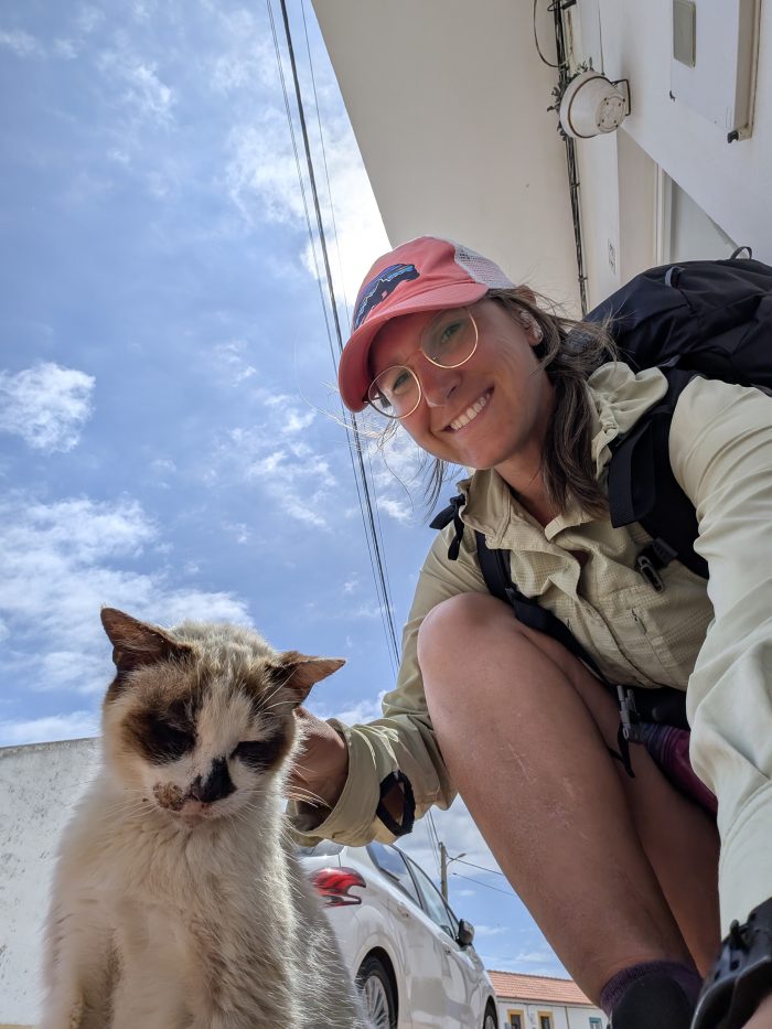
Making friends with the locals in Cavaleiro
In the afternoon, the landscape turns more dramatic. Jagged cliffs, the trail hugging the very edge. Far below, hidden coves with golden sand framed by dark rock. I reach Cabo Sardão, a white lighthouse with a red roof, standing proudly on steep slate cliffs. The water around it is a surreal turquoise — almost like it’s been dyed. I could stay here forever.

The path leads through a tunnel of wild greenery, offering shade. The ground is soft and sandy. I hear only my own steps. No cars, no people — just nature. In the afternoon, I arrive at Entrada da Barca, a tiny fishing hamlet that looks like something from a postcard. A small harbor with turquoise water, colorful boats lowered into the sea by ramp, and rustic shacks decorated with buoys and nets. It’s like the sea decided to move in and make itself at home. Everything feels so still and lovingly chaotic — nets, barrels, boats. For a moment, it feels like vacation.

Then it’s road walk time to Zambujeira do Mar, with its whitewashed houses, narrow lanes, and the chapel of Nossa Senhora do Mar, overlooking the ocean and dedicated to the fishermen.
Just outside town, I spot a public restroom with showers and outlets — exactly what I need! But of course: it’s closed. So I head to the Monte Carvalhal da Rocha campground. The campground is about half a mile uphill off the trail, and on the way there, I’m surprised by the sight of yaks and zebras grazing next to the road — part of the nearby wildlife park. Maybe today I’ll get that small dose of comfort I’ve been hoping for. And I do: for €10 I get a tent spot under eucalyptus trees, a hot shower, a place to charge my devices overnight, and I can hand-wash my sweaty clothes. There’s even a restaurant on site. I don’t see any other hikers — just a cyclist and van lifers. One of them in a Trabant — that iconic little car built in East Germany, famous for its noisy two-stroke engine and cardboard-like body — now sporting a rooftop tent. We had one of these tiny box cars too as I was born in former East Germany. There weren’t many choices in the DDR, and we had to wait over 10 years to get one since availability was low. Nowadays, only hardcore lovers of these quirky old-timers still have one.

At the campground
Day 4: Coast, Cats, and Cake
Monte Carvalhal da Rocha – Azenha do Mar – Odeceixe – Rogil – Pedra da Mina
19.3 miles / 1,480 ft elevation gain / 7 hours
In the morning, I struggle to get up — I’m still not feeling 100%. Because of the late start, I end up merging with the crowd that set off earlier from Zambujeira do Mar, just a few miles away.
Several hikers inch down a steep section, not keen on letting anyone pass. I veer left, scramble cross-country, and go around them. Sometimes you just have to step out of line — literally.
The trail today shows its full range: jaw-droppingly beautiful, occasionally frustrating, sometimes just plain confusing. And once again, there are plenty of storks — unflappable observers on their absurd cliffside nests. On one rock, I spot three nests side by side — and with a bit of luck, I can see chicks in them.
The Fishermen’s Trail is rerouted inland for a stretch here, with a sign warning of landslides on the coastal path. But nothing’s closed, so I go for it. Instead of danger, I find a small jungle with a stream — a bit overgrown, but easily navigable. And then: Praia de Amália. A hidden cove framed by rugged cliffs. A waterfall spills from a crack in the rock, draping it like a veil. I’m alone — the others must’ve followed the signs. A moment that feels like a gift.

Praia de Amália
I stop at Café Palhinhas in Azenha do Mar. There are cats, cake, and ocean views. As I devour my slice, a sailboat glides through the water below. For a moment, I wonder if I’ve fallen off a cliff and gone to heaven. No idea how I got here, but I like it.

Cake, Cats & Coastal Views — I’m in Heaven
I reach a small harbor, and from there it’s a steep uphill — which, of course, causes another hiker traffic jam. The trail continues along the cliffs, offering incredible views of natural stone arches and caves, little bays, and — you guessed it — more storks. I now understand why it’s so hard to make progress here. With all the beauty, detours, and hidden gems, how are you supposed to keep moving?
Approaching the beach of Odeceixe, I can already see from above that the river separating me from the other side is low enough to cross. It must be low tide. I head down and wade through the Rio Seixe like many others, skipping the long detour through the town and over the bridge. I take off my shoes but keep my socks on — they need a wash anyway. It’s my first time crossing a river in just socks, and it feels surprisingly good. Honestly, I’m the kind of person who doesn’t like taking off their socks unless it’s for a shower.

River crossing at Odeceixe
I lay on the beach for a while, drying out my rain-soaked tent in the sun, and basking like a lizard. Then I head to one of the many beach bars for lunch and treat myself to a surprisingly good burger and salad. For the first time on this trail, I even find a public restroom that’s actually open. That alone feels worth celebrating.
From here on, I improvise. I don’t want to follow the trail inland — I want to stay along the coast and avoid towns as much as possible. According to the map, it should be doable. And it works — until it doesn’t. The “trail” ends abruptly at a crumbling rock wall. I backtrack, try a new route, bushwhack through some shrubs. Eventually, I end up in the town of Rogil after all, passing quickly through its streets, looking for a way back to the coast — another gamble based on the hope that I can cross tomorrow’s river at low tide as well. Otherwise, it’ll be a frustrating 8-mile detour into Aljezur.

Staying at the coast as much as possible
It’s late, but I make it back to the sea just in time for sunset. With the sandy trail in the foreground, soft evening light, and the dramatic silhouettes of umbrella pines, it feels like a gateway into another world. The pines stand tall and peaceful, like quiet guardians of the day’s end.

Back to the coast after a short inland detour
My tent is tucked between pines, sheltered from the wind. I’m starving, so I stuff the leftovers of my lunch into my mouth while watching the sun go down. So far, I haven’t needed my rainfly — just the mesh inner tent to keep the evening mosquitoes away — and that means I have a completely unobstructed view of the breathtaking night sky above me.
Day 5: Hares, Old Ropes, and Battery Woes
Pedra da Mina – Monte Clérigo – Arrifana – Da Bordeira até ao Mar
19 miles / 2,560 ft elevation gain / 7.5 hours
Today I see my first hare. Up to now, it’s mostly been gulls, storks, lizards — and some impressively large stag beetles. I arrive at the Ribeira de Aljezur, which I hope to cross to stay along the coast and avoid the detour into the town of Aljezur. Low tide isn’t until 11:30 a.m., and it’s only 10:00 when I reach the river. I see a surfer cross and fall once — no big deal for him, but a problem for me. I really don’t want to get my gear wet. The river isn’t deep at all, but the current is strong. I walk up and down, looking for a wider section — shallower water, ideally. My first attempt fails, the current is too strong for me to make it to the other side. So I wait another hour, breathe deeply, and try again — this time close to the surf zone, where incoming waves cancel out the current. It works. A small test of patience and the laws of physics: passed.

River crossing to skip Aljezur
On the other side, the trail climbs steeply. A tiny bird hops ahead of me, pausing every few steps to proudly show off its prize — a still-singing grasshopper — then hops a little farther. I call him Leapfrogger. We play our own little trail game.
I spot another hiker struggling through deep sand with a huge pack — no trekking poles. I have to respect the effort. That’s definitely not the easy way to hike. Since Odeceixe, it’s been quieter on the trail; most people hike only from Porto Covo to there. Now I mostly meet hikers going the other direction — which honestly seems like a great idea to beat the crowds.
By midday I reach Monte Clérigo — time for a break, some food, and of course… charging. My miles before lunch are getting shorter each day, but honestly? I have time. And there’s just so much to see.

Monte Clérigo
All along the cliffs I keep noticing old ropes — hanging from rocks, installed long ago by local fishermen. These men are deeply tied to the coastal culture, and I keep running into them throughout my hike. They use traditional fishing spots called Pesqueiros, often hard-to-reach ledges directly on the cliffs. To get there, they rig ropes, metal rods, and carved footholds into the rock — precarious but effective.

Can you spot the ropes?
Most of these fishermen are older men. The traditional cliff fishing style is physically demanding and dangerous, and younger generations often prefer more modern jobs. But the older ones? They grew up with it. They know the tides, the best fishing hours, the places that won’t flood at high tide. It’s not just about food — it’s pride, skill, identity. I often see them with long, flexible rods — today made from fiberglass or bamboo, in the past from natural materials. These rods allow them to cast far into the sea from dry rock — avoiding the deadly pull of the waves. They mostly catch sea bream (douradas), European bass (robalos), sometimes even octopus or smaller rockfish. This form of fishing is considered intangible cultural heritage (património imaterial). In some coastal towns, knowledge about Pesqueiros and fishing techniques is passed down through generations. It’s a matter of honor to reach a difficult spot or land a good catch. Many families still know “their” Pesqueiros.
Back in the day — and in some places still today — each fisherman had his own Pesqueiro. A specific rock or secret cliff ledge with the right mix of depth, fish density, and manageable current. These spots were never marked. And when you see them standing there — still, patient, completely in their element — you can feel that deep, quiet bond between man, ocean, and cliff. A kind of silent pride.

Fishermen on a cliff
Just before Arrifana, I reach the ruins of a coastal fort — little more than a few crumbling walls, but offering a stunning cliffside view. Built in 1635 to protect the almoçadas, the tuna traps anchored below, it was later destroyed by a wave triggered by an earthquake. A place full of stories — of wind, sea, and centuries gone by.

In Arrifana, I stop by a hostel bar — quieter than the packed restaurants and cafés, as today’s a public holiday and a long weekend in Portugal. Everything is fully booked all the way to Sagres. It turns out my power bank isn’t holding charge like it used to, and I have less juice than expected. So once again I sit there waiting over an hour — just to get to 50%. The sheer number of photos I’m taking drains my battery like crazy. Not an exaggeration: I average about 450 photos a day on the Fishermen’s Trail.

Arrifana
After Arrifana, the trail heads inland for a while, past scattered homes, farmland, and gravel roads. And then: trail magic. Someone left a box with lemon tea and cookies on the roadside — a true act of kindness.

Trail Magic on the Fishermen’s Trail
When I approach the coast again, a thick layer of clouds hangs in the sky, but right in the middle it splits open dramatically. Through this crack, powerful rays of sunlight spill down, casting an almost otherworldly glow. The beams sweep across the hills like fingers from the sky, reaching down to the Atlantic where the light dances silver on the water.

Back on the coast
Just in time for sunset, I reach the coast again and find a beautiful clifftop camp spot. The last light turns the sky violet, the clouds pink, and the sea into a quiet sheet of molten lead. My tent is nestled among red succulents that cling to the rock like twisted roots — wild and beautiful, like the trail itself.

Campspot of Day 5 on the Fishermen’s Trail
Day 6: Stormy Night and a Long Day
Da Bordeira até ao Mar – Carrapateira – Vila do Bispo – Praia do Telheiro
19.7 miles / 2,790 ft elevation gain / 7 hours
The night was wild. I fall asleep to absolute calm — and keep waking up to sudden storms. Lightning flashes across the sky, followed by gusts of wind, and by 4 am, thunder is rumbling loudly overhead. Sleep? Impossible. The sky is raging. My tent, perched on an exposed clifftop, offers little comfort. I’m nervous. But stumbling through darkness and rain to find better shelter doesn’t sound appealing either. I lie there, tense, hoping it’ll pass. Nope. Heavy rain and wind gusts hammer my tent, pushing it dangerously inward. Only around 6 am does it calm down, and I manage to squeeze in one last hour of rest.

It’s just about 3 miles to Carrapateira, and I’m desperate to charge my phone and power bank. My new strategy: plug in at a hostel while shopping in the local minimarket. The morning is cold and rainy, but things improve once I’ve stocked up. I have my first (if awkward) conversation with another hiker walking in the opposite direction. It doesn’t go great — we talk past each other, I think. People are hard for me.
I eat a banana and a chocolate croissant, down a liter of juice, and get moving again. The next stop isn’t far — a beach café where I stop only because I need power again. I order a Bifana with egg and fries, plug in, and wait. I book a night at a hostel in Sagres for tomorrow, just to finally fully recharge, shower, and hopefully find a second cable and wall charger. This battery situation is really wearing me down.

A sunhoody is a good choice for the Fishermen’s Trail: It not only protects from the sun, but it also doubles as a way to hold your hat, so it doesn’t get blown away by the strong winds
Soon it’s hot again and the sweat returns. A few steep climbs, but they’re short. Then comes one of the most stunning parts of the trail — a landscape that reminds me of Iceland. Possibly my favorite view of the entire Fishermen’s Trail: I stand high above the coast, looking down at a jagged rockscape where dark, sharp-edged formations jut out into the sea. The cliffs are layered like open books — tectonically folded, eroded, and revealed again. A dramatic rock tower stands alone, like a sentinel rising from the water. Below, waves crash into a rocky bay lined with black stone and pale sand. The contrast of deep Atlantic blue, ashen strata, and warm orange-brown rock feels almost surreal — as if someone painted it deliberately. In the distance, green hills roll inland. It’s a place that feels both powerful and peaceful — like time and nature have carved it together.

What a view!
After that: a monotonous road walk, which I’m actually grateful for — I can make some miles and save battery by not feeling the urge to take photos. I reach Vila do Bispo just as another rain shower starts. The public toilets are — as always — locked. My first hope: dashed. I head to Aldi. There’s a toilet there, but no outlets. I bounce from socket to socket, but my power bank is nearly useless now. So I move on. Resupply, search, hope. On a bright note: I spot some Trader Joe’s products at Aldi — a small, unexpected hello from another world. Apparently, Trader Joe’s belongs to Aldi, I had no idea.

Vila do Bispo
The only charging option left is a café. No hostels in town. I order a sandwich and a Guaraná Antarctica, a Brazilian soda I’ve discovered here in Portugal. I plug in again and try not to touch my phone. I finalize my Sagres hostel booking — fingers crossed I’ll make it that far with what charge remains.
I hike much farther than I planned today. Not out of ambition, but necessity. No sheltered campsites until the cliffs before Praia do Telheiro. Just a windswept plain of low vegetation. So: keep walking. Keep searching. Keep breathing. Tomorrow will be a short day — and that’s something to look forward to.
I eventually find a sheltered spot between juniper bushes and set up camp just as the sun begins to set in a spectacular display of light and shadow. Thick, dark clouds gather over the ocean, but a glowing gap opens in the sky, and from it, beams of light stream down like divine fingers. The colors range from deep violet and warm orange to golden edges lining the clouds. The sky feels alive, almost turbulent — like it’s pouring all the day’s energy into one final, breathtaking moment. Below, the jagged coastline lies still, silhouetted in shadow — a perfect contrast to the drama above.
It’s a scene full of tension and calm — like a promise that after a long, stormy day, peace will return.

Sunset on Day 6 on the Fishermen’s Trail
Day 7: A Well-Deserved Nearo — With a Lighthouse, Cats, and Amatriciana
Praia do Telheiro – Cabo de São Vicente – Sagres
8.3 miles / 1,040 ft elevation gain / 3 hours
Today’s plan: just 8 miles — and thank goodness, because my foot (the one with the osteonecrosis) has been hurting since yesterday. I must have stepped wrong. But after the most restful night of the trail so far — no mosquitoes, no storms, just silence — I’m ready for a proper nearo.

Good morning
In the morning, I reach the red-and-white lighthouse at Cabo de São Vicente — the “southwesternmost point of Europe.” Geographically, it’s not actually Europe’s westernmost tip — that title belongs to Cabo da Roca near Lisbon. Or the Azores, if you count islands. But Cabo de São Vicente has the cooler lighthouse, more dramatic cliffs, stronger winds, and french fry stands. Historically, it was the departure point for sailors heading west into the unknown. For the Phoenicians, Greeks, and Romans, this was the end of the world — they called it Promontorium Sacrum. They believed the sun hissed as it sank into the ocean here. So… it kind of counts.

Lighthouse at Cabo de São Vicente
By the roadside, I pass a food truck advertising the “Last Bratwurst Before America,” complete with a smiling sausage on the roof. I’m not planning to head to America anytime soon, but I appreciate the sentiment. The stand is still closed, though — which is probably for the best.

Last Chance for Bratwurst before America
A light drizzle follows me into Sagres, where I check into the hostel by midday. Shower, recharge all my devices, and — best of all — cuddle with the hostel cat (who later tries to steal another guest’s lunch with surprising athleticism).

Cuddling the Hostel Cat on my Nearo
The hostel has a cozy, welcoming vibe — turns out it’s also a dive hostel. I manage one of three (yes, three) successful social interactions today when I ask what there is to see underwater. The answer? Coral, anemones, nudibranchs, octopuses, rays, small fish — and a few cool caves. I’m tempted, but decide I’m here for hiking this time.
I head to the Intermarché in town and finally find a second charger and cable, so I can charge my phone and power bank at the same time. Over 8,700 miles of long-distance hiking, and I’m still learning. No matter, how short and urban the trail is, bring a two-port-wall-charger and two cables. I grab some picnic food and spend the afternoon at the beach. I even put my feet in the ocean, without socks. Does that count as swimming?

Beach Time in Sagres. Shout-out to all sock-loving neurodivergents! I never understood the romantic idea of walking barefoot on the beach to be a desirable activity.
In the evening, I treat myself to dinner at an Italian restaurant I’d picked out beforehand. I say “Just for me” as confidently as possible to the waiter at the door, and sit down solo. Bruschetta, followed by Pasta all’Amatriciana. Everything is delicious. The pizzas look amazing too. I’m proud of myself today.
I booked a four-person dorm to reduce my chances of encountering snorers. No luck. I got two. The perks of a hostel.
Day 8: Dinosaur Tracks and the Last Night in My Tent with Frozen Lasagna
Sagres – Salema – Barrancão
14.5 miles / 3,190 ft elevation gain / 6 hours
I start late today — around 9 am — on purpose. There are only about 19 miles left to the end in Lagos, and I’ve got two days to get there. No need to rush. The sky is moody: intense but short rain showers sweep in repeatedly, driven by wind that tears at the cliffs.

A gloomy morning in Sagres
I pass a pond where a loud frog concert is underway. These little amphibians are like shadows in the reeds — you hear them long before you see them. I take my time trying to spot individual brown frogs, which isn’t easy thanks to their excellent camouflage. Only when I move do I see dozens of them leaping away in every direction.

Hello, Mr. Frog!
More stork nests appear — by now they feel like familiar companions. They perch dramatically atop a rock spire directly above the turquoise Atlantic, looking like it could topple into the sea with the next gust of wind. And yet, there they are: three fluffy young storks, safe and sound. I wonder how they don’t just get blown out during storms.
Turns out, one parent usually stays with the chicks in strong winds or rain, sitting protectively over them, wings slightly outstretched like a roof. They often position themselves so that wind and rain are deflected. The adults only leave briefly to hunt if absolutely necessary. If the weather is too extreme, they wait it out — the chicks can go several hours without food as long as they’re warm and dry.
The nests themselves are also cleverly built: deep, with a little hollow in the middle where the chicks sit lower than the rim. The outer structure is open to wind, but the inside is soft and insulated, which cushions gusts. And although these rock pinnacles look exposed, the birds are careful: they choose stable, less windy spots with natural windbreaks like ledges or rock indentations. Still, sudden storms can be tragic — especially if the nest is damaged or the parents don’t return. But these cliffside nests actually offer more protection than you’d think — especially from ground predators.

One of the crazy Stork Nest
At a secluded beach in a sheltered cove, I discover a small sea cave. I stand inside, looking out through the stone archway at the calm ocean.

Caves on the beach
In Salema, I find a different kind of highlight: dinosaur footprints, right there in the rock on the beach. How cool is that? The tracks were left by a herbivorous ornithopod about 125 million years ago. Three short, rounded toes are still visible — almost like it just walked by.

Dinosaur footprints on Salema Beach
Salema was a fishing village for centuries — and it shows. You can still see active fishermen, small boats resting between traps and nets, and a black cat overseeing the scene. I walk uphill through narrow streets lined with white houses, pastel-colored doors and windows, and the classic Portuguese blue ceramic tiles known as azulejos.

Salema
Back on the coast, I pass the ruins of Forte de São Luís de Almádena, built in the 17th century to protect the region’s valuable tuna fisheries from pirates. Today, only fragments of walls and fortifications remain — but the view from up here is magnificent. History and landscape blend into one quiet, wind-whipped vantage point above the Atlantic.

Forte de São Luís de Almádena
By 5 pm, I start looking for a sheltered campsite. From here, things get more urban, and I’m unsure about wild camping options. The wind is howling, and more rain seems likely. There’s a bittersweet feeling in the air: the last night camping. The last evening in nature. Tomorrow: civilization.
Tonight’s dinner is frozen supermarket lasagna. I sit inside my tent and eat it straight from the plastic tray. These are the little weird moments I’ll remember. It actually tastes better than expected — or maybe I’m just that hungry. A true hikertrash moment.

Hikertrash Deluxe: Thawed Frozen Lasagna
I crawl into my sleeping bag one last time and listen to the wind in the pines. Saying goodbye to a life I love.
Day 9: Cliffs, Crowds, and Cravings for Schnitzel
Barrancão – Burgau – Luz – Ponta da Piedade – Lagos
14.5 miles / 3,180 ft elevation gain / 6 hours
The final stretch to Lagos — just 12 miles to go. The day starts quietly, with the familiar wild coastal vibe: red and ochre rock formations, blooming wildflowers, and the turquoise sea shimmering far below. In the distance, I can already spot the white houses of Lagos — the finish line is in sight, but not quite within reach.

Getting closer to the end
The closer I get, the more I feel it: I’ve arrived in tourist territory. Sun umbrellas, packed restaurants, tanned vacationers clutching ice cream — the summer season on the Algarve is in full swing. I pass through smaller towns like Burgau and Luz, where colorful facades and pastel holiday homes line the narrow streets. In Burgau, an old coastal battery ruin reminds visitors of times gone by. In Luz, palm trees line the streets — I only stop to refill my water. At least here in the Algarve, public restrooms are actually open.

Burgau
At the famous Ponta da Piedade, things get truly hectic. Most visitors stick to the boardwalks, though. I veer off, following narrow cliffside trails to discover hidden viewpoints overlooking the surreal rock formations — like something out of a fantasy film. Below me, the grottos and coves glow in shades of turquoise and emerald. Boats glide between them. Yellow kayaks dance on the waves. Two young men leap boldly from the cliffs. A lighthouse stands watch over it all.

Ponta da Piedade
I take one last chance to step into the Atlantic — well, kind of. I’m not really a jump-in-for-fun kind of person. Snorkeling, diving, surfing — sure. But just being wet? Meh. And sandy feet? Absolutely not. I often keep my socks on even at the beach (shout-out to all sock-loving neurodivergents!). My brief dip in the ocean only confirms this: it smells like algae and fish, the saltwater is sticky, flies are pestering me. Nope. I’m good. That’s enough, I’m leaving.

Beach in Lagos
Then comes the final leg: along the harbor inlet, past the marina, over a small drawbridge. The official endpoint? Underwhelming: the train station of Lagos. But I did it. The Fishermen’s Trail is behind me. Ta fixe!
That evening, I treat myself to dinner at a Bavarian restaurant. Weird in Portugal? Maybe. But Portuguese cuisine is very fish-heavy — not my thing. I’m craving schnitzel, potatoes, and asparagus. I’m served two giant schnitzels, which means: schnitzel sandwiches for tomorrow!
I spend the night in a private room. In Lagos, there’s plenty of budget accommodation, and it’s easy to find a single room for €30. Finally, peace and quiet — at least in theory. The windows barely muffle the street noise, but it’s still a big step up from the dorms.

Completion of the Fishermen’s Trail in Lagos, Portugal
These last few months haven’t been easy. I was supposed to be on the Arizona Trail right now, but that didn’t work out. I longed for that stillness and simplicity hiking usually gives me. I only found it in fragments this time — but also: I slowed down. I was by the sea. I listened to the waves. I could breathe again.
But honestly? I wouldn’t recommend hiking it in late April. It’s so crowded — a full-on migration from town to town. For me, it was often too much. I was constantly searching for quiet corners and alternate routes. It was an emotional rollercoaster — but through one of the most beautiful coastal landscapes I can imagine. Once again, I’ve realized: Nature is incredible. People, less so. I love watching the world, I don’t like interacting with it.
I’ll definitely be back — with a van, to surf, to feel free. But next time? In winter.
This coastline is magic.

Sunset in Lagos, Portugal
Planning Your Own Hike on the Fishermen’s Trail
Getting there is easy: Fly into Lisbon, take a bus to Sines, then a short Uber to São Torpes. At the end, Lagos has train and bus connections back to Lisbon.
Resupply is simple, with small markets and cafés in almost every town. Accommodation is abundant but fills up fast in peak season — unless you camp. Wild camping isn’t officially legal, but it’s widely tolerated when done respectfully.
If you start early and stay ahead of the crowds, you’ll get magical sunrises, quiet trails, and empty beaches — and avoid the daily wave of hikers moving town to town. Late April was crowded between Porto Covo and Odeceixe. I recommend March as the best time of the year as you will already get the wildflowers and the nesting storks. Otherwise, winter is a great time if you want a more secluded experience.

The Fishermen’s Trail in Portugal


