
Last night, I managed to sleep a little bit on the plane. It definitely wasn’t the most comfortable night obviously. You can really only get so comfortable and stretch out so much in those small airplane seats. But I definitely slept a little bit. My flight got into Boston right around 7 AM And then I grabbed my checked bag and met my dad.
I know I saw him a few weeks ago here in Boston, but it is so nice to see your family again. It’s too bad the timing isn’t working out to actually see my mom and more family. But I’m very grateful that my dad was able to meet me today, pick me up at the airport, and drive me back to New Hampshire. It took about 2 1/2 hours to drive from Boston to Hanover, NH. While we were driving I reached out to a few different people and was checking the weather a lot. Today is Tuesday and the weather in the area looks really good today and tomorrow. Then it seems pretty decent for most of the day on Thursday. And Thursday night a nor’easter is going to be passing through the area. That should be dropping some substantial snow on the higher peaks.
I reached out to some of the people from The Notch Hostel just to get some opinions on the conditions. Personally, I really only trust the opinions of people who have serious experience hiking through this part of the country. I’ve had plenty of people reach out, saying that this weather is only going to result in rain. But if you aren’t checking the weather forecast for the high mountain passes, then you aren’t getting a well rounded and informed overlook of the weather.
I have a pretty loose plan of attempting to do as much mileage today and tomorrow as possible. Then Thursday and Friday I could do a couple shorter days to get over some of the easier peaks. My hope would be that by Saturday and Sunday the weather has mostly settled. If the wind is low enough, I should hopefully still be able to get up and over Franconia on Saturday and the Presidentials on Sunday. I’m well aware, though that weather is changing constantly and I’m going to just have to take it one day at a time.
Once I got to Hanover, my dad and I stopped at a couple stores. Recently, one of my trekking poles stopped locking into place. So I’ve only had one working pole. Which was totally fine for the PCT where I really didn’t even use them at all. But it would be nice to have two for the rougher conditions out here. Especially if I’m going to be making my way through snow. And I was concerned at the possibility of breaking my only working pole. Because my tent requires the pole in order to be set up. I think getting a new set was a really good idea just to be extra cautious.
Back in Hanover, NH!
Then I went to a grocery store and got some last food to get me through the next couple days. And my dad and I parked somewhere so that I could start going through my backpack, re-organizing everything, and switching some of my gear out. The only major things that I am changing or adding or that I am taking micro spikes with me. Currently, I’ve heard there’s basically no snow left on the trail up here. And I’m not sure how useful spikes will be in fresh snow. But I think having them is going to make me feel a lot better just in case. Most likely within a week I’ll send them back home.

Making my way toward Velvet Rocks.
I also switched out my alpha 90 and got my alpha 120 back. The temperature up in these mountains can be crazy cold especially with the windchill. I think I’ll appreciate having the warmer layers for at least the next week or so. I also switched out and got a different Nitecore power bank. I got another of the smaller banks, which I’ve really been liking.
While I did all this packing my dad got some pizza so that I could just eat quickly and then get back to trail. Then once everything was packed up, I got ready to roll. My backpack felt a little bit heavy with the additional gear. I’m sure I added a pound or two between everything. I picked up a handful of those hand warmers as well. I think those will be a really good emergency resource if things get crazy. Those do really good job of keeping you warm.
Then I say goodbye to my dad and headed the rest of the way through town! The Appalachian Trail passes right through Hanover. Then you go past a co-op and behind a soccer field, where the actual trail picks back up. It felt so weird to be back on the Appalachian Trail. I know I was only gone for three weeks, but the PCT was so drastically different. Less than 24 hours ago I was out on the PCT and hadn’t even made it to Kennedy Meadows South yet. Now here I am back on the AT! It’s really hard to wrap my mind around.
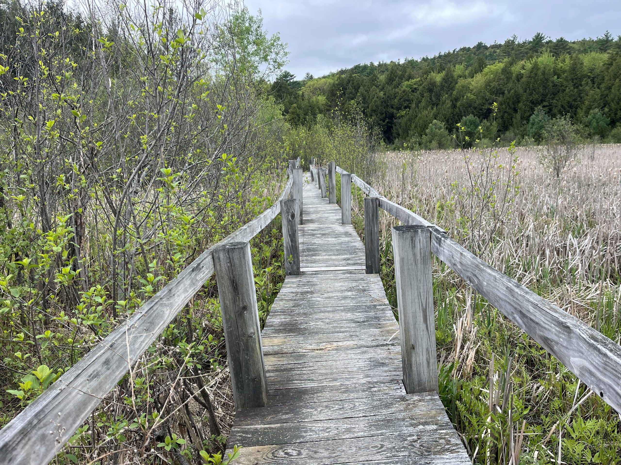
Walking along a cute wooden boardwalk.
Once I was back in the woods, the trail began climbing almost immediately. Initially, I was thinking that it would take some getting used to. Obviously the PCT has a significant amount of elevation gain, but the grade is much more manageable. I was surprised though the ones that climbing started I actually felt really strong. The first 10 miles of the day were pretty cruisy. I made my way up toward velvet rocks, then the trail leveled out a bit for a few miles. But over the course of the day, I was mostly going to be going uphill.

My first trail magic back on the AT! And only a few miles in.
After another few relatively easy miles I began to climb up to Moose Mountain. Which I was pleasantly surprised by. I think the grade was fairly nice and easy. One of the things I like a lot about New Hampshire is how rocky it is here. I think that the variable grade and terrain actually is easier on your body at times. You’re not just burning one muscle group consistently. The trail is switching up so frequently that you’re sort of working your entire body. Which in some way is harder, but in other ways is actually easier. At least for me.

I thought this sign was hilarious.
Moose Mountain has a southern and northern peak. The two are about a mile or so apart, with a fairly easy amount of elevation gain in between. I got service up toward the top and decided to watch some YouTube while I walked. I won’t actually watch the videos, but I’ll listen to the audio. I know I’m going to be in a hostel tomorrow night so I didn’t have to worry about draining my battery. At this point in the day, I was already planning to go fairly far. So I figured it would be a nice treat to listen to some videos while I had service. I knew that would help to pass the time by more quickly.

There were some really cool AT signs along the trail today.
Once I got up and over the northern peak, there was a fairly steep to send. But it really wasn’t too bad at all. Then almost immediately once I got down, I began another climb up to a peak with no name. It was very similar in elevation gain to the previous climb. And honestly, I got up to the top before I even knew it. I think having done this trail before I have an expectation that the climbs are going to be very hard. So I’m pleasantly surprised almost every single climb. In between now and the last time I did this trail I’ve hiked so many miles. I think I’ve done over 11,000-12,000 more miles since the last time I was out here. I’m so different than the hiker that I used to be in so much stronger.

I felt lucky to enjoy some great views on my first day back out east.
The next climb brought me out to Holt’s Ledge which was really pretty. There were actually fantastic views all day today. The sky was blue and clear and I couldn’t have asked for anything else. I know that as the days go on, weather is going to turn very quickly. But I’m just happy to enjoy some good weather today and tomorrow if I can. There are some comments on FarOut saying the descent of this next mountain was super steep. But I was actually pleasantly surprised that it wasn’t too bad.

The south peak of moose mountain.
The trail dropped you down to a road which I walked along very briefly. Then went through a grassy field before getting back into the woods. Around this time, I saw a sign for an upcoming shelter. Tonight I was planning on tent camping toward the top of Smarts Mountain. But somehow, I completely forgot that there’s a fully enclosed fire warden cabin up there! It’s not marked as a separate icon on FarOut, so I didn’t even notice.

This sign was cool, but no longer accurate! The trail is longer now so the mileage is off.
That was a very exciting surprise! Now I was even more stoked to get to the top of the mountain and camp for the night. I’ll be able to be nice and dry and warm this evening. Then I’ll be staying indoors tomorrow night and possibly the next night as well. once I got through the next parking area, I had a relatively gradual climb up to some ledges. This would be the last available option for camping unless you went all the way to the top of the mountain. And I was shocked that I actually walked past the tent! When I was out here before a few weeks ago, there were absolutely zero hikers on trail. But now that it it’s been a few weeks there are actually up here.
I continued to pass the tent and made my way up the rest of the climb. On my way up I got some great views along the ledges. Then the climb went up and over some very large exposed boulders. Before taking me back into the woods again. I knew I’d be walking in the dark this evening, but didn’t realize how late the sun sets here now. I pulled my headlamp out and was expecting it to get dark around 8 PM. But I didn’t even have to turn it on until closer to 8:20-8:30 PM. That was a big surprise.

Climbing up some ledges, heading up Smarts Mountain.
I forgot how steep the final ascent was up Smarts Mountain. I was making pretty decent time until I got closer to the top. Then the last mile or so or crazy steep. We’re talking having to use my hands a little bit on boulders, and some sections with rebar and wood steps. Obviously it wasn’t anything too crazy, but I had just totally forgotten that it was technical at all.
That slowed me down a little toward the end of the day, which wasn’t ideal. I just wanted to cruise along and make as good of time as possible. But you just can’t rush these things. As I got closer up to the top, it got pretty misty. It definitely wasn’t raining, but there was a lot of moisture in the air. Every now and then I brushed up against a tree and it dropped some water on me as well. I was very warm though because of how steep the climb was.

The sky was beautiful just before the sun set.
It was just before 9 PM when I got up to the top of the mountain. There’s a privy up there and a fire tower. And I knew that there was an old fire warden cabin. But because it was dark out, I really struggled to find the cabin. I wandered around for probably 10 minutes looking for it. I remembered it being very close to the fire tower, but didn’t remember exactly where it was. And because of the thick pine forest up at the top, it was super hard to see. I was honestly thinking I was going to have to sleep in the shelter on top of the fire tower. Because at this point, I was a little bit damp and cold and did not want to set up my tent.
Eventually though after over 10 minutes of wandering around, I managed to see a structure through the woods. At least enough to assume it was the cabin. I was so relieved to head over there and get into the cabin for the night. But when I went inside, I scared the living hell out of someone. I’m still used to there being no hikers out here. That’s what the case was when I was out here a few weeks ago. So I was not expecting a guy to be sleeping in the shelter.
I woke him up and apologized profusely. Stating that I didn’t realize anyone was in here and that it was cold and wet outside and I was definitely going to be sleeping inside. Then I tried to get set up for the night as quietly as possible. I ate some dinner and boiled water to make a hot chocolate. I was shockingly very cold. Just because I’ve been so sweaty when I got to the top of the mountain, then spent 10 minutes slowly, wandering around looking for the cabin.
I should’ve probably stopped immediately and put some layers on, but I was so preoccupied by finding the building. By the time I actually got inside I was very cold. But I put layers on right away and felt a lot better after I had a hot drink.
I had a bit of service and wound up, laying up and checking the weather for the next few days. It looks like the storm is going to be its worst Thursday night, but there’s still might be some rain or light snow in the days that follow. I did attempt to look at the map and make some alternate plans. But there are hardly any portions of the trail between here and Canada that are at lower elevation. Just about everywhere above 3000 feet is going to get at least dusting of snow. So I think it’s going to be next to impossible to jump up ahead anywhere to avoid weather. I’m just going to have to hike for a couple days in some cold weather and snow.
My hope for tomorrow is going to be hiking as far as I possibly can. It would be ideal to get up and over the first 4000 footer of the whites. It’s not the end of the world if I’m not able to do that though. But if I managed to get up and over Moosilauke, then that’s one less mountain I have to worry about hiking up in bad conditions.
If you enjoyed this blog and would like to support my hike by buying me a soda or a snack along the way, there is a “Tip the Author” button below! It links directly to my Venmo. Any and all support is incredibly appreciated!


