
This hike got real in the Whites. I anticipated them with excitement and dread. The Whites and southern Maine are known as the hardest section of the trail. I knew that I’d traverse many 4,000 foot peaks and mainly rocky terrain. Franconia Ridge and the Presidential Range are long stretches of trail above tree line where the weather can be so extreme that the mountains have claimed lives there.
My time in the Whites was exhilarating. The difficult terrain felt like exactly what I signed up for. It was satisfying to conquer some of the tallest, most imposing peaks in the northeast. My hard work on climbs was usually rewarded with a beautiful view at the top. It reminded me of the south, where mountains extend to the horizon and man feels small in comparison with their power.
7/8 Kinsman Notch to Tentsite (16 miles)
I made myself pancakes for breakfast at The Notch hostel before heading back out to the trail.
Today I hiked Kinsman Mountain; another 4,000 footer in the Whites. I rock scrambled over large, slippery boulders near the top of the ascent and descent. It was an adjustment getting used to the long climbs and descents (most of them have been pretty short since the south), but today’s felt manageable because I took my time, knowing that I’m lowering my daily mileage expectations.
The Appalachian Mountain Club operates huts along the trail in the White Mountains. Each hut includes a common building, with a kitchen and seating area, bunk rooms, and bathrooms. For the most part, they are utilized by section hikers/weekenders willing to pay a pretty penny to make their wilderness experience a bit more luxurious – it costs upwards of $150 per night to stay in a hut. That does come with dinner and breakfast though.
I passed my first hut today, the Lonesome Lake Hut. I stopped in to check it out. Huts sell food too, and I got a slice of freshly made cake as an afternoon snack. The entire hut compound is made of wooden structures. The whole place had a log cabin in the woods vibe. I see why visitors pay to stay in them. There was an awesome view of Mount Lincoln above Lonesome Lake, during a part in the clouds. Shortly after leaving the hut, I saw another black bear in the woods! Bear number six of my hike!
I found a great tentsite next to Cascade Brook. It’s at the base of the climb up to Franconia Ridge, which I’ll do tomorrow morning. I spent a while soaking my feet in the brook. It was a relaxing way to decompress from today’s hiking.
I’m loving the Whites so far! The grandeur of these mountains is overwhelming. Even though the summit of Kinsman was socked in today, I’m still riding the high from the summit of Moosilaukee yesterday. There’s something satisfying about conquering such monstrous mountains. This is exactly why I am hiking the AT. I’m excited for the challenge of the Whites. They feel like a magical place.
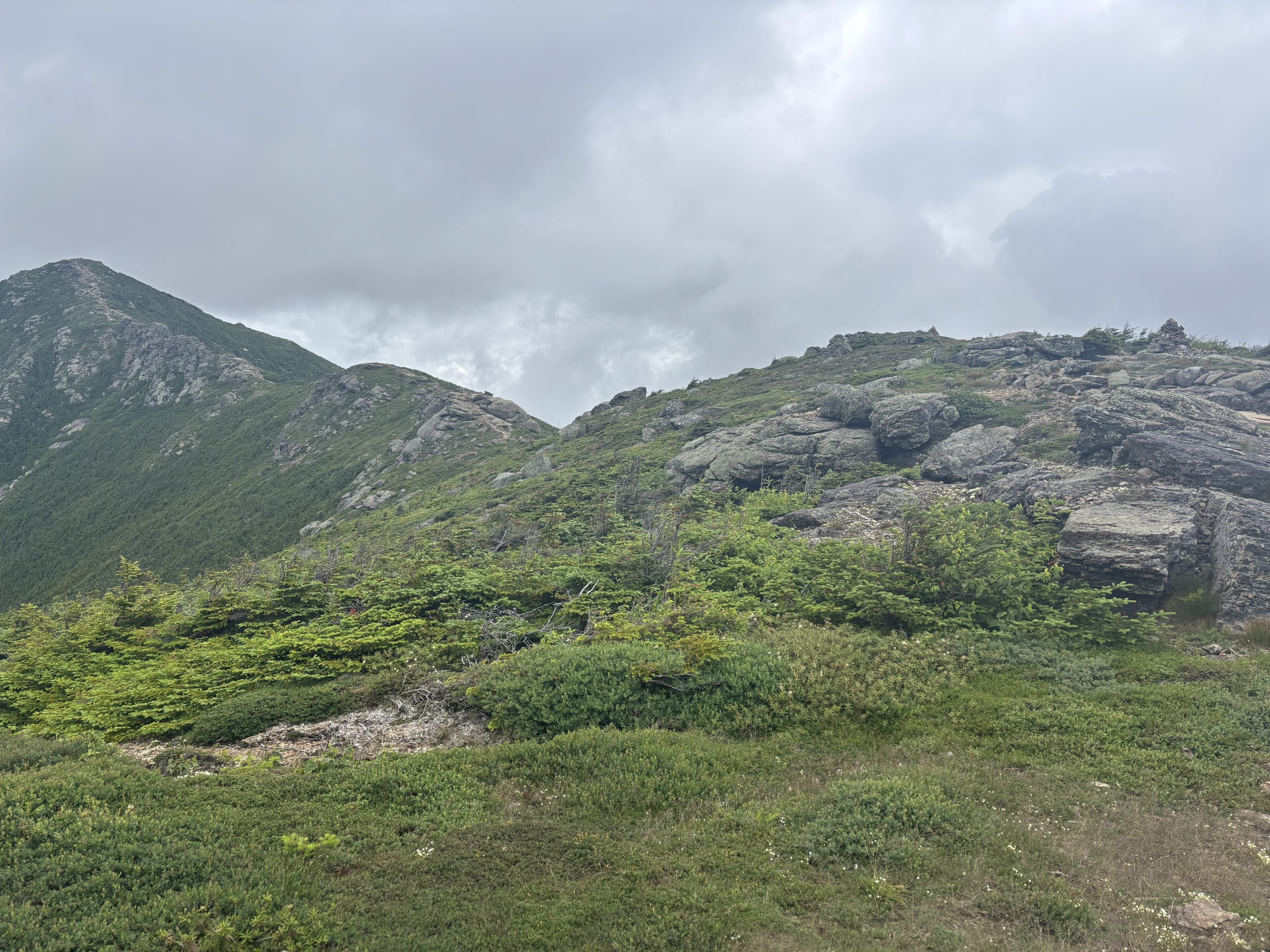
The view of Franconia Ridge above Lonesome Lake Hut!
7/9 Tentsite to Galehead Hut (13 miles)
Today was a hard 13 miles with over 6,000 feet of elevation gain, but I took my time and really enjoyed it. I hiked over Franconia Ridge, including Mount Lincoln and Mount Lafayette, and also Mount Garfield. It was slightly cloudy on the peaks but strong winds created parts in the clouds and I got some great views. Hiking above tree line is so exciting. I can almost ignore the difficulty of any elevation change above tree line (there was still lots of it along the ridgeline today) because I am so enthralled with my surroundings. There were some sketchy, rocky descents with water flowing down the trail which I really had to slow down to tackle safely.
One of the perks of the AMC huts is that they offer thru hikers a work for stay option. I took advantage of that at Galehead Hut. All that I had to do was sweep the floor of the common space and clean the table after dinner. In return, I got to eat leftovers from dinner, which was rice, curry and salad. I also got to set up my sleeping pad and bag on two benches which I slid together and sleep in the common area of the hut.
Franconia Ridge!
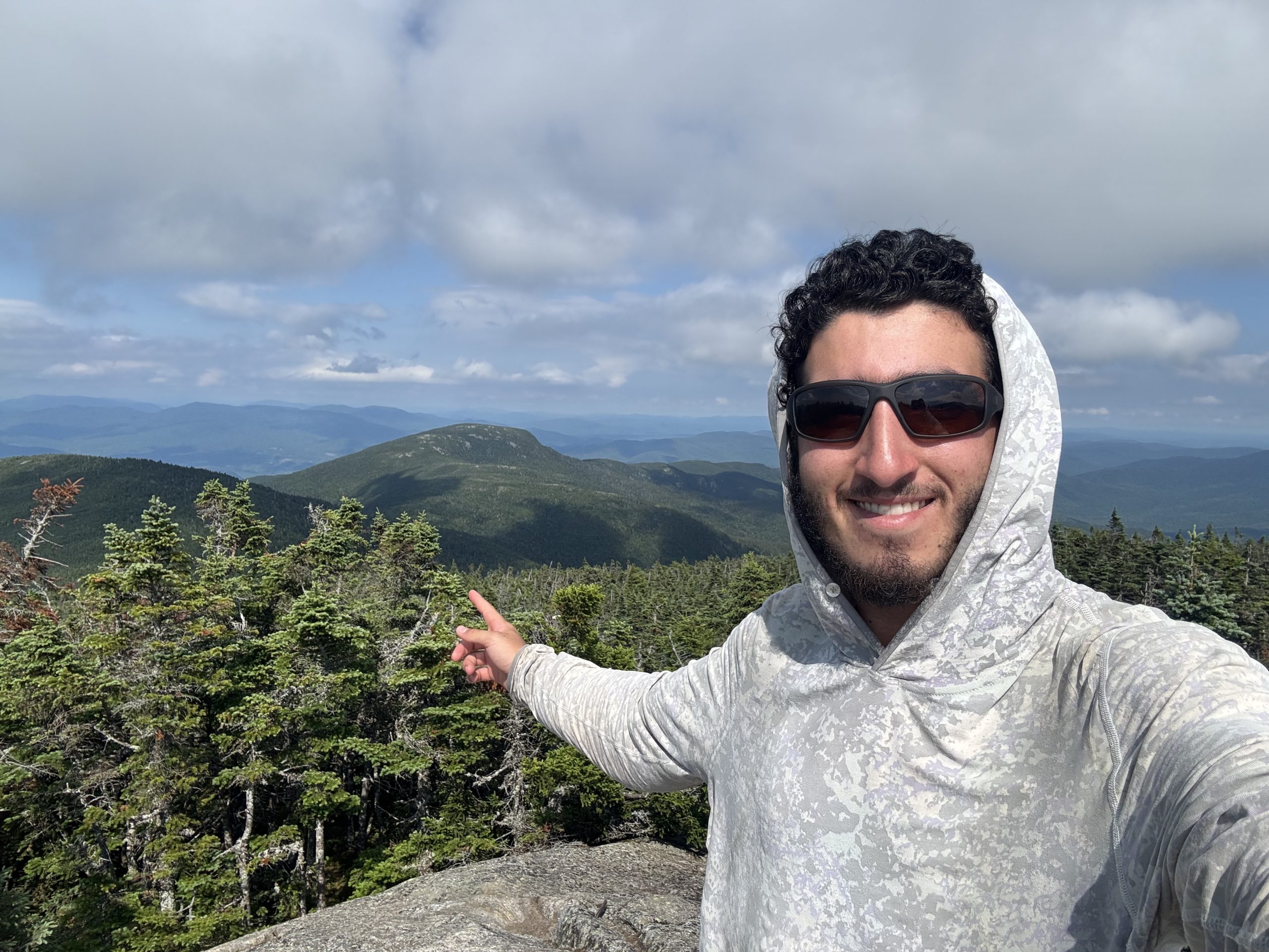
The view from Mount Garfield!
7/10 Galehead Hut to Tentsite (16 miles)
As part of my work for stay at Galehead Hut, I got leftover oatmeal and scrambled eggs for breakfast. Afterwards I headed out and hiked the steep, rocky, short climb up South Twin Mountain. The summit was in the fog and it rained for much of the morning. I took a short side trail to reach the summit of Zealand Mountain.
I hung out for a few hours at Zealand Falls Hut to get out of the rain. They had even more leftover oatmeal which I ate. I enjoyed chatting with Josie; the hut’s resident naturalist and the cook of the day. Each hut has a naturalist who educates guests about the environment and how to recreate responsibly in it. Each hut has a “croo” (a unique spelling for crew, basically the hut staff) of around 4 people for the summer season. They all take turns cooking and taking days off. I watched Josie make homemade challah bread to go with tonight’s dinner for the guests there. I’m really impressed with the meals that croos cook at the huts! It makes me look forward to home cooking after my hike. Another interesting fact that I learned about the huts is that helicopters drop off and pick up supplies from them three times per year. Croo members supplement what gets dropped off by helicopters by hiking in perishable food or other needed supplies, and hiking out trash. They do those trips twice per week using old fashioned wooden “packs” which are more like a wooden frame, which they strap boxes to. They sometimes carry upwards of 75 pounds!
The hike was easier today. There was an abnormally flat few miles for the Whites after Zealand Falls Hut. I had some extra daylight at the end of the day and decided to knock out some of the climb up from Crawford Notch to get to tonight’s campsite.
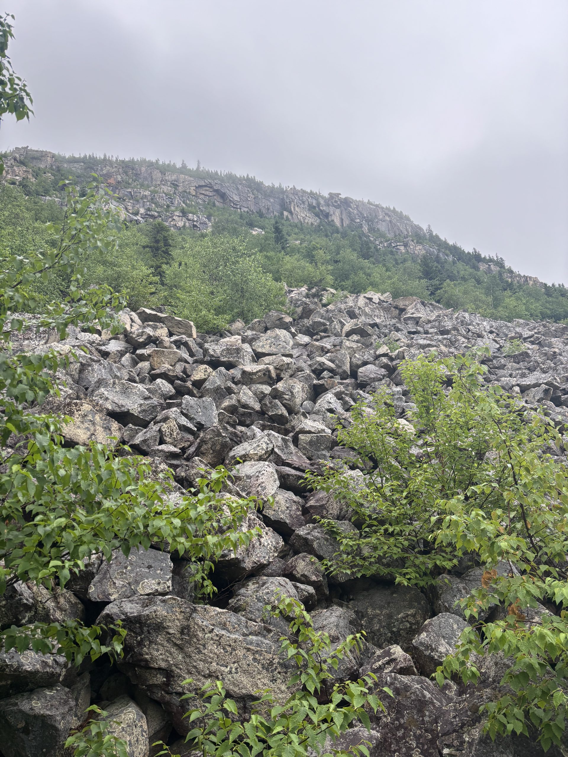
A rocky mountainside
7/11 Tentsite to Madison Spring Hut (16 miles)
My day started at a lower elevation where I camped last night. The weather there was cloudy but the sun was starting to come out. I climbed up Mount Webster and Mount Jackson. I climbed pretty slowly; it involved a lot of rock scrambling. The clouds increased as I ascended. All morning I was hoping that the weather would clear by the time I reached Mount Washington.
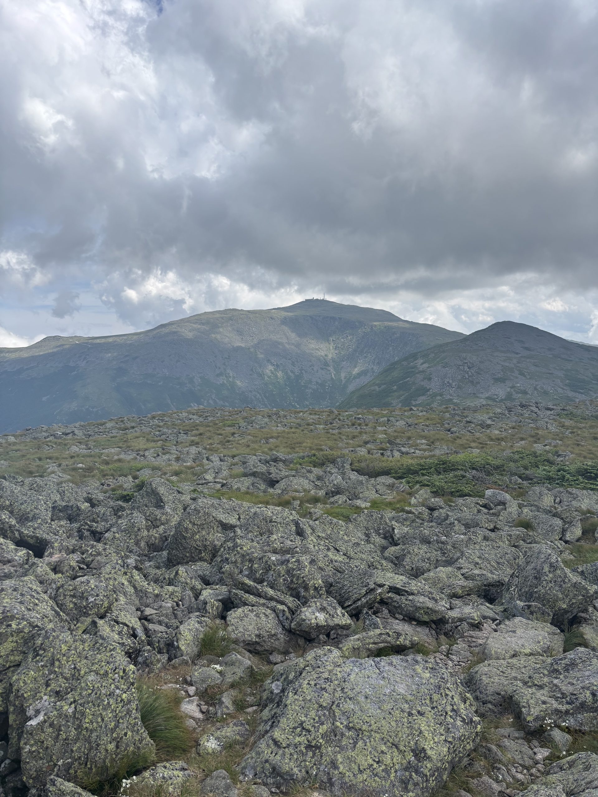
After summitting Mount Pierce, the trail went above tree line, where I spent the rest of the day. As I made my way up towards Washington, I got glimpses of dark, rocky, and foreboding peaks in the Presidential range. The mountaintops were 100% covered in rocks. I’d never seen anything like it. The lifeless peaks seemed to be saying, “don’t come up here.” After all, the Whites are home to the most extreme weather in the country. The rocks made me feel like I was on another planet.
I reached Lakes of the Clouds Hut, a little over a mile below Washington’s peak, and I could not see the mountain at all. It was completely in the clouds. I passed a sign warning hikers about the extreme weather and that deaths have occurred on Washington.
I ended up totally lucking out with a weather window. The clouds mostly cleared during my climb! As I closed in on the summit, the observatory and weather monitoring towers became visible. Like the other nearby peaks, the summit was entirely rock.
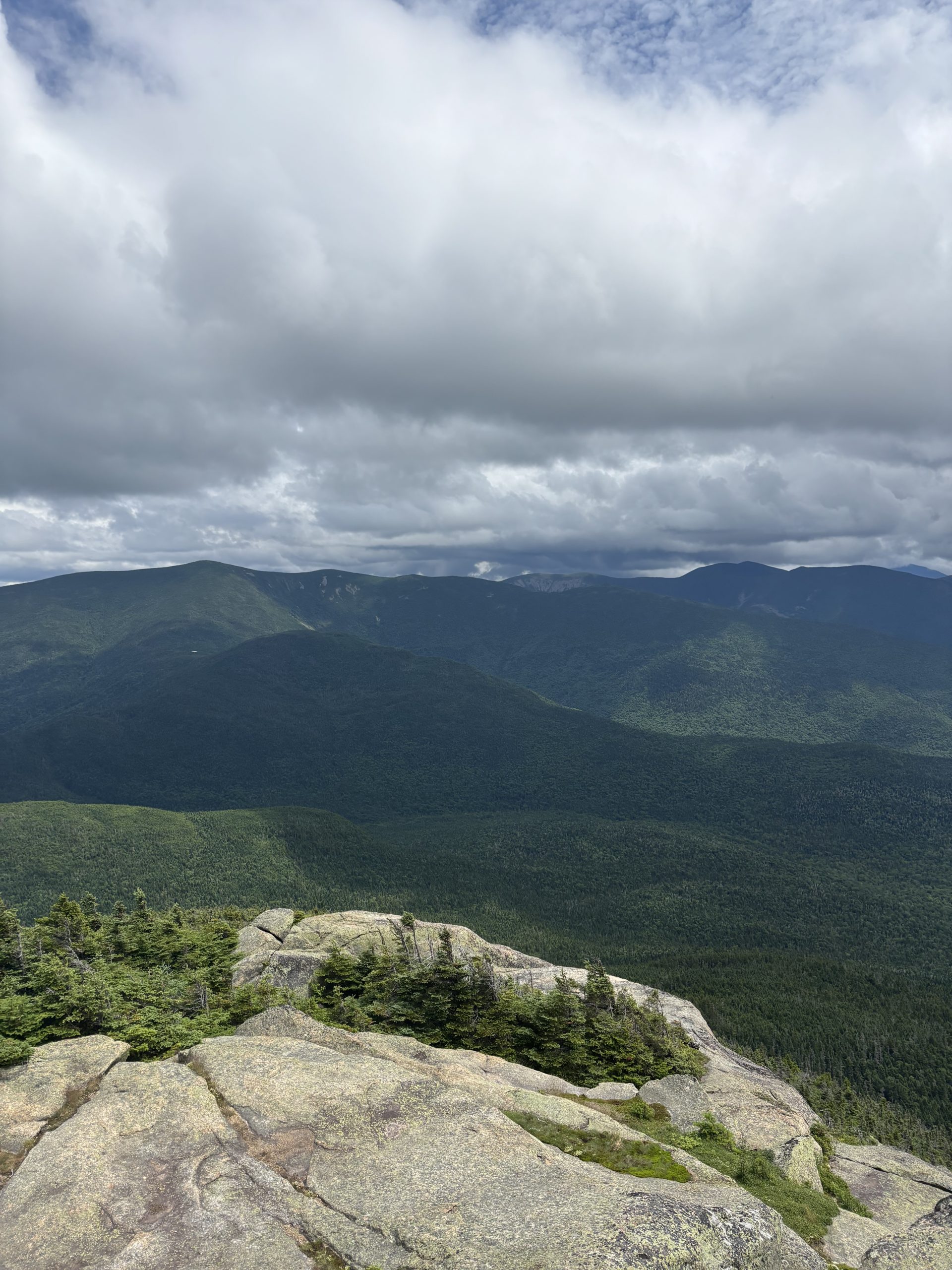
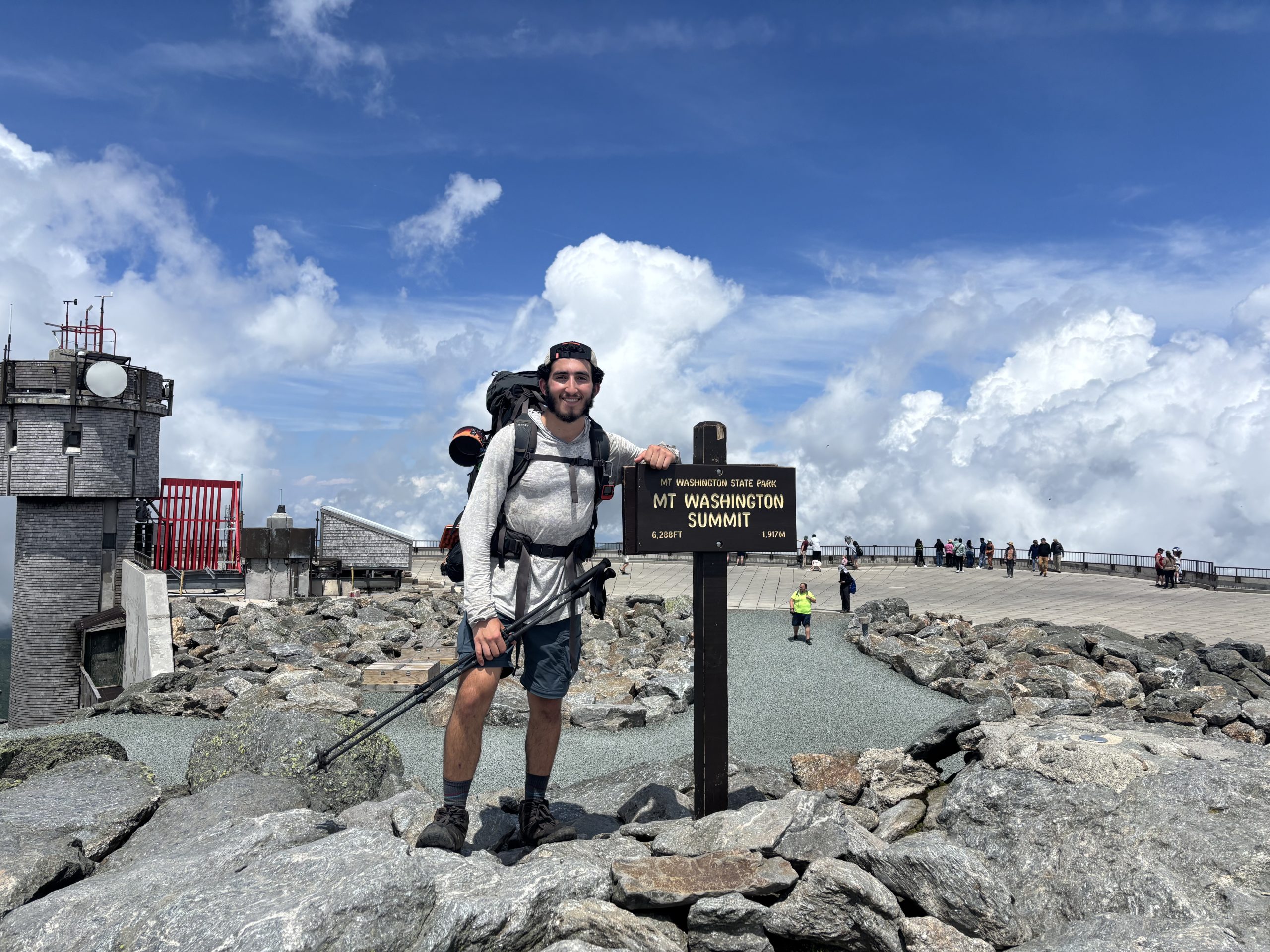
Mount Washington’s summit is one of my favorites that I’ve ever been on. Mainly because of how high it is (6,278 feet) and because of all the hype about it being so dangerous. I couldn’t get enough of the views of the neighboring Presidential peaks now that the clouds parted. There’s a nice visitor center at the summit, where I got chili dogs for lunch.
While I descended from Washington, I stopped every few minutes to take pictures of the mountain now that I could see its full body. I was so fascinated by the rock landslides across its face. Add that to the list of dangerous things about Mount Washington.
I got work for stay at Madison Spring Hut. The hut is stationed in a saddle between Mounts Adams and Madison so the scenery was very pretty. For my task, I cleaned out one of the fridges. I got to feast along with the croo on delicious dinner and dessert leftovers.
The summit of Mount Washington!
Mount Washington from afar
7/12 Madison Spring Hut to Wildcat D Peak Ski Patrol Lodge (10 miles)
This morning I hiked over Mount Madison. Then, I descended several thousand feet over slippery boulders. It was very tiring. I slipped and fell lightly a few times but didn’t get hurt.
I hitched from Pinkham Notch into Gorham to resupply at Walmart and eat a huge lunch at a Chinese buffet. I met a nice couple there, Don and Brenda, who gave me a ride back to Pinkham Notch.
The climb up to Wildcat’s D peak was insanely steep. It felt like one of the steepest climbs of the entire hike. It was also technical, rocky and slippery. To be honest, I really didn’t feel like doing the climb. I went slower than my usual pace and it took me almost three hours to go three miles.
I was happy to find the ski patrol lodge unlocked when I got to the summit. I got to spend the night in an enclosed building. It started raining in the afternoon so it was especially nice to be under a roof. The lodge even had a couch too.
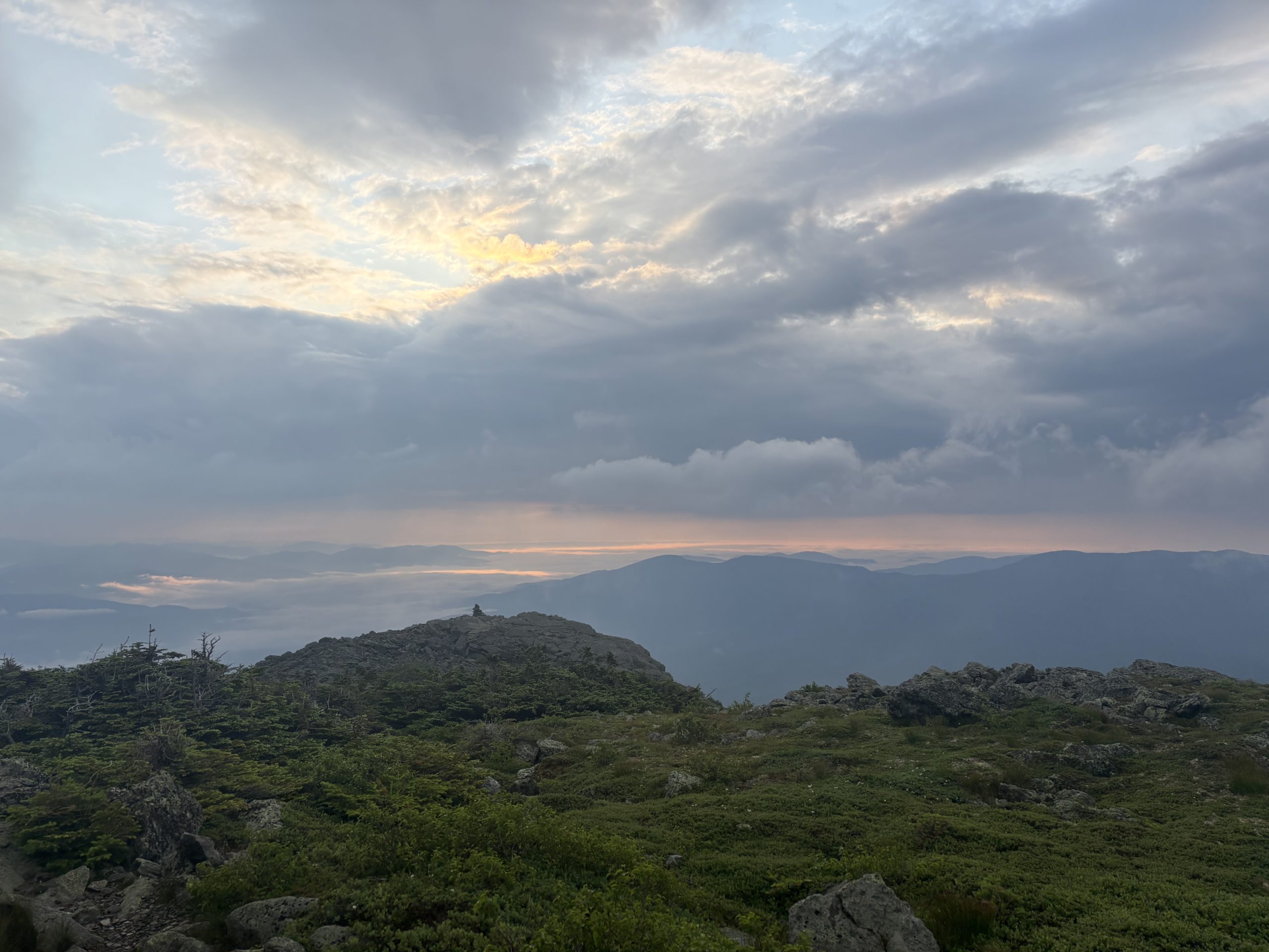
Morning sky near the top of Mount Madison
7/13 Wildcat D Peak Ski Patrol Lodge to Rattle River Shelter (16 miles)
This morning I hiked over several more peaks of Wildcat Mountain, including its “A,” or main, peak. Then there was a steep, thousand foot, rocky descent to Carter Notch, right into a nearly two thousand foot ascent to Carter Dome. I hiked the rest of the Carter Range, including South, Middle and North Carter Mountains, and also Mount Moriah. Moriah was my last 4,000 footer in NH. That felt like a big accomplishment, to have made it through all the big mountains in the Whites. There were some nice stretches of trail without rocks on the final descent to the shelter. We’ll see if I am officially through the rockiest terrain, or if this was just a short break from it.
My first glimpse into Maine on top of Mount Moriah!
7/14 Rattle River Shelter to Carlo Col Shelter (19 miles)
My time in New Hampshire ended with yet another long, hard day. I climbed over 6,000 feet. The climbs and descents had very steep, slick sections. I fell several more times. One of the steepest rock scrambles had a rope attached to a tree that I had to use to hoist myself up the rock face. On the bright side, the terrain was easier than the previous days when I was in the big White Mountains. Most of the trail was rock-free.
Mount Success was my last mountain in NH. Overall, I’d definitely call my time in NH a success. The hiking was hard but I successfully traversed some of the hardest mountains of the AT. At the end of the day, I crossed into Maine!
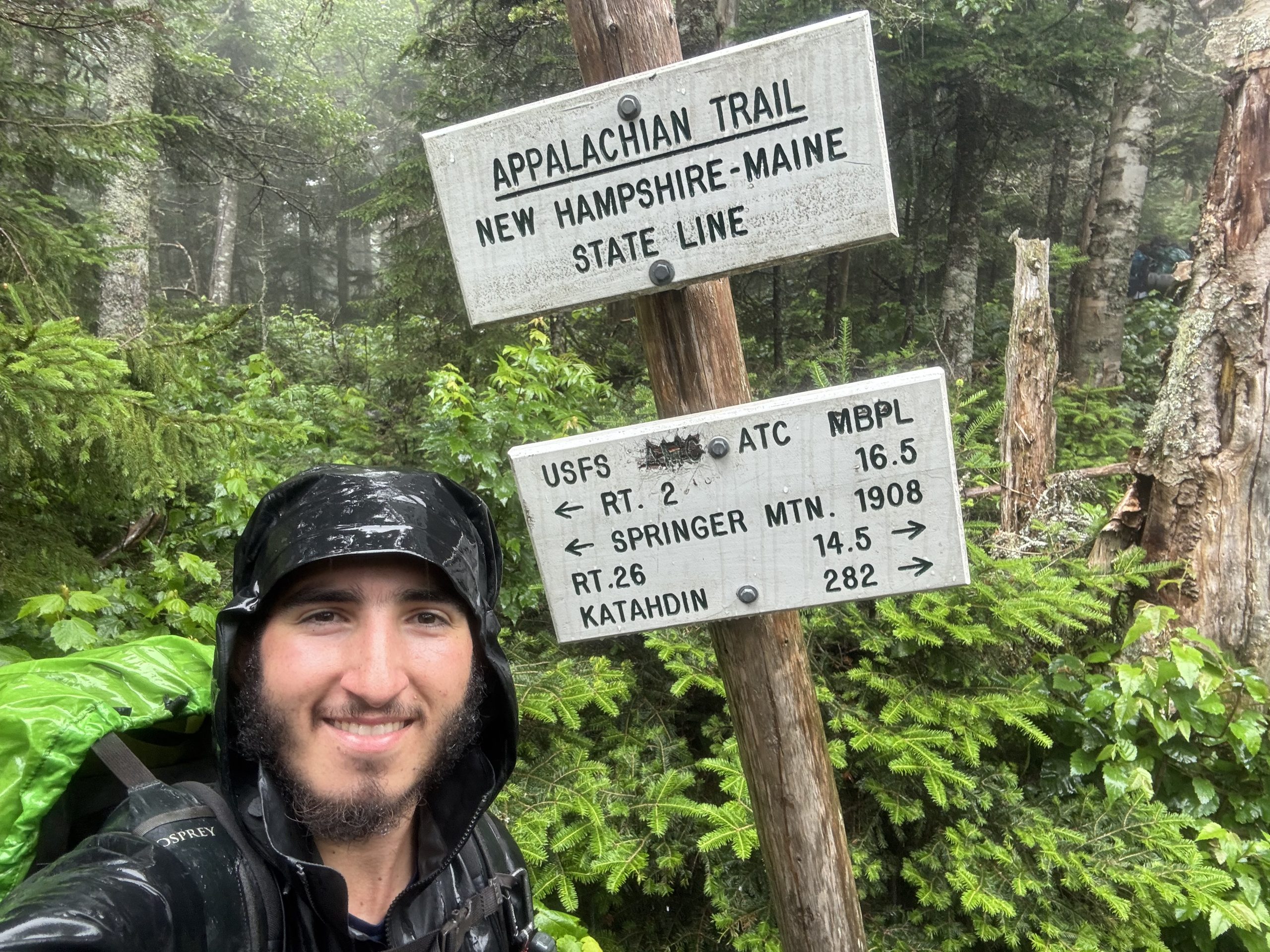
My final state line!
7/15 Carlo Col Shelter to Grafton Notch into Bethel, ME (14 miles)
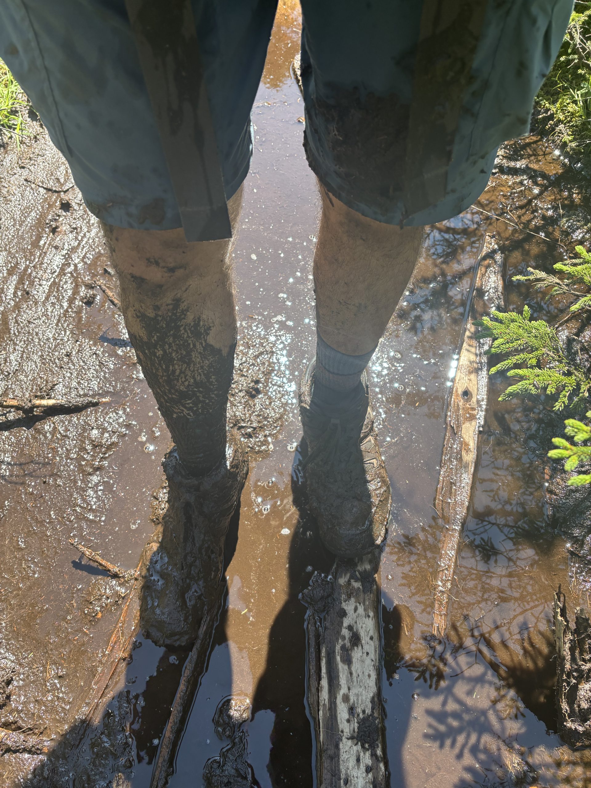
Today was a brutal start to Maine. It took me 9.5 hours to cover 14 miles. All of the terrain was slick which made the hiking treacherous, especially the descents – I slipped and fell many times. The day had a steep 4,700 feet of ascending and 6,100 feet of descending packed into a relatively short distance. While the trail wasn’t strewn with smaller boulders like in the Whites, much of the elevation change was on wet, steep rock faces. For the brief moments when I was not climbing or descending, I was hiking across boggy ridge lines. Many of the wooden planks meant to guide you through the bogs were submerged. I slipped and sank shin-deep into the mud three times. Oh, and not to mention that today I completed the so-called “hardest mile of the AT;” Mahoosuc Notch.
This morning I hiked over Goose Eye’s West, East and North Peaks, and Fulling Hill Mountain. All before even reaching Mahoosuc Notch.
I caught up with John and his friend Jim at the start of the Notch. John is my friend who picked me up from a remote mountain road in Virginia when I got sick and brought me to civilization to seek medical care and rest. That was over two months ago. In the meantime, we’ve stayed in touch. I knew that I’d run into him at some point because he and Jim are sectioning the entire northern part of the trail this summer. It was great catching up with him in a non-dire situation when we were both in our element, hiking through the hardest part of the AT. He and Jim gave me trail magic in the form of double stuffed oreos. We began the Notch together. Unfortunately that was the end of our time together for now, because I went ahead of them to keep getting miles done.
Honestly, Mahoosuc Notch wasn’t as hard as I expected. It took me close to an hour to get through the mile, but it was pretty fun hiking over, under and through huge boulders and crevices between them. There was ice in some of the crevices, which illustrates how cold it stays in the Notch even in the middle of summer. The Notch was a fun break from the relentless climbs which otherwise occupied my day.
After the Notch came the hardest climbs of the day: Mahoosuc Arm and Old Speck. They were so steep. My left quad was getting sore by the end of the day from all the up and down. Today was just as hard as the Whites. I’m looking forward to northern Maine where there is less elevation change.
On the bright side, the views were great today. The boggy ridgeline sections were through pretty alpine meadows with mountains in the background. I got a filling dinner in town, camped at a nice campground in town, and may take a zero tomorrow to recharge before tackling the rest of the trail.
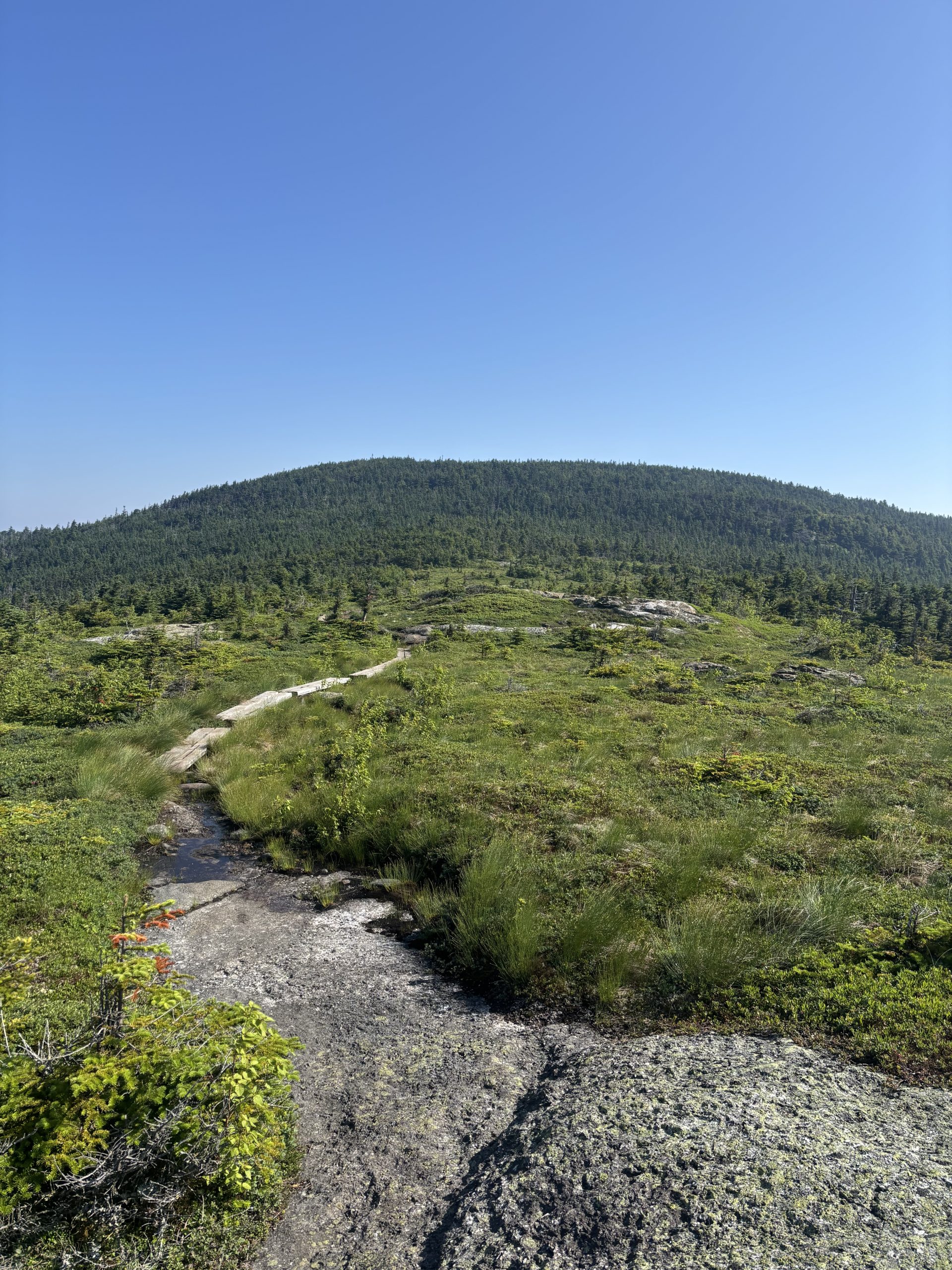
One of the alpine meadows that I hiked through
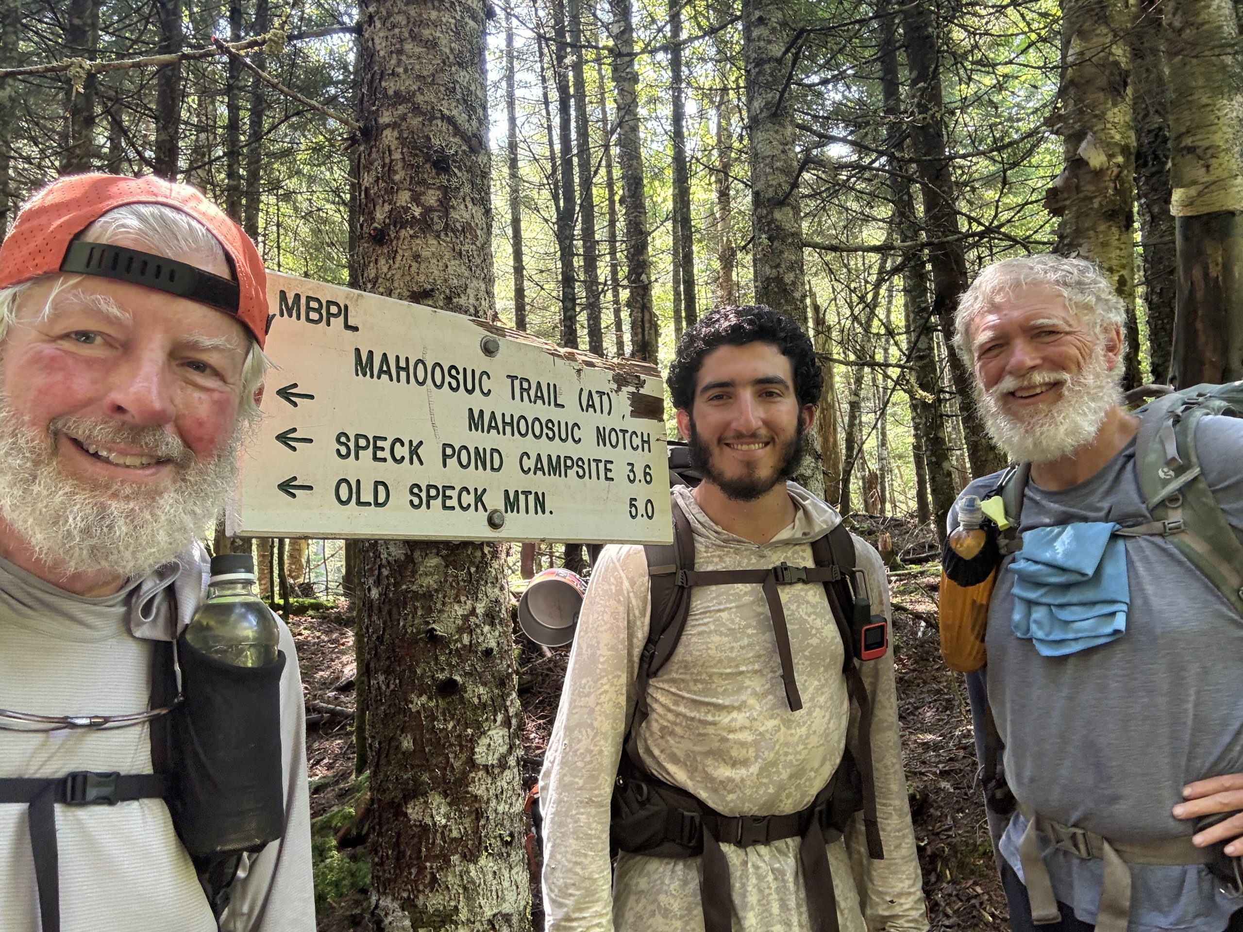
John, Jim and I at the start of Mahoosuc Notch – “the hardest mile of the AT”
Maine is so boggy!


