
I’m calling it The Robert
After one last bakery stop at Brownies in East Glacier for our first cinnamon rolls of the thru-hike, The Show, Free Samples, and I left the comfort of town for the secluded Bob Marshall Wilderness. “The Bob,” as it is colloquially shortened by outdoorspeople and locals, is one of the most remote and roadless sections of the Continental Divide Trail. It is the fifth largest wilderness area in the lower 48 states and home to the highest grizzly bear population in the US, excluding Alaska and Yellowstone.
I began referring to it as The Robert, because I am entertained by coming up with alternative names for things. This turned out to have a serendipitous meaning by the end of our journey.
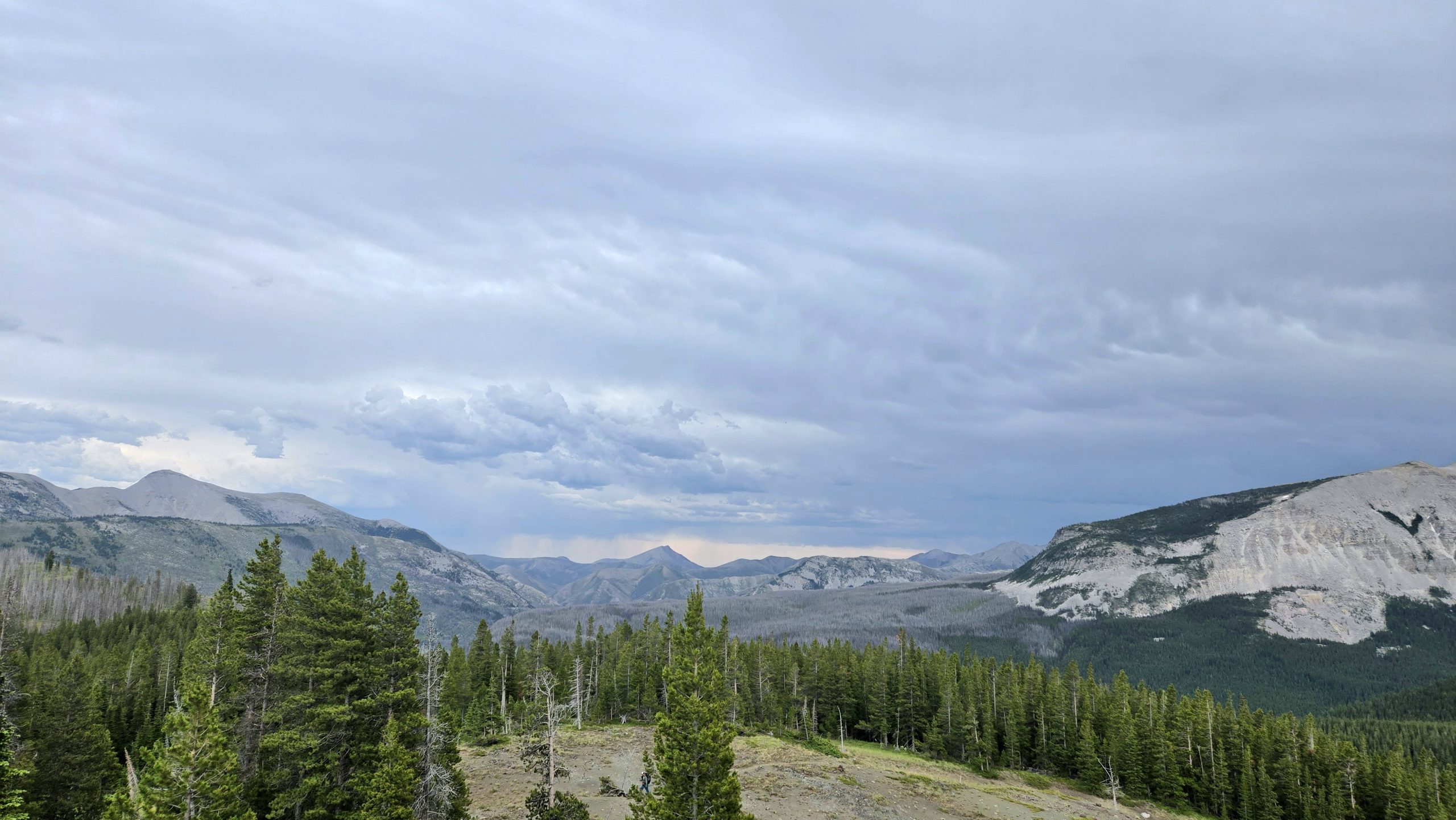
The first two and a half days of this stretch weren’t technically within the wilderness boundaries, but rather a sort of approach to it. I’ll admit they were rather boring, with nothing to write home about. It was mostly walking in the woods and walking through old wildfire burn scars, which Montana seems to have a lot of.
One of the many burn scars we walked through. I believe this may have been taken in the area that was the aftermath of the Strawberry Creek Fire in 2017.
The Hog Hunters
Our first night staunchly contradicted the isolation we’d soon face later on in the leg. We camped at an off-highway front country campground and nodded off around 8PM to the sound of semi trucks and freight trains rushing past in the near vicinity.
At around nine, I awoke to our site neighbors briefly returning and what sounded like letting their children run around for 10 minutes. They then got back into their vehicles and I watched from the tent as two trucks and an SUV and again left the campground.
At 12:30AM I startled awake to bright lights high-beaming our tent. Car doors opened and closed. A racket was being made that sounded like items being unloaded from the vehicles and/or pots and pans were being shuffled around in addition to loud voices conversing.
Were these people just making dinner now? Where and what did they just get back from? Did they not realize they have neighbors sleeping 100 feet away? Did they just not give a fuck? In all my years growing up going to campgrounds I had never heard anyone be this loud, this late at one before. Lying in our tent I was silently equal parts confused and fuming, trying to decide if I should say something. Then I heard, in southern drawls:
BOY: “What’s our internet?”
MAN: “H-O-G-H-U-N-T-E-R dollar sign”
BOY: “Hog hunter? You ain’t huntin’ no hogs”
MAN: “I useta hunt more hogs than y’all ever did see!”
I decided to play it safe and keep quiet. I probably shouldn’t profile people, but in my mind, southern + hunter = likely has guns. People are always going to be your biggest threat on a thru hike. I wasn’t going to take any chances getting into it with these people. I put in my earplugs instead and eventually they settled down. We didn’t purposefully make breakfast and pack up loudly the next morning, but we also didn’t go out of our way not to.
Caught in a Thunderstorm
On our second day out we had plans to eat dinner about a mile from camp. This is recommended protocol in grizzly territory to avoid lingering food smells which can attract bears to your campsite. The final miles of our day, a bit of a planning oversight on my part, involved a long, over 1,000 foot climb up to a ridgeline. It was hot that afternoon and we dilly dallied taking breaks to wait out some of the hottest part of the day.
Throughout the afternoon we had been seeing some thunderstorms brewing and unleashing on the distant horizon. However, they seemed to be keeping to the ridgelines of some faraway higher mountain tops and not moving in our direction. As we neared the top of our climb the wind picked up and we could see the streaky darkness of rain falling from those ominous clouds in the distance.
At the top around 7PM we were on a ridgeline with a semi-tree-protected flat area where we decided to cook dinner. We heard a few low rumbles of thunder but they sounded far off. A half hour later the weather rapidly deteriorated. Just as we were finishing eating, the sky simultaneously darkened and lightened, a sickly yellowish gray hue like a healing bruise. Fat rain drops began to fall. No sooner had we scrambled to pack up all of our gear, the storm was upon us. And we were in the worst possible place: an exposed 6,800 foot ridgeline.
Distant storms in view from the ridgeline we were on.
The rain turned to a pour, soaking us almost instantly. The wind blew viciously, threatening to knock us over as we ran along the ridge. Thunder crashed and lightening lit up the sky in increasingly frequent intervals. There weren’t a lot of trees along the trail to act as “highest thing around” in case of a lightning strike. I wondered about the possibilities of my umbrella functioning as a lightening rod to my detriment.
As the eye of the storm climaxed around us, we made the call to dip down off trail into the treeline to take immediate shelter. We huddled under our umbrellas, getting pelted by rain and blasted by wind. After a few minutes we decided to take our chances and just get the fuck down from the ridge. It was pure chaos as we ran for it down the mountain.
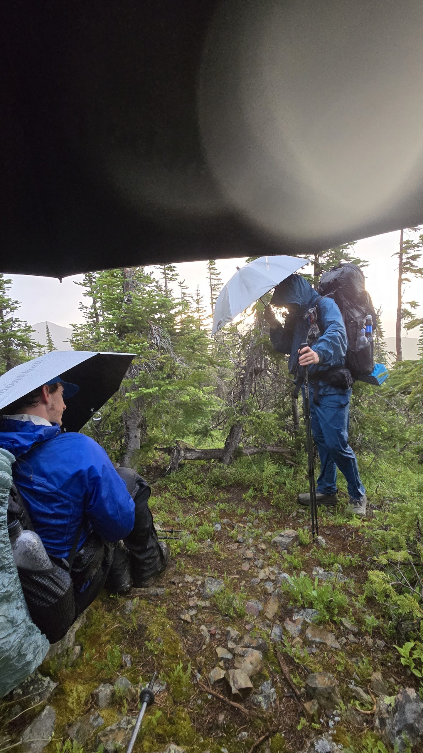
Sheltering from the storm under our umbrellas. Picture does not do justice to how intense and vulnerable it felt.
The trail itself closely followed a sheer drop-off so we went rogue, traversing further in from the edge. The ground was made up of lumpy dirt mounds with tufts of grass. I tried to move quickly to keep up with the guys, but rolled my ankle navigating the uneven terrain and went down. I crash landed on top of my umbrella. I was OK, but pissed to find out that I had irreparably broken one of the spokes.
As we descended, the storm let up little by little. I had awful stomach cramps plague me for the entire mile and a half of running/briskly walking to our campsite. Fast-paced hiking immediatly following a big meal of Backpacker’s Pantry Beef Bolognese was not a comfortable experience. We learned a few things from this experience:
- Thunderstorms don’t just happen in “the afternoon” out here. They can come post 7PM.
- Don’t assume distant storms won’t make their way over to you even if they seem stalled on the horizon.
- If you’re on a ridgeline and see any storm activity, don’t make dinner, don’t pass “GO” and collect $200, get the fuck down.
We felt stupid in hindsight getting caught on a ridgeline in a storm, because that’s entry level common sense of what not to do when hiking. But we’re only human, we live and make mistakes sometimes and learn.
The Main Attractions
Lake Levale
When planning this stretch at home pre-hike I stumbled across a comment on FarOut about this slightly off-trail lake that allegedly had “Gatorade blue water.” I was intrigued as I loved seeing the turquoise and cobalt blue waters of the High Sierra lakes along the PCT. I added it to my CDT bucket list to camp near and swim at this lake.
The day before we were expected to arrive at the lake I checked the weather forecast via Garmin. I was disheartened to see that it was likely going to be rainy at worst, cloudy at best when we’d arrive at the lake. I know you win some and lose some in terms of views and experiences on long trails due to weather, but the disappointment got to me. I rode out a “meh” mood for awhile after discovering the unfortunate forecast.
Even though it was in the 40s, cloudy, and windy when we arrived at the lake junction, we decided it was still worth it to walk the extra 600 or so feet to at least experience the lake visually. I wasn’t initially sure which Gatorade flavor this person was referring to, so it was a fun surprise to see that it was closer to a “Frost Glacier Freeze” coloring than a “Cool Blue.”
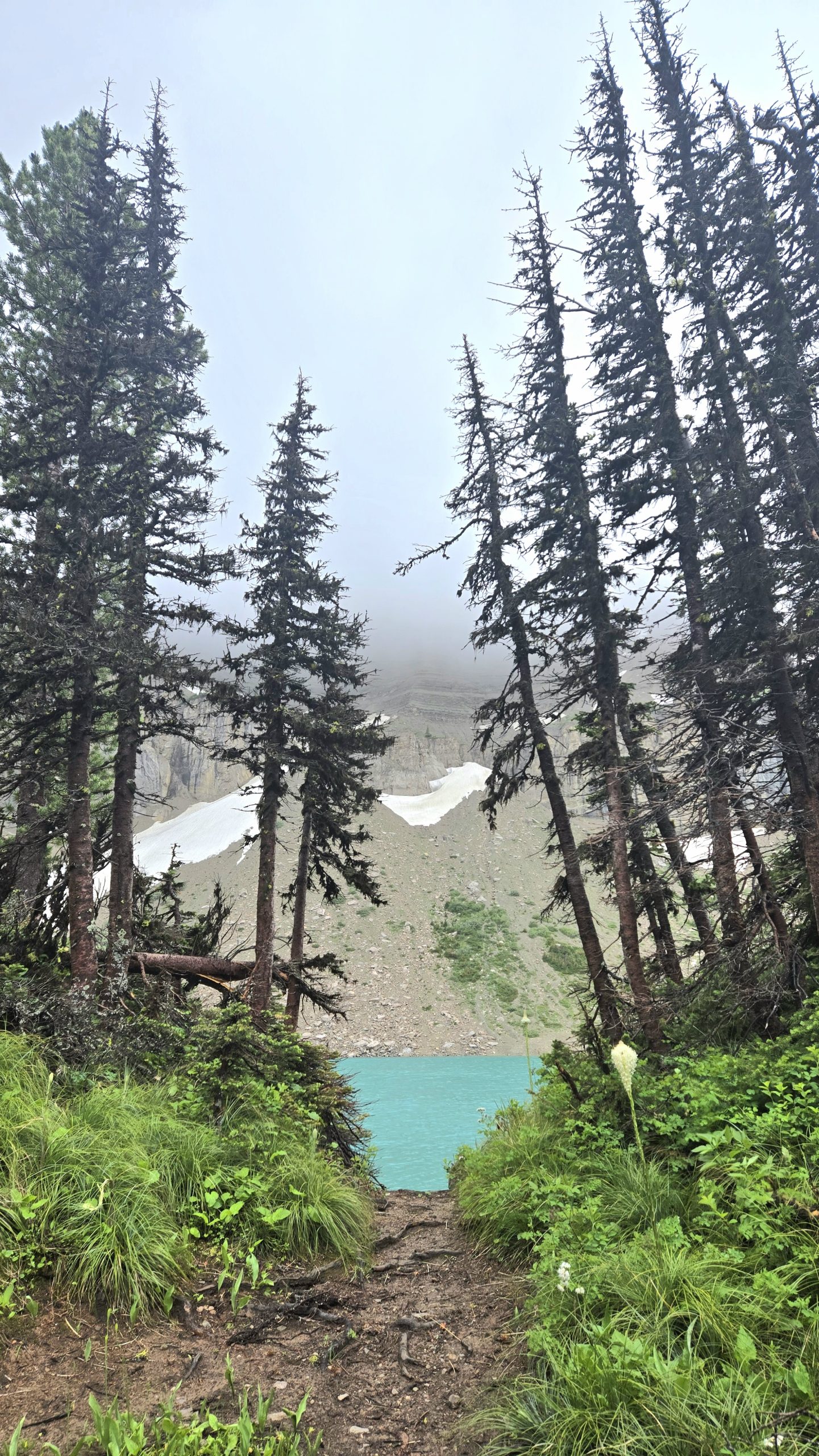
First sneak peek of the Gatorade blue water approaching the lake.
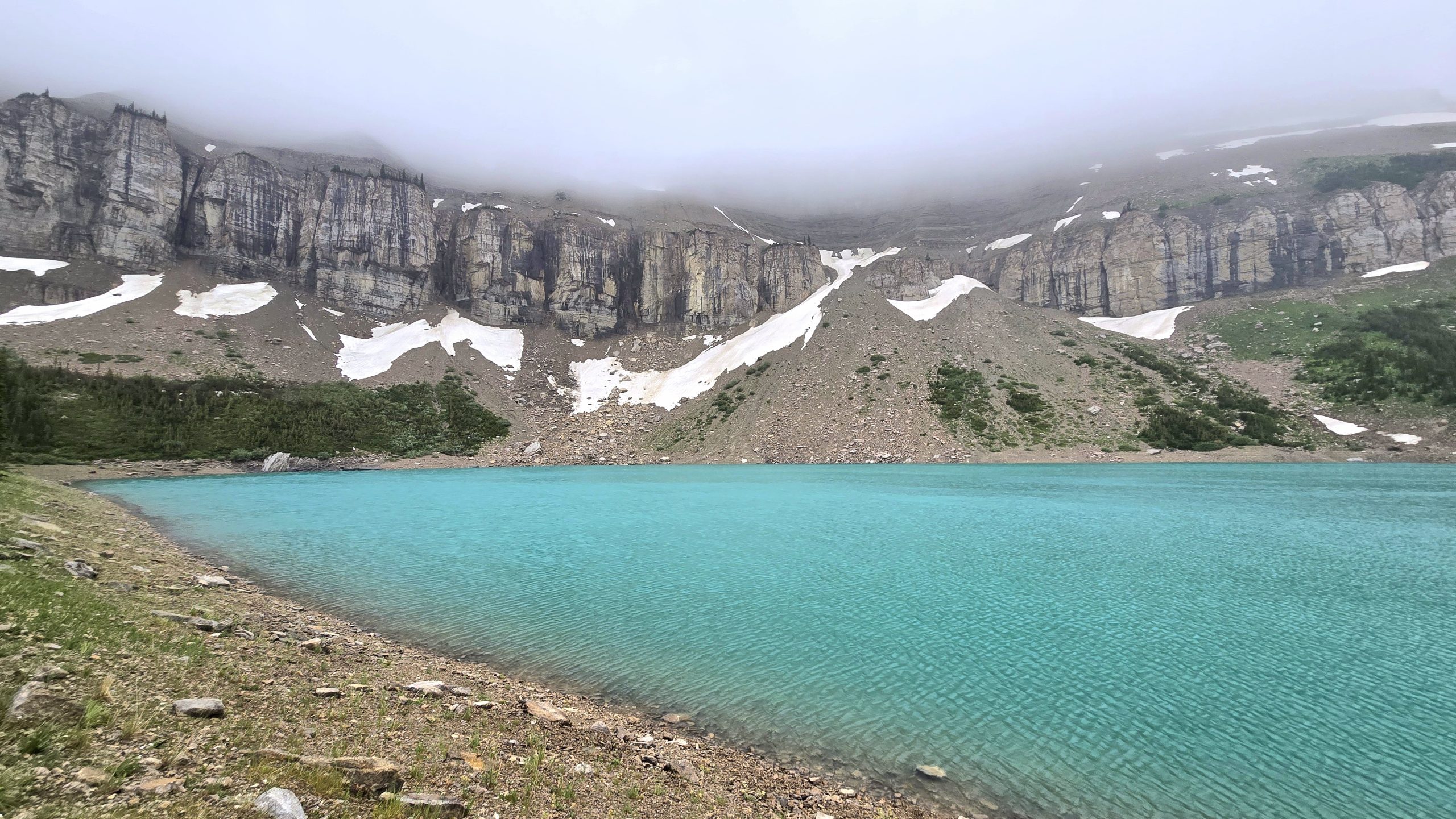
I’m calling it “Gatorade Lake.”
We briefly considered a quick dip just to say we did but decided it wasn’t worth the hypothermia that would likely result. I took a bunch of photos and in the end was glad I at least got to see it, as it was by far the prettiest lake of the trip so far. We’ll see if any others can top it.
At least we got some nice photos in lieu of a swim.
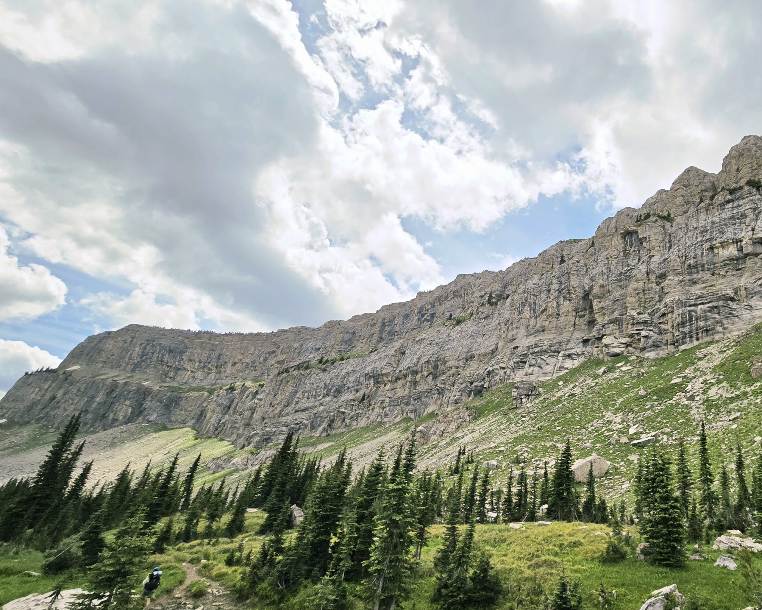
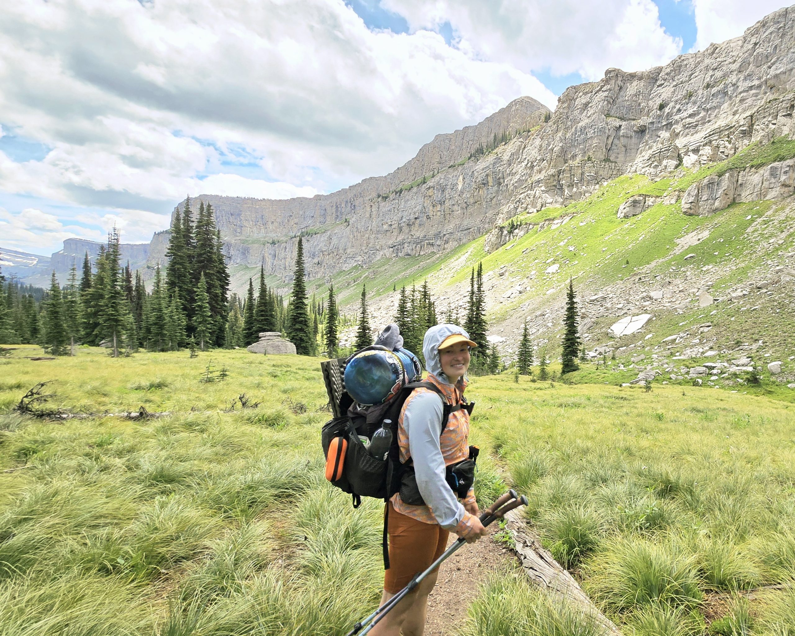
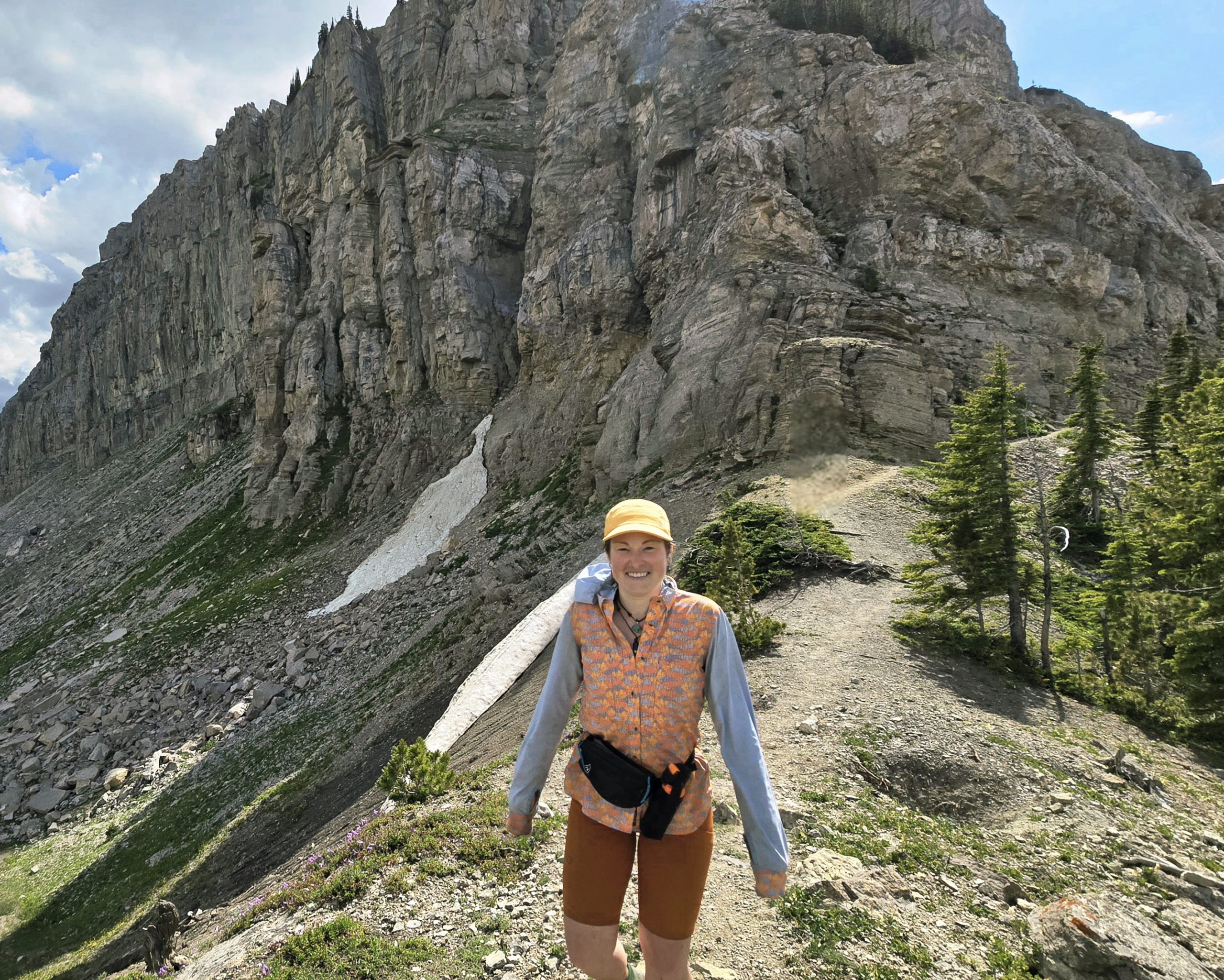
Chinese Wall
Perhaps the main attraction of The Bob is the Chinese Wall, a glacially-formed limestone escarpment that runs along the spine of the Continental Divide. This sheer rock face ranges from 700-1300 feet high and is approximately 15 miles long. It was a truly unique sight to take in and walk along for miles.
What makes it all the more special is that it’s roughly 20-something miles into the wilderness. This preserves it’s relative solitude as it’s not easily accessible to swarms of tourists. Anyone wanting to see it must do so on some kind of overnight trip, be it backpacking or horseback riding.
Unexpected Trail Magic
Cheers
We only saw a handful of other people, mainy other CDT hikers, in the heart of the Bob. We started seeing many more people, mostly groups on horseback, as we neared the southern boundary of the wilderness area. But prior to that, hardly anyone. One evening as we were a couple miles out from camp, feeling tired and worn down as we were still getting used to the daily grind of thru-hiking again (and I still grumbling about the failed Levale swim) we crossed paths with a group of four early 20s guys out backpacking.
One of them greeted us and asked “are you doing the long one??” We responded that yes, we were doing the CDT. He called back to his friends a little ways back, “we’ve got some CDT-ers coming through!” The others stepped off trail and insisted we have the right of way passing them. As we passed, one of them wished us luck, clapped, and shouted “LET’S GOOO!”
It was the boost we didn’t know we needed to get us motivated to finish the last miles of the day. Such a small gesture from a stranger went a long way in improving our mental stamina. I’ve noticed that about being on the CDT in comparison to the other two long trails – people seem genuinely impressed by what we’re doing and are outwardly expressive of that.
I found there to be somewhat more apathy or maybe just habitation to thru hikers on the AT and PCT. I certainly don’t require or expect reverence from the community for thru hiking, but getting it in this capacity was truly a positive surprise and reminder that we are, in fact, doing something big.
Robert
Our original plans upon exiting The Bob were to stop briefly at Benchmark Wilderness Ranch to pick up our resupply boxes and then go right back into the woods for another seven day stretch. They don’t offer hot food (or food of any kind) for purchase nor laundry, my top two priorities during a resupply stop, so it didn’t seem worth it to pay to stay the night there without those resources.
After taking our pictures with the southern boundary sign we began a hot and grueling three mile roadwalk to the ranch after 17 miles of trail. We knew of a town called Augusta and hour and a half drive away that some hikers are able to hitch to from the road we were walking. The intel we had told us it was a gamble, sometimes you get picked up by people heading to/from the remote trailhead, sometimes there’s just not enough traffic passing by.
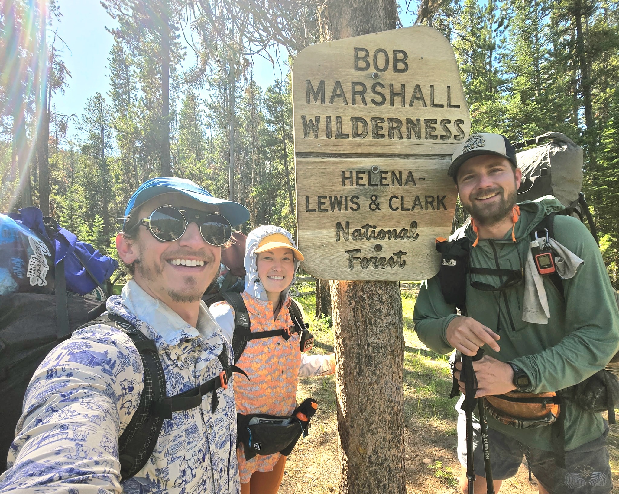
At the southern boundary of The Bob. Left to right: Toddler Snacks, The Show, Free Samples. We were happy to get a photo here because the northern boundary sign looked like it got mauled and eaten beyond recognition by a grizzly.
I planted the seed in my mind that on the off chance that someone were to drive by and offer a ride, I don’t know that I could pass that up. I felt pessimistic about actively attempting to hitch, though, and didn’t want to get my hopes up. Thoughts of juicy burgers and fresh smelling clothes seeped through the cracks in my resolve to complete a 14 day wilderness stint without town comforts.
A truck approached, crunching along the gravel road and kicking up a trailing cloud of dust in the air. The driver slowed, rolled down his window, and spoke one glorious word: “Augusta?”
I new right then that we were in the midst of some seriously lucky trail magic. And I knew we were going to town. Free Samples had already considered it in concern he didn’t have enough food in his resupply box to get him through to the next town of Elliston. I figured if he was on board and I was, I could easily get The Show to agree as well. We played coy and told the driver we needed to discuss with our friend (Free Samples was a half mile or so ahead of us at the time) but accepted a ride the rest of the way to the ranch to get our boxes.

At the ranch, the driver explained to us and the other hikers hanging out there that he was an Augusta local that liked to help out hikers. He operated free of charge, but graciously accepted donations from those who could afford it and saw his service as valuable.
He made a strong pitch for the town, talking up its giant breakfast burritos smothered in gravy and its motel/saloon/campground all-in-one accommodations with on-site laundry. The best part: he said he’d take us right back to the trailhead the next day. That’s always the trickiest part about hitching to town – the return trip – as more cars are generally heading to town than away towards a remote trailhead. It was a no-brainer. We were headed to town!
The best best part? We ask what his name is. It’s Robert.
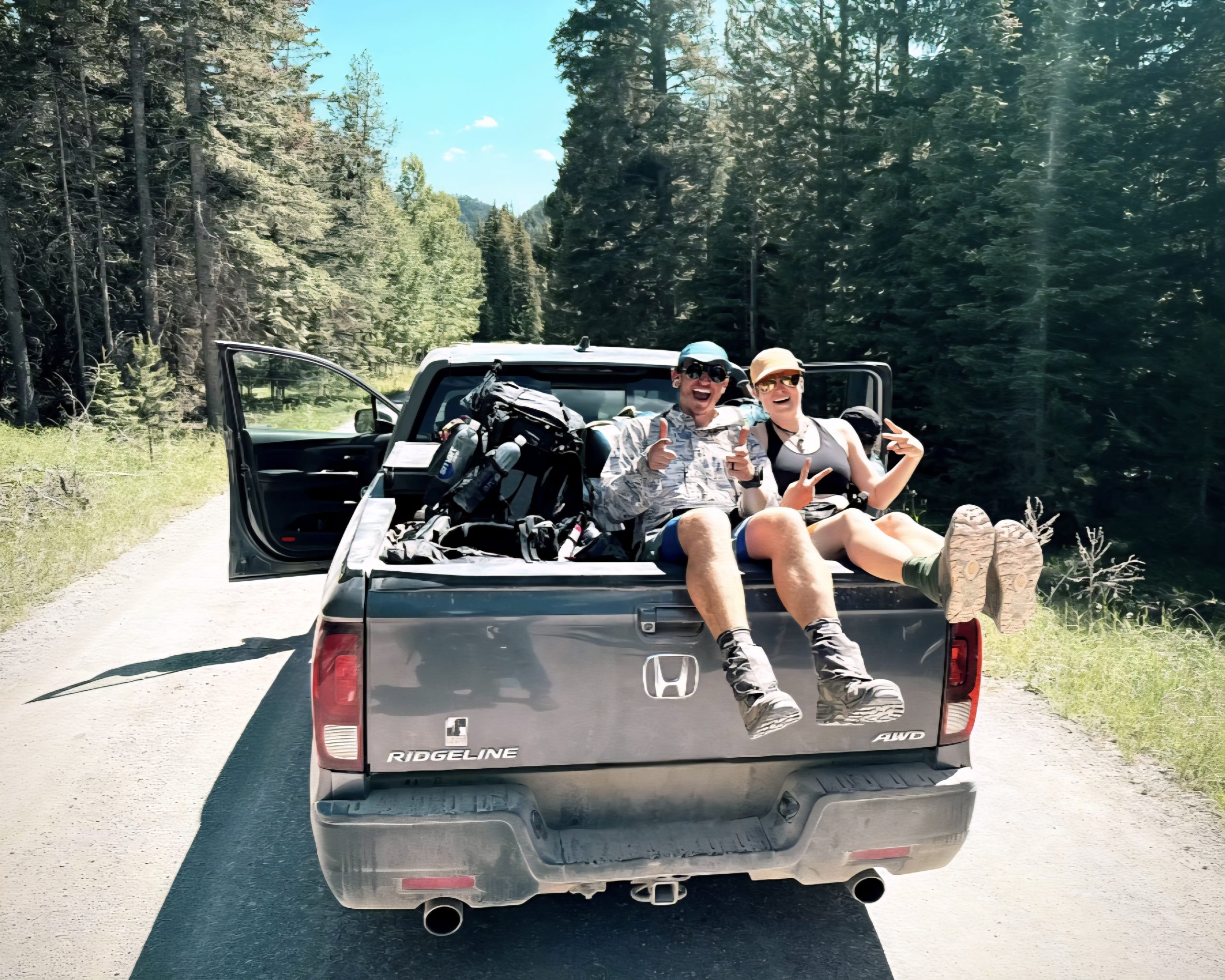
The Trail Provides
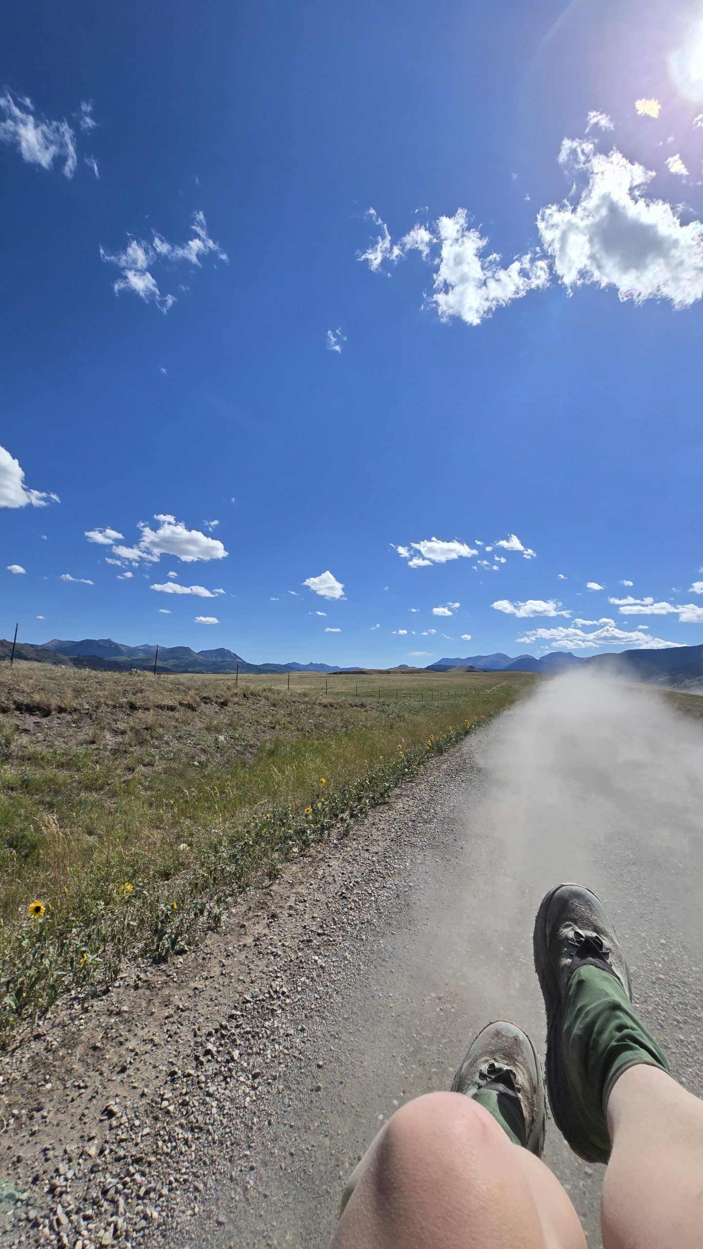
We piled one local bartender, her dog, five stinky hikers, five stinky packs, and Robert into Robert’s truck. The Show, Free Samples, and I took our places on top of all the packs and various other miscellaneous items in the truck bed, donning our buffs and sunglasses as face coverings for the dust.
Just as we were about to leave, one of the mules grazing in the area decided that directly behind the truck’s tailgate was where he wanted to be more than anywhere else in the world and had no plans on going elsewhere anytime soon. Robert first gave him some encouraging pets, then told him to “git!” among other verbal abuses, and finally resorted to shoulder tackling him out of our way. He called him a “stubborn asshole, well, ass…” hopped in the driver’s seat, and we were on our way.
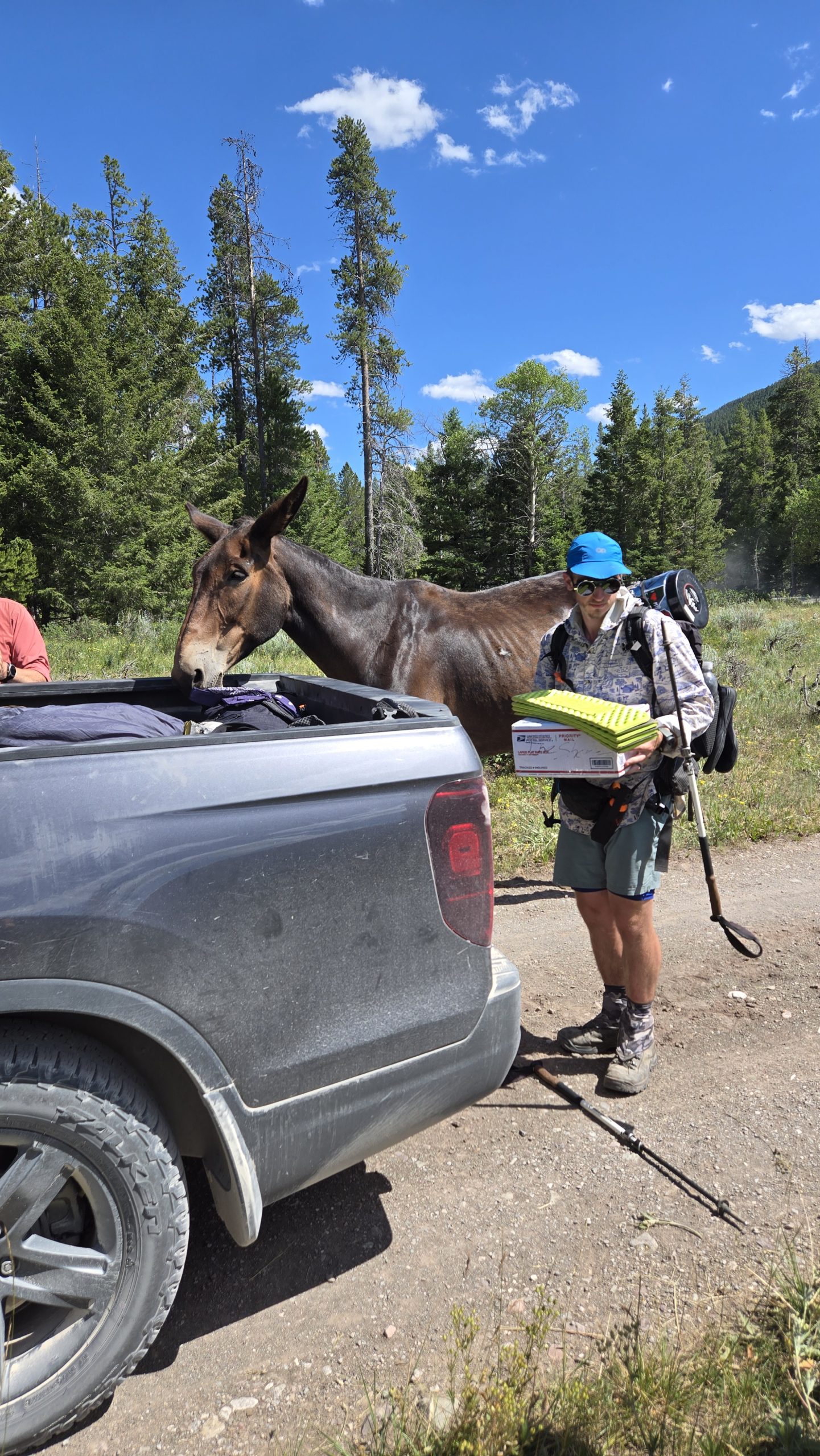
The stubborn asshole
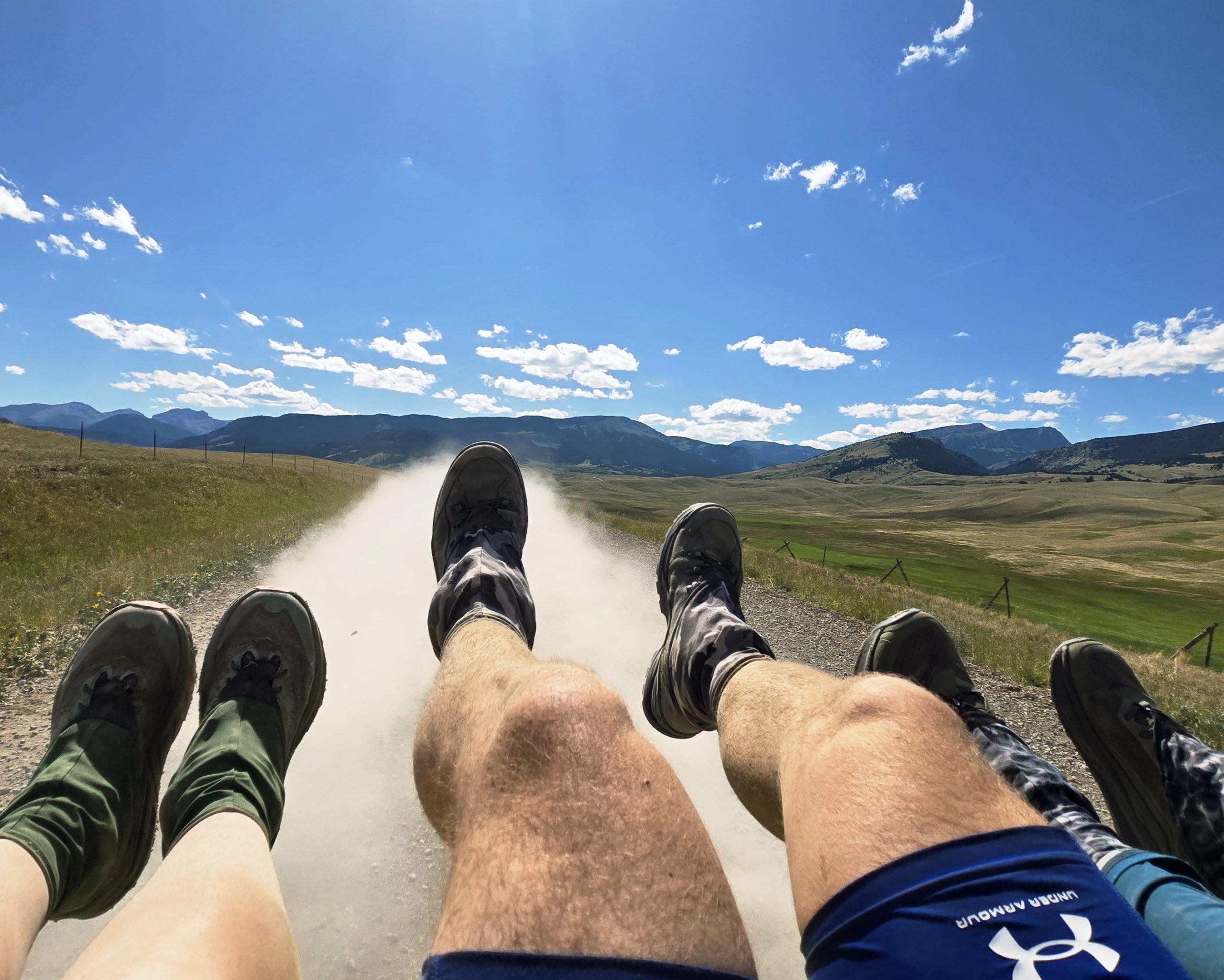
The ride to Augusta had stunning views of The Bob mountains where we’d come from, with rolling, sparsley treed, grassy foothills and farmlands beneath them. The name “Big Sky” came to my mind looking at the endless cottony fluffs of clouds dotting the wide open skyline. Along the road were patches of yellow flowers that looked like small sunflowers. We dangled our feet out over the tailgate above the steady stream of dust coming from the tires and laughed and hooted and took as many photos and videos as we dared, at the risk of our phones getting ripped from our hands (luckily they didn’t).
In that moment looking out from the truck bed I could sense I was in the middle of experiencing a core memory of the trail. Rides to and from town secured, I felt at ease and content, and looked forward to all the luxuries we’d been seven days deprived of that we’d soon find in town. All I could think was the saying you hear often among thru hikers: the trail provides.
Sometimes when you’re least expecting or planning for it, things just work out perfectly. It’s a nice reminder for someone like me who is always (sometimes overly) concerned about logistics on thru hikes. I like to plan ahead. I like to feel in control. But sometimes going with the flow, relinquishing certainty, and accepting kindness and help can provide some of the best memories on trail.
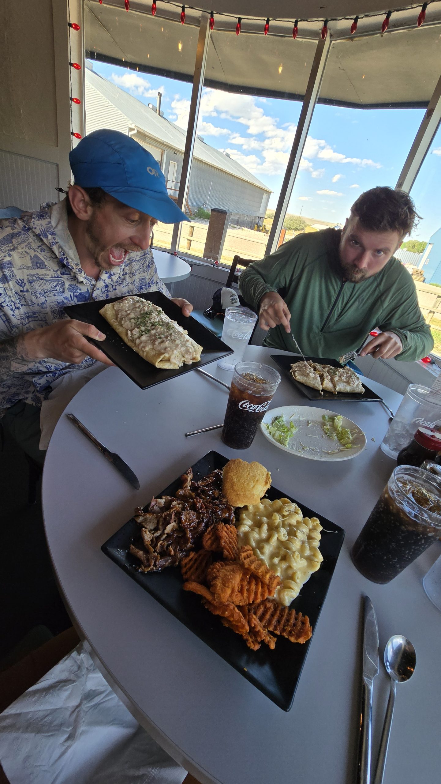
P.S. the guys got the burritos
For more thru-hiking content (and other miscellaneous life updates) follow me on Instagram @keljens


 – Una titra todo")