
*these posts are coming straight from trail, I apologize in advance for typos!*
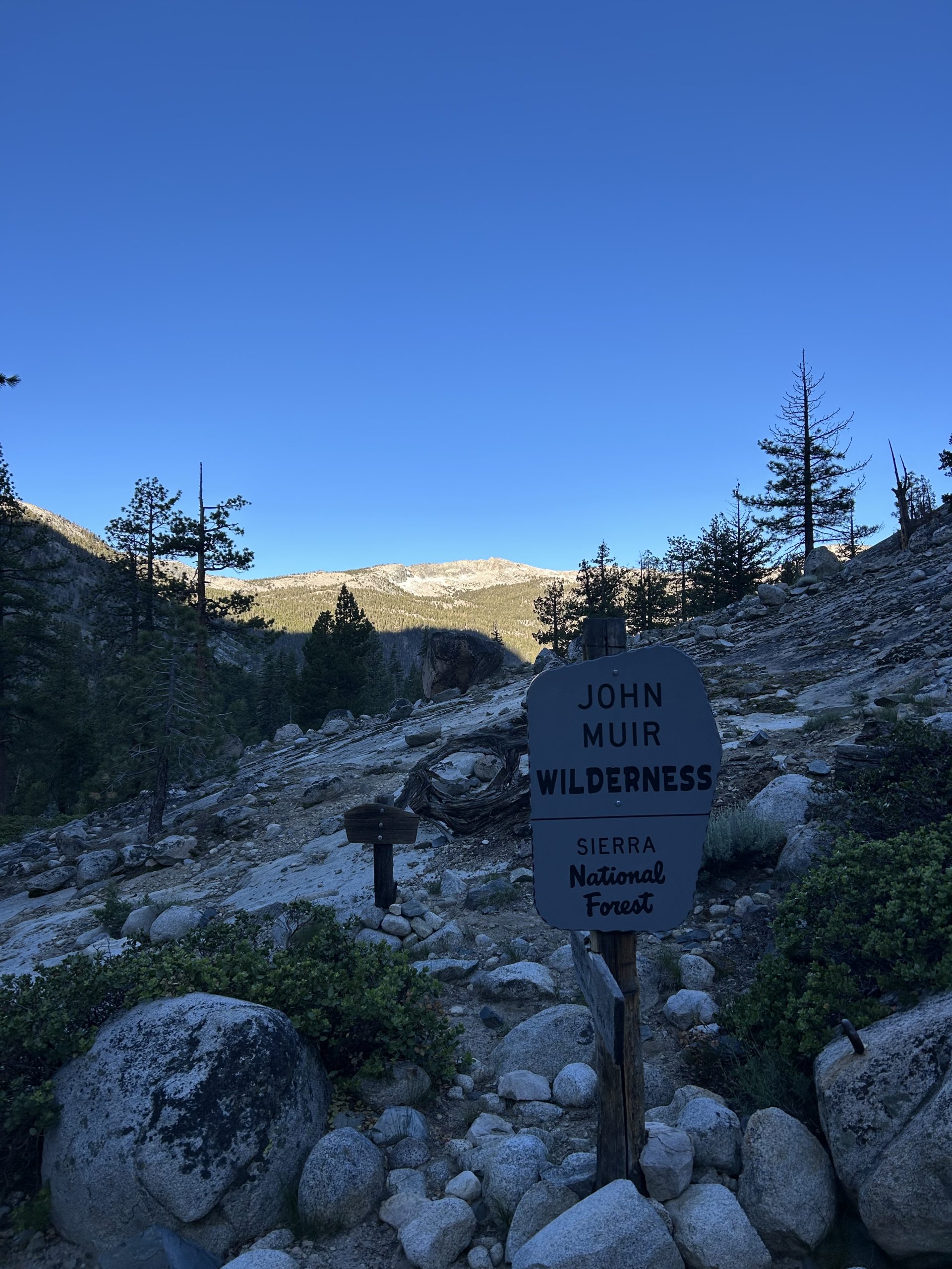
Location: High Sierra
Start: Tentsite – 820.6
End: Tentsite – 837.7
Miles: 17.1
Ascent: 3362 | Descent: 3048
Sleep: Tent
Today was a good but tiring day. Morning at the Tentsite was beautiful and peaceful, it felt like we were the only two people in the world. There were several marmots running around while we were packing up and we enjoyed hearing them squeak at one another. Once we got moving it was around 6:30am.
The trial followed a rock cliff overlooking Palisade Lake. We hiked along the rock well above the shore for a while before descending down to the edge of the water. There were tons of waterfalls in every direction, some of them high on the cliffs above us and other at our feet flowing directly into the lake. It was a super scenic and beautiful start to the day.
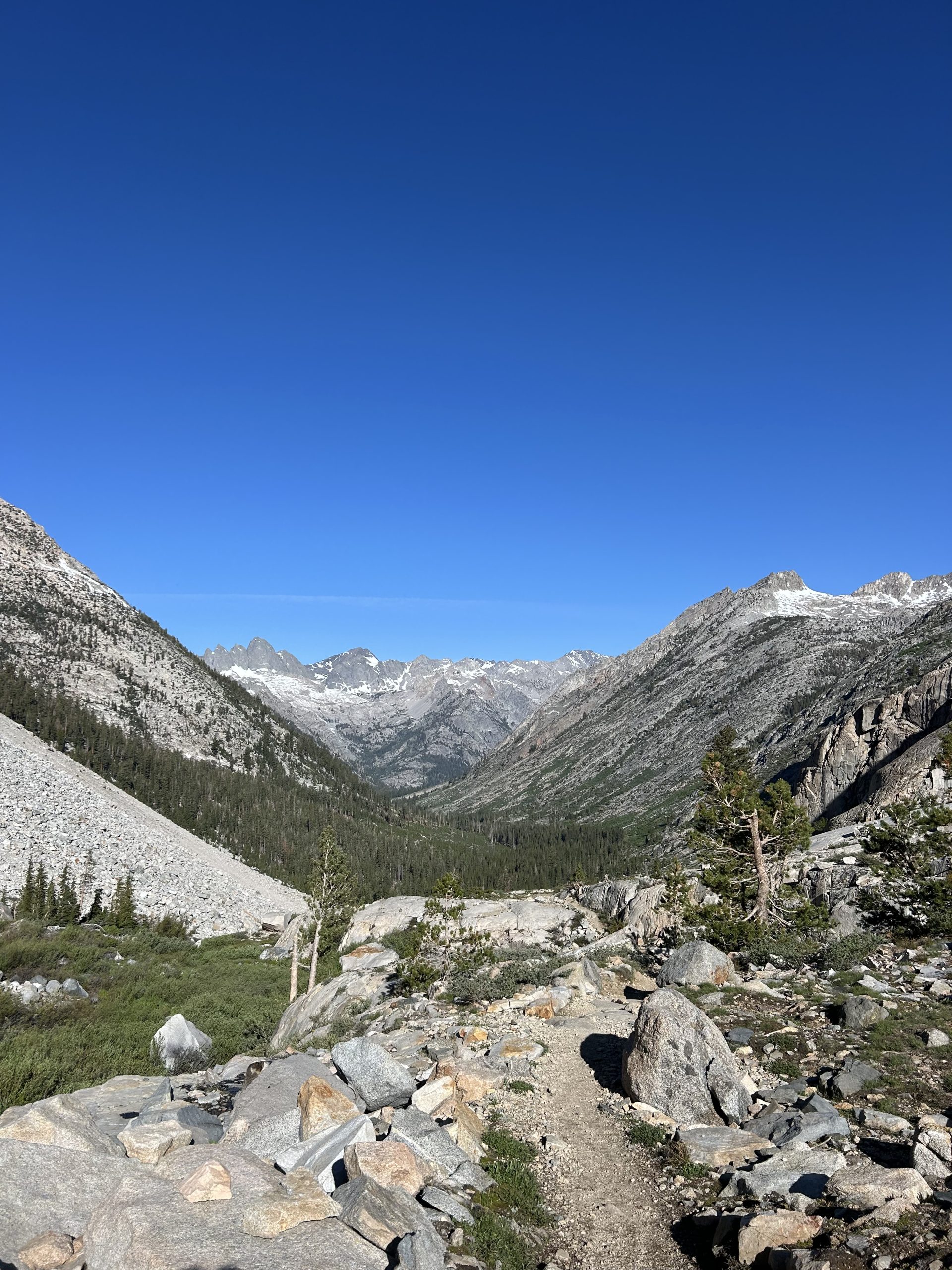
We continued hiking along the water and had to cross several small streams before we made it to a dramatic plateau overlooking the valley below us. The rock face we were standing on sloped downwards and bottomed out miles below us in a valley covered with pine trees. Off in the distance we could see towering snow capped mountains. It was a gorgeous sight. We stopped to admire it for a while and Gandolf walked over to join us. We chatted for a bit before beginning the long descent to the valley floor.
The trail wound its way down the rocky mountain with stone stairs. There was a huge waterfall gushing close to the trail that was cool to walk so close to. We made switchback after switchback in the stairs, all the while getting lower and lower in elevation. On several areas the creek ran directly over the trail, but our feet were already wet so we didn’t mind.
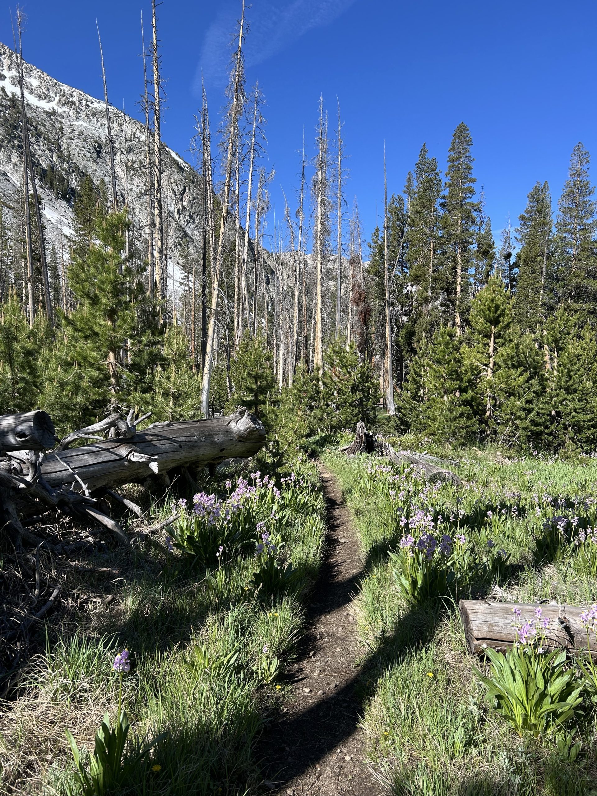
Eventually we bottomed out and were in the pine forest again with the river running close by. The trail was mostly flat and we were able to cruise. I ran into Footzilla and stopped to filter water with him. Truffles walked by without realizing I had stopped, so I spent the rest of the morning trying to catch up to him. Apparently he thought I was ahead of him so he was trying to catch me. Thankfully he gave us after crossing a bridge and I was able to catch up to him. His water filter is broken and he wanted to catch me to filter water. I found him just as he was debating on drinking the water straight from the river since he was so thirsty. We had a good laughed, filtered water, and hiked on.
The trail from there was uphill the rest of the day. It looked like a pretty mellow climb on FarOur, but it was steep in sections and ended up being much more challenging than I expected. I listened to my audiobook and podcasts to power up the climb. We decided to break for lunch at the campsite we had originally planned to stay at for the night. About a mile away from the campsite the trail got very steep and we didn’t feel like we’d ever make it there.
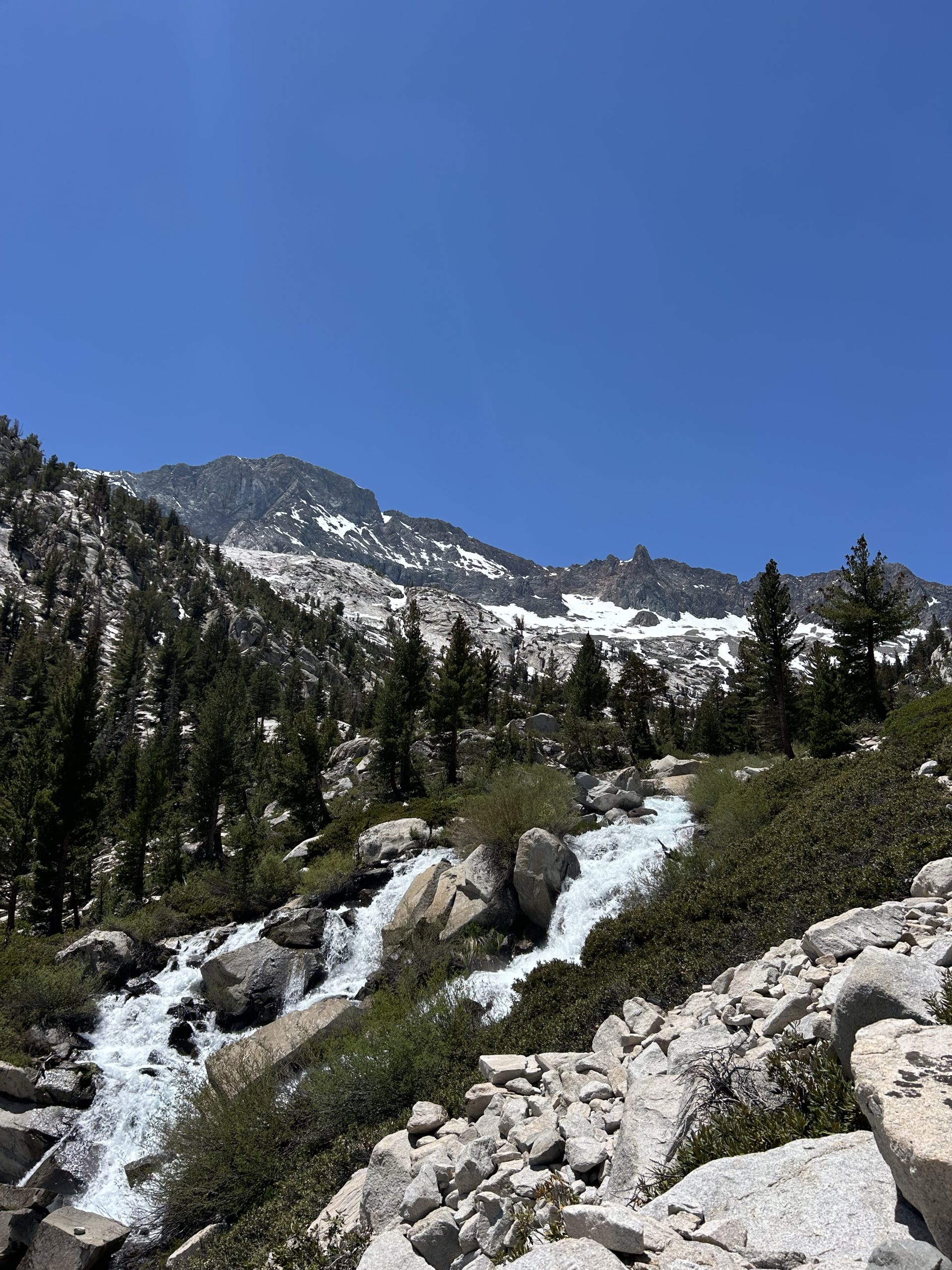
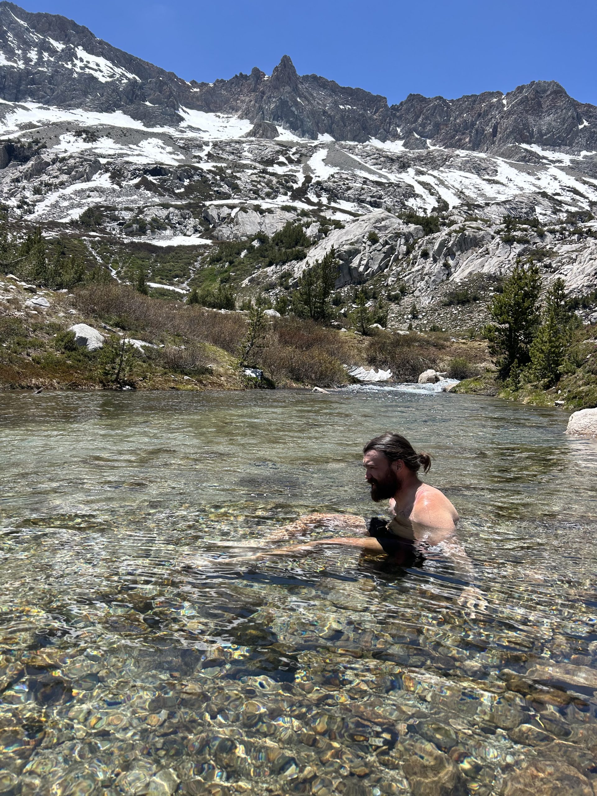
Finally the campsite appeared and it was absolutely beautiful! We’d been following the Middle Fork Kings River uphill and it was raging in some sections. The section near the campsite, though, was a gentle flow with a large pool perfect for a dip. We were both hot and sweat from climbing and dropped our packs and got in the water immediately. It was freezing and hard to make ourselves wade in, but we worked up the nerve to dunk under the water and quickly scrambled back to shore.
It was sunny and made drying out after the dip easy. We ate lunch while admiring the river and pretty pink flowers blooming along the shoreline. We decided to hike a couple more miles and set our sights in the campsite 2 miles away. We packed up and were off.
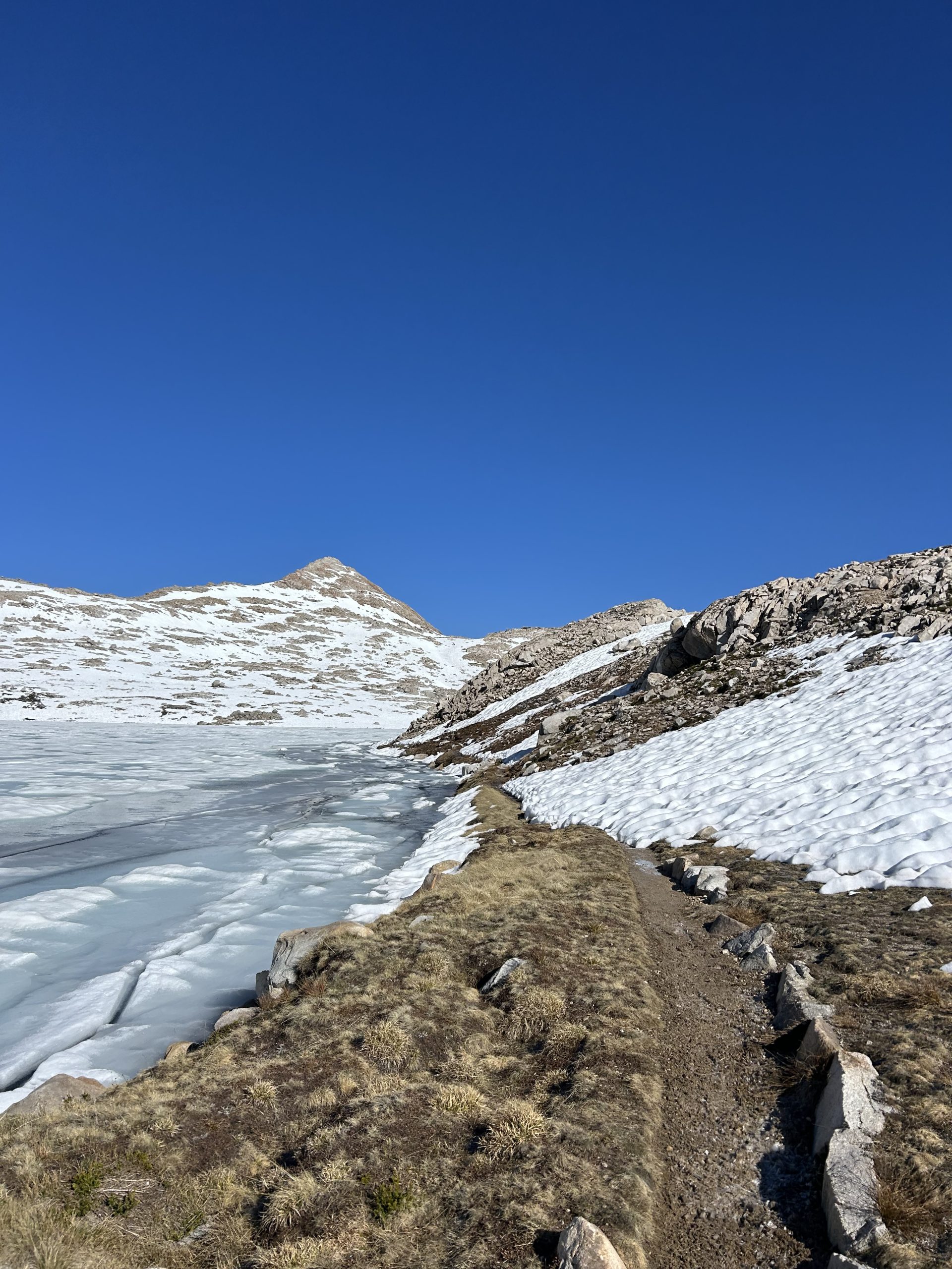
We continued climbing and ran into snow. It was the first snow we’d seen all day and made me weary for what we would face if we went over Muir Pass this afternoon. The snow was slushy in the later afternoon sun and we post holed a decent bit in the few miles we hiked over the snow. The trail kept going up and was covered in more and more snow. We decided to make it to the Tentsite and see how we felt. We slogged through the snow and saw a plateau we were convinced the Tentsite was on. Once we reach it, though, we checked the map and realized we had passed the Tentsite by a quarter mile or so and had to backtrack through the snow yet again.
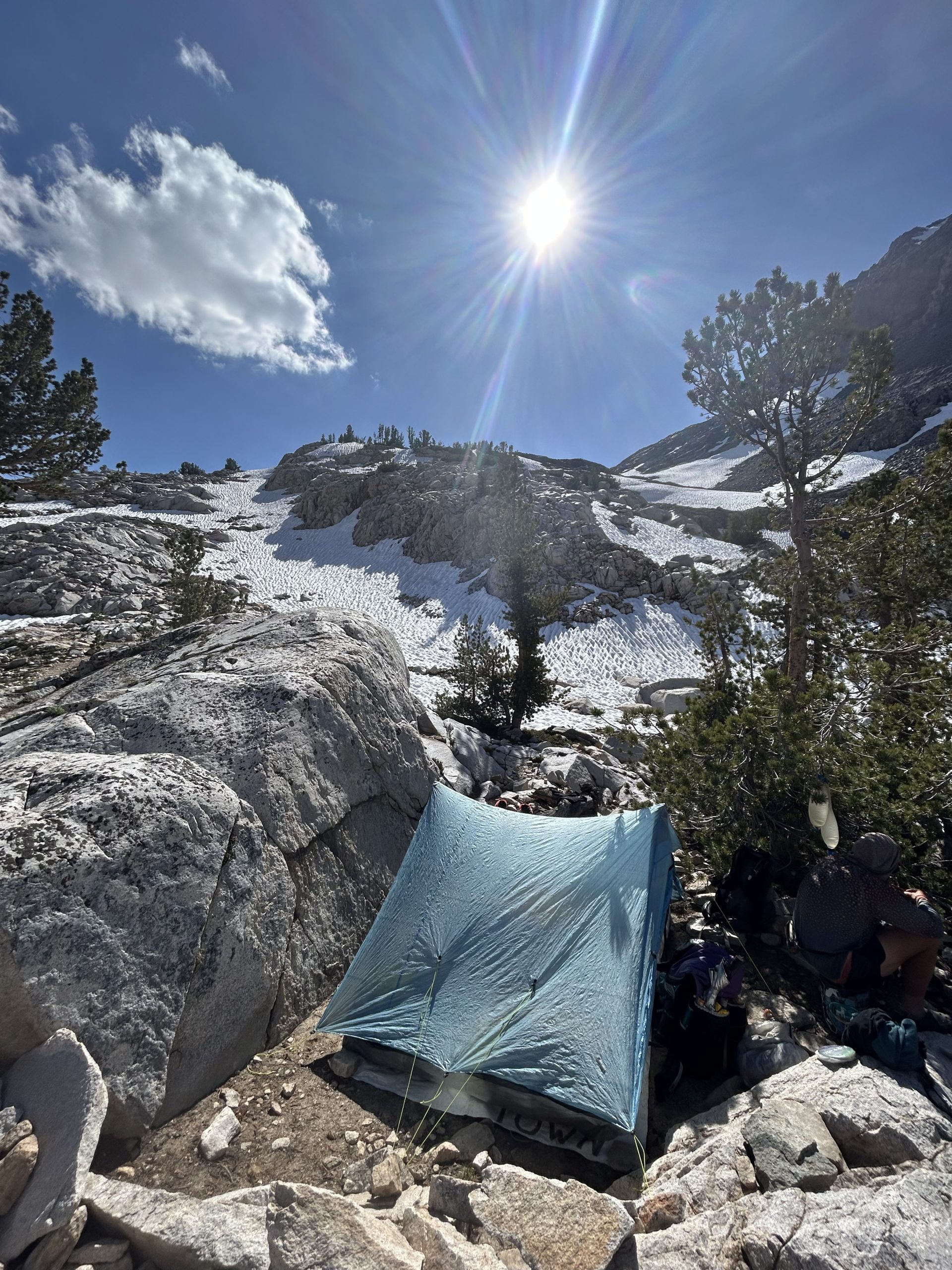
We arrived at the Tentsite just before 4pm and decided to call it. We didn’t want to have to fight the remaining 2 miles over the pass and then slog through the slush on the backside of the mountain. Maddy, Holly, and Petra were already at the campsite set up and thankfully where was enough room for our tent. We set up and realized before Truffles went to have dinner by a waterfall. The edge of the falls made me nervous so I decided to have dinner with the girls instead.
We talked about our lives back home and I learned about Holly’s job as a midwife and how she moved from London to New Zealand several years ago. Petra told us about her family and teenage kids at home and talked about how she hoped to inspire more mother to go out and pursue their dreams.
After dinner Truffles and I crawled into the tent to play on our phones a bit. We were pretty tired form two bigger days back to back and I’m sure we’ll sleep well tonight.
Location: High Sierra
Start: Tentsite – 837.7
End: Tentsite – 857.1
Miles: 19.4
Ascent: 1352 | Descent: 4448
Sleep: Tent
Another good day on trial. My alarm went off at 4:30am and I really didn’t want to get up. It got chilly during the night and I was so warm and cozy under my quilt. I knew that if I delayed our departure, though, we would likely be post holing the entire way down Muir Pass. That was enough motivation for me to get up and moving. It takes us about an hour and a half from the time I wake up for us to get on the trail, so we were hiking around 6am.
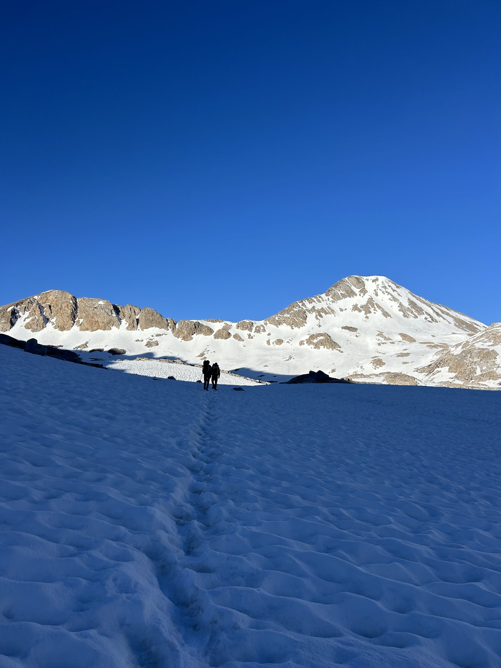
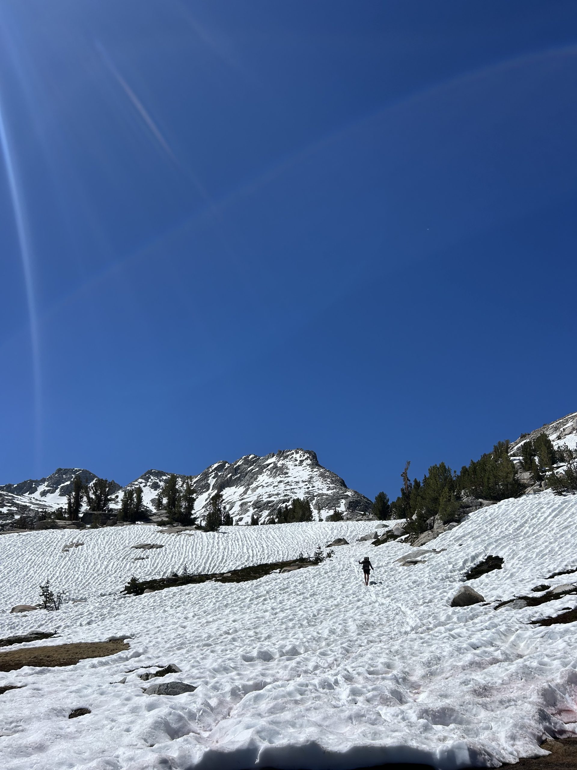
We only had about 2 miles of climbing to do before we got to the top of the pass. Thankfully we did most of the ascent yesterday, and the toughest parts were definitely behind us. The campsite we stayed at last night was right in the edge of the snow, so as soon as we started hiking we were basically in the snow. We had a hard time staying in the trail and ended up way off course several times. We finally got it sorted out and were able to follow the boot prints all the way up.
We leap frogged with another couple all morning, they seemed like they really didn’t want us to pass them. I stopped and out my spikes on and pulled out my ice axe to give me more space, but we still caught up with them quickly. I asked to pass when we started going uphill in earnest, and thankfully they let us by. I hate passing people because it makes me feel like I have to hike really really fast to keep ahead of them. In this case it was challenging because we were climbing over snow, but I was able to set a decent pace and Truffles and I stayed ahead.
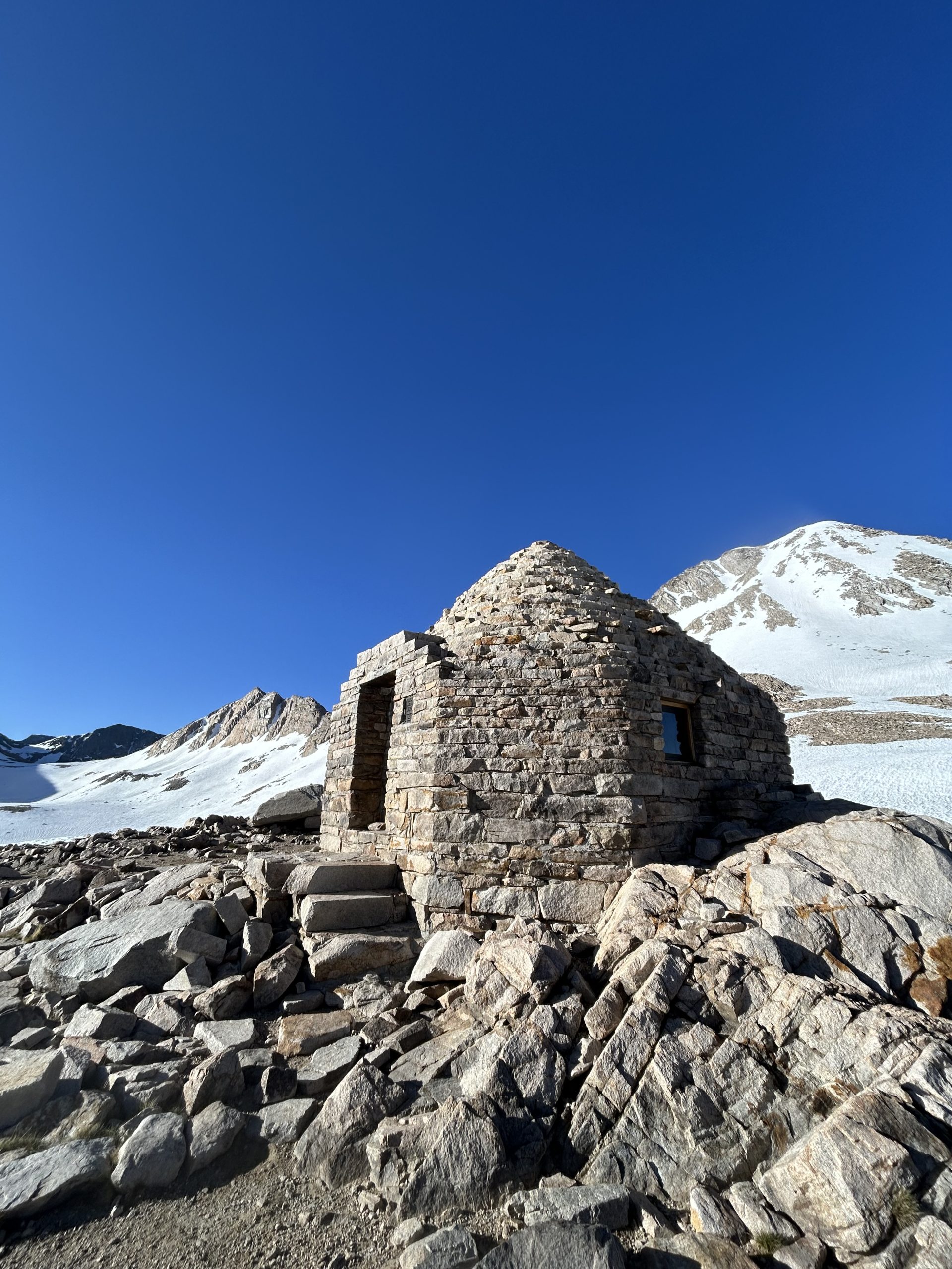
The trail took us around several frozen lakes on our ascent before a final push up to the top of the pass. It was a short and sweet ascent and before I knew it we were at the Muir Shelter. This is an iconic spot on the PCT and one of the few shelters on the trail (although a sign said there was no camping allowed in the shelter). I had seen so many photos of this shelter and it felt like a big milestone to be there. I have a Buff from The Trek that is a PCT map with iconic places listed with their mile markers, and Muir Hut is on there. It was exciting to mentally check off another destination off from that map and see how far we’ve come.
We hung out in the hut for a bit and admired the architecture. I loved the circular dome structure and thought it was so cozy inside. We signed the log book and took some time to read the “confessional” (alas no juicy trail gossip other than people saying they weren’t packing out their TP). Once we were ready to leave we bid goodbye to the hut and set out.
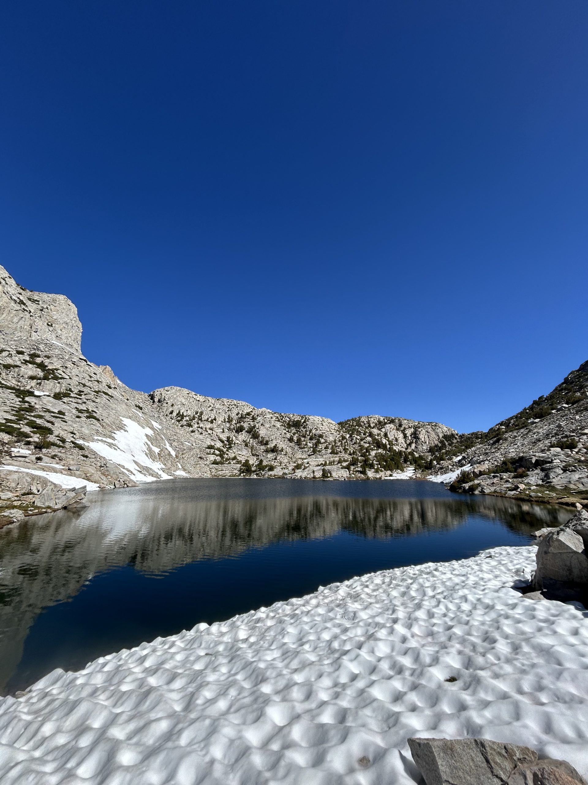
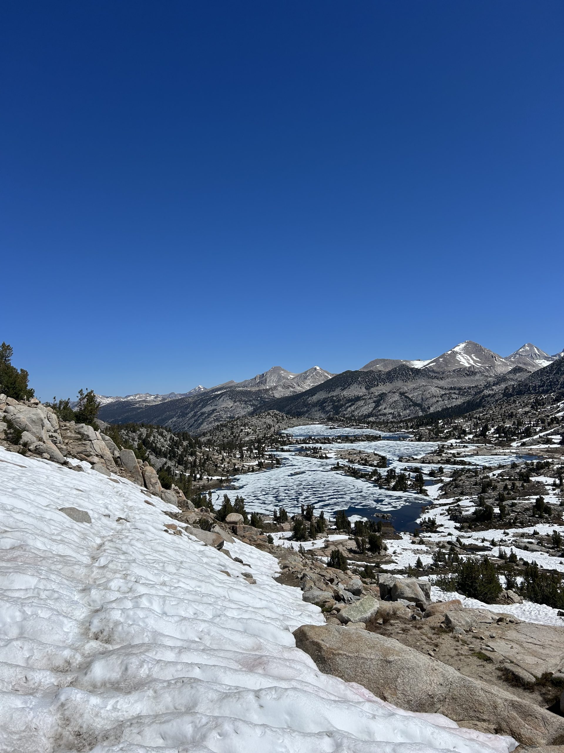
We weren’t sure what to expect on the descent and I kept my ice axe out and my spikes on. We began heading down the pass around 7:30am and thankfully the snow was still firm and it made for easy walking. We didn’t post hole a single time! The trail wasn’t steep or technical and it was easy to follow the boot prints and stay on trail. We passed several more frozen lakes and hiked over lots of small streams that were totally frozen over. We saw more ice today than I think we had any other morning. Some of the rocks even had thin layers of ice on them, especially around the water.
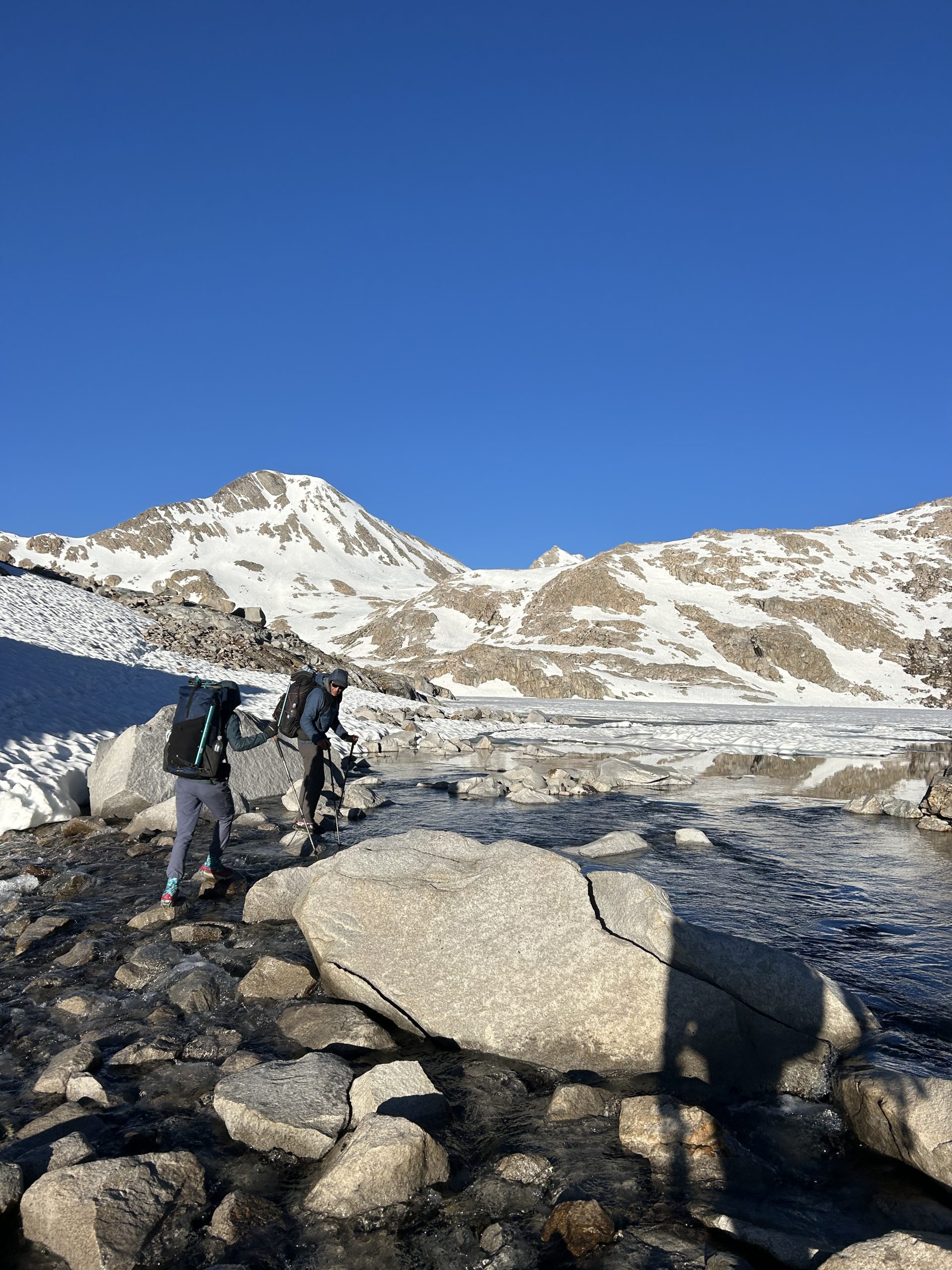
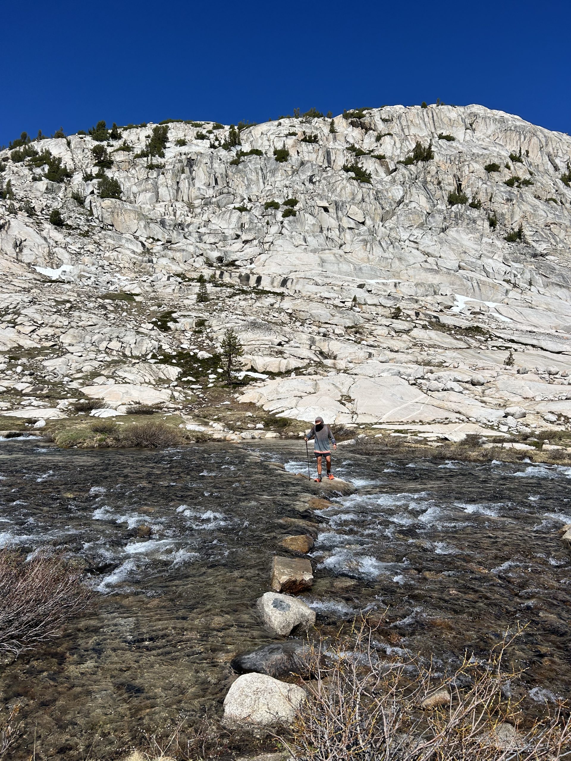
We made good time coming down and were out of the snow about 3 miles after the shelter. We descended to Evolution Lake where we had to cross the inlet. We just waded in through, the water level wasn’t too high. In the crossing, though, Truffle’s trekking pole came off his wrist and floated down stream. I didn’t realize what happened and just saw him drop his pack and take off running down the inlet towards the lake. He said he was afraid it was going to float all the way into the lake and he’d have to swim after it, but thankfully it got stuck in some weeds and he was able to retrieve it.
After that excitement, we stopped to filter water and continued on. The entire rest of the day was downhill and very easy hiking. We hiked around the lake before really beginning to descend into the valley with large pine trees rising up to meet us. We were mostly in a forest for the afternoon and I found myself feeling kind of bored. Today was the first day on trail I just felt like of “meh” about being out here. The scenery was beautiful and I felt fine, but mentally I was just kind of over it. I know there are good days and bad days in trial and I don’t even think today was a bad day, I just wanted really feeling it this afternoon.
One stand out moment from the afternoon was running into a backcountry ranger doing trail maintenance. The interaction was brief, but he did ask to see my permit. I was so excited to hand it over because it was the first time I’ve been asked to show it! He wished me happy trails and sent me on my way.
Getting to lunch helped to get me out of my funk. We stopped at a beautiful campsite just past the McClure Meadow ranger station. It was right in the water, but the river was slower moving here and had deep pools that were clear blue. We found a good place to sit in the shade and even found a log to serve as a back rest! It was easily the best break spot, the only downside was all the mosquitoes. We doused ourselves in bug spray and that seemed to keep them at bay while we ate. Truffles had the great idea to make some hot coffee to pep us up for the final miles of the day. I could have sat and stared at the water drinking coffee for hours, it would have been an incredible campsite. But we needed to cover more ground and willed ourselves to pack up and keep moving.
My boredom faded in the afternoon because we hiked along the river the entire time. Sometimes it was smooth, flat water that was a gorgeous aqua color, and other times it was raging and churning so much that we couldn’t hear each other speaking. We crossed creeks several times I think the cold plunge of my feet was also helpful (plus the lunch time coffee).
We made it to Evolution Creek and chose to take the alternate through the meadow rather than seeing what the river crossing would be like. The meadow gave me flash backs to the bogs on Maine on the AT because of all the mud! It was everywhere and unavoidable. The “meadow” was more like a swamp, but we crossed the river several times and it helped to clean off my shoes. The mud was annoying but the alternate was beautiful! When we passed the ranger station earlier we noticed an inner tube propped up outside the binding. The river was so calm through this stretch we’re certain the ranger comes out here to go tubbing.
The alternate was short lived and we reconnected with the PCT near Evolution Creek Falls. The waterfall was absolutely gushing and one of the most powerful I’ve seen at such a short distance. We loved all the moving water along this stretch! The trail continued taking us down, down, down. We finally hiked away from Evolution Creek and took many stone stairs all the way down to the valley floor. We ere greeted by a bridge over the South Fork San Joaquin River and another few cruisey miles with the river close by.
The last few miles of the day went by quickly as I was excited to get to camp. We found an open and spacious campsite just before Piute Creek Bridge. We arrived around 4:30pm and quickly set up and made dinner. We were both tired and hungry and tried to eat fast so we could hide in the tent from the mosquitoes. They are out in force and making our lives miserable. We’re planning for another big day tomorrow and then looking forward to VVR the following day!
Location: High Sierra
Start: Tentsite – 857.1
End: Vermilion Valley Resort – 875.7
Miles: 18.6
Ascent: 4700 | Descent: 5091
Sleep: Tent
Our first *almost* marathon day! My alarm went off at 4:30am and I accidentally turned it off instead of pressing snooze. Thankfully I woke up around 5:30am on my own and was very confused why the sun was out. I quickly realized my mistake and was up and moving shortly thereafter. I had wanted to be on trail around 6am and we were still able to hit the trail at 6:30am, so I think that’s pretty good.
I completely misread the elevation for the morning and thought we would be climbing right out of the gate. Turns out we got to cruise for nearly 3 miles before the trail began going uphill. This was a pleasant surprise and gave Truffles and I time to chit chat while we hiked.
Once we started going uphill, though, it felt steep and tiring. The first several switchbacks took a lot out of me and I felt slow on the more drawn out climbs. Thankfully once we crossed the 10,000” sign the trail evened out and was a much more gentle incline. Truffles stopped to dig a cat hole and I crossed the creek and hiked ahead of him.
There was significantly less snow today compared to any other day in the Sierra so far. There were small patches hidden in the shade on the climb, but overall it was mostly snow free. I passed several small lakes and waterfalls and was proud of myself for keeping my feet dry on the creek crossings.
About 2 miles from the top of Selden Pass I ran into Holly. I went ahead of her but promised she’d catch up when I stopped to filter water. I hiked hard to get to Heart Lake to get water and take a break to wait on Truffles. I ran into a little bit of snow as I climbed but was able to move swiftly.
There was a large open meadow by the lake that I stopped at and I saw multiple marmots running around as I waited. Holly and Truffles reached me quickly and we all talked about the fish we’d seen during the creek crossings. Truffles and I continued on for the final push up to the pass.
The last mile was steep but manageable with just enough snow to slow us down. We took switchback after switchback and followed the boot prints to lead us to the top of the pass. Once there we could see Marie Lake in the distance and the trail snaking along the shoreline. We didn’t linger and began the descent.
There was more snow on the backside of the mountain, really just enough to be annoying. It was around 11am but the snow was still firm and we didn’t post hole. We alternated between hiking in snow and the dirt trail all the way down to the lake. We were surprised to hear frogs croaking under the snow and even more surprised to actually see some! It looked like they were mating and Seek identified the frogs as several different species, so who knows what we actually saw.
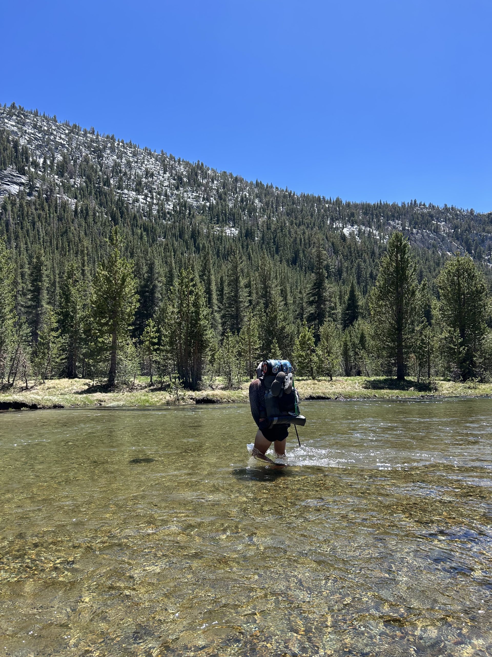
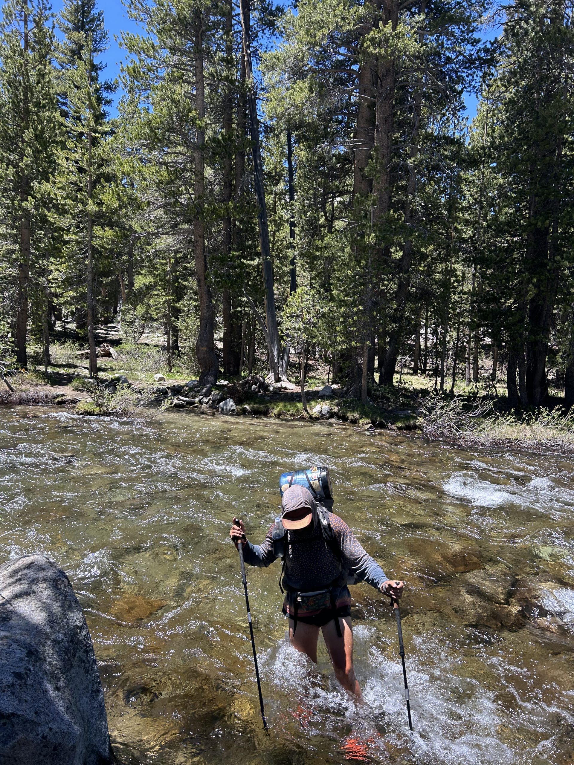
We hiked hard over the snow and were very eager to get out of the lingering snow. It ended about 33 miles after the pass and we were so grateful to see the solid dirt trial. We decided to take lunch after crossing Bear Creek. According to the comments, “Bear Creek is often cited as the most dangerous crossing”. We weren’t sure what to expect but were less concerned when we actually saw the water. We must have hit it at a good time because while the water was rushing past, the current wasn’t overwhelmingly strong. We felt comfortable crossing at the trail and the water came to my upper thighs. The current was swift but I never felt like I was going to be swept away.
Once on the other side we ate a quick lunch and continued hiking. Our initial plan for the day was to get to the junction with Bear Ridge Trail and then hike down to VVR the following day. When we stoped for lunch around 12:30, we realized we were only 12 miles from VVR (including the 7ish mile side trail to actually get there). We decided to try and push it and see if we could make it in time for dinner at 5:30pm.
We were at an advantage in the afternoon because the trail was mostly downhill. This allowed us to fly and we made great time to the junction to head down to VVR. The only hard part in the afternoon was the final climb up to the junction which absolutely kicked my butt.
Once we were at the junction it was basically all downhill. We still had 7ish miles to go, but I was so motivated by the thought Kristin restaurant food. The trail was pretty but partially swampy and had lots of blow downs. We still hiked quickly and were at the trailhead around 5pm. Form there we had a couple miles to walk on a gravel road, but thoughts of real food propelled us forward.
We arrived at VVR at 6pm and were so happy to see the rustic “resort”. It’s basically a small store and restaurant with some campers parked out front. It was perfect for hikers though! Thru hikers get their first drink for free and we placed orders for the shrimp and steak platter and enjoyed our beverages on the porch while waiting for our food. Most of the other customers were thru hikers and it seemed like this was a good hangout spot.
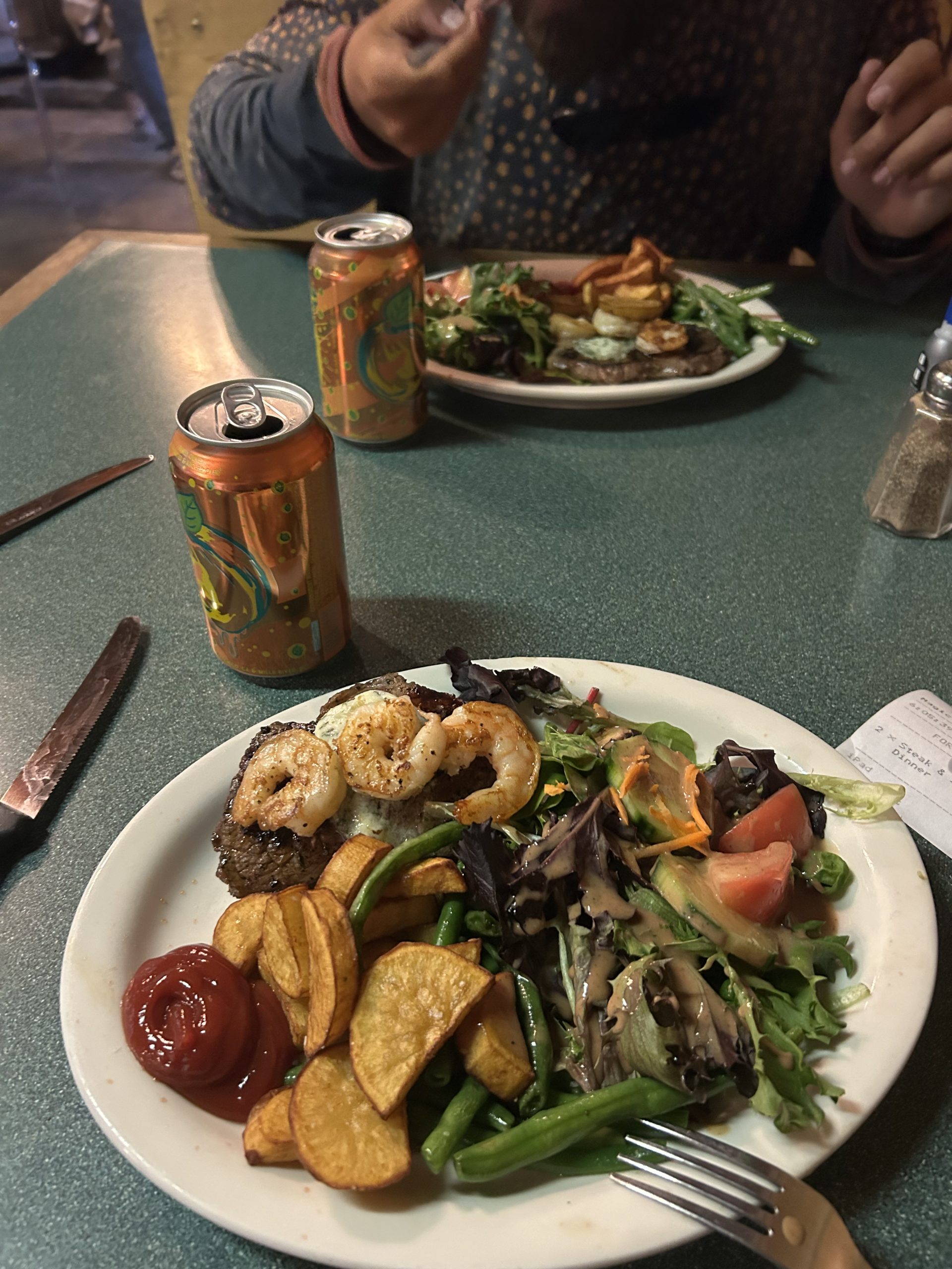
When our food was ready we were so happy with our salads, potatoes, green beans, shrimp, and steak. A normal person would have been stuffed, but I honestly could have eaten an entire additional plate. The food at VVR was said to be expensive and the rumors were true, but we figured we saved money by hiking in rather than taking the $20 ferry.
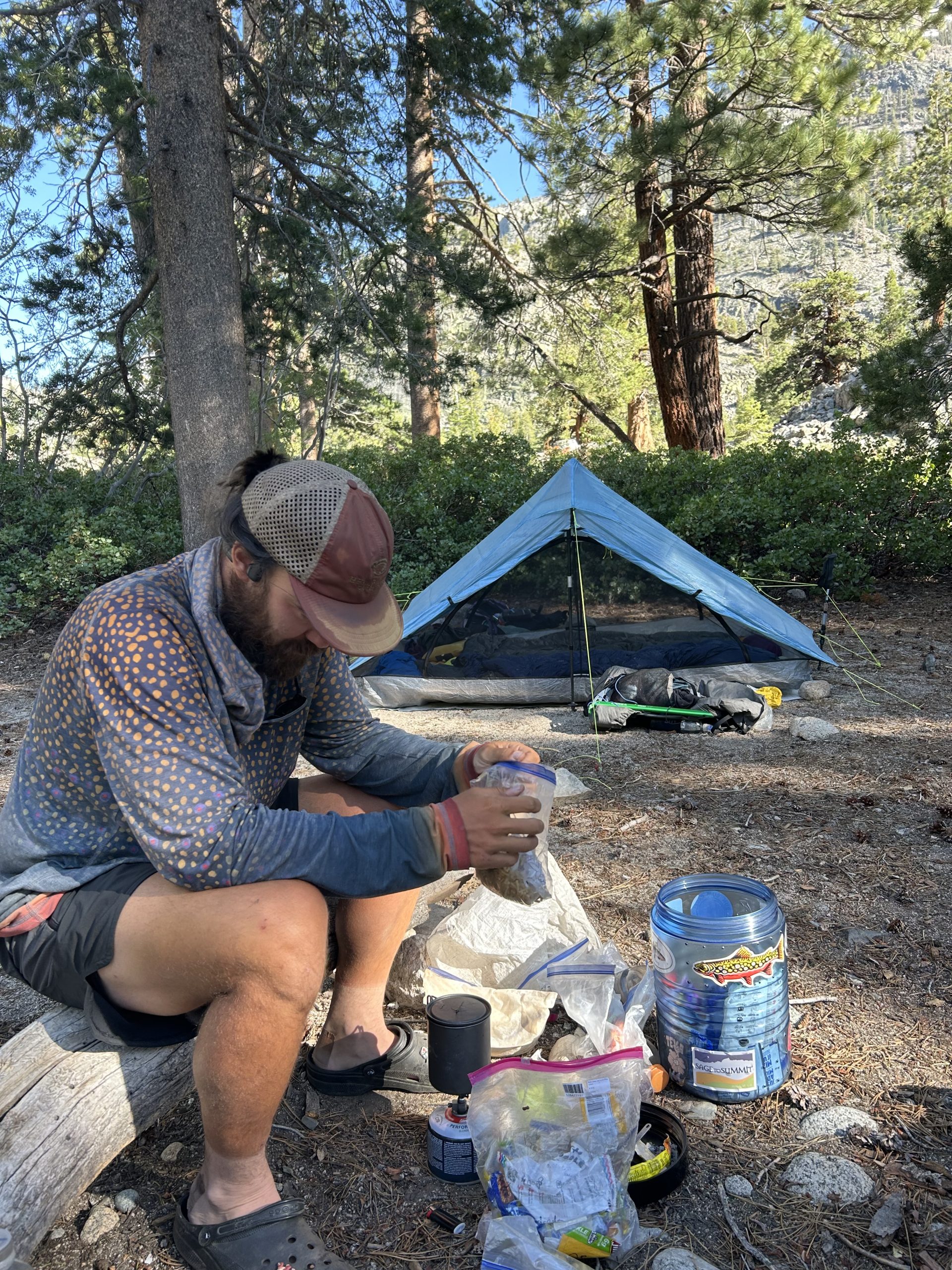
After dinner we set up our tent in the mini tent city and sorted through our food. We only need 2 days of food to get us to Mammoth and neither of us ended up needing to buy anything extra. We talked to Andrew, Shaman, and Footzilla a bit before going into the tent to hide from the mosquitos. We officially hiked 25.6 miles today, 18.6 of them being PCT miles. I’m already looking forward to breakfast in the morning!


