
This morning when I woke up down by the river, the bugs were a lot less bad. Last night the mosquitoes were absolutely crazy. Fortunately, I haven’t experienced mosquitoes like that while hiking. It just seems to be when I get to camp at the end of the day every now and then.
I tried to get packed up nice and early and was out by first light. Forester pass is still 9 miles away and I want to get up and over it as early as possible. I’m very curious about the snow conditions on these mountain passes. Far out comments from about 5–7 days ago describe the conditions as majorly improved. There are small patches of snow primarily on the north side of these mountains. Forester is the highest pass on the PCT, so I think the snow conditions on that mountain will be a good representation of what to expect moving forward.
Another beautiful sunrise in the Sierra.
I passed by a bunch of people over the course of the morning who were still set up at camp. And had a brief climb to start the day before the trail dropped down for a couple miles into a meadow. I tried to eat as much as I could before I began climbing once more. The climb up Forester goes on for about five or so miles and is over 3000 feet of gain. The pass itself rests at 13,200 feet and change. Making it the highest point on the PCT. Only Mount Whitney is higher, but isn’t technically on the PCT.
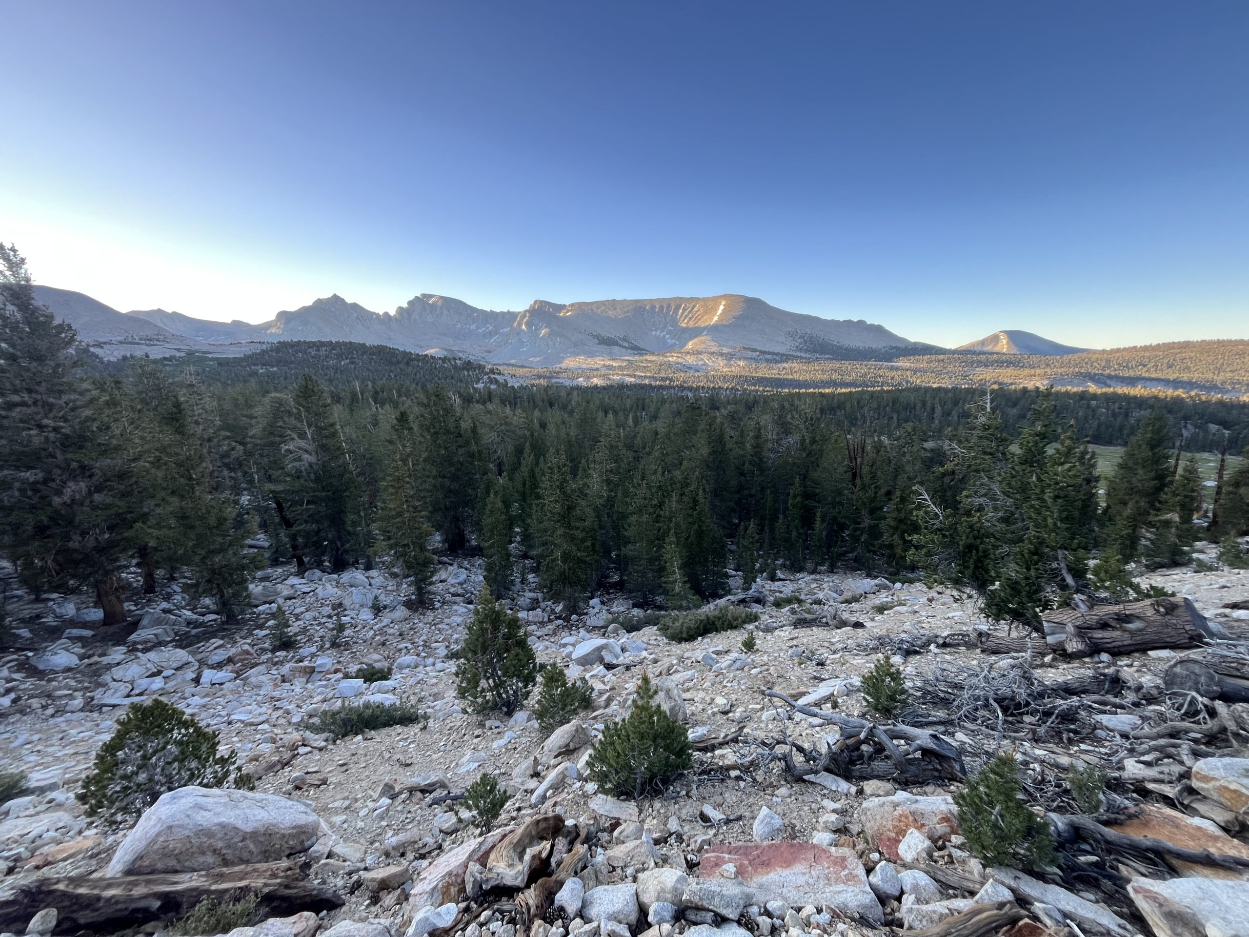
I love the glow of the mountains in the morning.
Some sections of the climb were gradual and fairly easy. But as I got closer to the base of the mountain, it became steeper and steeper. I passed a hiker going the opposite direction who talked to me briefly. And he did something that some men on trail just can’t seem to help but do. He made some snarky comment about how I should “enjoy all the climbing“. It was clear he didn’t mean it literally and was more so attempting to say that the climb up the pass was going to be really bad. I love when people make comments like this to me, especially men. I immediately felt more energized as I made my way towards the pass.
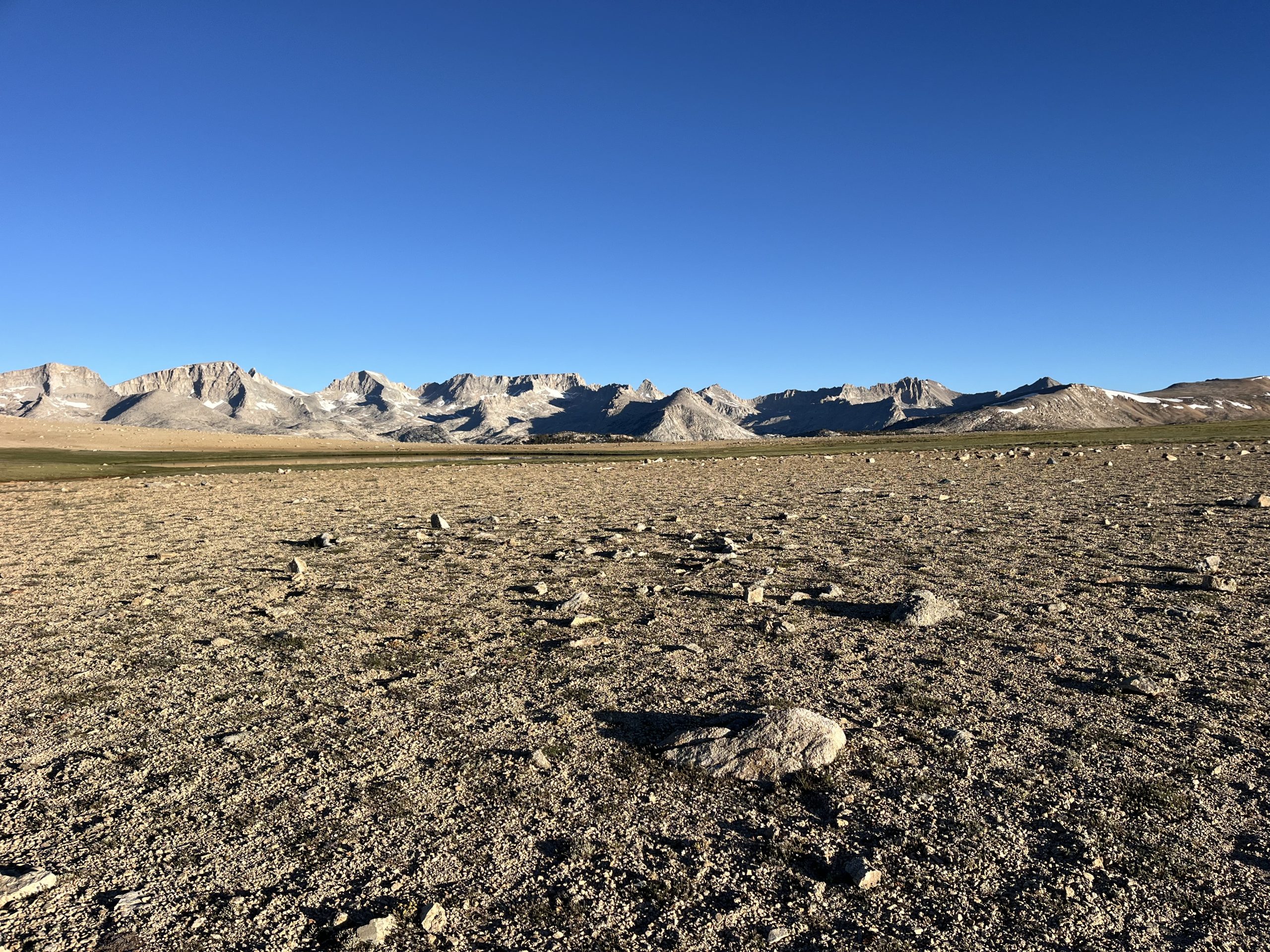
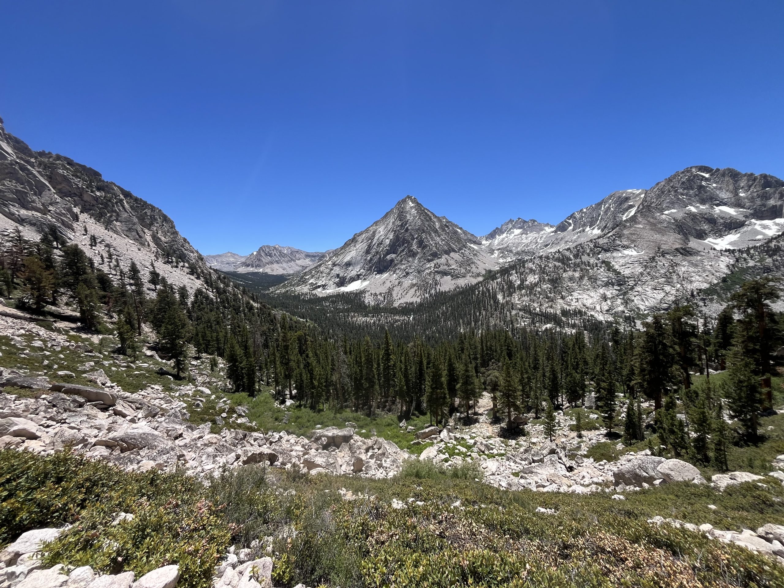
Before continuing to climb, the trail went across this flat stretch of valley.
The more time that I’ve spend in the thru hiking community, the more I’ve realized that experience hikers tend not to give advice. Sure, every now and then you hear or see something and you have to give a helpful tip or two. Generally, I’ll only give my opinion on a situation if I think that a person is going to make an unsafe choice. Perhaps I’ll share stories from prior experiences. But I really never try to give advice to anyone else. You don’t know other hikers skill level, comfort level, or anything like that. The man who walked by me this morning certainly doesn’t realize that just a handful of days ago, I climbed 10,000 feet of elevation gain in one day in the white mountains. Even doing three passes a day here in the Sierra, you’ll never climb that much in one day. And if you climb three passes in one day, you’re doing about 35–40 miles.
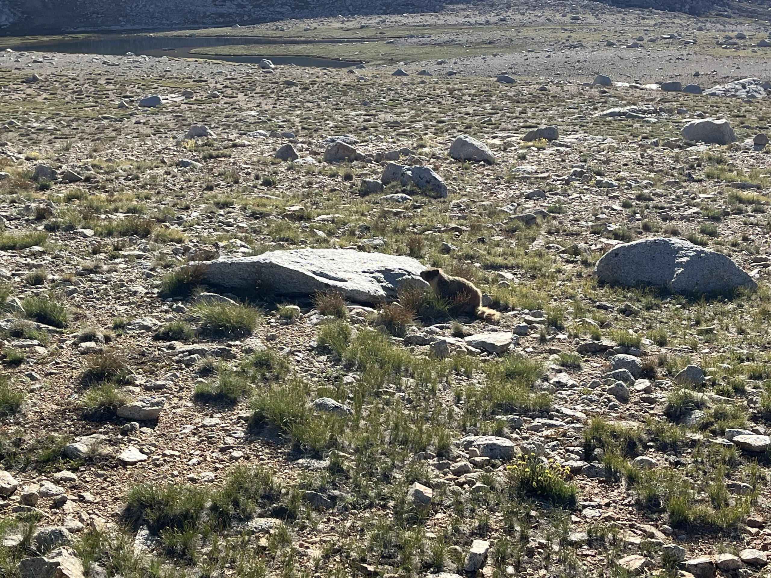
A marmot! I love watching them scamper around.
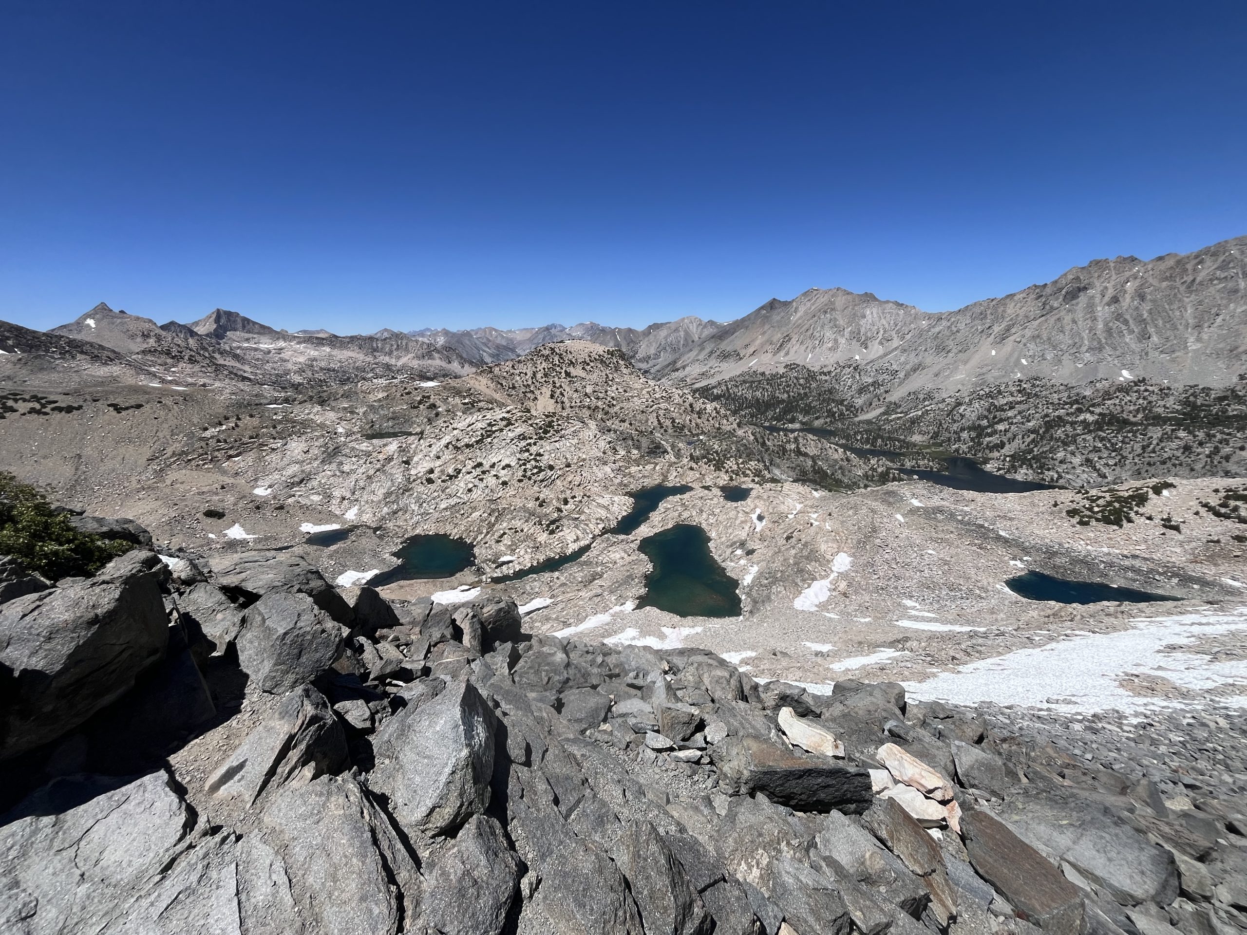
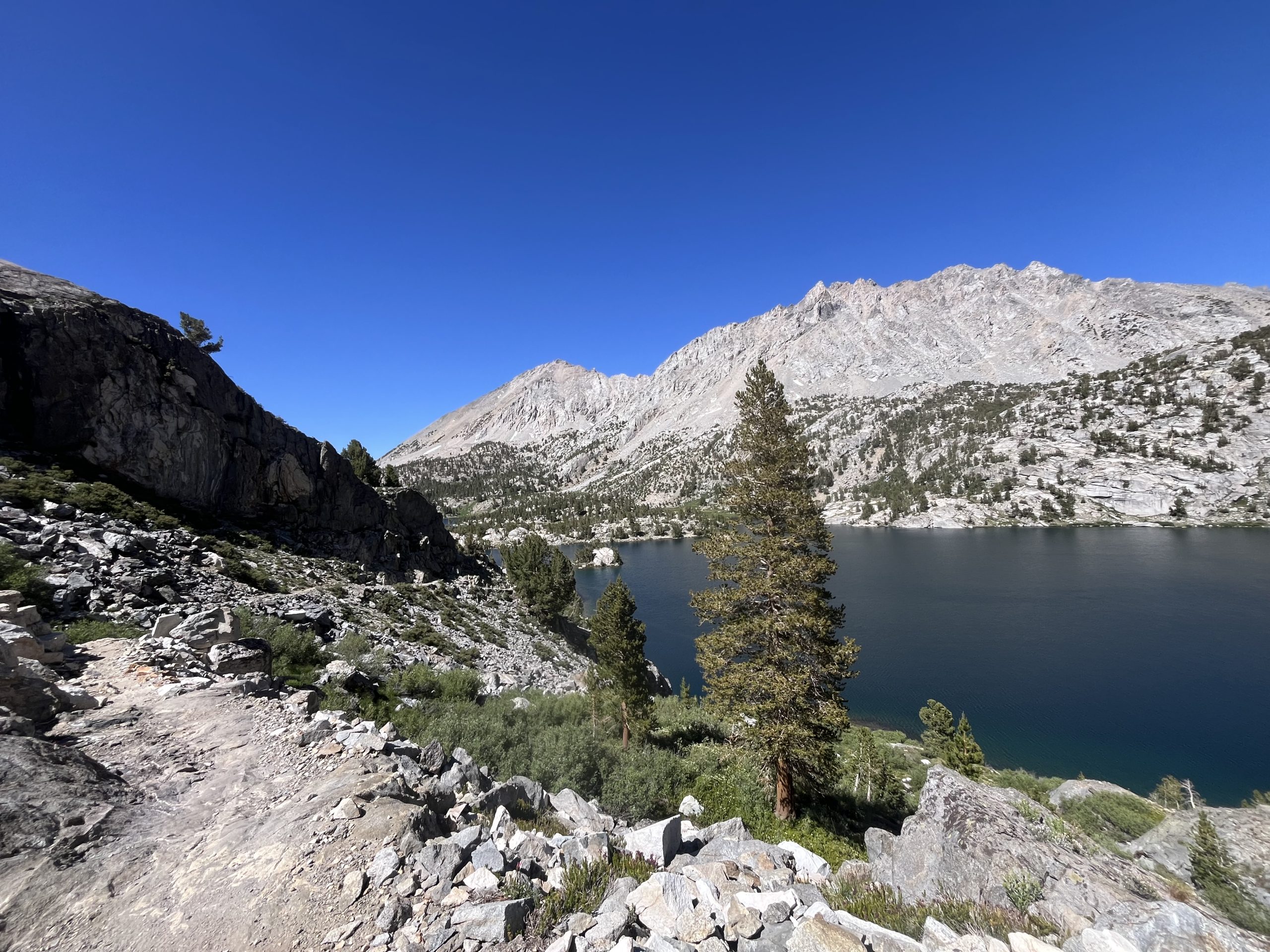
As I got closer to the pass, I went by a bunch of hikers going the same direction. Then had to navigate across a couple very brief segments of snow. Most of them you could easily walk around if you wanted to. I saw loads of marmots, which are some of my favorite animals in the whole world. And the views were exceptional as I continued to make my way toward Forester pass.
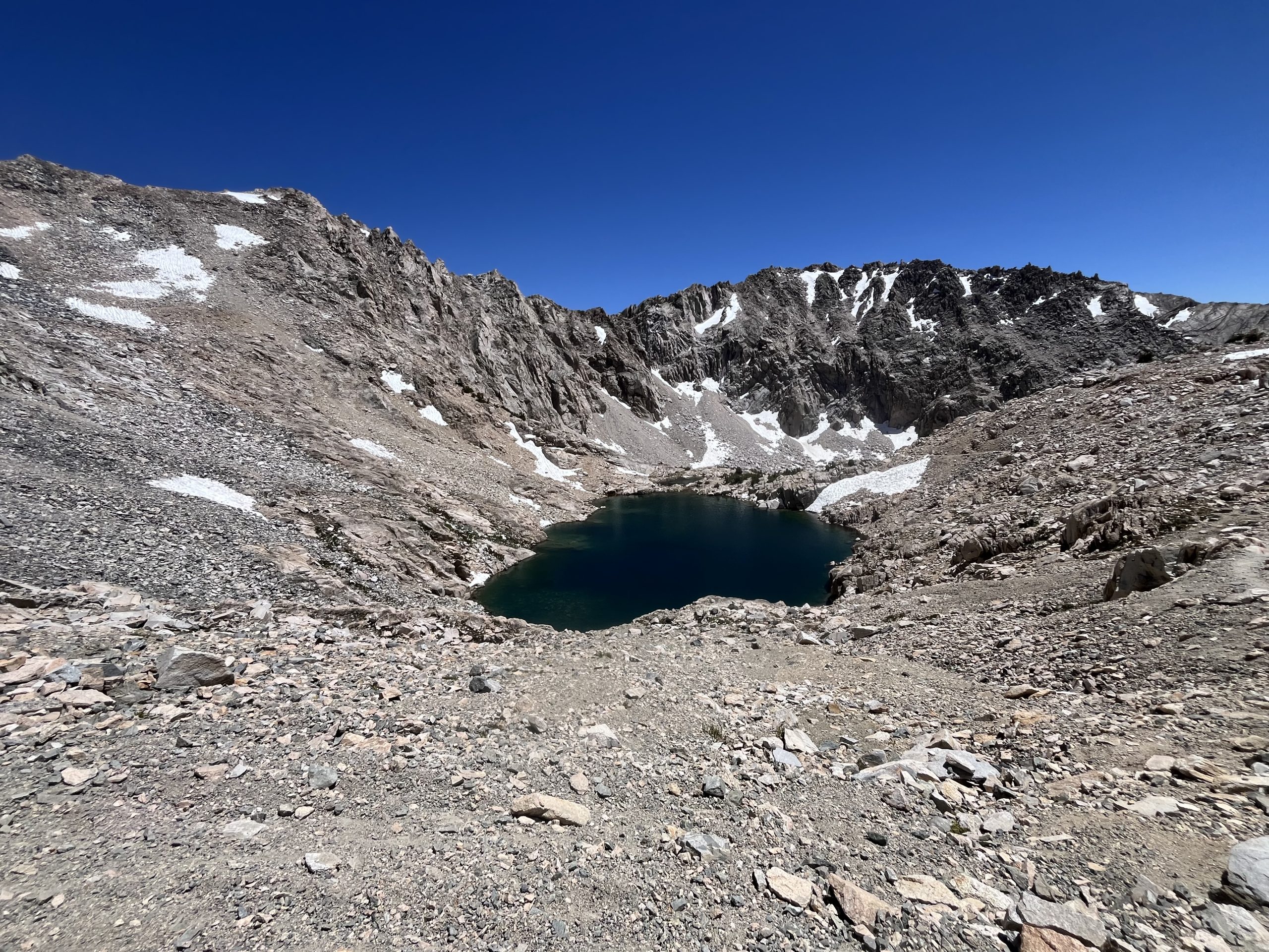
Great views as I continued up forester pass.
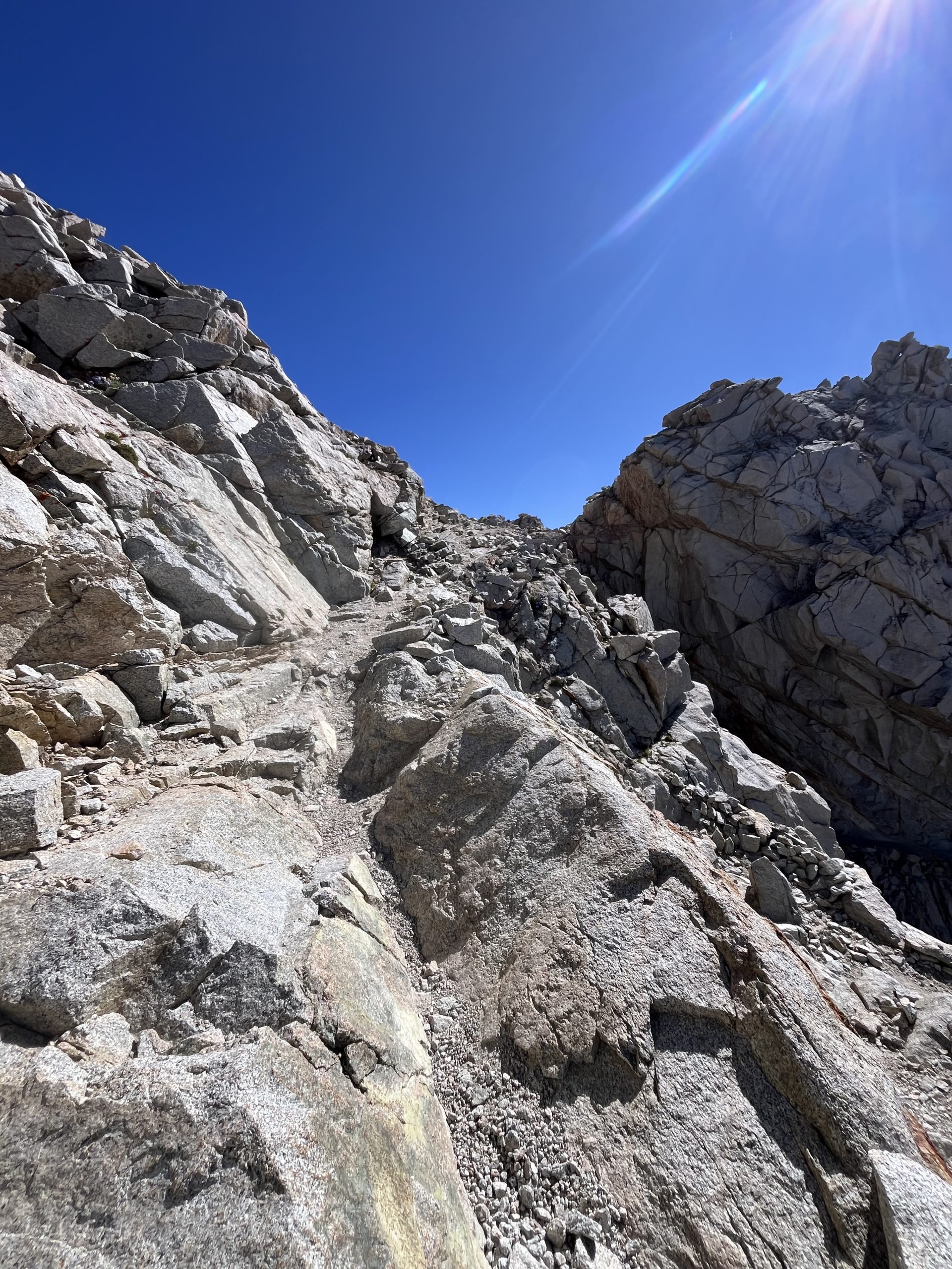
Luckily, the trail provided a little bit of reprieve before the final push up toward the top. I went past a couple more hikers, and then began switch backing up the final chunk of mountain, heading towards the pass. I could see a hiker off the distance and at first I thought it was one of the guys I’d passed earlier. But then, as I got a closer look, I could tell it was Hillbilly! A Hiker that I met at KMS who left a day before me. I must’ve passed him this morning when he was still in his tent. He has a Palante desert pack, just like mine, which made him easy to recognize. I think he’s the first person I’ve seen all year with a Palante. He has the same green one that I used all last year on the CDT. Which is probably my favorite. But I wanted to use a white one this year so that I could get friends, Trail Angels, etc., to sign it.
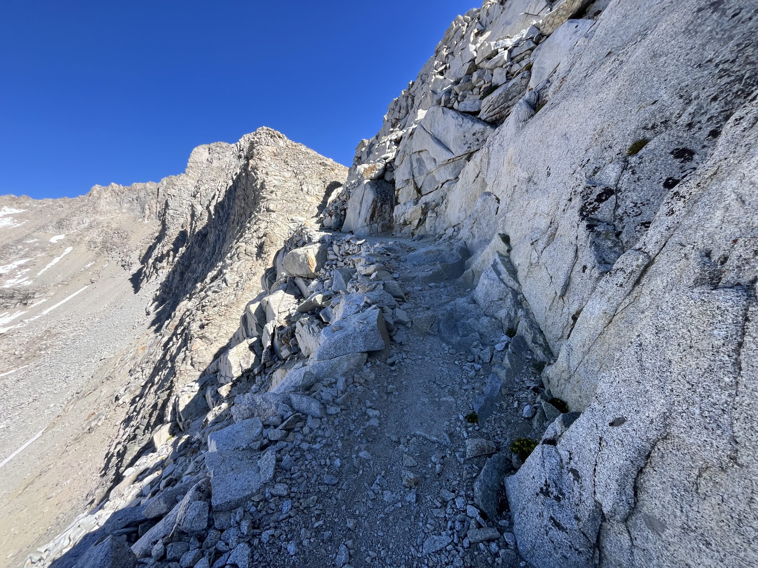
The final climb up to the top of forester.
I had to stop a few times on my way up the switch backs just to breathe and rest briefly. I’ve been feeling really good at the higher elevation, but it still gets you a bit tired. Which is funny because the climbs won’t have me huffing and puffing, but I just feel the overpowering need to rest every now and then. Not long after that I was up at the top of the pass, the highest point on the PCT.
Forester pass is so much more enjoyable to climb without deep, scary, snow!
I lingered for a minute or two because I knew Hillbilly wasn’t far behind. Right as I began to descending he made his way up to the top and I chatted with him for a minute. He had seen me walking past earlier today. But was going through some of the bear boxes to see if hikers had left any food behind. It’s really common in places with bear boxes that people will abuse them and leave trash and additional food behind to cut back on weight. That’s one of the unfortunate things about even having access to things like bear boxes. While it’s great for storing your food and protecting wildlife, it usually just results in hikers leaving things behind for someone else to deal with. But that works out great for hikers who needed a little bit of extra food.
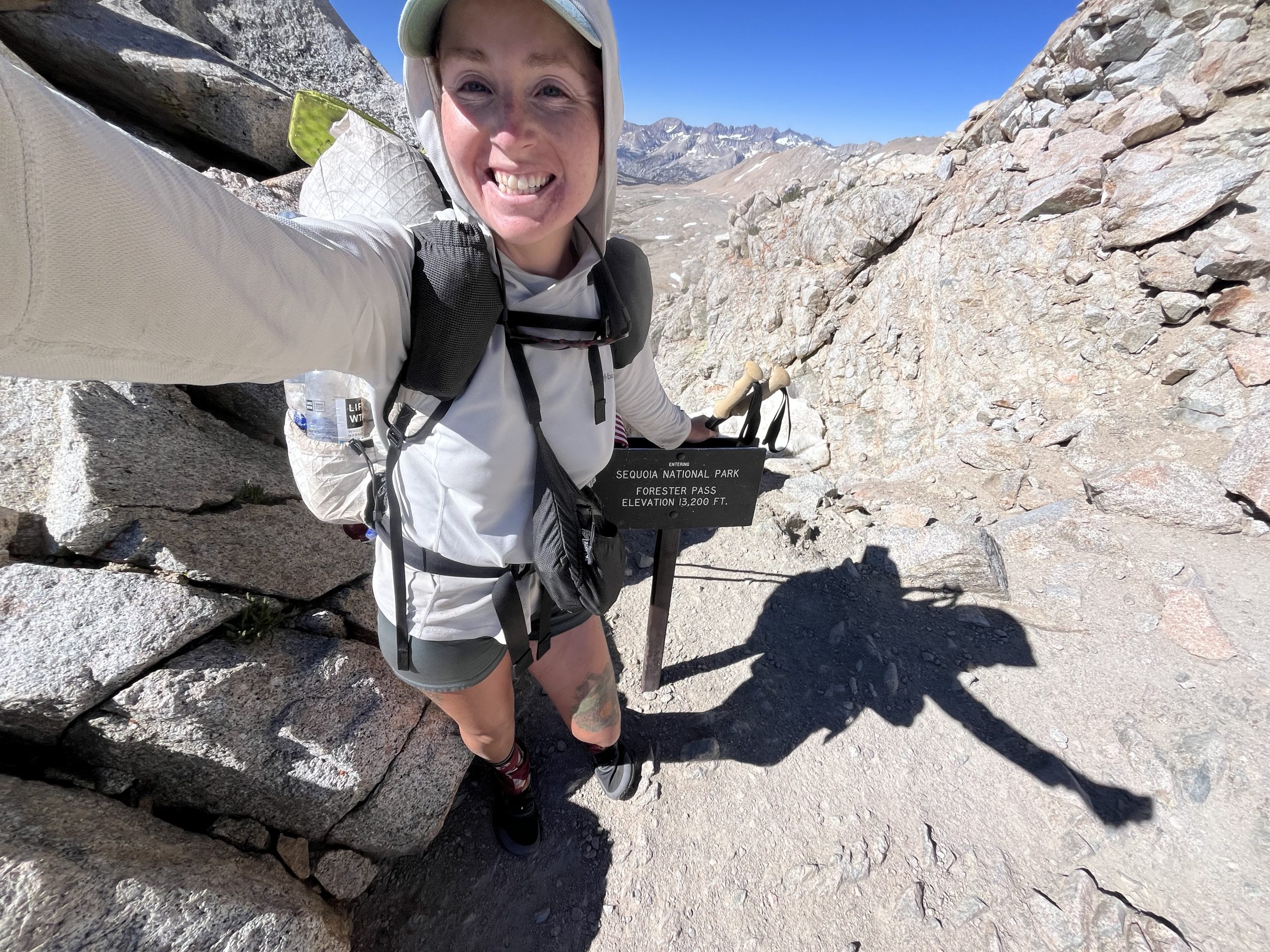
On top of the PCT high point!
On the descent, there were a couple patches of snow that I was able to walk completely around. Then I ran into a hiker going the opposite direction who recognized me off of my videos. He’s doing the JMT and was really nice. He had said yesterday he thought about quitting, but kept going anyway. Which is good because he’s almost done! He warned me about one small patch of snow that I would have to cross, which was steep with big fallout. But he said he didn’t even put micro spikes on for it and it was fine. If I only have to worry about one see section of snow in the Sierra, then I’m doing pretty well.
I continued descending and eventually Hillbilly caught up with me and we wound up walking together for a while. When we did come to that patch of snow it was definitely a lot steeper going downhill versus uphill. It just looked slushy and slick and if you did fall you probably would’ve been hurt. I’m carrying microspikes because I wasn’t certain of the snow conditions. So I decided to throw them on quickly to at least use them once.
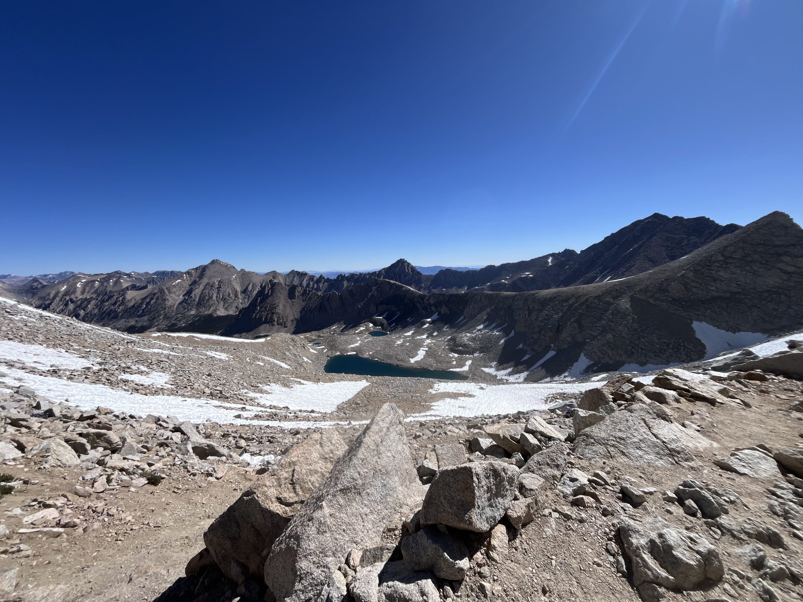
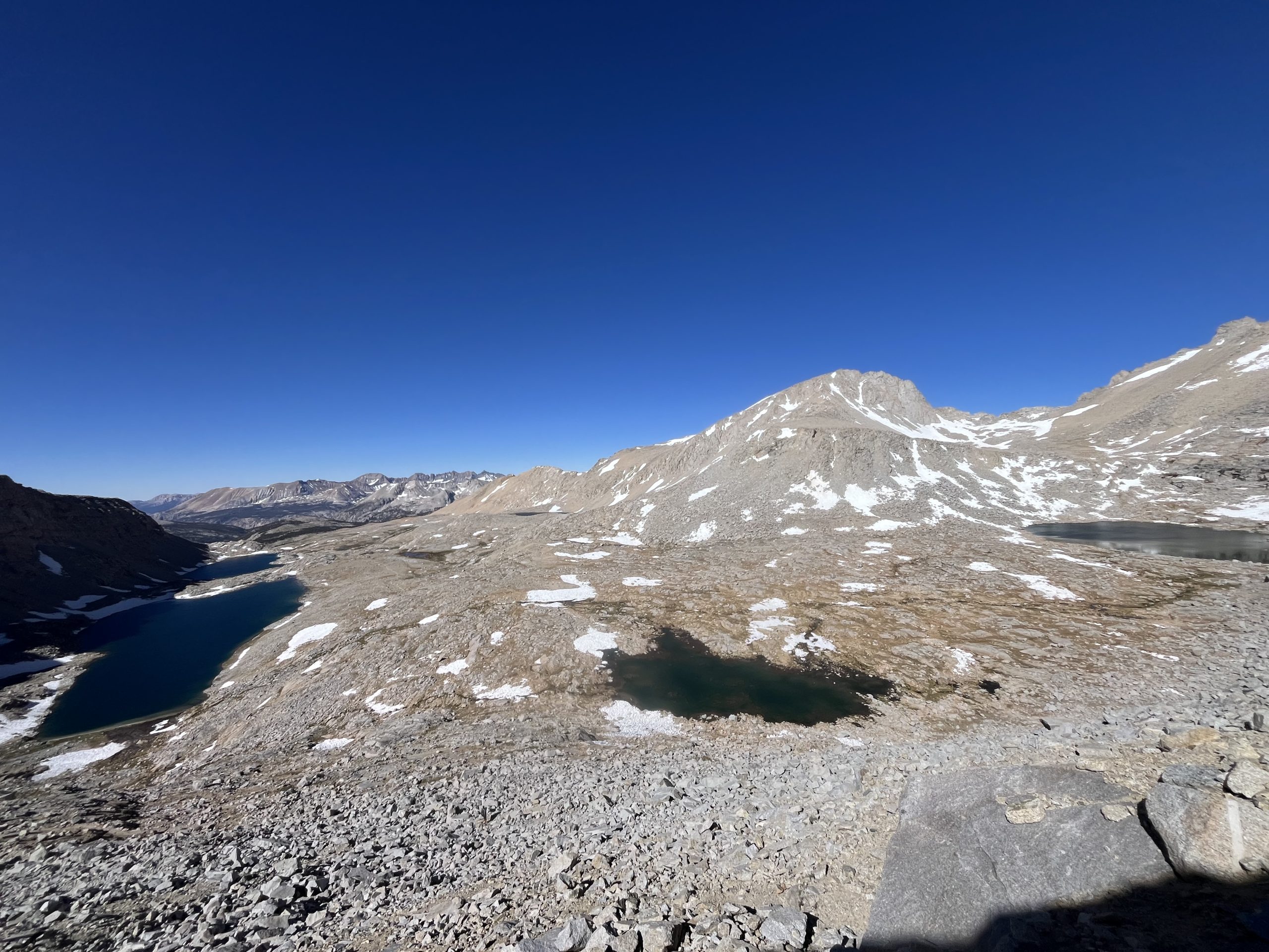
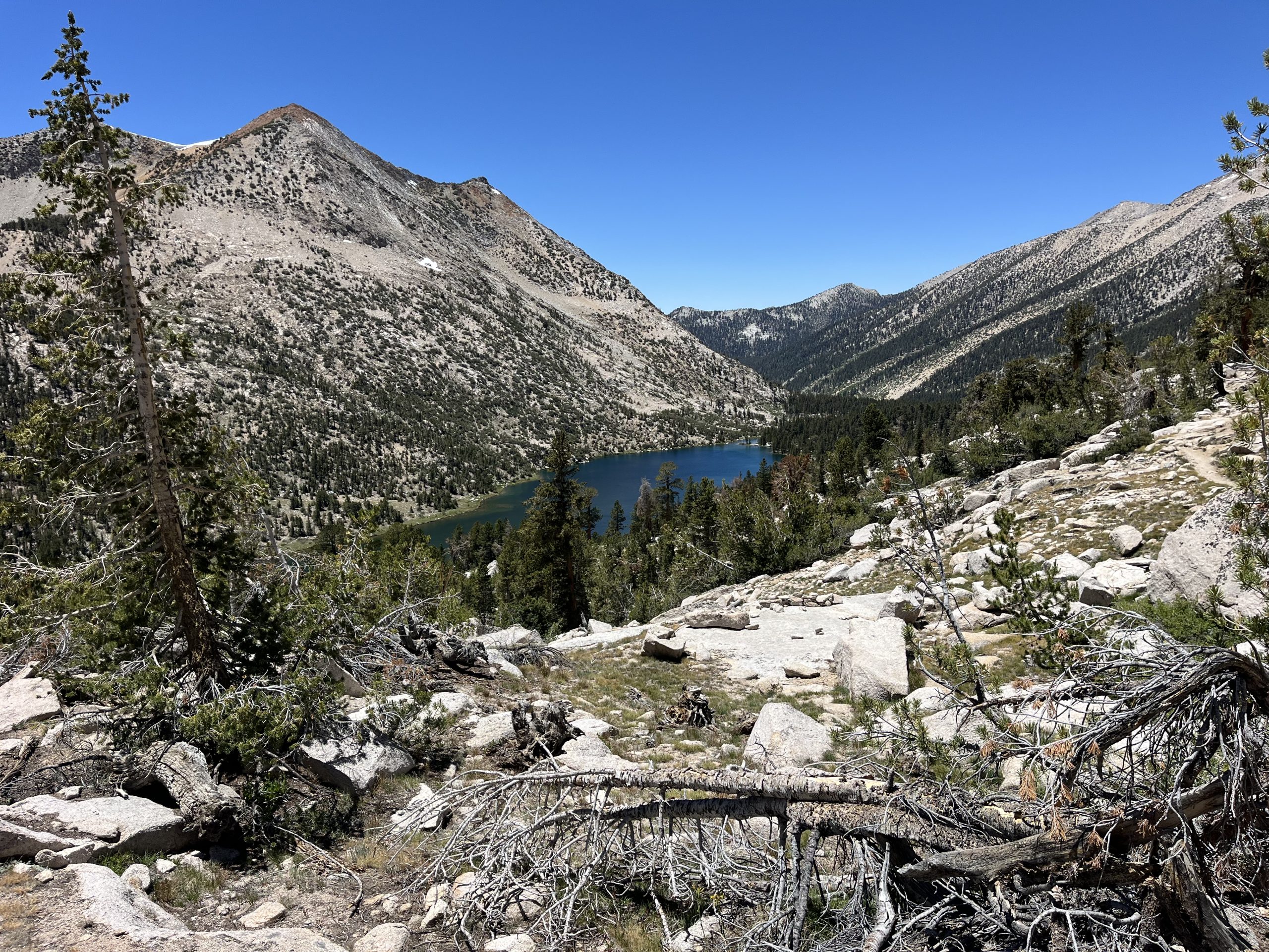
Looking ahead north, down off of forester pass.
I felt pretty comfortable once I had the spikes on. And Hillbilly who was just behind me didn’t use them and had a perfectly fine time getting across the snow as well. From there, we continued walking together for a couple of miles and chatted. He is hiking the PCT with his partner of 10 years, Flower. I met her at Kennedy Meadows as well, but she thinks she has a stress fracture in her foot. So she’s taken the last two weeks off and plans to take two more weeks off while Hillbilly makes his way through the Sierra. They’ve done the JMT together, so her hope is that by the time he completes this section she can get back on to do the portions of trail that she hasn’t done before. Even though the JMT and PCT don’t parallel through the whole Sierra, there’s a lot of overlap.
It’s a unique routine, climbing up and down passes in the sierra. Each time the terrain changes in such a predictable way.
Eventually Hillbilly decide to stop off to eat something and grab some water and I continued along. He’s really tall and his pace is quite fast, but I’m not sure if we’ll see each other again. He’s generally doing closer to 25 mile days, which is really solid in the Sierra. I’m just trying to push myself as far as I can every single day. Which definitely isn’t necessarily the most fun or comfortable way to hike a trail. If I wasn’t on a time crunch and wasn’t doing the calendar year triple crown, then I would certainly be going a bit slower. But I think if I can do the Sierra in above average in pace, then that will set me up for the rest of the year. There won’t be very many sections remaining for the entire year that are as difficult or tiring as this one.
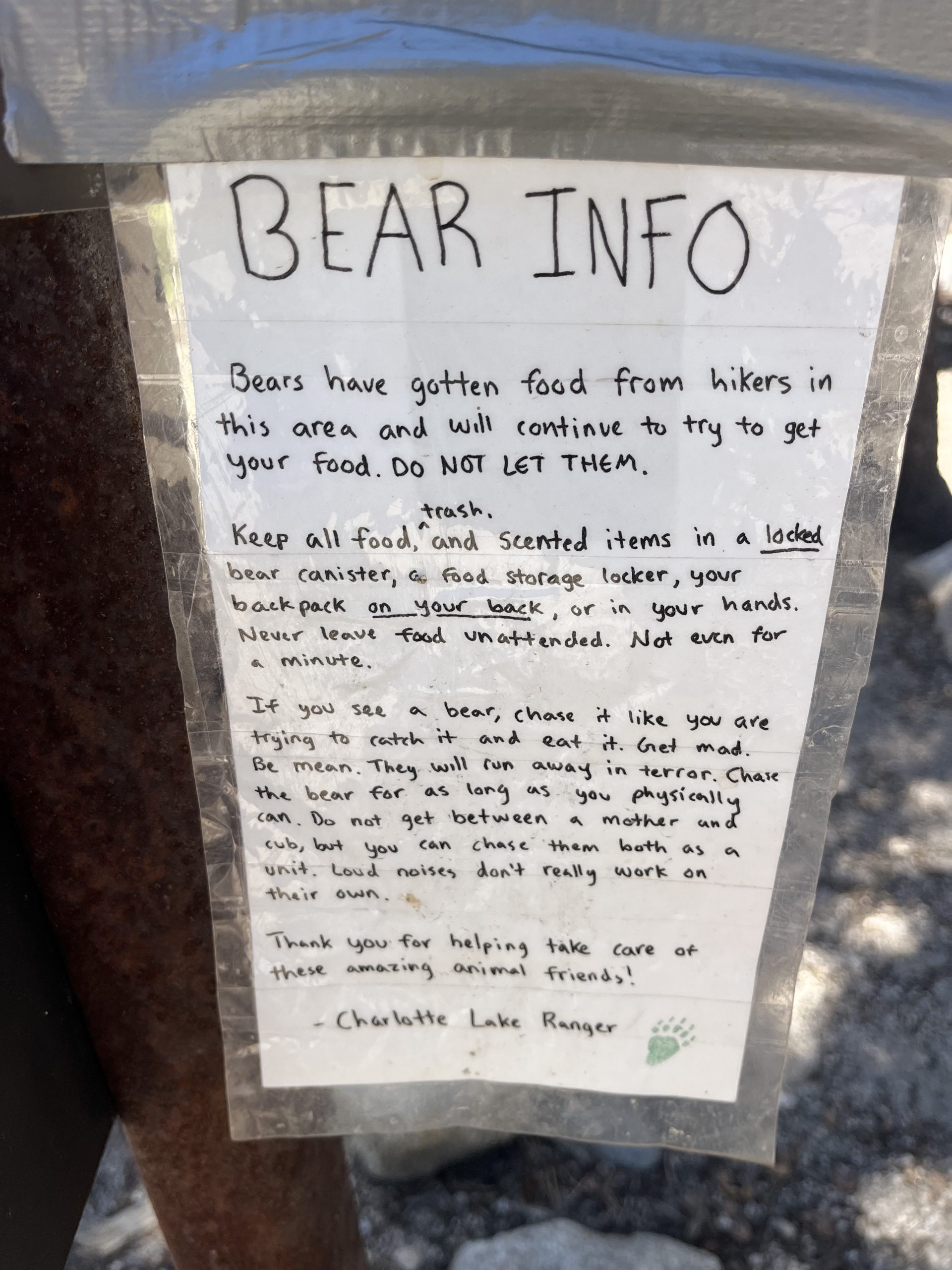
I thought it was hilarious that you can “chase a mom and cubs as a UNIT.” Imagine actually doing that? I don’t know if I’m that brave.
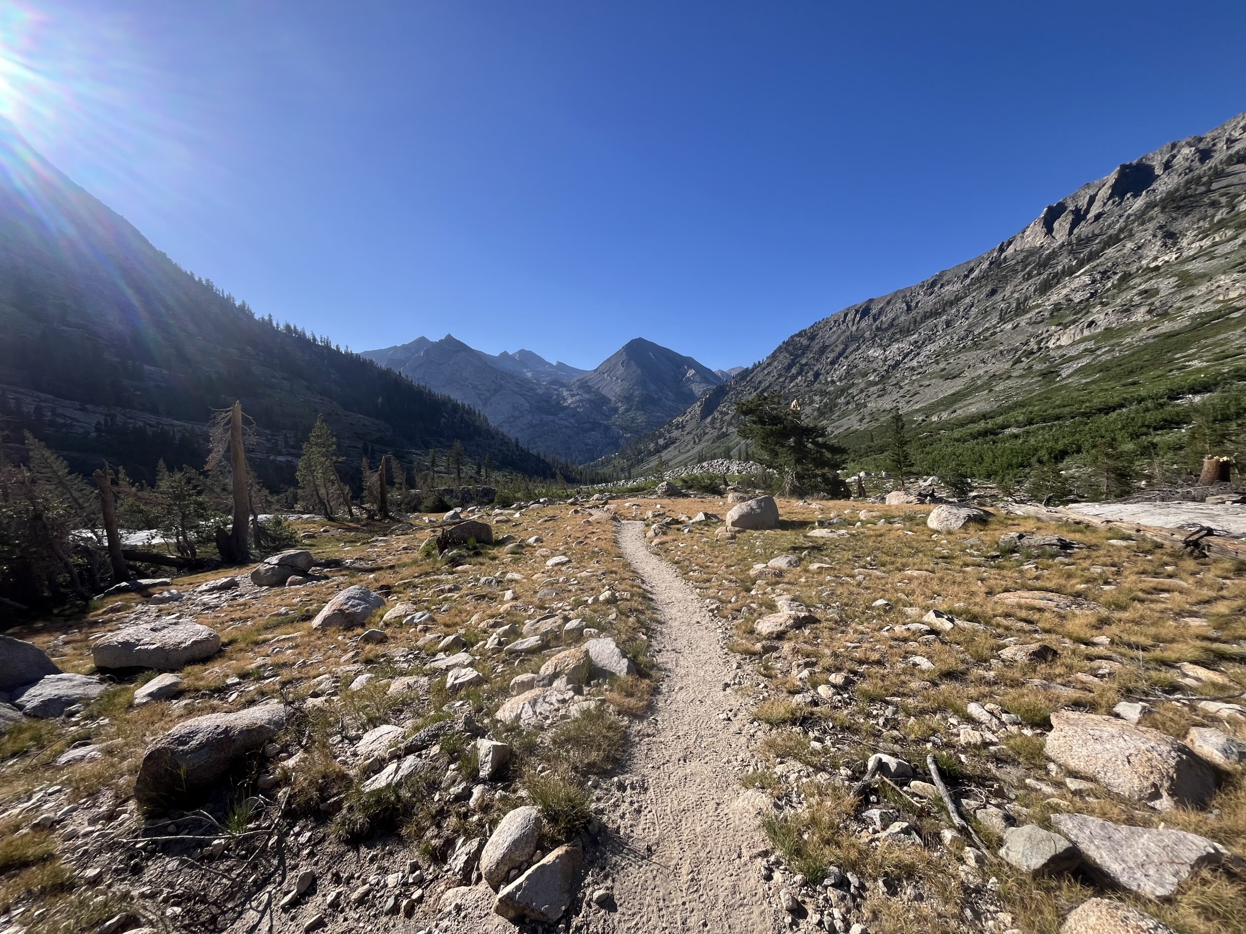
Leaving Forester Pass, there was a really long section of downhill which went on for about 6+ miles. Sometimes the downhill has been feeling even harder than the uphill. Maybe because the temperature continuously increases as you make your way down. Maybe because I have to be a bit more cautious about my footing so that I don’t trip and fall. Either way, I generally have been feeling a lot more tired on the descents than the climbs.
Continuing toward the base of the climb up Glenn pass.
Once I got down to the bottom, I grabbed some water and began seeing tons of hikers. I was super close to the junctions for Kearsarge pass, an area where hikers can get on and off the trail. In 2017 and 2022 I had to take Kearsarge pass in order to get into Bishop. A very common resupply location along the trail. Most people have to go in there because the alternative is carrying tons of food. And some years these other resupply locations like VVR and red meadow aren’t open because it’s too early or late in the season.
Over the next hour, I must’ve passed 30–40 hikers going the opposite direction. It’s crazy to think that just a couple years ago in 2022 I took Kearsarge pass down to resupply. Now today I’m passing by the junction and I’ve only been out for a little over 2 days since Kennedy Meadows. I’m so glad that I didn’t plan to go into Bishop, because it really would’ve been a huge waste of time. In 2017 and 2022 though, this section of mileage took me 2-4 times longer than it did this time around! Which is mind blowing.
The climbing began again around this time. I was making my way up toward the Kearsarge pads junction and then eventually up to Glen Pass. The climb initially was super steep and I actually remembered it pretty well. Then it leveled out a bit as I went by the pass. I saw even more hikers and then continued on towards Glen pass. The first stretch of climbing up towards Glen pass wasn’t too steep, but as I got closer the grade got more and more steep.
Views as I made my way past the Kearsarge Pass junction and toward Glenn pass.
The final mile are so felt harder than the entirety of Forester pass for some reason. Maybe because it was later in the day and I was more tired. Who knows. I went past about five hikers on my way up. There was a group of three who were out for an overnight and had a really great energy. The one girl in the group works for the national Park service. And was just enjoying a trip on her day off with her friends.
I felt so slow going up that last bit of the pass. But the girl made me feel a lot better and told me that I wasn’t going slow, I was flying. It’s funny how a little comment like that automatically makes you feel so much stronger.
It was spectacular climbing up Glenn pass.
Glenn pass tricks you a couple times by making you think you’re closer to the top than you are. Then you wind up weaving up a handful of switchbacks before finally getting toward the top. The views were great and it was still fairly early in the day. Not as early as I had hoped, but I would likely still be able to go as far as I had originally intended. Even though there’s no snow on these mountain passes, they still take a little bit longer than your normal hiking. The steep up and down slows me down a bit.
As I began the descent off of Glen pass, I could see a huge snow field that I had to go through. It was a very unique one though, because it had formed a deep channel of snow cups that rose past your waist. You basically had to walk through a snow tunnel to eventually get back to the trail. Which I didn’t mind at all, because it left no room for error and you couldn’t possibly have fallen or slipped.
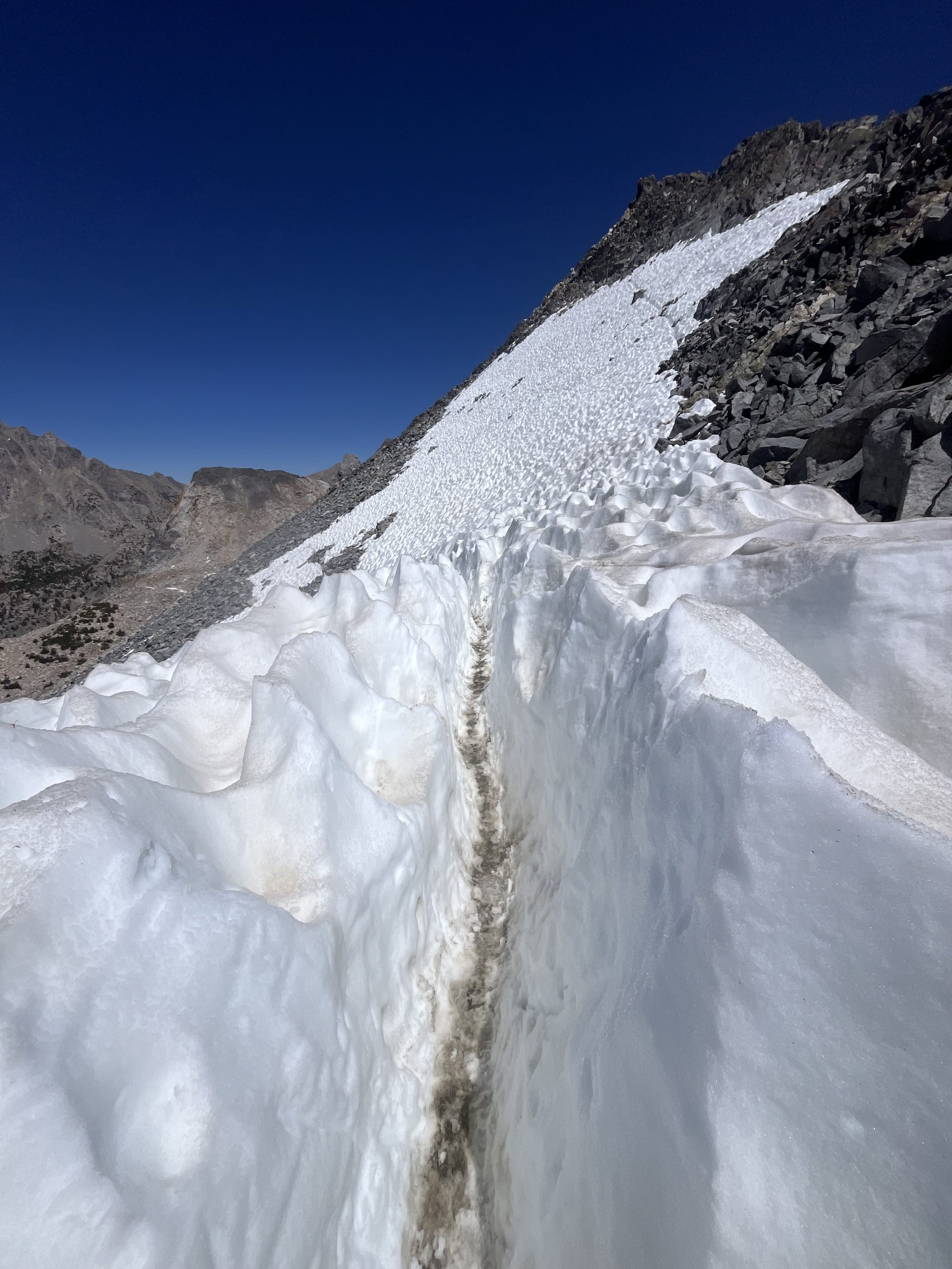
The snow “tunnel”! I’d never seen anything like it.
And after getting through there, and across one other snowfield, I didn’t encounter any more snow on the descent off of that pass. I did feel like I was going pretty slow on my way down though. It wasn’t a bad time to slow down however, since the views were absolutely incredible. Because all the snow is melted off so recently, everything is blooming and so incredibly lush. The bright orange, pink, purple, and yellow wildflowers are blooming all across the trail once you get down to around 11,000 or 10,000 feet. All of the grass and other plants are vibrant green and exceptionally bright. There’s tons of streams and rivers flowing because of the excess snow melt. It truly feels like a dream here. Even after both of my other experiences hiking through the Sierra, I think that this might be my best experience yet. The time of year and trail conditions are unmatched.
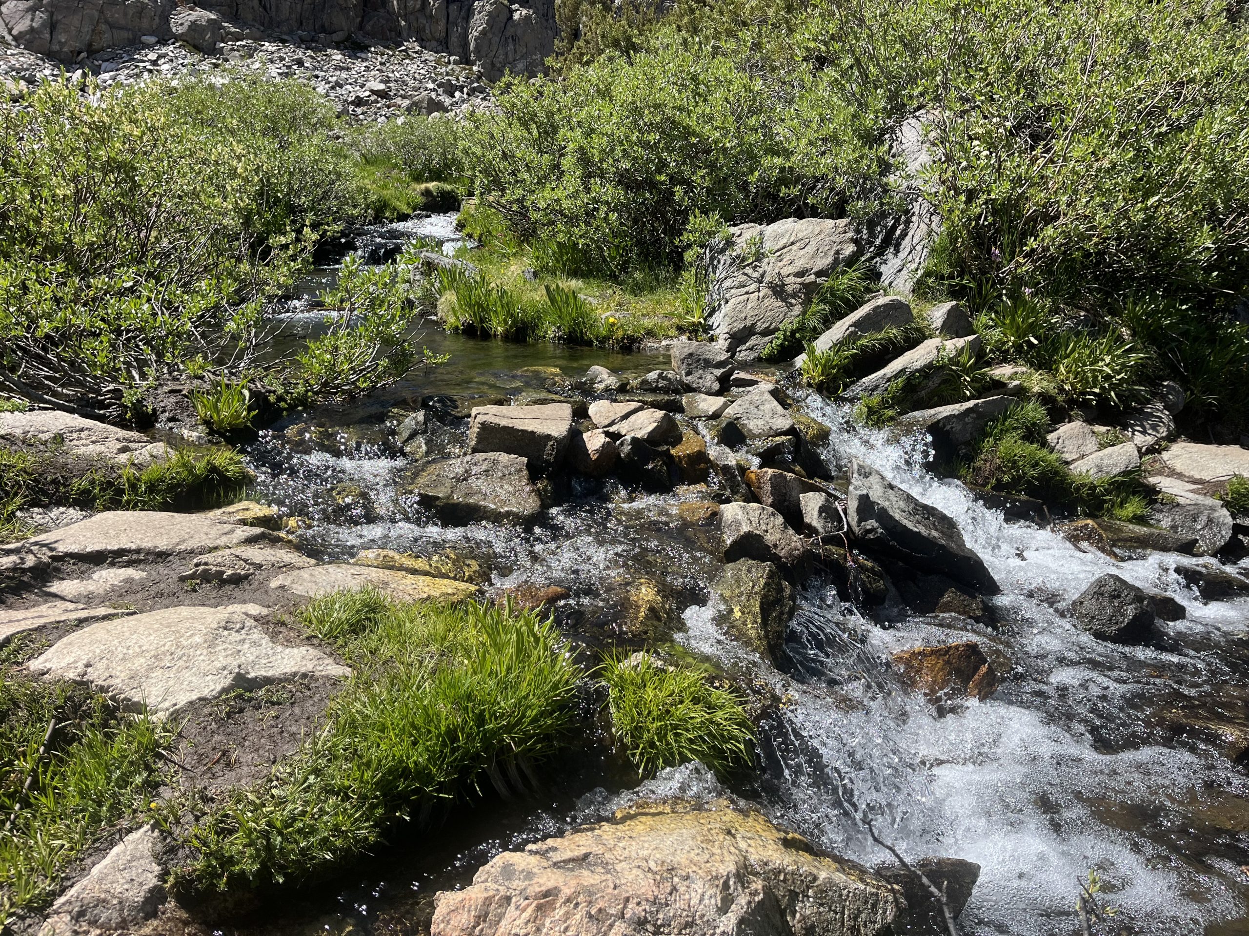
Gushing steams filled with snow melt water.
I’ve been thinking a lot about my injury from a month ago and how at the time I was so angry and confused about taking two weeks off trail. And now I’m here in the Sierra, under perfect conditions. Truly, they couldn’t be any better. Just about all of the snow is gone, which means I don’t have to take any risks or extend my time unnecessarily. And the snow melted so recently that there are tons of water sources and the trails incredibly lush and blooming. And at least so far, the mosquitoes haven’t been as bad as one might imagine. In my experience, they tend to be a little bit worse at the start of peak snow melt. But obviously, I’ll have to see how that continues over the next week.
A lovely stone walk way. The area surrounding Ray Lake looks like wonderland.
If I hadn’t gotten injured, I would’ve wound up coming back here about two weeks ago when the snow was still incredibly high and dangerous at times. Navigating through it would’ve likely slowed my pace down to 20–25 mile days. Who knows, if the conditions were bad enough, they could’ve slowed me down even more. Navigating across snow and route finding can be very time-consuming.
But because I’m here now under better conditions, I’m able to do about 32–35 miles a day. Which means that just through that average alone I’m able to buy back a handful of the days that I took off for injury. And moving past the Sierra, the snow conditions through Northern California and Oregon have likely improved as well.
Overall, this just means I’m spending less time going slow across difficult trail conditions. And I’m expending less energy. I think that’s the most significant factor. I watched a lot of hikers become mentally exhausted after going through the Sierra and northern California with all of its snow. At least one hiker I know quit their hike entirely likely due to these conditions. Another hiker I know almost quit, and the conditions were definitely messing with their head. Everything certainly happens for a reason.
The trail drops down and wraps around this beautiful, bright blue, lake.
After descending off of Glen pass for a few miles, I eventually got down to Ray Lake. An incredibly beautiful, vibrant blue green, lake. It rests in the center of these massive mountains, and is definitely one of the most beautiful places in the Sierra. The trail weaves down around the lake and then actually goes across a small island, providing even more great views. I went past loads of people stopped, enjoying the views. But the descent had slowed me down enough that I knew I had to keep going if I wanted to get far enough for the day.
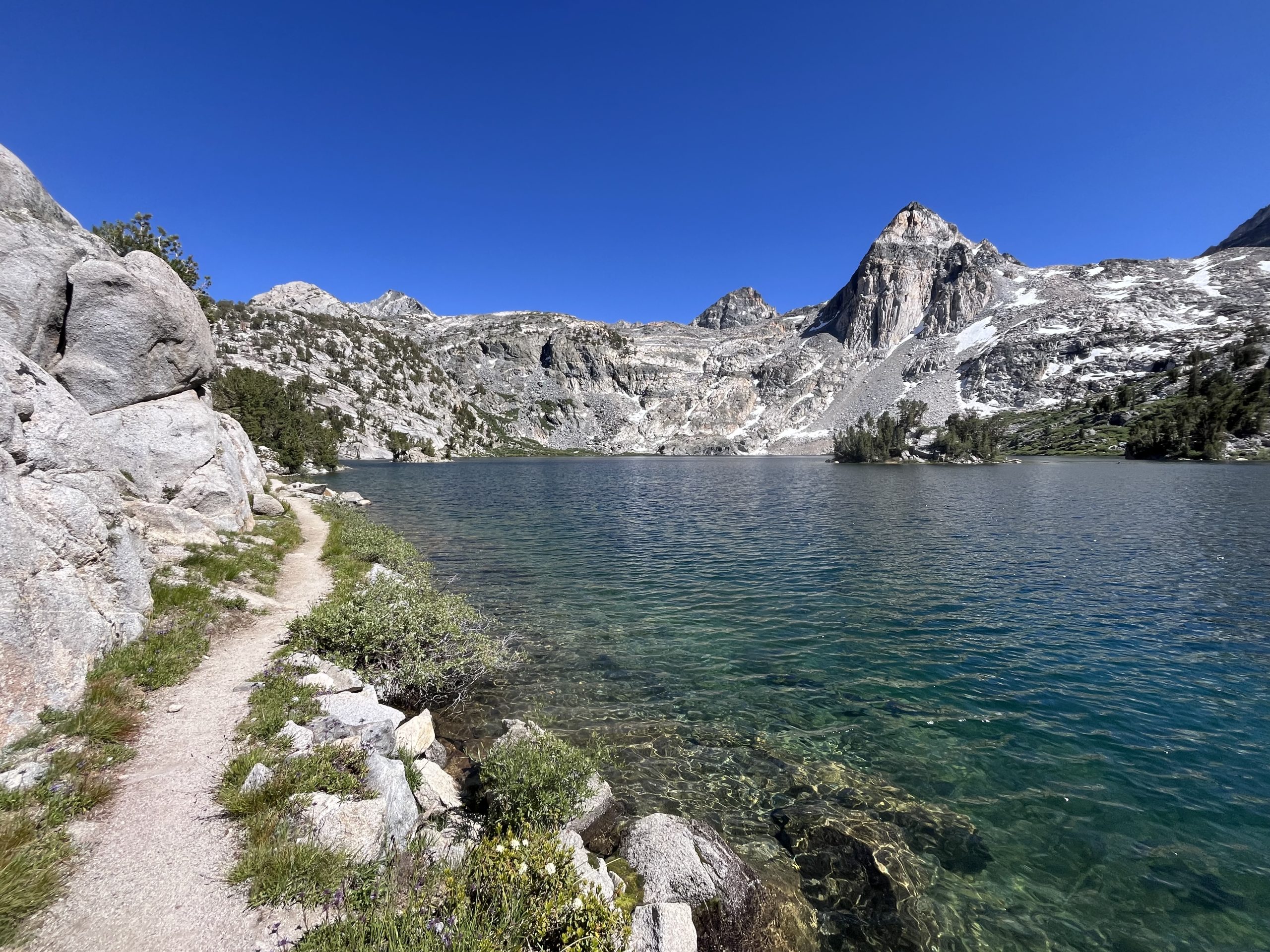
Some of the best views in the entire sierra.
As I continued making my way around the lake, I crossed paths with a group of about five people. Oddly enough, a little girl in the group looked super familiar. At first, I really couldn’t tell why and it didn’t make a lot of sense to me. Then I went past a woman toward the back of the group and it all came together in my mind. I just went by the daley family! A family of two parents and three children who hiked the PCT in 2022 when I did. They videoed their journey with their three small children.
I talked to the mom for a few minutes after we crossed each other on trail. It was fun to do a little role reversal and get to fan girl a bit over someone else. It seems like most days recently I walk past at least one hiker or a group of hikers who recognizes me off my videos. It was a nice change of pace to get to tell her that I recognized her and had followed their journey and also hiked in 2022. We shared some information on upcoming trail conditions in both directions. Then I just continued along.
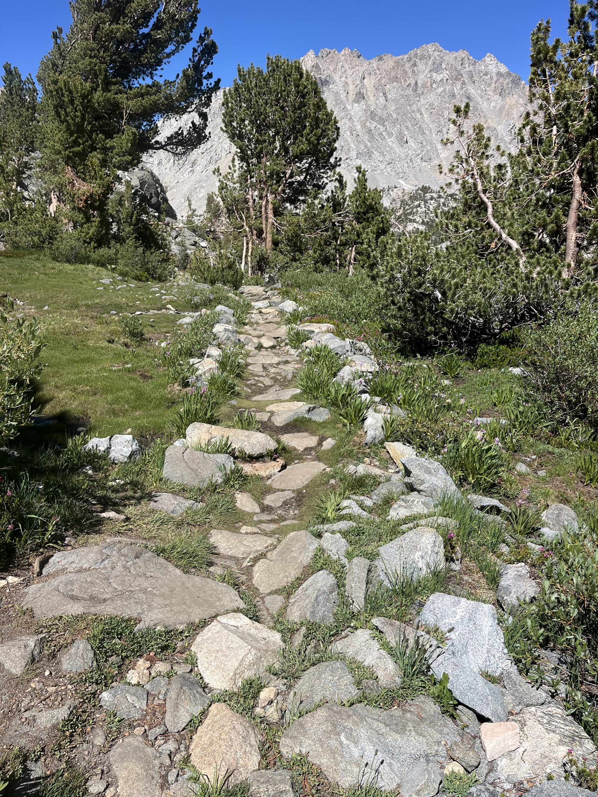
Continuing toward the base of the climb up toward Pinchot pass.
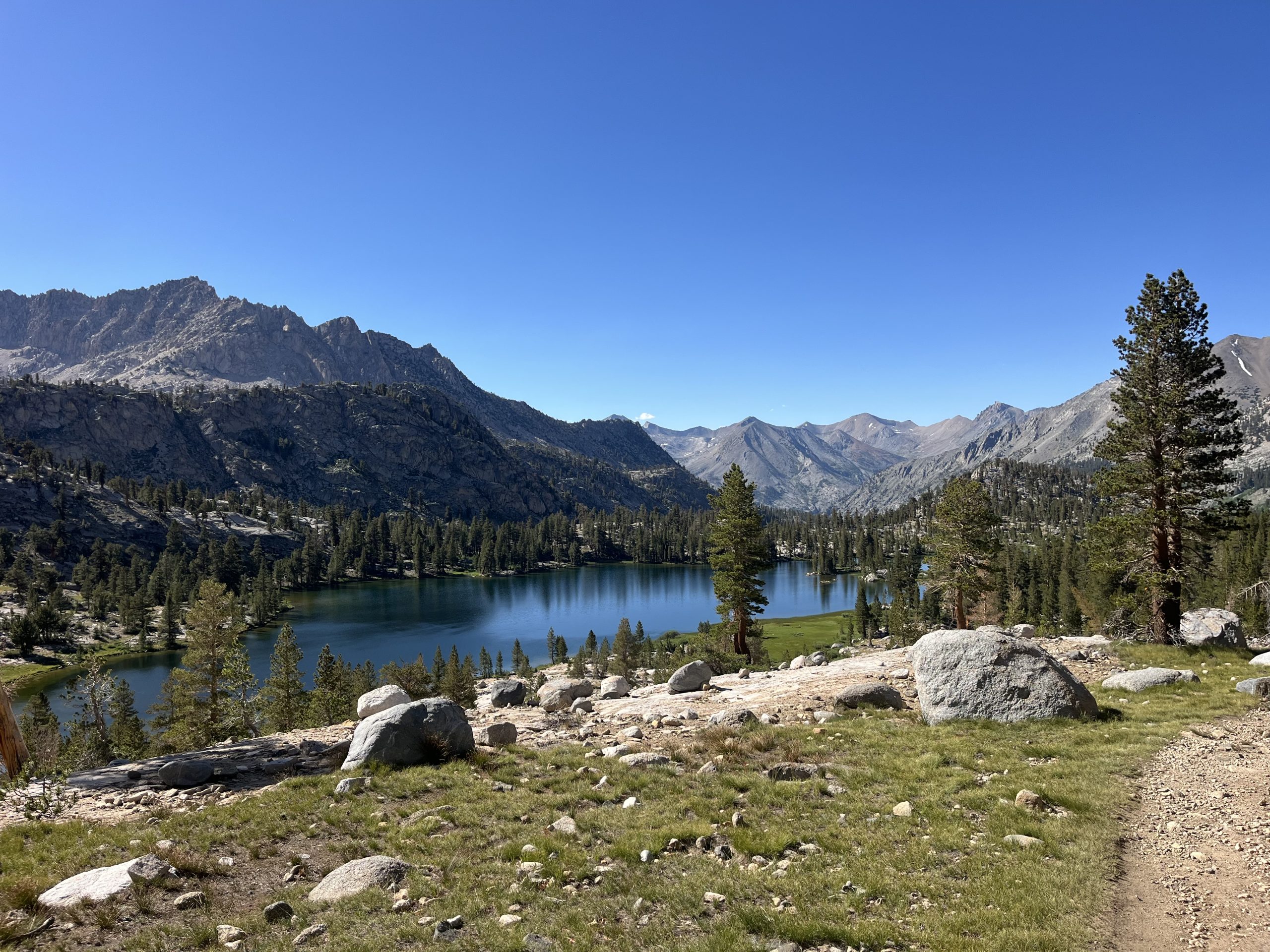
The next handful of miles continued to be incredibly beautiful. The trail wrapped around the lake still and had just the best views. I went past another cute ranger station, which would’ve been an absolute dream to work at. To be the Ranger at the Ray Lake station would just be incredible. There are tons of Ranger stations throughout the Sierra. Over the last few days I’ve already gone past a couple and will go past even more.
When I had about eight more miles to go for the day, I decided to sit down briefly and take a break. The downhill is slow going, and the weather was just feeling so hot. Even though the conditions have been absolutely perfect while I’ve been here, it has been really warm. I swear the temperatures by midday have to be in the high 80s. I’ve just noticed a trend the last couple days that the afternoon temperatures keep getting me exhausted. But I find if I take one last sit down break when I have about 3–4 hours remaining of the day, it keeps me going.
The end of the days have been my favorite lately. The temperature is finally comfortable again. And the trail is so quiet!
I decided I also needed to put a book on or something to get me out of my head. So I turned on north by Scott Jurek, the book about his FKT attempt on the Appalachian Trail. And it turned out to be exactly what I needed. It’s narrated simultaneously by him and his wife who supported his hike. And the story it was just absolutely amazing. Those are definitely been some of my favorite books that I’ve listened to so far this year. Books about FKT attempts and calendar year triple crown attempts. It’s just really cool to get a relatable perspective on pushing your body as far as one must under those circumstances.
That book got me going, and I eventually got all the way down to the bottom of the descent. There was a suspension bridge and a really nice campsite with bear boxes. A handful of people were set up there for the night. I would’ve loved to have stopped there, but knew I had to go a little bit further. So I ran away from the beautiful spot as quickly as I could. I crossed the suspension bridge and then it began climbing, generally up toward Pinchot pass. I wouldn’t make it up to the top of the pass tonight, but could set myself up for a fairly early crossing tomorrow morning.
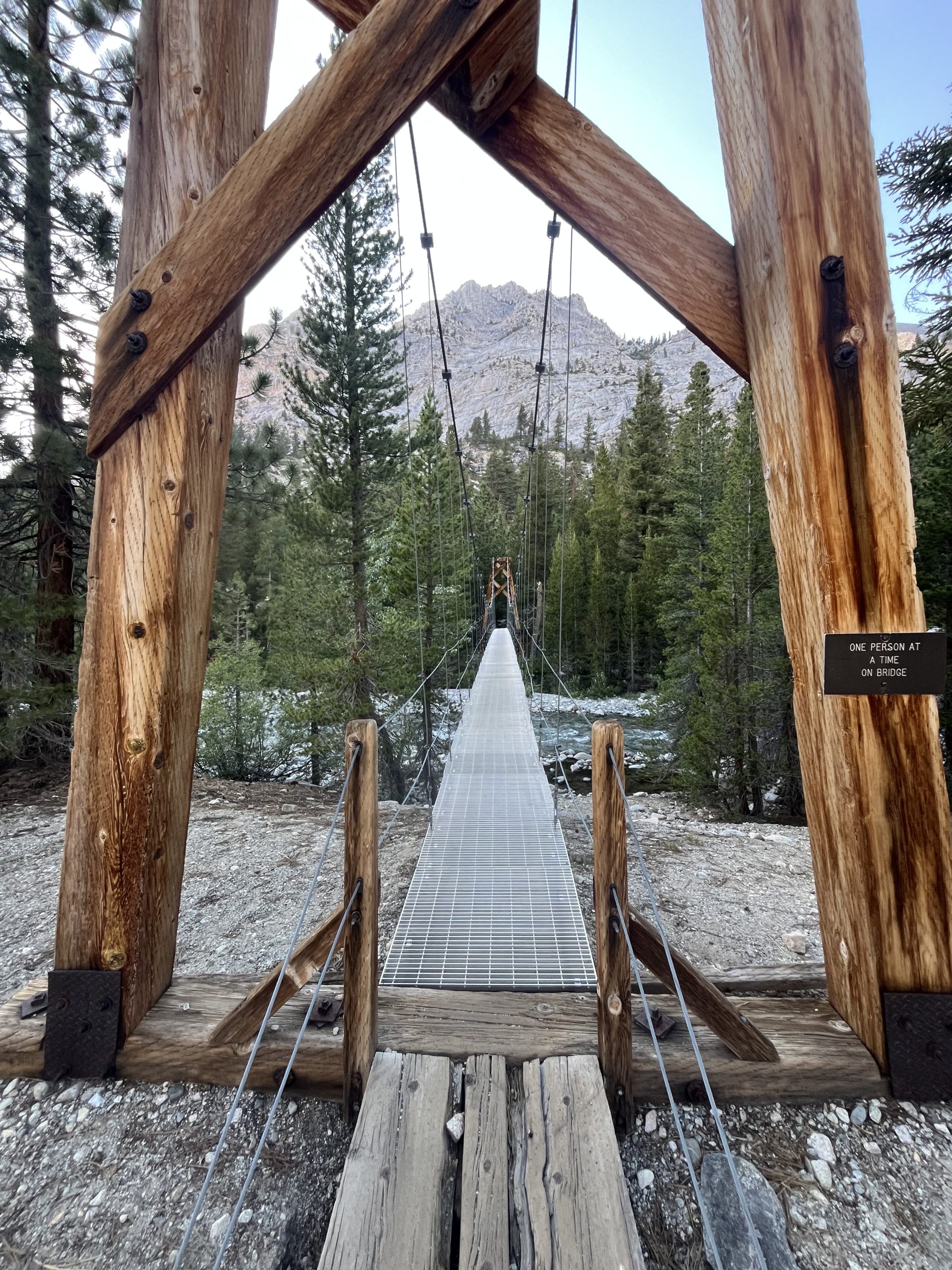
I ran across this suspension bridge so fast. Running from my desire to camp earlier!
I really just wanted to do about 32 miles for the day. So I planned on walking for another hour or so until I pass by water or a nice tent spot that called my name. After a little while I could see a hiker off in the distance who looked like they were carrying a day pack. As I got closer, I realize she was definitely backpacking, but just had a really small kit. I wound up talking to her and she said she was out doing the JMT. And kept her pack light by doing big days.
This definitely intrigued me because I haven’t ran into a lot of people who are doing consistently big mileage. I would absolutely love to run into someone who could match my pace and I could hike with a little bit. It always works well to when I run into someone like that toward the end of the day. That way it’s easier to hike together.
The hiker I ran into was named Cara and we talked for a little while. She let me go ahead and set the pace and she followed behind closely. But after only another mile or so, I went past a water source and a campsite that looked nice. I had gone over 32 miles for the day, which just left about 4 miles in the morning to get up to Pinchot pass. It was just after 7 PM and I was definitely in the mood to be done for the day. I’ve been hiking for 14 hours, so it felt like a good place to stop.
Cara hadn’t gone as far for the day so she decided to keep going a little bit further. But we figured we’d run into each other tomorrow just because she’s doing slightly less mileage per day. It was exciting to think about running into a familiar face at any point tomorrow. Typically I see someone one time and I never see them again.
After she continued on, I got my tent situated and then grabbed some water. Then I made a mountain house meal for dinner and ate a bunch of snacks. Finally, most of my food fits into my beer canister, which is great. And I do think I’ll have enough food to get through this section all right.
I just realized today that I actually have a secondary option as opposed to resupplying at VVR. VVR is a resort with a store just off the trail. They run a water taxi twice a day which saves you the 5 mile hike to and from the store. But very likely I wouldn’t be able to line up the timing right to take the water taxi both ways. So at the end of the day, I would wind up adding 5–10 miles to my life if I resupplied there. Not far past there is a place called Reds Meadow. In 2017 they were running shuttles from there to Mammoth Lakes. Which meant you could go straight into a town without adding any mileage or elevation gain. But in 2022 I came through too late in the season and they weren’t open. Then I’ve heard that the past two years the road was closed for some kind of construction. But apparently the Shuttle started operating again on 7/3. Which means I could likely go into Mammoth Lakes after all.
Originally, I was planning on just getting food at VVR and going straight to Kennedy Meadows north. Which was a perfectly fine option, but certainly not the most exciting. VVR sold hot food and would have a very expensive resupply. And Kennedy Meadows north would basically be the same deal. It would be nice to be able to get hot food at both locations, but there really wouldn’t be much going on. The prospect of being able to go into Mammoth Lakes, a bustling town with tons of restaurants and places to stay, sounded amazing.
And because I’ve been going further each day than I originally expected, I could likely afford to do a short day and spend the night in Mammoth. I haven’t had service since I left KMS so I’m fairly behind on writing a video at work. It would be great to be able to spend the night in town and catch up on work. And also eat an absurd amount of calories. By the time I go into mammoth, I will have been out for six full days and a morning. Which is definitely the longest I’ve gone in between town so far this year. Typically I’m stopping into town every 2–3 days because of the mileage that I’m doing. So this is probably the longest that I’ve gone on such a big caloric deficit. That got me excited and I figured I would GARMIN message to my dad to confirm the time and day of shuttles. Just so I knew for sure I could bank on entering Mammoth Lakes by way of Red’s Meadow. Obviously, if that wasn’t an option, I could still go into VVR a day earlier. But I would rather push on for an extra day before town if it meant actually being able to go into a town and enjoy myself.
After I ate, I did my stretching and attempted to do a little bit of writing and video work. I’ve managed to do a couple things over the course of the day when I’m on very gradual sections of trail. Which is very helpful. And I have so many blogs and videos completely done and ready to go, but simply can’t upload them because I haven’t had service. Then after a little while, I eventually called it a night and headed off to bed. Tomorrow I have another big day climbing multiple mountain passes. Then the days to follow should be relatively a bit more easy.
If you enjoyed this blog and would like to support my hike by buying me a soda or a snack along the way, there is a “Tip the Author” button below! It links directly to my Venmo. Any and all support is incredibly appreciated!


