
*these posts are coming straight from trail, I apologize in advance for typos!*
Location: High Sierra
Start: Tentsite – 974.0
End: Stock Camp – 997.3
Miles: 23.3
Ascent: 5443 | Descent: 3623
Sleep: Tent
Another good but tiring day. Recently I’ve felt like every day has been long and hard, but it isn’t until I actually look at our elevation that I realize just how much we’ve done. Aside from Half Dome, today was the most climbing that Webber done. No wonder I’m so worn out!
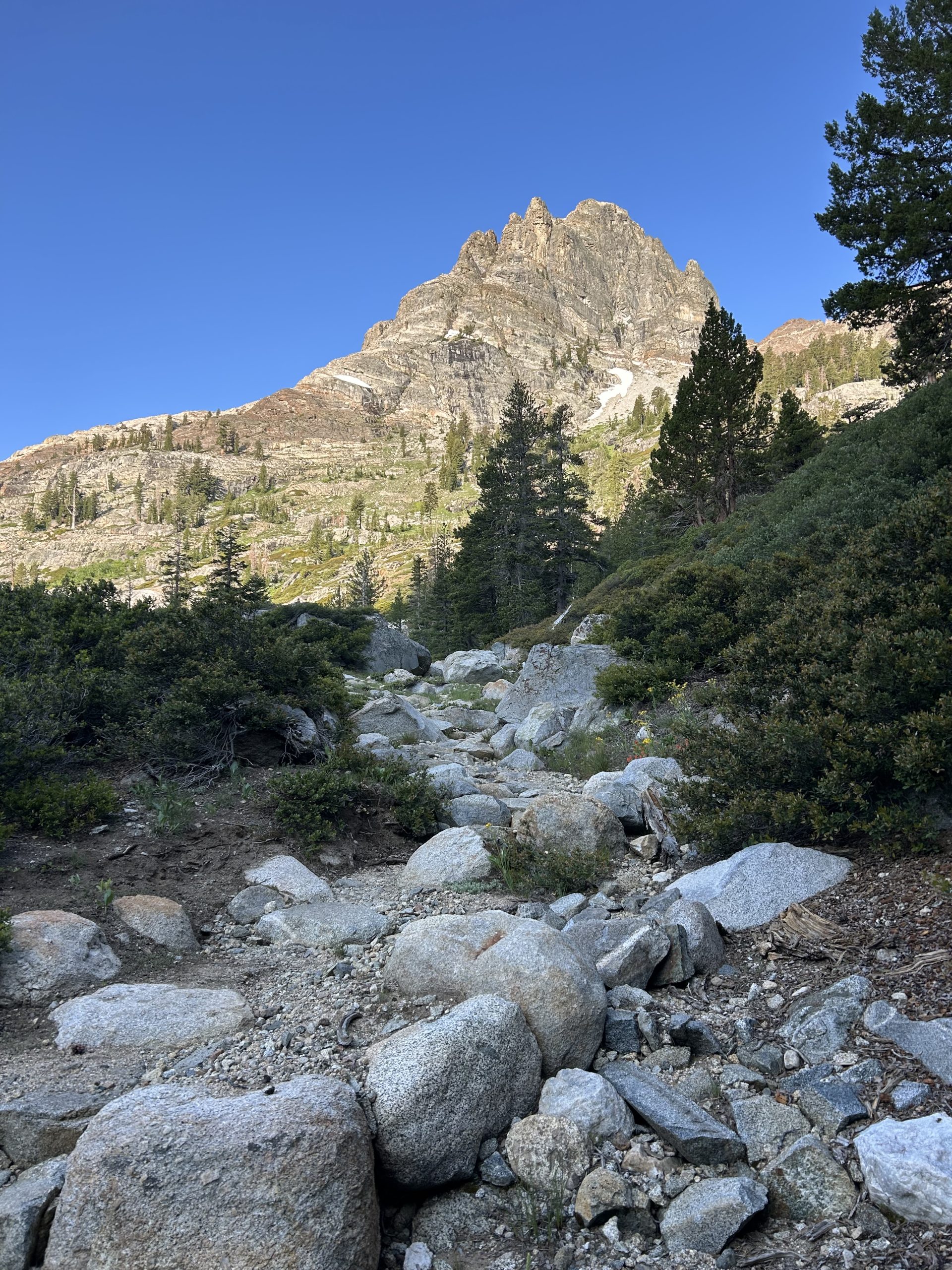
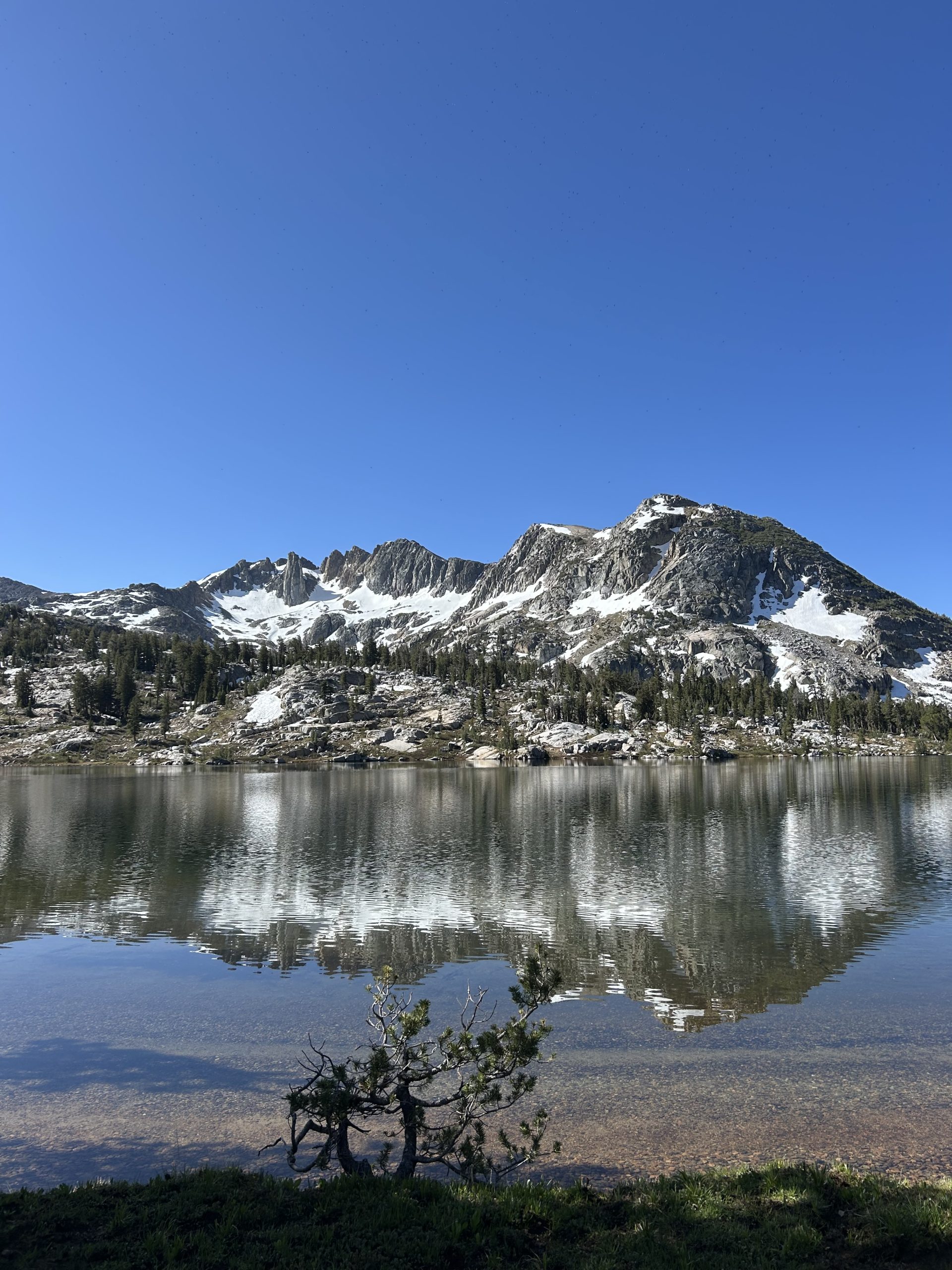
The day started off just before 7am when I left the campsite before Truffles since he had to dig a cat hole. We had camped right at the base of Seavey Pass so it was uphill right away. It wasn’t a very long or steep climb, and the early morning light it look extra pretty. Instead of long range views, the views were of the close by granite rock faces which I thought were really cool. I also enjoyed all the green ferns and tall pine trees I go to hike past. Many of the flowers were in full bloom, and there were several small waterfalls along the trail. I had a great morning climbing up to the pass!
Once I reached the top there were multiple ponds I got to hike around before beginning the steep descent. It leveled out as I neared Rancheria Creek and I had a lovely stroll alongside the water under the tree cover. I stopped to filter water and Truffles caught up to me. Together we headed towards the first of two “bumps” in the day after. Neither big hill were passed or named peaks crowing to FarOut,they both just looked short-ish but very steep.
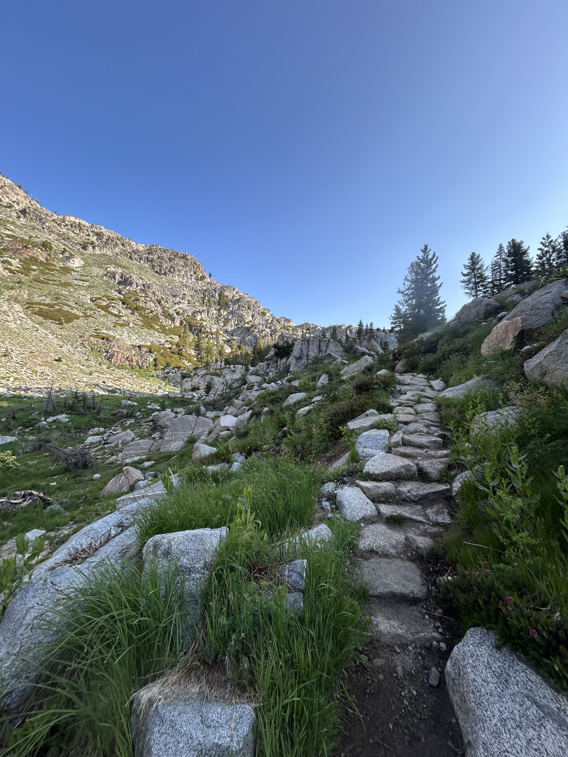
We crossed Kerrick Creek and began the first climb. There were stone stairs but it was still ridiculously steep. The only bright spot was the fact that there were tons of wolly mules ear flowers in bloom lining the trail, so it looked like we were hiking through fields of mini sunflowers. We hiked over large granite slabs and continued climbing.
When we finally began the descent we were greeted by a creek flowing heartily over the trail. Thankfully we were able to rock hop across and continued climbing going downhill. The descent was steep and spit us out basically at the base of the next “bump” for the day. This was along steep climb with several false summits. We slowly made our way up to the top where we had a short descent before coming to the “small lake” where we had decided to eat lunch.
Lunch at the lake seemed like a great idea until we actually got there and were swarmed by mosquitoes. It was after 1pm and we had already hiked 13 miles to get there, we didn’t want to keep going any further without eating. We decided to sloppily pitch the tent by the lake to eat in peace. I was extremely cranky during lunch thanks to the mosquitoes. I didn’t want to exit the tent and be attacked by the little vampires. We rallied and hurriedly packed up the tent after lunch, all the while swatting uselessly at our attackers.
Up until this point the mosquitoes had only been swarming when we were standing still. Today, however, they flew around us relentless even while we were hoking. Shortly after lunch we stoped briefly to apply more bug spray to our legs, but even that didn’t seem to stop them. We continued on a ways and were so aggravated by the assault we decided to throw our rain gear on just for some peace. We both donned our rain pants and broke out our bug nets for the remainder of the day.
Shortly after this wardrobe change, Truffles hollered from behind that he needed toilet paper. Confused I turned around and saw that his nose was gushing blood through his big net and into his cupped hands. He had a random nose bleed, poor thing. I stopped and pulled out my TP for him to stanch the bleeding. I feel like this is the perfect summary to our afternoon: walking through mosquito hell with a nose bleed.
Once he was patched up we hiked hard to try and get to camp. When we left our lunch spot we had about 10 miles left in the day. We made quick work of the first 6 thanks to the mosquitoes, but I hit a wall with 3 miles to go. Thankfully the terrain was easy with a gradual include, but I was on autopilot with every step just praying to get to camp quickly.
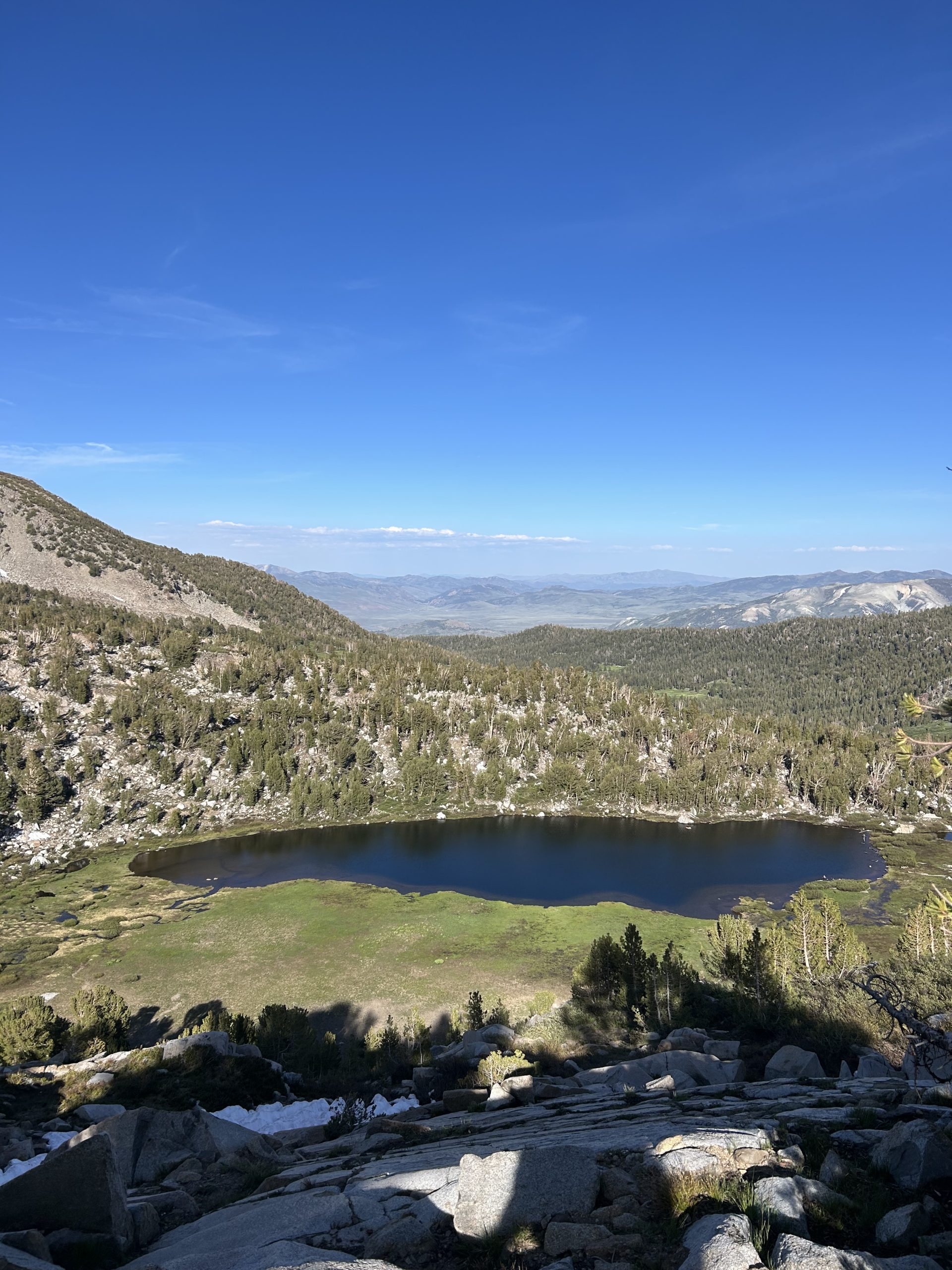
When the sign for the “stock camp” came into view I was overjoyed! It was springs 6:30pm, we’ve been hiking for nearly 12 hours. We found a beautiful spot close to the lake and pitched the tent and kept inside to avoid the mosquitoes. It’s a shame to have to eat dinner inside the tent when we’re at such a beautiful spot, but we were sick of being eaten alive. As we were winding down for the evening a chorus of bullfrogs began to croak. We are planning an easier 15 mile day tomorrow, so I’m excited to drift off to sleep to the frogs and even more excited to sleep in a little tomorrow!
Location: High Sierra
Start: Stock Camp – 997.3
End: Tentsite – 1012.0
Miles: 14.7
Ascent: 2732 | Descent: 1597
Sleep: Tent
Short and sweet day! Since we knew we weren’t going very far and the terrain didn’t look that tough, we slept in until around 7am. We didn’t get moving until after 9am which was lovely. Our campsite on Dorothy Lake was beautiful and I was tempted to go for a dip before leaving, but the mosquitoes lurking outside our tent dissuaded me. When we finally did pack up, we had our full rain suits on along with our bug nets. The mosquitoes were swarming outside our tent doors, there were easily over 50 waiting to suck our blood. we packed up and tried to get moving quickly despite the heat in our rain gear.
Thankfully we just had a quick climb in the morning over Dorothy Lakes Pass which also served as the boarder for Yosemite. We were in the park for less than 60 miles but it feels like a big milestone to come out on the other side. FarOut said “be ready for a dramatic change in scenery”, in my mind this is really where NorCal begins (but we’re still technically in the Sierras I think so I’m not sure where the distinction really is).
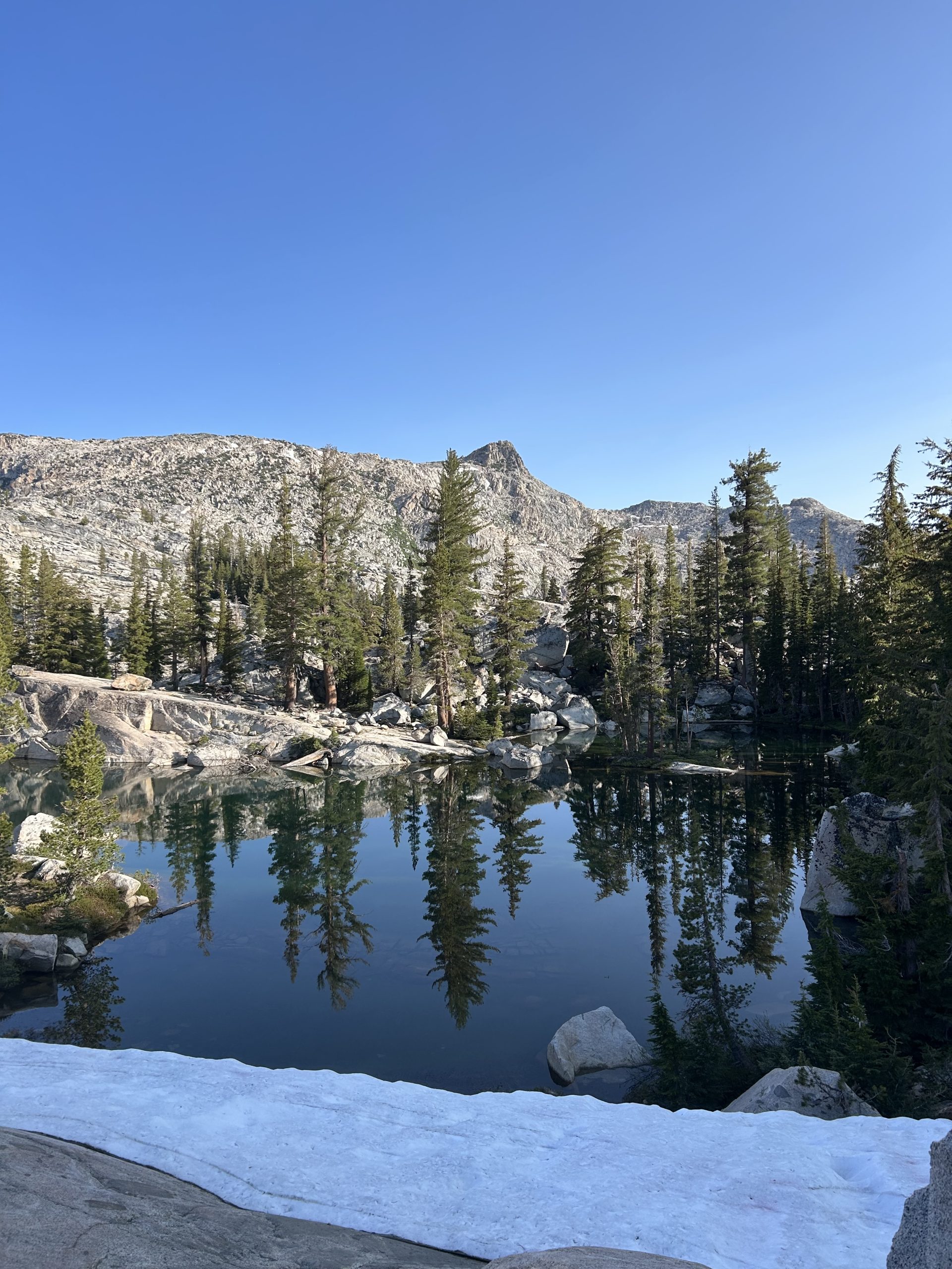
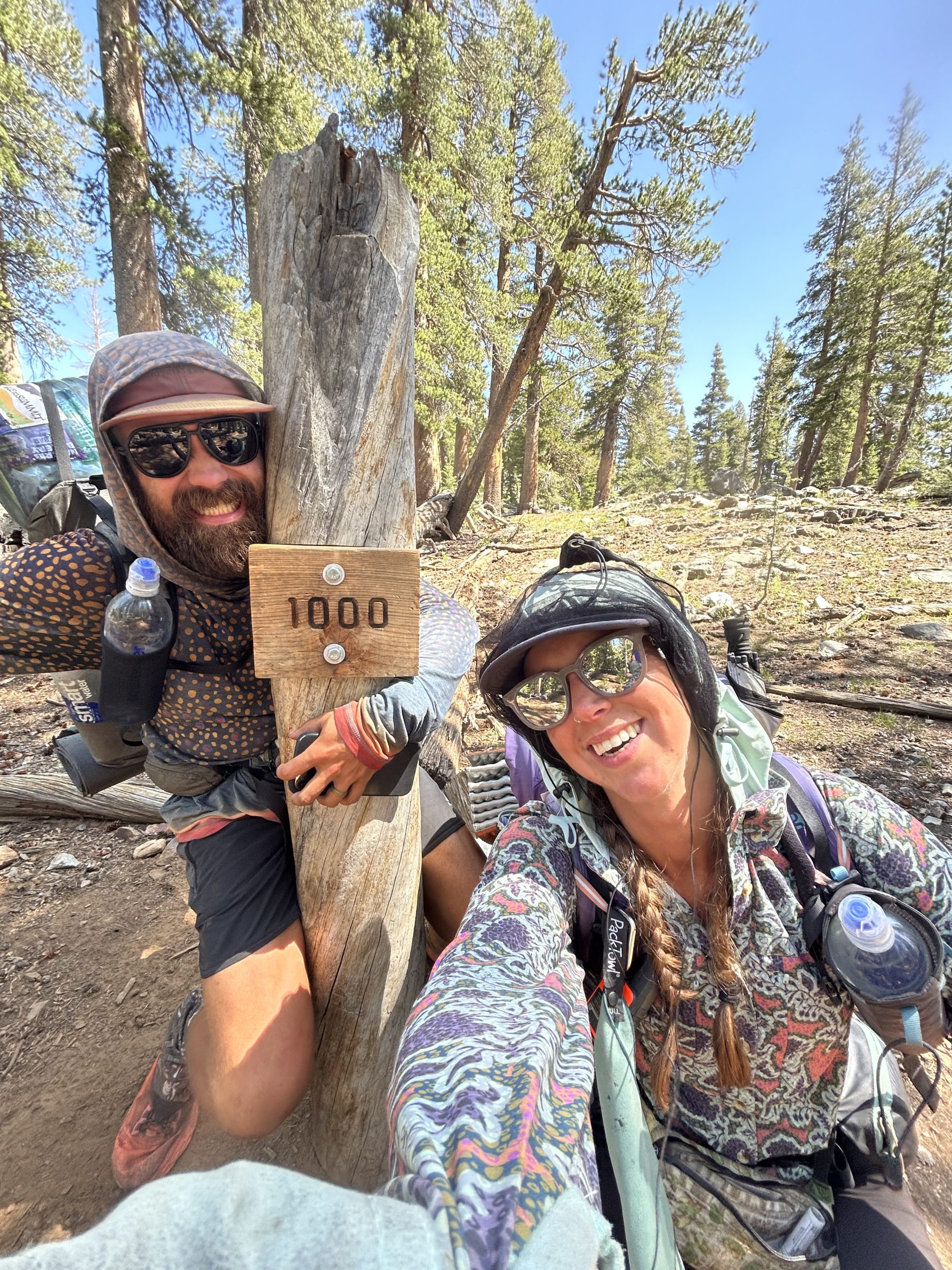
Coming down from the pass was rocky with a handful of snow patches. On the descent we passed the 1000 mile marker! It was just some rocks arranged to say “1000” but it still made for good pictures. I stopped and waited for Truffles so that we could take a couple of photos together. Only 1650 more miles to go…
I stopped to filter water and decided it was safe enough to shed my bug layers. I doused myself with bug spray and kept my bug net on top of my head just in case. Shortly afterwards I caught up with Truffles who was waiting for me by an actual mile marker sign. There was a post with a big sign stating “1000” which we of course also had to take pictures with.
The trail continued to trend downhill with several long flat stretches. We hiked over rocks and past several marshy areas and small creeks. Eventually we got to the West Fork Walker River bridge which I was thankful to see was still standing. Comments on FarOut were contradictory about whether or not the bridge was open or safe, and thankfully it was done when we arrived.
We hiked a couple of miles further a decided to stop for lunch just before the big climb of the day. Miraculously there was a breeze that kept the mosquitoes away and we were able to eat in peace without having to hide inside the tent. While we were eating, Silver Linings walked by. We hadn’t seen him since KMS and spent a while catching up. After he hiked on we packed up and began our climb.
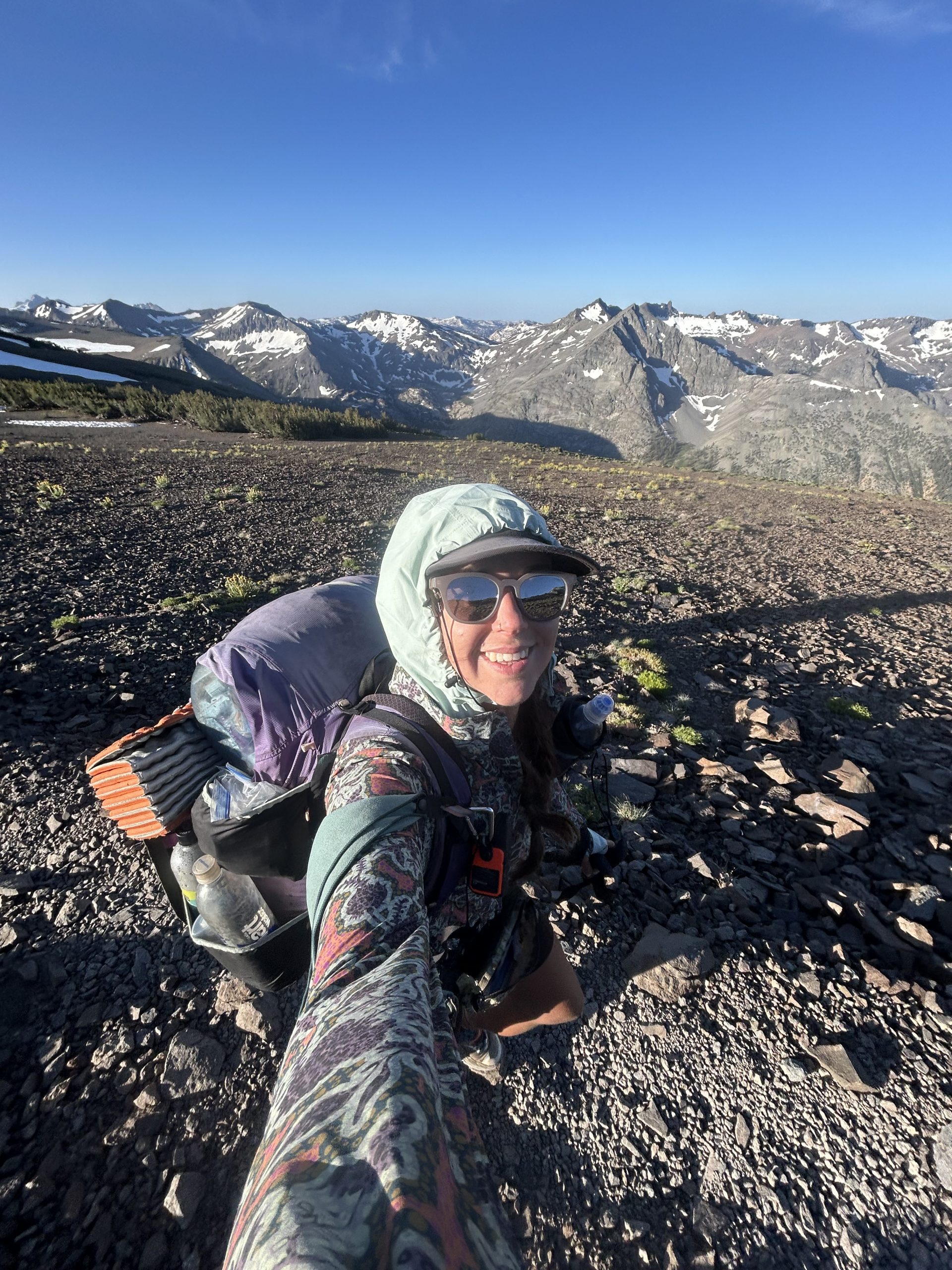
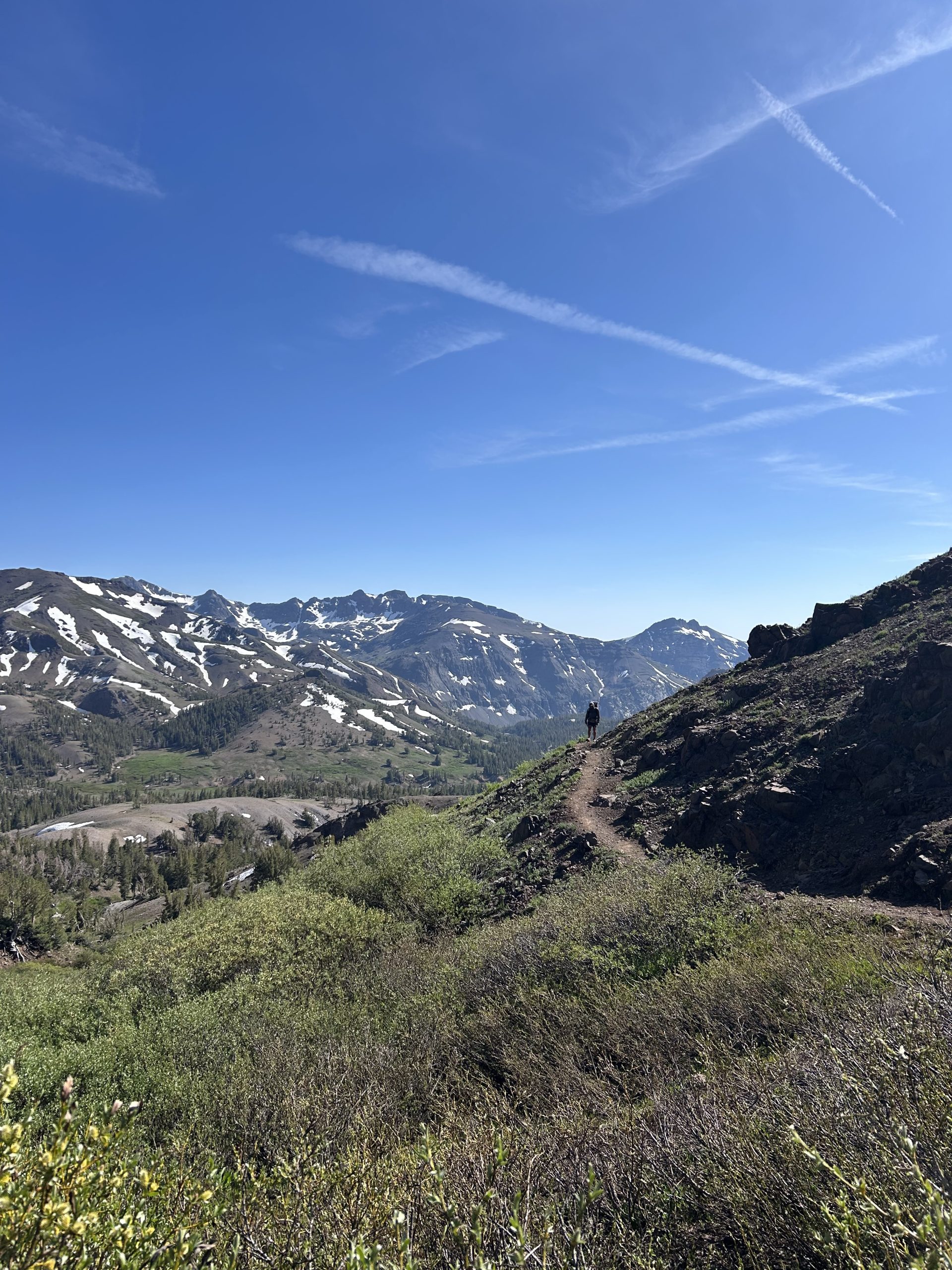
This hill and the hill after Sonora Pass will be the last time we’re at 10,000’ for a while (maybe the last time the entire trail?). We’ve been at elevation for nearly a month while we’ve been in the Sierras so it’s hard to imagine being down low again and how different the scenery will look. I’ve enjoyed my time in the Sierra way more than I thought I would, especially after leaving KMS and my difficult time on Whitney. The mountains are just so big and the endless alpine lakes and snowy peaks are breathtaking. I’ll forever treasure our time spent walking through this area, it truly has felt like a gift and it saddens me that most people will never be able to experience these wonders first hand.
The climb up to Leavitt Lake junction looked daunting on the elevation map, but ended up not being as bad as we feared. It was steep in sections but overall we were able to keep moving at a reasonable pace. We had to stop for water and fill up for our dry campsite, so our packs were heavy with 4L of water. There were several very long but mildly graded switchbacks to get us to the top of the ridge. There was also a straight shot up to the ridge that looked crazy steep, I suspect it was an alternate snow route. Truffles decided to take the straight shot and I took the switchbacks to see which route was faster.
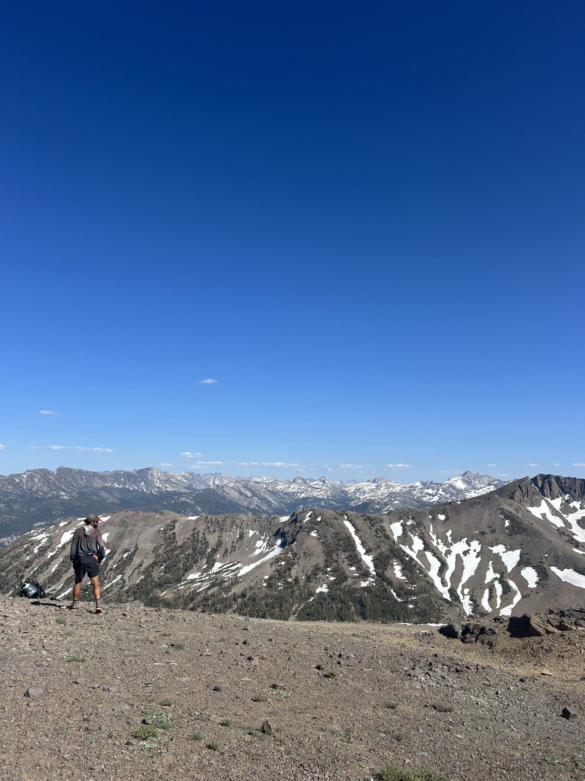
The switchbacks were long but not very tedious. There was one patch of snow that I took my time going over, but it was short lived and had I failed I wouldn’t have slid far. Truffles beat me to the top and was waiting near the Leavitt Lake junction. There was a stunning view of the valley before us that we would be descending down into, and a good look at what was to come. Behind us were the towering Sierras, and comments on FarOut said this was the perfect place to say goodbye to the Sierra. I had signal and called my parents and Hangman, the later said he and Pinky were good and he wanted to hear all about our mosquito hell the last week.
Once I got off the phone we began hiking again. We only had about 2 more miles to our desired campsite and it was only 4:30pm. Had this section of trail been covered in snow it would have been super sketchy! Thankfully it was clear and sunny, but the sheer drop still made me nervous if I stopped to think about it or looked around too long. There were a couple of shaded snow patches we had to hike over, but the boot track was good and it was easy walking.
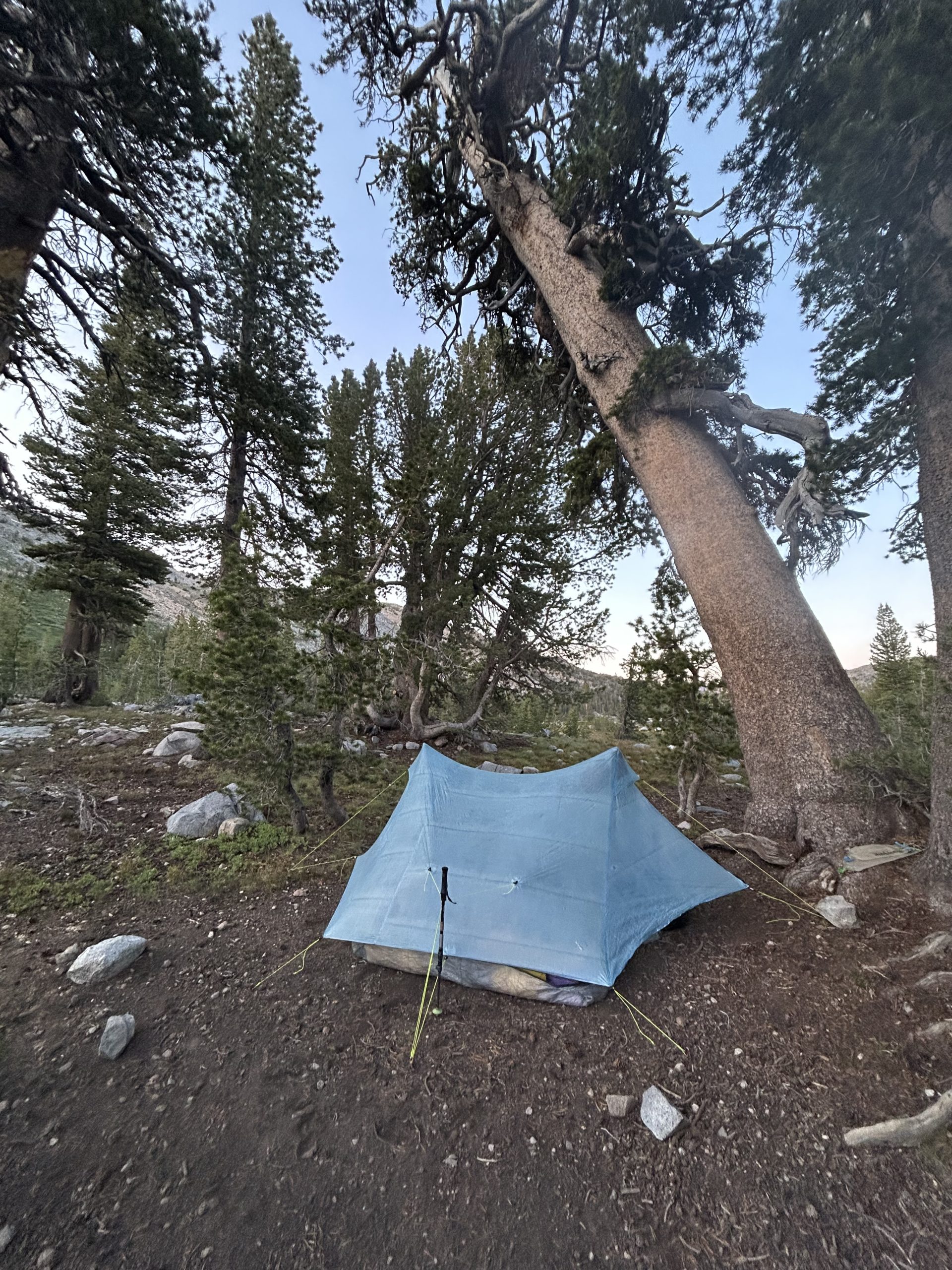
Our desired campsite for the night was tucked in a small grove of trees that would hopefully help to block some of the wind. The campsite was very exposed and windy, but we found a decent spot to pitch the tent in the trees. With the sun out the wind was still chilly, but I’m hoping to stay cuddled up and warm tonight. The benefit to a windy campsite is that there are no mosquitoes! We ate dinner outside the tent (for the first time in several days) and reminisced about our time in the Sierras over our ramen. We got in the tent before the sun went down and spent some time talking about what we think the next stretch of the trail will be like. Looking forward to a beer and meal at Kennedy Meadows North tomorrow!
Location: High Sierra
Start: Tentsite – 1012.0
End: Tentsite – 1024.4
Miles: 12.4
Ascent: 1889 | Descent: 3360
Sleep: Tent
Town day (kind of)! We woke up at our normal time around 5am and were on trail around 7am. Thankfully the wind hadn’t been too bad over night and we slept fine. Truffles’ stomach was hurting when he woke up, but it turned out to be gas pains and after a few nasty farts he was good to go.
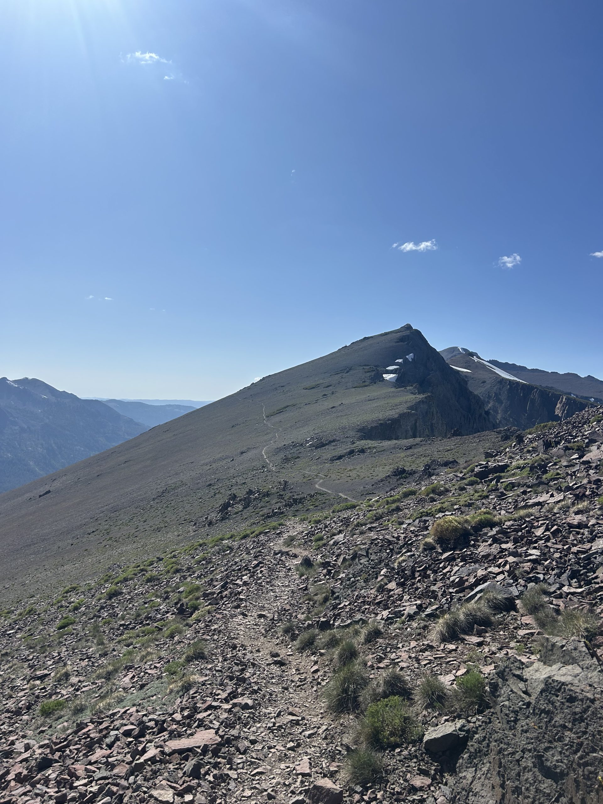
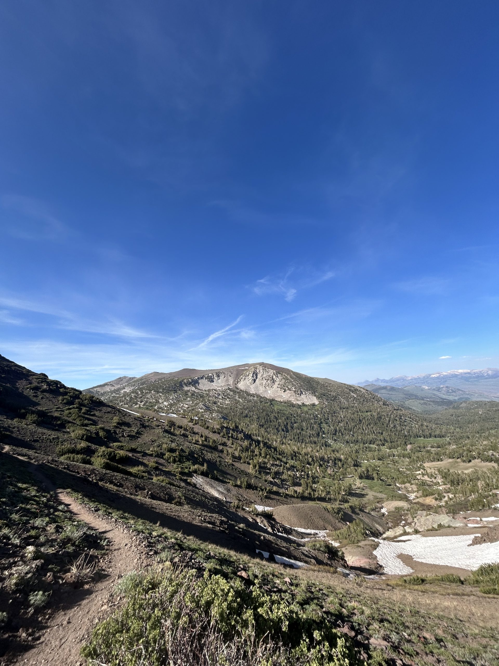
We had a little bit of climbing to do before beginning to make our way down towards Sonora Pass. It was sunny when we started hiking hit the wind was still whipping and made for a chilly start to the day. We were hiking on an exposed ridge line with little vegetation around to block the wind. It was also very sheer and with lots of loose rocks all around, so I tried to tread carefully.
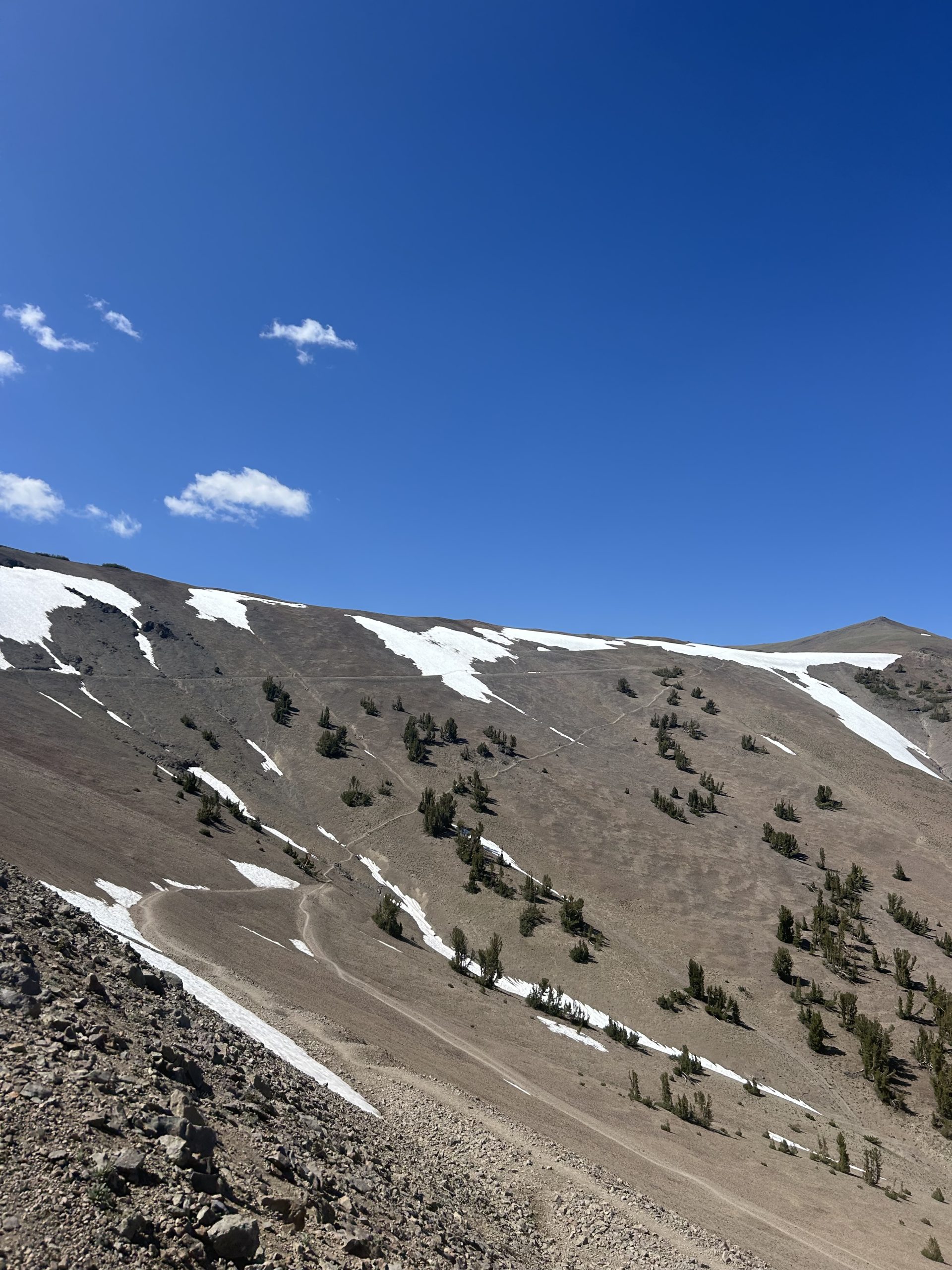
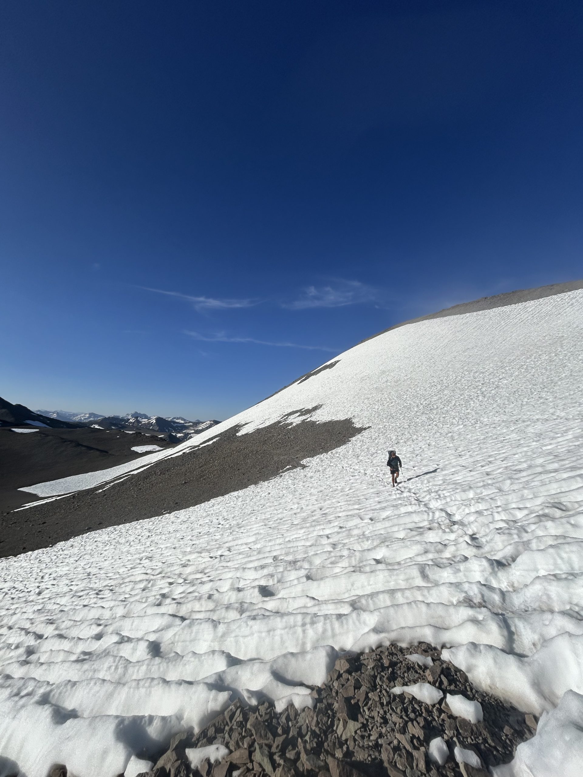
Once we were up and over the hill we began to encounter small snow patches. We were traversing across what was basically a giant bowl, and the snow was still piled up around the edges and down some of the slopes. The boot track was obvious and made following the trail easy. There weren’t any steep drop off, worse case scenario if you fell you’d just slide 10-20’ down until you stopped on the rocks. It would be fun but it wouldn’t be deadly, so that made me feel more confident. Even if we had our ice axes I wouldn’t have gotten mine out, and I never felt the need to dig out my microspikes.
We made our way around the bowl and up and over another small unofficial pass. On the other side of the mountain was more snow that was more annoying to deal with than dangerous. We trekked through that section and up and over another ridge where we were finally out of the snow.
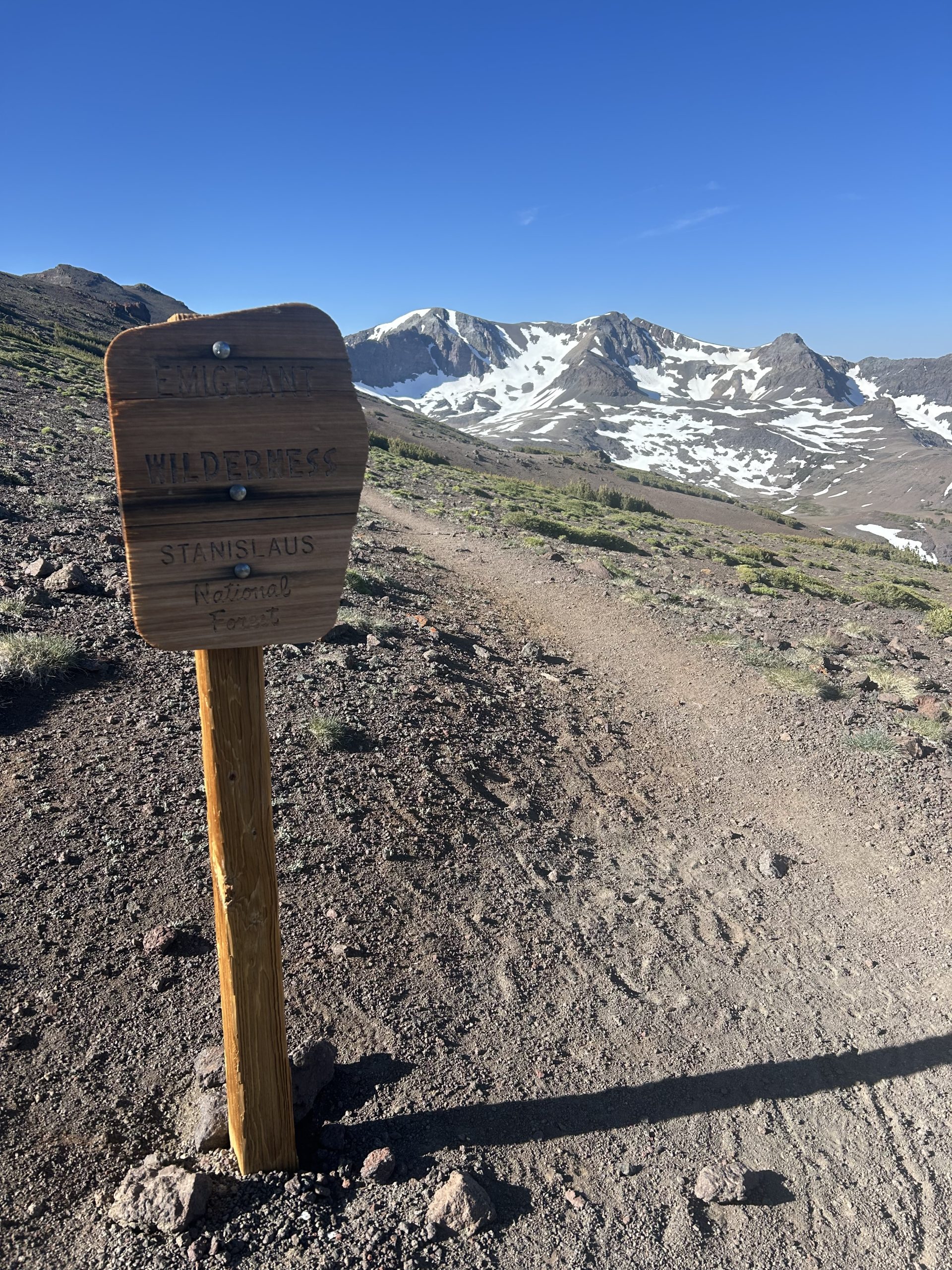
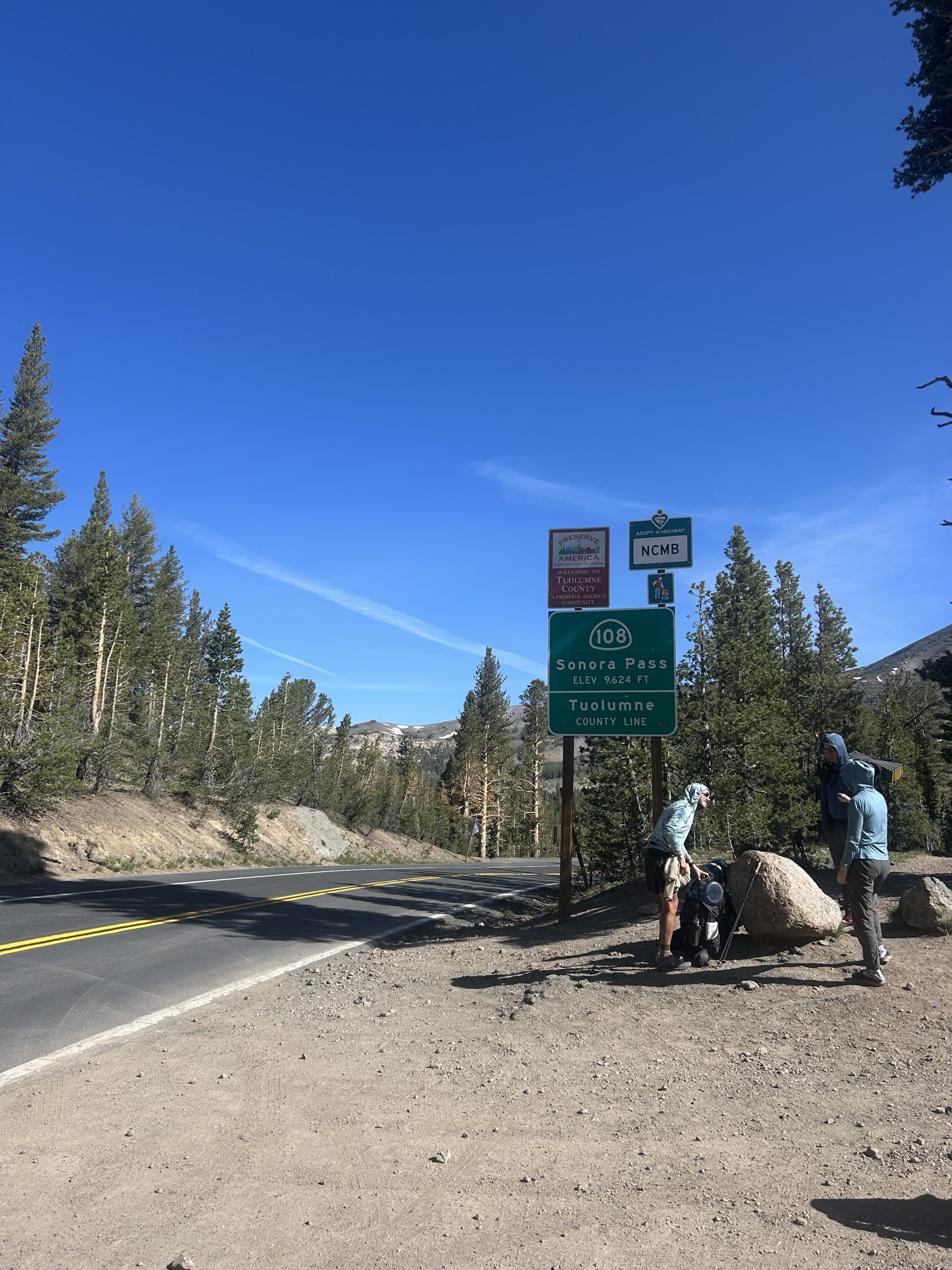
We shit straight across the ridge and made it to the sign for the Emigrant Wilderness. We were on a hilltop looking down to the road- that meant we were close! On FarOut we saw several comments talking about a shortcut trail along the ridge down to Sonora Pass. We decided to take that rather than the PCT to save a little time.
The shortcut trail was steep on loose gravel with one long snow chute. We were able to traverse down the chute halfway and then glissade the rest of the way down. The loose rocks felt much sketchier than the snow, but we made it down without any issues. We made it down to the road around 9am and were greeted by Silver Linings and Ghost.
Our plan was to try hitching to Kennedy Meadows North. If we couldn’t get a hitch, there was a 10am shuttle for $10 per person. Thankfully we didn’t have to stand around with our thumb out long, the first car that drove buy pulled over to give us a ride.
The guy that picked us up was named John and he drove a brand new Audi SUV. Apparently he was in sales and were driving for work, but was interested in the PCT so he was eager to stop and talk to us. He gave us, Silver Linings, and Ghost a ride and we all chatted the entire time. It was only a little 10 miles down the mountain, but the ride took nearly 20 minutes because of how winding the road was.
John dropped us off right at the front of Kennedy Meadows North. My expectations were low just based off how other “resorts” have been out here. I thought at best it would be similar to VVR, at worse it would be like KMS. This resort lived up to its name and was truly wonderful! They had a restaurant, bunk house, cute little cabins, a bar, and a fully stocked general store. The main attraction was the horseback rides, but they also had hiking and fishing on the property.
We arrived skeins 9:30am and immediately got a table for breakfast. The 4 of us ate together and realized we all had done the AT different years. We spent breakfast reminiscing on the AT and talking about the many differences between the two trails. Truffles and I split pancakes and chicken fried stake for breakfast, it was such a treat to get hot coffee!
Truffles and I had planned to hero in and out of KMN, we knew it would be expensive if we stayed and decided we’d rather spend the night somewhere in Tahoe. Once we arrived, though, and saw how nice the place was, we were tempted to change our minds. Since we had arrived so early we decided to resupply quickly after breakfast, sit around and chill for a while, eat lunch, then get back to trail.
The resupply at the general store was the best resupply we’ve had on trail outside of a Walmart or other large grocery store. They had everything and anything we could think of or want! All the hiker staples like honey buns and breakfast essentials, plus every variety of Knorrs and tuna. We were very impressed and got 3.5 days of food to get us to South Lake Tahoe.
Since we weren’t going to spend the night and do laundry/shower, our chores were done. We had plugged up our electrics to charge when we first arrived, so we were set to go. We bought a 6 pack of beer at the general store to drink while we were hanging out waiting for lunch. We sat in the shade at the hiker hangout area and talked to Killer, DayGlow, and Fox.
Once we had organized our food and killed our 6 pack, we went back to the restaurant with Killer and DayGlow to get lunch. We all had double cheese burgers either locally raised beef and it was phenomenal!
After lunch Truffles and I went back to the hiker area and were packing up with plans of trying to hitch out. A gentleman walked up, introduced himself as Mighty, handed us both a beer and said he was visiting the area as a representative of the Florida Trail. He sat and talked with us about the trail for a long time and showed us pictures of the maintenance his crew had done down in Florida.
We talked for a long time and eventually I asked him if he was heading up to Sonora Pass and if he’d give us a ride. He agreed and we loaded up in his truck and headed back up the mountain. On the drive we passed several cars pulled over with their hazards on, apparently a van had driven off the road in one of the sharp curves and wrecked. We pulled over to see if they needed help but the other cars already stopped assured us that help was on the way and they were already getting people out of the van.
We continued in a few more miles and pulled into the campground at Sonora Pass. Another hiker was trying to hitch down into KNN so we swapped places and Mighty sent us on our way. We visited the pit toilet before embarking on the last stretch of the day. We had about 3 miles of uphill and 3 miles of downhill to get us to the campsite. It was around 4:30pm when we started hiking again, but the climb wasn’t bad and offered some beautiful views. It’s amazing how different the scenery looks only one day outside of the Sierras. The mountains here remind me of the rocky outcroppings we saw in the desert, and apparently many of the mountains we’ll cross in this section are volcanic.
We got up and over the mountain easily and began the long descent. There was still snow in some sections, but it was easy enough to get across. We made it to the campsite around 7pm and there were already a decent amount of people here. We pitched the tent and snacked since we were still full from lunch. Today was a long but good day and I was tired and fell asleep quickly.


