
While thousands of people attempt a thru-hike of the Pacific Crest Trail each hiking season, even more step foot on the trail for shorter hikes throughout the year. This post is dedicated to the weekend warriors out there—to the past and future thru-hikers among us who, right now, can only manage weekends in between what we sometimes call “real life.”
It’s worth mentioning that all of the sections below have varying degrees of elevation gain and loss, so doing your own research before heading out is recommended. Some of the resources I like to use when planning my weekend trips include the Forest Service webpage for the area I’m hiking, FarOut, AllTrails, Google Maps satellite view, and of course, checking the weather forecast. Be sure to also double-check the PCTA website for updated permit requirements for the section you’re hiking.
The following sections were chosen not only for their natural beauty and interesting highlights but also for their logistical ease—all start and end where the trail crosses a highway, road, or trailhead parking lot, making weekend vehicle drop-off or shuttle logistics more manageable. Planning logistics for a section hike that isn’t an out-and-back is probably one of the biggest hurdles of the trip. The best way to tackle this is to first figure out if you’ll need a car at both ends, plan to hitch a ride back to your car, have someone drop you off and pick you up, or work out something else entirely.
These sections were also selected with distance and time in mind, with hikes ranging from 22.1 to 42 miles. The goal is to pick a section that’s doable for your fitness level in the time you have. Here, I’ve aimed for routes that work well for a typical two- or three-day weekend. Feel free to adjust the mileage or pacing to fit your schedule!
Once the logistics are planned, all that’s left to do is walk and enjoy.
Sections Perfect for a Weekend Trip on the Pacific Crest Trail
Starting in the Desert
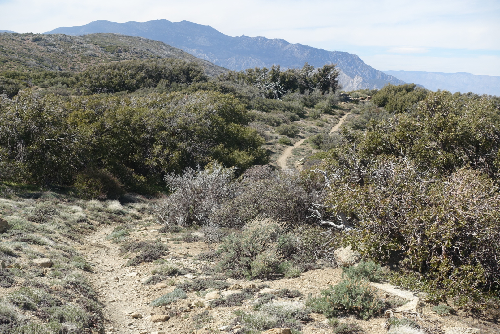
Scissors Crossing to Warner Springs (PCT mi 77.3 to mi 109.5)
Mileage: 32.2 miles
Permit required? No
The grasslands leading north toward Warner Springs.
This Southern California stretch is ideal for a weekend adventure and offers a surprising variety of landscapes over its 33 miles. You’ll start with panoramic views of the Anza-Borrego Desert, gradually climbing into rolling grasslands and shaded oak-studded chaparral, making it feel like you’ve hiked through three different ecosystems in just a couple of days.
As you near Warner Springs you’ll pass by Eagle Rock, one of the most recognizable and beloved landmarks of the PCT’s desert section. With its striking resemblance to a perched eagle, it’s a photo-worthy landmark, a natural gathering point for hikers and, if you camp nearby, you might end up sharing camp with some cows, too.
While there’s a small parking pullout at Scissors Crossing, Warner Springs is generally the better spot to leave a car due to its quieter surroundings and distance from Highway 78. If you’ve got time to spare, make a detour to Julian, a nearby mountain town famous for its homemade apple pie, hiker-friendly vibe, and welcoming local shops—perfect for carb-loading before you hit the trail, if time allows.
Paradise Valley Cafe to Idyllwild (PCT mi 151.8 to mi 179.4)
Mileage: 27.6
Permit required? Yes, $5 per person for permit covering San Jacinto Wilderness and San Jacinto State Park. More permit details here.
Heading up to the San Jacinto Mountains from Highway 74.
This is a beautiful and accessible section to tackle for a weekend backpacking trip in Southern California, offering alpine views, steady elevation gain, and a perfectly rewarding finish in Idyllwild, one of the cutest mountain towns in all of Southern California. With parking available at both ends, it’s a great option for hikers using the two-car shuttle method or anyone looking to experience a memorable stretch of the Pacific Crest Trail over a few days.
The hike begins near Paradise Valley Cafe, just off Highway 74, about a mile from the PCT. This rugged and beloved biker bar and cafe is a popular stop for thru-hikers and offers a decent sized parking lot. If you plan to leave a vehicle there, it’s important to contact the cafe in advance and ask for permission, since the lot is privately owned. This same rule applies to any privately owned lots—always check before leaving a car.
From the trailhead, the route climbs into the San Jacinto Wilderness, offering a mix of mountain views, shaded forest sections, and dramatic glimpses of the desert far below. The hike ends in the town of Idyllwild, where you can enjoy good food (Idyllwild Pizza Co.), a walkable downtown, and a great mountain-town atmosphere to end your weekend on trail.
The Sierra
Kearsarge Pass to Rae Lakes out and back (PCT mi 790.3 to 794.7)
Mileage: ~24.5 miles
Permit required? Yes, permits for Inyo National Forest are required. 60% of permits released six months in advance and 40% released two weeks in advance, both at 7 am PST on Recreation.gov.
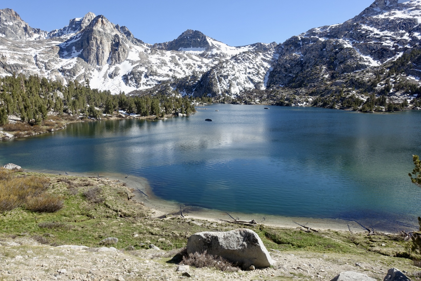
View of Rae Lakes.
Starting at Kearsarge Pass, you’ll head 7.5 miles up the Kearsarge Pass Trail until you hit the PCT at mile 790.3. From there, you’ll head North on the PCT for 4.4 miles, hiking up and over Glen Pass, before you reach camping options around Rae Lakes. This is an out-and-back route—about 12 miles each way—crossing two high alpine passes (Kearsarge and Glen Pass) to reach the remote and beautiful Rae Lakes and then retracing your steps back to the trailhead.
The scenery in this stretch of the high Sierra is almost unbelievable. Towering granite crags, deep alpine lakes, and potential Sierra wildlife encounters make the challenging miles worth it. If tackling this section, be prepared to be above 10,000 feet for most of the hike. It’s definitely one of the harder areas to secure a permit for in the Sierra but if you can manage it and are flexible on your hiking dates, it’s an extremely rewarding weekend trip in the Sierra.
Bishop Pass to Muir Hut out and back (PCT mi 832.2 to mi 839.7)
Mileage: 38.4
Permit required: Yes, permits for Inyo National Forest are required. 60% of permits released six months in advance and 40% released two weeks in advance, both at 7 am PST on Recreation.gov.
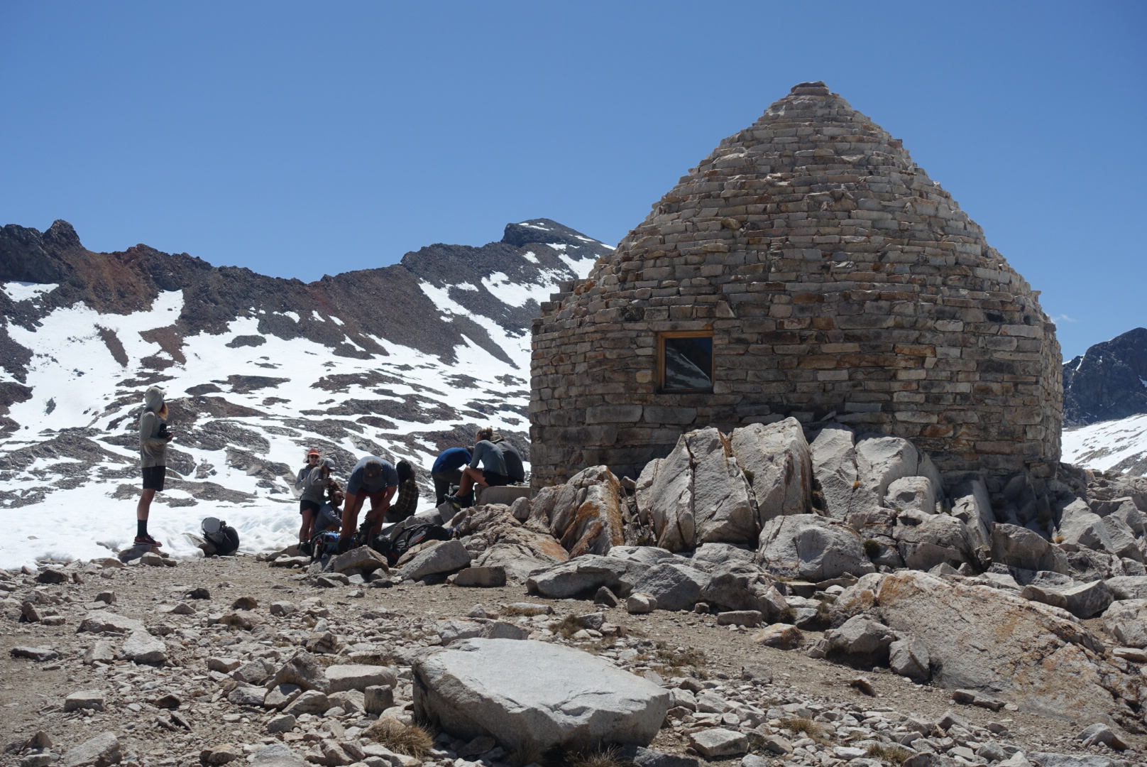
Muir Hut atop Muir Pass on this section of the PCT.
Starting from the Bishop Pass Trailhead, you’ll hike 11.7 miles up and over Bishop Pass until you reach the PCT at mile 832.2. From there, head North on the PCT for another 7.5 miles until you reach Muir Pass and the iconic stone Muir Shelter perched at the top. Campsites can be found both a few miles before and after the pass, giving you some flexibility depending on your pace and direction.
This stretch is dramatic and rugged, with big climbs, sweeping alpine views, and that classic high Sierra feeling of being way out there. One important note: Muir Pass is notorious for holding snow well into the summer, with long snowfields on either side. Be sure to check current conditions and plan accordingly—sometimes snow gaiters and long pants can help when you posthole, even late in the season. If you’re up for the challenge, though, it’s an unforgettable section of trail.
Reds Meadow to Tuolumne Meadows (PCT mi 907.8 to mi 943.7)
Mileage: 35.9
Permit required: Yes, permits for Yosemite Wilderness are required. 60% of permits released six months in advance and 40% released two weeks in advance, both at 7 am PST on Recreation.gov.
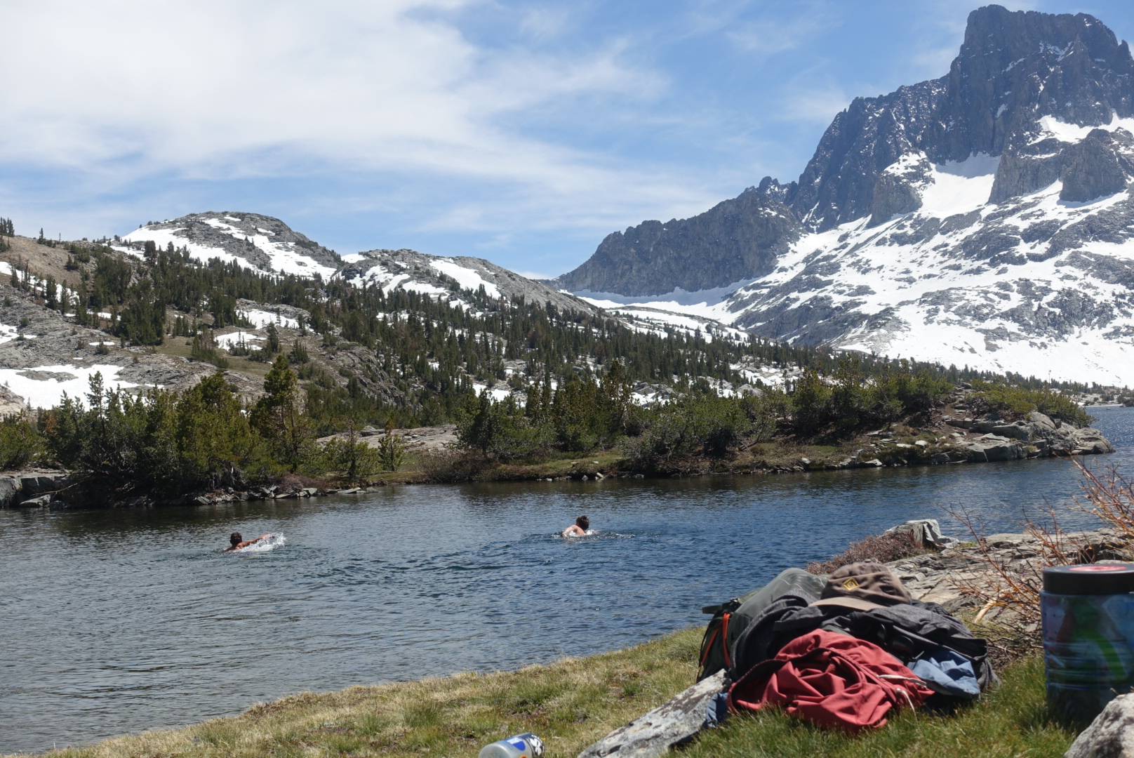
A swim in Thousand Island Lake to cool off.
This section is your classic, jaw-dropping, Sierra scenery. Red’s Meadow makes for a convenient jumping-off point, with a small general store and summer shuttle service into Mammoth Lakes. It’s only about a half-mile off the PCT, making it an easy spot to begin hiking north (or end if you decide to hike south).
Important note: as of current, Red’s Meadow Road is closed for construction and is expected to remain closed through 2026. During this time, consider starting your hike from the Horseshoe Lake Trailhead near Mammoth Lakes instead. There’s a large parking lot and established trail access there, but it will add about 4.4 miles to your trip.
Along this stretch, you’ll pass iconic High Sierra landmarks like Devil’s Postpile, Thousand Island Lake and Donohue Pass before descending into the outskirts of Yosemite National Park. The Tuolumne Meadows Store, located just 0.3 miles off trail on Tioga Road, can be a great end location for this section. If you’re looking to extend your trip, you can catch a shuttle or drive from Tuolumne into Yosemite Valley—but keep in mind that campsites in the Valley book up well in advance so plan accordingly.
Northern California
Donner Summit to Sierra City (PCT mi 1154.5 to mi 1196.5)
Mileage: 37.5 (if starting at Highway 80)
Permit required? No
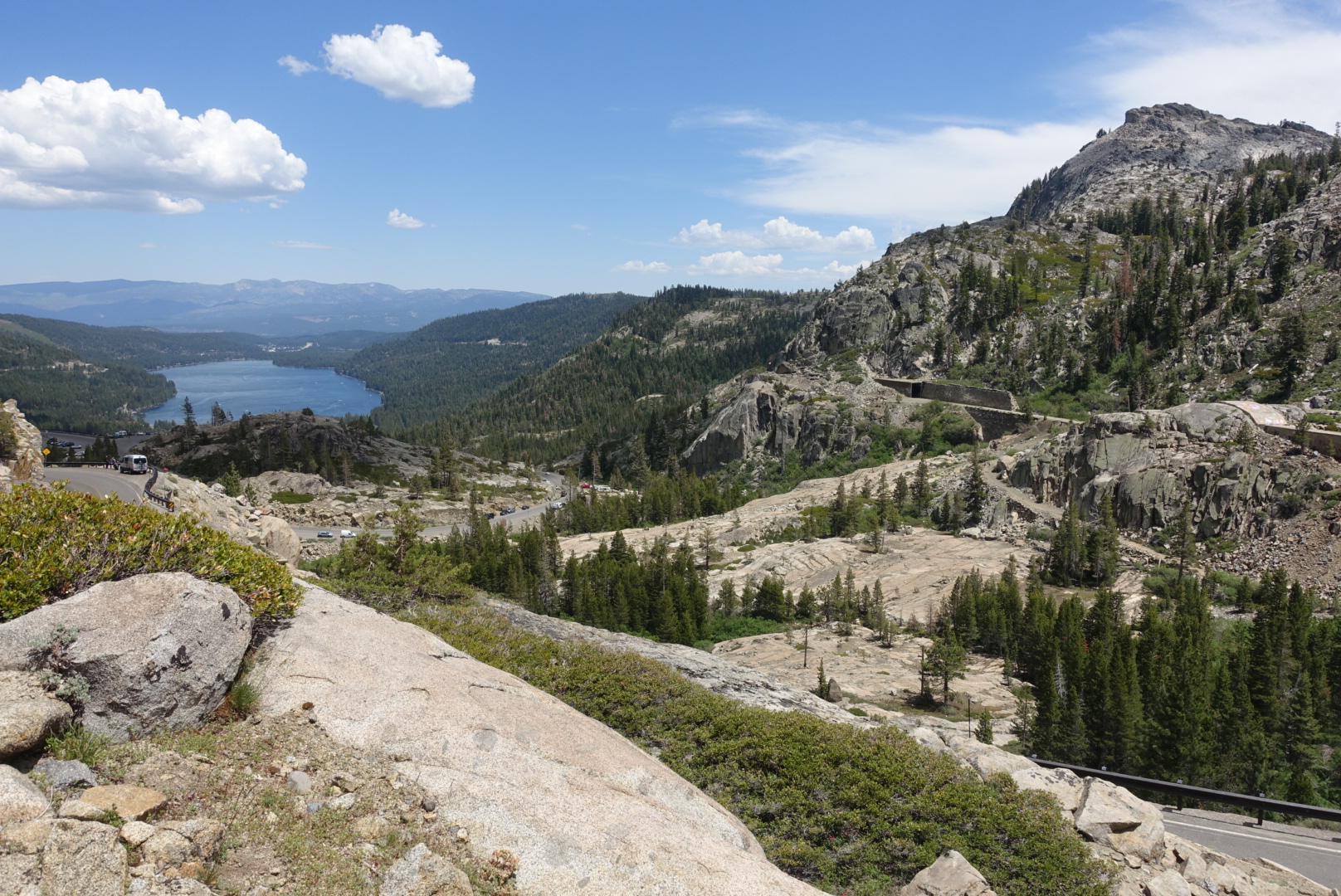
Views from Donner Pass of Donner Lake below.
Otherwise known as California Section L of the PCT (Highway 80 to Highway 49), this stretch covers about 37.5 miles—starting officially at Highway 80, a few miles north of Donner Ski Ranch. Donner Ski Ranch is just 0.3 miles off trail across Highway 40 and makes for a great spot to grab a meal before you start your trip; they are very used to hikers coming by and are super hiker friendly.
This section features some beautiful Tahoe National Forest scenery, a pass by the Peter Grubb Hut managed by the Sierra Club, and a visit to the small mountain town of Sierra City where there are a handful of restaurants and a general store built alongside the Yuba River. The town of Sierra City is accessed by walking about 1.5 miles down Highway 49 from the PCT and is filled with local charm- a great place to end your section, especially since the climb out of Sierra City heading north on the PCT is notoriously steep.
Hat Creek Overlook to Burney Falls State Park (PCT mi 1381.5 to mi 1420.5)
Mileage: 39
Permit required? No
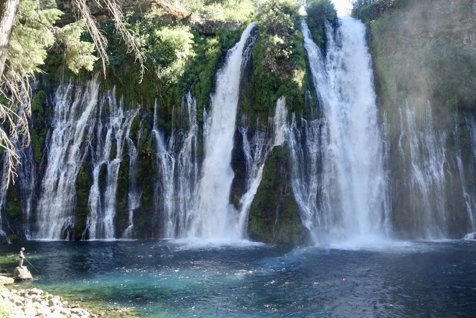
Burney Falls with a fisherperson off to the left for scale.
Highlights of this section include the welcoming Hat Creek Resort campground—a great spot to make camp if you have a night to spare before your hike. Just a short detour from the trail heading north, Subway Cave offers a fascinating glimpse into the area’s volcanic history with its walk-through lava tube formation, making it super fun side trip- just remember your headlamp or flashlight. Throughout this section, you’ll enjoy stunning distant views of Mount Shasta rising up over the valley, a constant reminder of the volcanic past (and future?) of Northern California.
The section ends at the breathtaking Burney Falls, one of the most spectacular waterfalls in the state and a must-see for any hiker passing through. The falls cascade into a crystal-clear pool, surrounded by lush greenery—a perfect place to relax and soak it all in after your trek. And if you’re lucky, the soft serve machine at the Burney Falls State Park general store will be up and running when you arrive and you can enjoy a well-earned treat to cap off your adventure!
Oregon
Mirror Lakes Trailhead to Mckenzie Pass (PCT mi 1960.6 to mi 1985.3)
Mileage: 28.2 (24.7 PCT miles + 3.5 side trail miles)
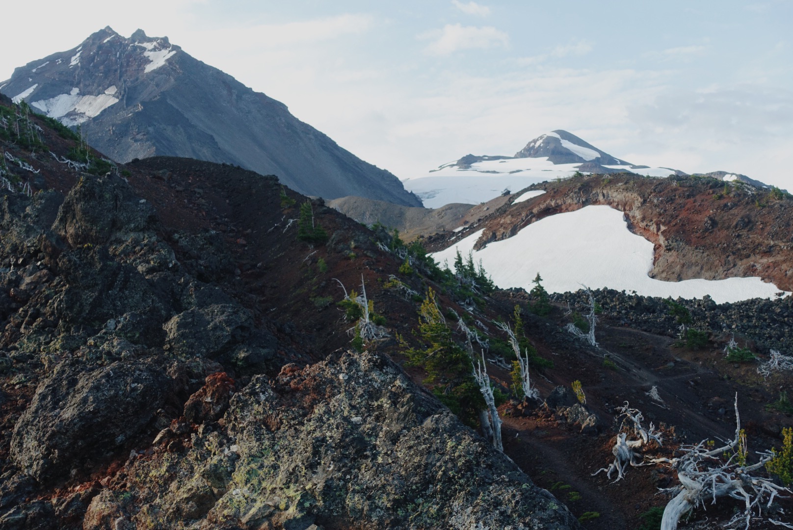
Views of North and Middle Sister looking south on the PCT at Three Sisters Wilderness.
Permit required? Yes, if visiting between June 15th and October 15th a Central Cascades Wilderness permit is required. 40% of permits are available the first Tuesday in April, then 60% of permits available 7 days prior to start of trip. Check availability at Recreation.gov.
Start by heading about 3.5 miles northwest on the Mirror Lakes Trail to reach the Pacific Crest Trail at mile 1960.6. From there, follow the PCT north through the stunning Three Sisters Wilderness, passing by the South, Middle, and North Sister peaks as you make your way toward Mackenzie Pass on Highway 242.
This section offers one of the biggest bangs for your buck as a section hike on the PCT, packing incredible scenery into a manageable couple day distance. Along the way, you’ll hike past several 10,000+ foot volcanic peaks that are part of the Cascade Volcanic Arc. You’ll also come across an obsidian area, where volcanic glass sits in piles along the trail, adding a unique geological aspect to your adventure. Wildflower fields bloom vibrantly in the spring and summer seasons, and on clear days, you can enjoy views of Mount Jefferson to the north. This stretch perfectly combines dramatic landscapes and diverse ecosystems, making it an unforgettable weekend backpacking trip.
Timothy Lake to Timberline Lodge (PCT mi 2077.9 to mi 2100.0)
Mileage: 22.1
Permit required? No
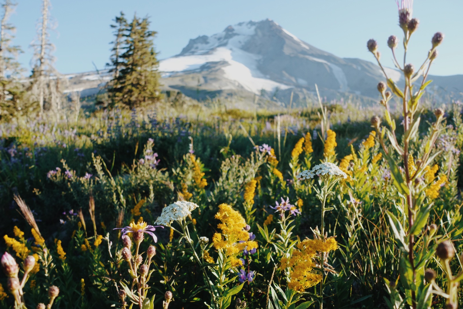
Mt. Hood and surrounding wildflowers as seen from the PCT.
Timothy Lake is a popular spot in Oregon with several campgrounds right around its shores—the closest just about half a mile from the PCT. Starting your hike here makes a lot of sense since it’s easy to get to from well-traveled roads and offers direct access to the trail.
This section has plenty of highlights, including the beautiful Timothy Lake itself and the quirky Little Crater Lake (not to be confused with the much bigger Crater Lake National Park). Along the way, you’ll come across a YETI Danger meter—a popular photo stop—which adds a fun element to the section. Plus, you’ll get spectacular views of Mt. Hood as you move through the landscape. When you wrap up this stretch, you can wander through the famous Timberline Lodge and maybe even grab a bite (or two) at the famous Timberline Lodge Buffet.
Washington
Snoqualmie Pass to Spectacle Lake and back (PCT mi 2396.3 to mi 2413.5)
Mileage: 34.4 (17.2 PCT miles out and back)
Permit required? Yes, free self-issue at most Ranger Stations in the area.
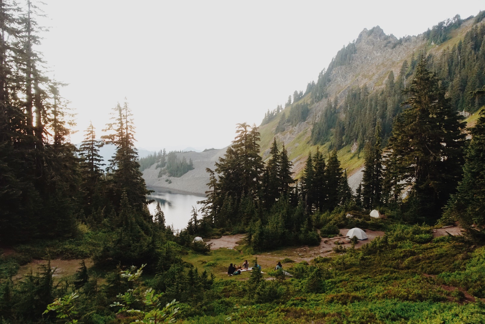
Camping right off the PCT in Alpine Lakes Wilderness.
This section gives you a real taste of the rugged Washington mountains as you hike through the Alpine Lakes Wilderness. You’ll be rewarded for the effort with stunning views of alpine lakes and jagged peaks all around. Snoqualmie Pass is a small ski resort area that offers a few good food options during the summer months (don’t miss the gas station pizza place).
If you want to get a little closer to the water, the Spectacle Lake Trail drops about half a mile down to the lake— worth the side trip before you head back the way you came if you don’t mind adding a bit more elevation to the day.
White Pass to Chinook Pass (PCT mi 2298.1 to mi 2327.0)
Mileage: 28.9
Permit required? Yes, since you pass through Mount Rainier National Park you will need a wilderness permit that can be obtained online in advance at Recreation.gov or on site first-come first-serve.
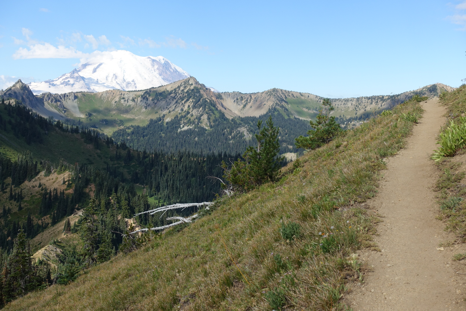
Mt. Rainier in the distance.
About 0.6 miles west along Highway 12 from the White Pass trailhead, you’ll find the Kracker Barrel—a small store with a limited but handy selection of food and supplies. It’s a convenient spot to grab snacks or top off your water before you hit the trail. There’s also a parking lot right where the PCT crosses the highway, making access easy for a car drop-off.
This section takes you through some stunning terrain within Mount Rainier National Park, where dense old-growth forests, wildflower-filled meadows, and of course, Mount Rainier, dominate the landscape. You’ll experience classic Pacific Northwest mountain scenery as you make your way toward Chinook Pass, climbing and enjoying breathtaking views at nearly every turn. This stretch is ideal for weekend backpackers wanting to soak in the beauty of the Cascades without the crowds (or the distance) of the Wonderland Trail.
Rainy Pass to Stehekin and back (PCT mi 2575.1 to mi 2594.6)
Mileage: 39 (19.5 PCT miles out and back)
Permit required? Yes, North Cascades National Park requires a permit. 60% will be reservable in advance on Recreation.gov and 40% will be available walk-up on a first come, first serve basis.
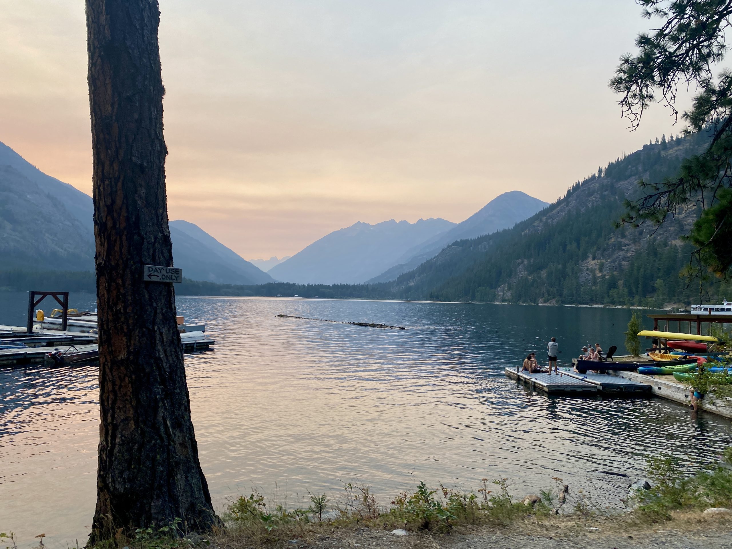
Lake Chelan from the Stehekin shoreline.
This section is out there—and that’s what makes it so special. It’s remote, rugged, absolutely gorgeous, and the only southbound hike on this list (but many of these sections you can decide to hike northbound or southbound). You’ll get big North Cascades views right away, with steep ridge lines and glimpses of massive peaks like Mount Rainier in the distance. The terrain feels wild and exposed in all the best ways.
You’ll eventually make your way down toward Stehekin, a tiny, off-grid community that’s only accessible by foot, boat, or float plane. From where the PCT hits High Bridge, you’ll want to catch the shuttle bus in the summertime, or else it’s an extra 10.8 miles round trip on Stehekin Valley Road. The shuttle is great- it stops at the Stehekin Pastry Company on the way into town, and trust me, that cinnamon roll might be the best thing I’ve ever eaten.
Stehekin itself has a post office, small general store, a few lodging options, and ferry access to the town of Chelan if you want to get a boat ride back to “civilization” instead of hiking back toward Rainy Pass. It’s one of the more remote and rewarding sections of the Washington PCT, and totally worth the extra logistics.
What sections do you love to hike over a weekend?
Comment below and let’s make an even bigger list of great section hike options!


