
This morning when I woke up at my tent site I was feeling so much better. I still had the slight tinge of a headache initially when I woke up. But I took some ibuprofen with my morning coffee and was feeling 100% by the time I packed up and left camp. I had about 10 miles to go before I would come to the junction for Cottonwood trailhead. That’s where OutsideJay left my bear can and all of my food.
It was a beautiful thing starting the morning at high elevation. I didn’t have much more climbing to do over those next couple of hours. I mostly just went up and down mildly along ridge lines. I watched the most beautiful sunrise and remembered all of the amazing mornings that I spent here in the Sierra in 2022. It was a ghost town in October when I was here previously.
My first sunrise in the Sierra.
It’s usually recommended to get out of the Sierra and to Kennedy Meadow south by the first or second week of October. That’s just a safety recommendation to avoid getting caught in the high mountains when snow comes. But I remember getting to Kennedy Meadows south for their Halloween party. I got really lucky.
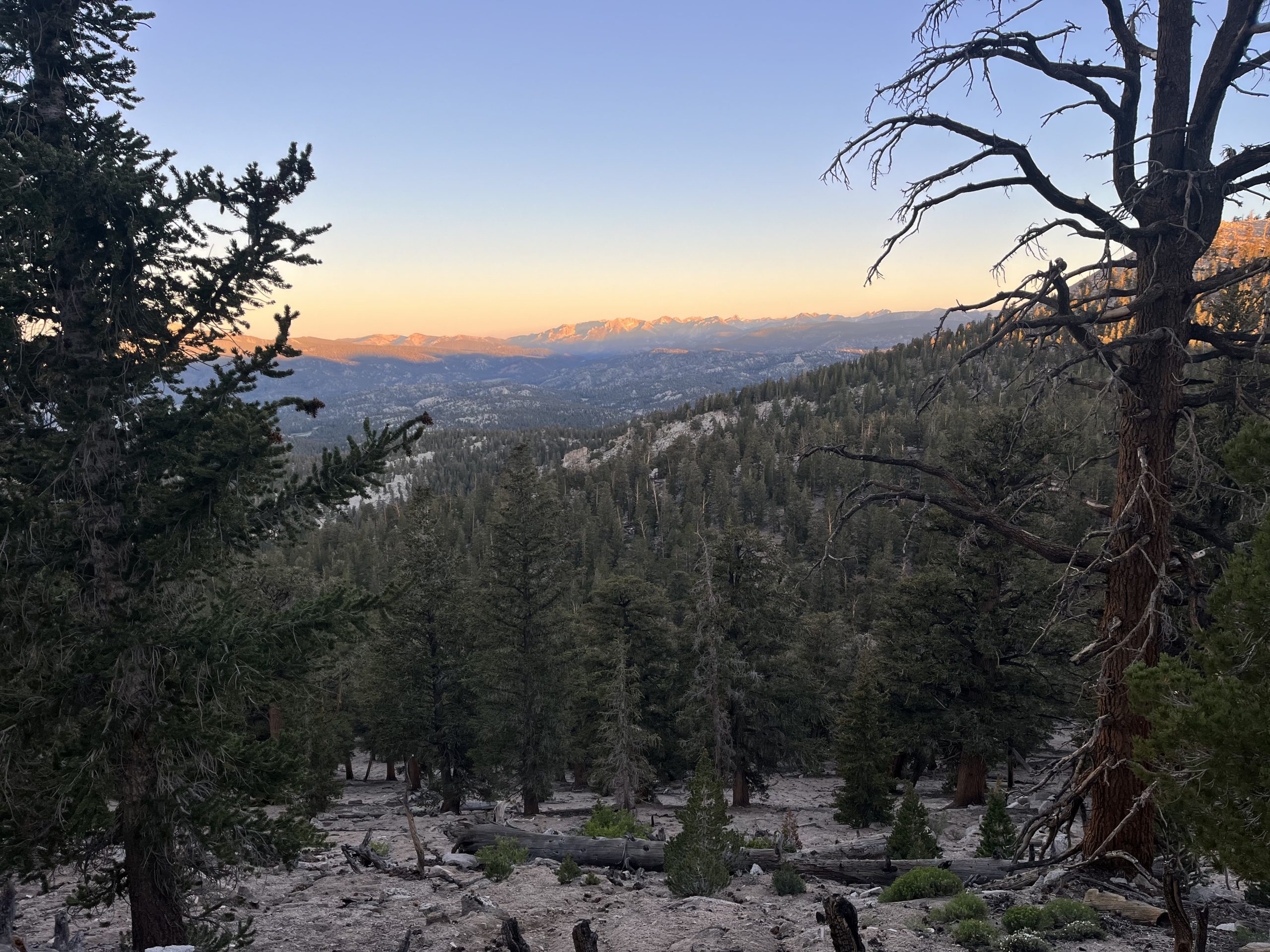
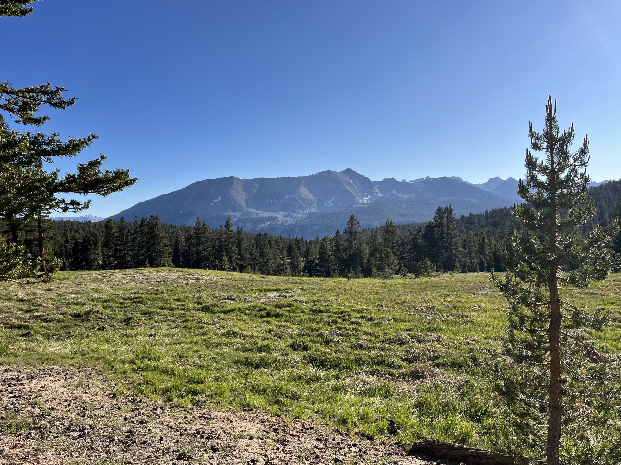
A beautiful start to the day.
The trail was nice and easy this morning. I was making great time. I felt like my head was in a bit of a daze still, likely due to the change in altitude. Typically, I’ll feel a bit tired or out of it for the first 24 hours or so. Then the more time that I spend at higher elevation, I typically start to feel very strong. And lucky for me, that’s the way it went this time around as well. After a few hours of walking, I started feeling really good. I felt the fog lift, and I was definitely more clearheaded. For the rest of the day I felt basically completely normal.
It was so early when I came to the junction for Cottonwood. This time going through the Sierra, I’m avoiding any side trails if I can. That means carrying more food and resupplying less frequently. Most of the towns you can hitch into in the Sierra involve adding significant mileage and elevation gain and loss. Cottonwood is a nice middle ground. I was able to have a light pack yesterday and for most of this morning. And going down to the trailhead and back up to the trail only adds a mile and a half and maybe 500 feet of elevation gain. In the end, I think it’s definitely worth it so that I could acclimate yesterday. Though I’m sure coming up from the parking area in a bit is going to be rough.
Jay had told me that I would get service before dropping down to the trailhead. He sent me photos of specifically where he had put my food. The camping area has tons of bear boxes so it would’ve been helpful to know which one it was in. But I never did wind up getting service. Instead, I just made my way down to the parking area and hoped for the best. When I looked around and noticed the 50+ bear boxes in the surrounding area, though, I became a bit nervous. Jay had given me a rough idea of where the canister would be, so I just headed in that direction and started looking in every box. Right as I was starting to get a bit anxious, I opened one and found my bear canister and box of food.
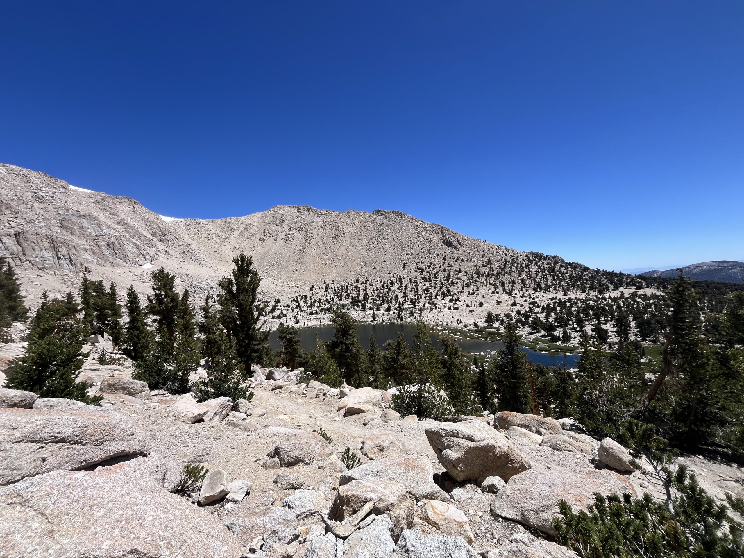
Views as I continued climbing up and past chicken spring lake.
The only bear canister that can fit in my small backpack is the bear vault 450. So in addition to fitting that into my backpack, I also had an additional 2–3 days of food that didn’t fit into the bear canister. Luckily in this area, you don’t need to store your food in the canister throughout the day. You just need to properly store your food at night. So today I’m going to hike as many miles as I need to in order to get to a campsite that has a bear box. That way I can properly store my food and don’t have to worry about it.
I wound up having to leave probably 1500 more calories behind in the box at the campground. I filled every single pocket of my backpack and shoved food into every last nook and cranny. Then eventually it was full to capacity and I couldn’t fit another bar. I’m just hoping that this will actually be enough food to get me where I need to go. As of now I’m planning to get more food at VVR, a resupply location just off the trail.
I’m so excited to continue further into The Sierra. It’s been so beautiful already.
I was in and out of the parking area surprisingly quick. Then got back to the trail and began climbing up Cottonwood pass. If I had stayed on the red line, I would’ve had a 500 or so foot climb regardless. Now I had to climb a little over 1000 feet to make up for the descent down to the parking area. I figured it was going to be rough going with how heavy my backpack was. It was incredibly heavy. I honestly can’t remember a time that I’ve ever carried this much food or weight. Typically as a rule of thumb, I say that my backpack can only fit 5 1/2 days of food. This time around, I’m stretching that out a bit in hopes of avoiding getting off trail to resupply at inconvenient locations.
Between the six days of food, the bear canister, and the 2 L of water, I was really feeling the weight of my pack. But surprisingly as I began making my way up Cottonwood pass, I felt really strong. Any tiredness that I had felt yesterday from adjusting to the change in altitude had faded away. I wound up passing a bunch of people as I made my way up to the top of the pass. It felt really good to feel strong again.
The climb went on for about 2–3 miles and it certainly wasn’t as bad as I expected. It was steep at times, but overall it was fairly gradual. Once I got up to the top, I reconnected to the PCT and then continued on to chicken spring lake. At the time, I didn’t realize that this was the last water source for the foreseeable future. Luckily, I still had a lot because I decided to bypass the lake on a whim. The trail would still get some views of the lake as I continued to climb a bit more. But it was early in the day and I had a ways to go. I just didn’t want to stop off and kill any more time. Even though the lake seemed like a beautiful break spot.
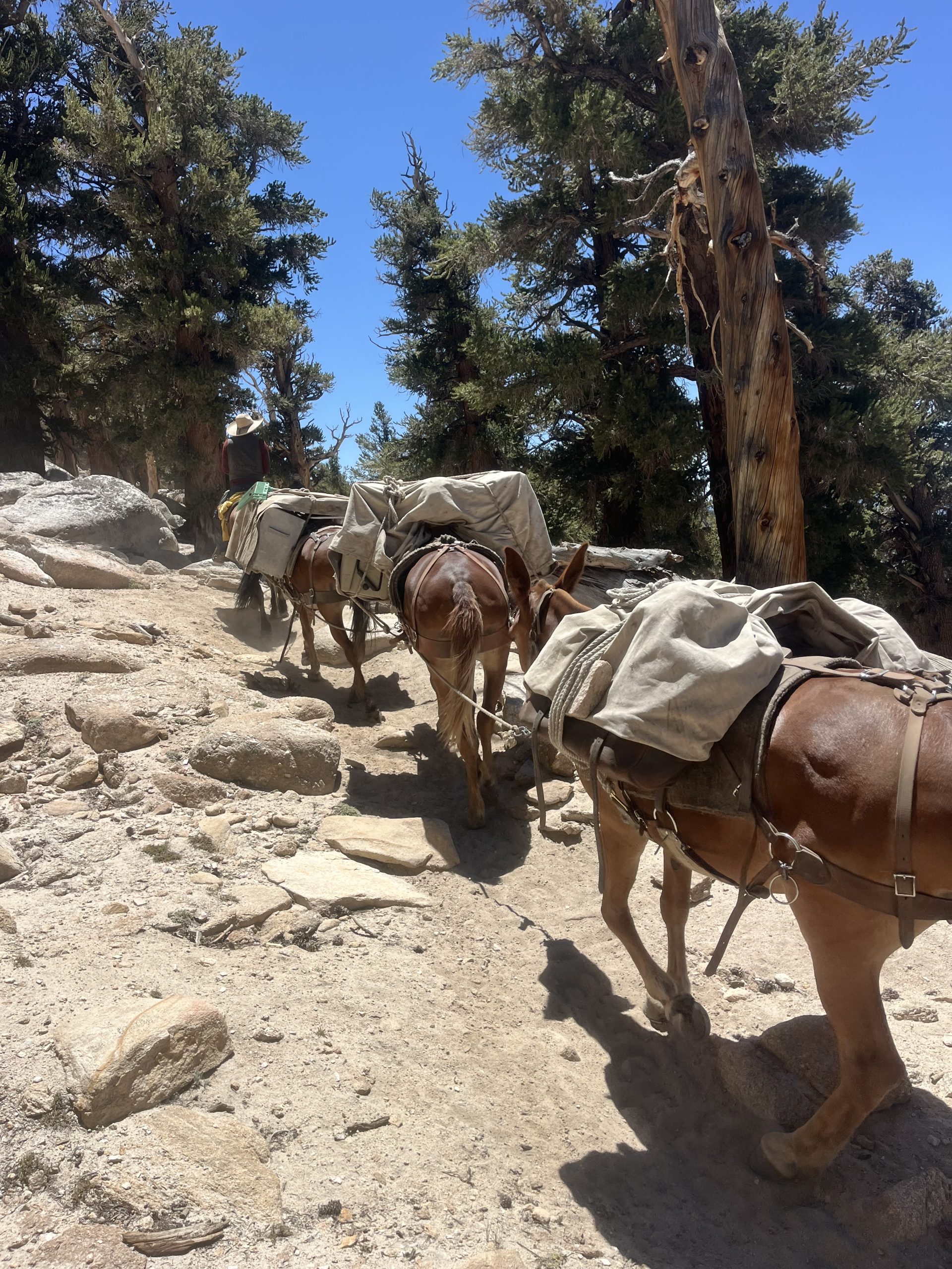
Getting passed by some horses and mules.
After climbing a bit further, I got up to the top and the next couple of hours would be nice and easy. There wasn’t much elevation gain remaining for the day until I would drop down to the bottom of the valley. Over the next hour or two I passed by a bunch of hikers who are doing the John Muir Trail. One of the ways around getting permits for Whitney portal when doing the John Muir Trail, is getting a permit for Cottonwood pass where I just was. It can be really difficult to get Whitney portal permits so it seems like the majority of people opted to enter Cottonwood and add a little bit of mileage.
It was pretty much every hikers first day, which was exciting to see. Most of the guys that I went past were able to guess that I was a thru hiker almost immediately. The Sierra is a hard stretch of trail. But PCT hikers have the luxury of a 700 mile warm up first. And the difference is noticeable.
Time went by pretty quickly over those next few hours. I was passed by a group of men on horses with mules. They just finished out a week trip near the Whitney area. It seems like they had facilitated bringing in the gear for hikers. I didn’t get the impression that it was a vacation for them, more like their job.
I ate as much as I could as I continued along this downhill stretch. And just like yesterday, by the afternoon it was growing incredibly hot. The further I went downhill the more it warmed up as well. That’s been a tough trend the last two days.
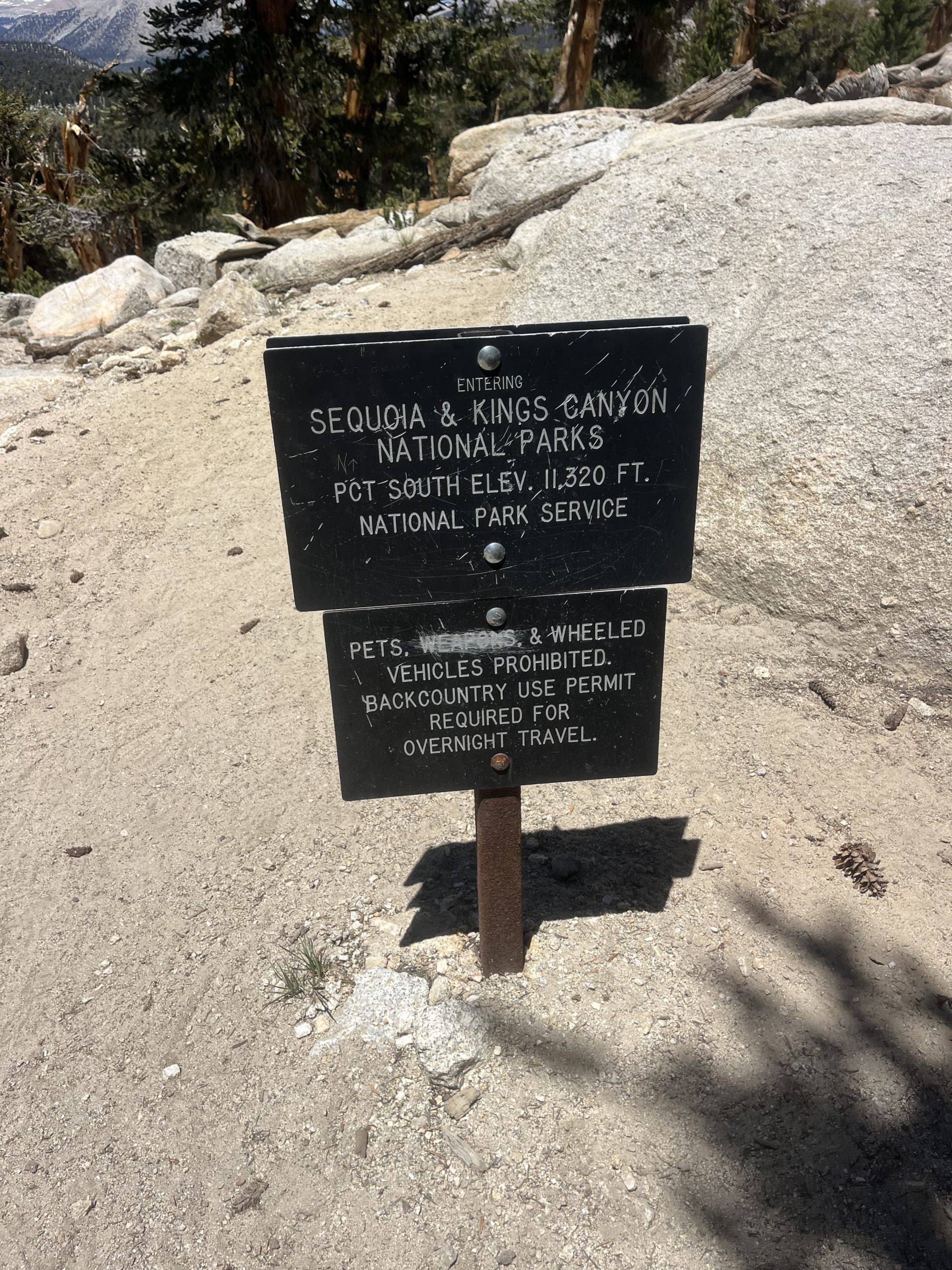
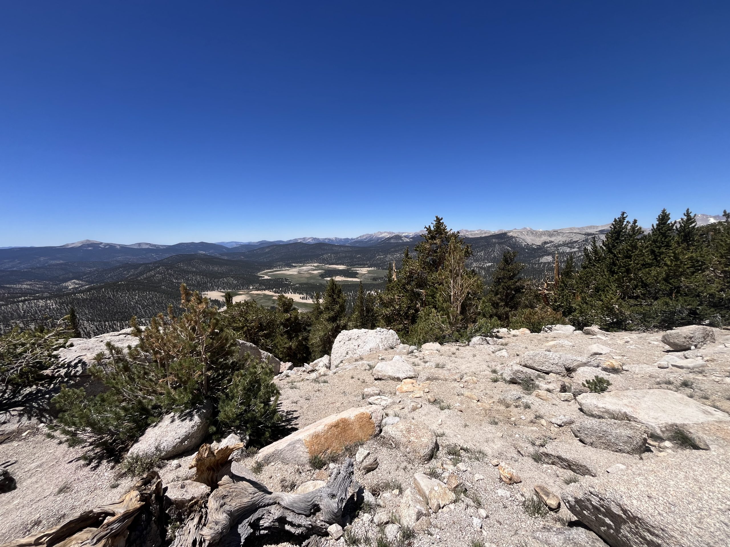
Entering Sequoia and Kings Canyon national Park.
As I was approaching the next water source and was still about 11 miles out from camp for the night I was feeling quite tired. It just felt like a very long way to go for the day and the heat had me very sleepy. I planned to fill up on water and then continue on for the rest of the day. If I reached my intended campsite, it would wind up being a 37 mile day though. Which is definitely going to help me in the long run and will set me up for getting to my next resupply location at a good time.
When I got to that next water source a couple hikers were heading out. I sat down and didn’t even notice that there were two hikers across from me. It was a guy and a girl and I heard the guy say something like “is that who I think it is” Which initially had me assuming that it was a complete stranger who recognized me off the Internet. I was wearing sunglasses and the section of trail we were on was pretty shaded. So I couldn’t see incredibly well. But when I took my sunglasses off, I realized it was Queen Liz! A hiker who I hiked about 800 miles with on the PCT in 2022.
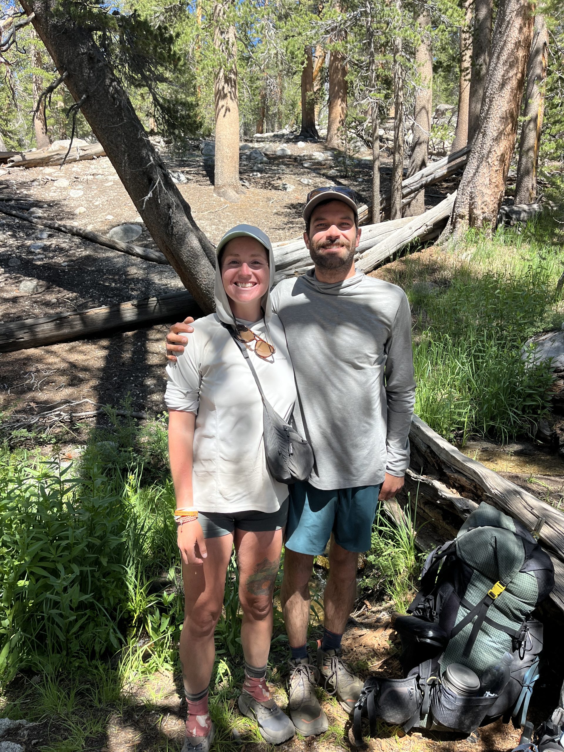
Queen Liz! Aka Leo. What a small world we live in.
Then, while he was hiking the Appalachian Trail last year, he stayed at my house in Philadelphia for a handful of day as he recovering from an ankle injury. He had been planning on doing the Appalachian trail and the continental divide trail in 2024. At the time we had thought we were going to run into each other on the CDT, but his ankle injury really never healed well.
Now here we are, in the middle of nowhere in the Sierra. And we’re both running into each other by pure luck? It’s always so wild how things play out on trail. He was out doing the section from Mount Whitney to Kearsarge pass with his girlfriend Chase. It was really nice to meet her and it was so cool to talk with him. It’s been way too long.
Before running into him, I was feeling tired and didn’t have a lot of energy left for the day. But chatting with the two of them and hanging out for a bit got me good to go. Unfortunately, he only planned to do another mile for the day. And I planned to do 11 more. At first, I thought he had said he was planning on camping at the same place that I was. But if I was only going to be out in the Sierra for a week, I would probably do shorter days and get to camp earlier as well.
We walked together for the next mile until we came to a beautiful river with tent spots and bear boxes. That’s where him and his girlfriend planned to camp for the night so he could fish for trout in the stream. I was feeling so much better at this point and was ready to roll out the next 11 miles. So I said goodbye to the two of them and continued on. The next few miles held a fairly steep climb, just short a 1500 feet. But after that, the remainder of the day would be relatively easy.
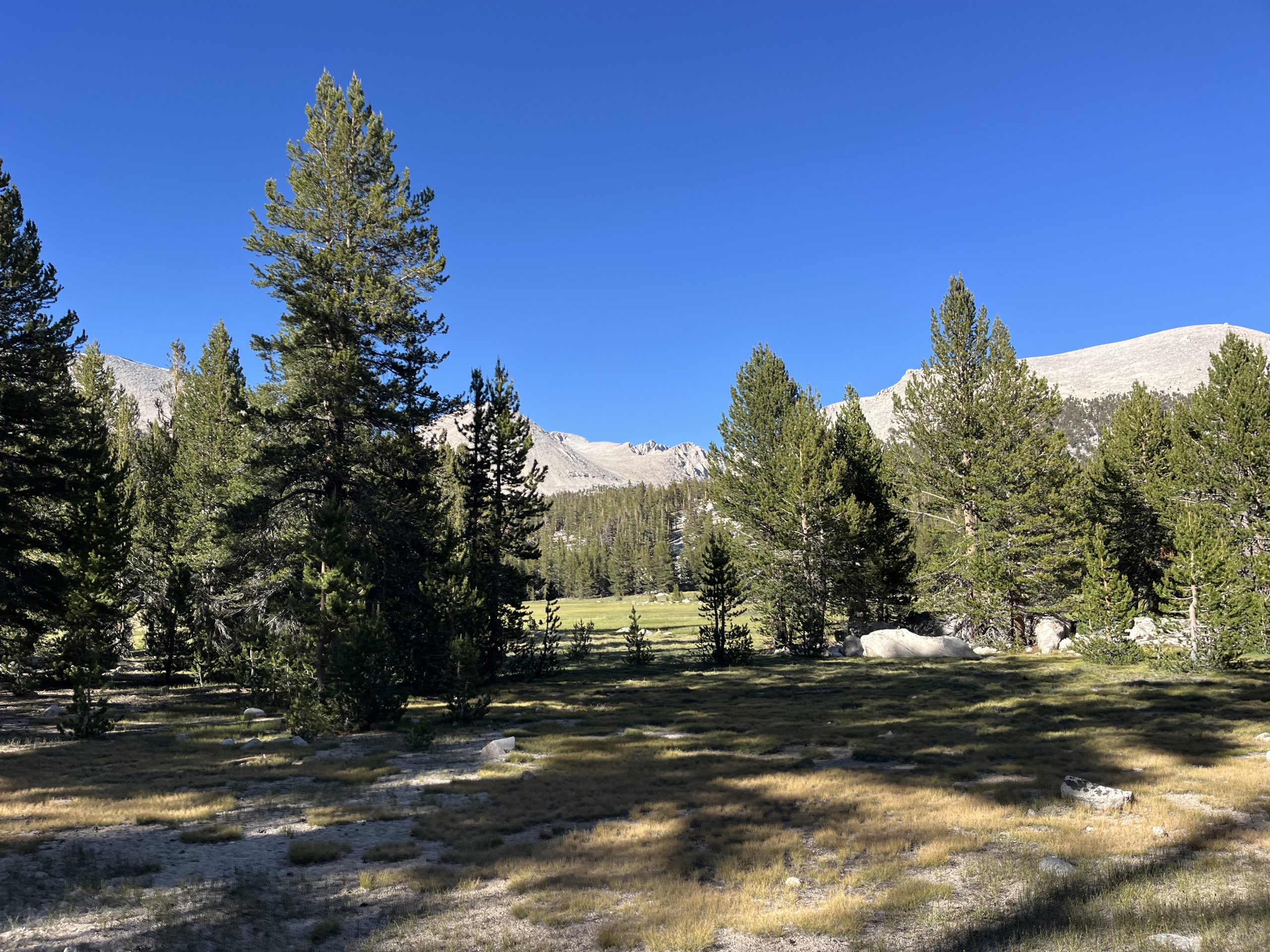
The trail walked me through a wide open valley near the turnoff of for Mount Whitney.
The climb wasn’t as bad as I imagined, and it actually leveled out about halfway in between the bottom and the top. Then I got to walk through a valley briefly before finishing out the last of the climb. I was feeling really good once I got up top and began descending. And the trail would be primarily downhill for the rest of the day. With the occasional short climb in between.
I wound up running into another hiker, who thought that I was someone else. I asked if they had seen any other PCT hikers and he informed me that he had been passed by Hillbilly about two hours ago. I met Hillbilly at Kennedy Meadow South. So it’s exciting to think that I’ll catch up to him either this evening or tomorrow. He left KMS the day before me, so I figured it would take another day or two at least to gain on him. It sounds like he’s trying to do 25–30 mile days.
By the time I was up at the top of that climb, I only had about 7 miles left for the day. And about an hour later, I passed the junction for Mount Whitney. There’s a campsite there that a lot of people use as a base camp. There were tons of tents set up when I went by. But this time around it’s just not in the cards for me to do Whitney. I’ve done it before and I would love to do it again. But I’m already carrying so much food and time is of the essence this year.
It wound up being a really nice end of the day. I’m always proud when I push on to my intended campsite, even when I’m tired.
The bugs were pretty bad when I passed that campsite and continued along the trail. But luckily, I only had a few miles left for the day. As I got closer and closer to my destination, I definitely started considering stopping off a little bit earlier. It still would’ve been a really long day either way. And I knew I had to do one last short climb before dropping down to the river where that would be tenting for the night.
I was just feeling lazy after a long day of walking. I passed by a couple water sources and looked around to see if there was tenting nearby. But there was nothing good so I forced myself to continue on. Sometimes I get the urge when I’m 30+ miles into a day to call it quits a bit early. But I’m always very glad when I don’t. This time was no different.
The remaining climb wasn’t too bad and I got up top pretty quickly. Then ran into a group of hikers as I began descending. One of them was named Bean Sprout and she recognized me from my videos. She was hiking with her boyfriend and two friends, and they were headed to the same camping area. At this point I was pretty excited to get to camp for the night so I kept moving at a good pace. Then dropped down to the river right around 7 PM. Maybe a little bit after.
I had read comments on far out, saying that this area had insanely bad mosquitoes. And those comments were incredibly true. I was swarmed immediately, but luckily took my pack off and put my wind gear on and my head net. At least once all of that is on the bugs can’t get to me, so I really don’t mind them. I just have to check to make sure I’m not getting bit on my hands. That’s the only portion of skin that’s still exposed when I’m wearing all my gear.
I got my tent set up and pulled out all my food. Then got everything organized and sorted and headed down to the river to grab some water. People often complain about mosquitoes when they’re at camp for the night. But I don’t really mind mosquitoes at the end of the day. I plan on spending the whole evening in my tent, relaxing, and eating anyway. So it doesn’t make a big difference to me if the bugs are out at the end of the day. I really only mind mosquitoes when they’re attacking me while I’m hiking. That can become pretty irritating.
I wound up having a mountain house meal for dinner. This one was the cheesy beef enchilada, another of their newer meals. More recently they came out with three new meals and I’ve now tried all of them. This one tasted really good and the smell was pretty nostalgic for me.
After eating dinner, I had some snacks and got everything put away. Then did a little bit of writing and video work before getting comfortable for the night. I figure that there will be a couple days on this section where I’m able to get some voice to texting. Just because there will be long segments of downhill coming off these mountain passes. A lot of the trail won’t be gradual enough to multitask. But I’m sure I’ll be able to find some moments. Today I wound up doing just shy of 37 miles with 5700 feet of elevation gain. And I set myself up very well to climb Forester pass tomorrow. I’m about 9 miles away, so not incredibly close. But I’ll at least be able to climb the mountain relatively early in the morning tomorrow.
If you enjoyed this blog and would like to support my hike by buying me a soda or a snack along the way, there is a “Tip the Author” button below! It links directly to my Venmo. Any and all support is incredibly appreciated!


