
Holy Moly, Wyoming is spectacular. But it also felt a bit like we were in that one Hunger Games arena- where everything is stunningly beautiful, but also designed to kill you. The bugs, bears and brutal elevation, all had a hand in making us question why we were out here. Though the views sheer, jagged peaks, swimming in alpine lakes and endless wildflower fields kept us walking.
Lander/ The Winds
Day 66-67: Some miles/ some ft gain
We opted to spend time with some friends rather than do the Great Basin. Something about hiking through hundreds of miles through the desert, with no shade and little water, didn’t appeal to us. So we skipped it -‘s spent a wonderful few days with friends climbing at Wild Iris near Lander instead! The climbing is world-class and the company was even better! No regrets there.
Day 69: 6.8 miles/ 2,000 ft gain
We filled the morning with some climbing up at the Main Wall at Wild Iris before hitting the road. The drive was about an hour and a half to Little Sandy Trailhead and Abby and her small car did a fantastic job getting up the rocky road. We ended up getting farther in than we anticipated which gave us an opportunity to hike in a bit more. The view from drive in built our excitement to begin this section- these peaks looked incredible!
After a few snacks and some last minute organizing, we started up the trail. We had a little over 5 miles and 1,500ft of gain to Little Sandy Lake which is where the Cirque of the Towers Alternate begins. The trail had a gradual incline for the first couple of miles as we wound through the meadows and Ponderosa Pine forests. There was evidence of a huge storm with the amount of trees blowdown, but also evidence of trail crews hard at work clearing them. Thank you trail crews!
The first few miles flew by as Devin and I had Abby to chat with while we walked. It’s so fun and engaging to have another person to hike with! Once the trail got a bit steeper, our conversations slowed as did our pace. Speed wasn’t a priority though, as our packs are at their heaviest with 8 days of food. Additionally, we didn’t have far to go, and wanted to enjoy the hike, so there wasn’t too much pressure to move quickly.
The climb eventually evened out at the top of the ridge, and through the trees peaked the most stunning view. Little Sandy Lake lied at the bottom of a basin with jagged peaks with vertical faces. It immediately reminded me of the granite walls and green valleys of Yosemite. Spectacular! We followed the trail as it weaved down the two miles to the junction of the lake. From there, we decided to push it a bit farther to the next lake to camp. This would take a bit of mileage and elevation off the next day’s docket.
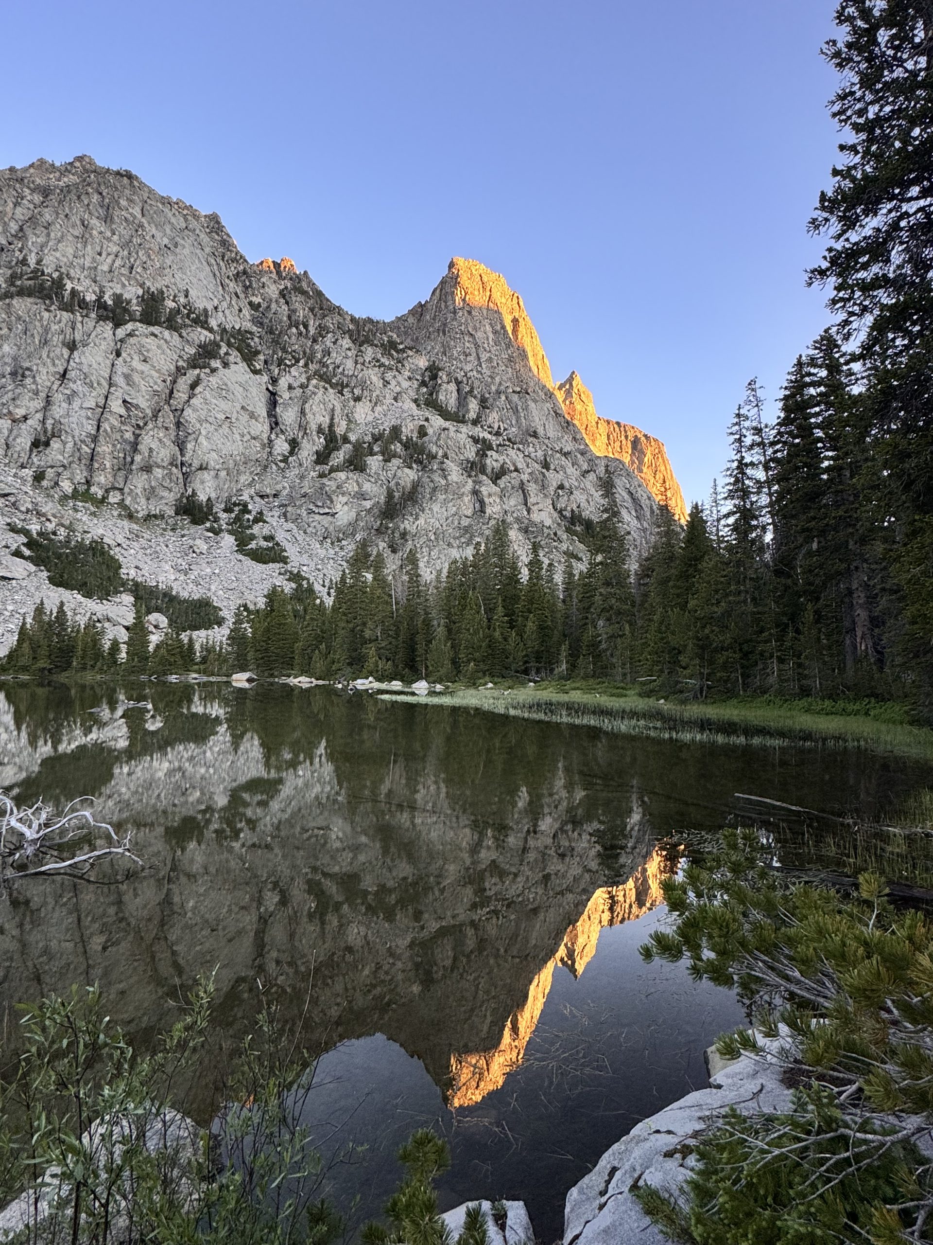
The trail climbed up the rocky ridge north of Little Sandy Lake and through the rocky meadows of the valley. Once the lake water peaked through the trees, we were stunned again by the view. The unnamed lake sat at the base of the huge vertical face of an unnamed peak. The “unnamed” aspect felt secret, like we stumbled upon something very special. We filtered water at the lakes outlet and set up camp on the start of the peninsula. Abby and I took a quick, chilly dip in the lake before the sun disappeared behind the wall.
We cooked dinner up on the ridge several hundred feet north of camp as we were now in Grizzly Bear country. Ramen with very spicy jalapeños was on the menu. Bear safety was a top priority, so after dinner, we hung our bear bags up in the trees and practiced some knot tying. The mosquitos started to become aggressive and we retired to our tents around 8:00pm, very excited about the days to come!
Day 70: 15.8 miles/ 4,800 ft gain
Sunrise at the unnamed lake was phenomenal. The lake was a glass reflection of the top of the peaks being kissed by the morning alpine glow. I took in the view before I untied the bear bags from their hangs and got breakfast started. We got ready slowly to squeeze the enjoyment out of the peaceful morning. Once all packed up, we began hiking up the first of 3 passes of the day.
After about a mile, we emerged from tree canopy into an idyllic valley. We walked on the marshy trail along the river as it meandered south. The sun was still hidden behind the peaks to our east, so the air had a refreshing chill. Slowly and gradually, we climbed out of the valley and into the warm sun. The trail was difficult to navigate as it disappeared into the thick alpine grasses. We did our best to follow the path and stay on stable ground.
The climb switched from gradual to super steep as we made our way up Temple Pass. The last mile or so was painful as we hiked straight up a scree field until some switchbacks appeared. We crossed a few small snowfields and let out a sigh of relief when the trail flattened out and the view opened up to the north. After a quick break, we descended down an equally steep trail toward Temple Lake. When the trail became buried under the snow, we glissaded (Abby’s first time!) down until we met up with the shore.
With each landmark we reached, the view kept topping the one before. The view north from Temple Lake was stunning, as was the view south up the sheer face of Temple Peak. After traversing along the east shore, we split off with the trail to take a quick alternate down to Deep Lake and Clear Lake. This basin instantly reminded me of Yosemite as we walked down the slabby granite. We took a break at the outlet of Deep Lake and took in the view of the huge surrounding peaks. Devin and Abby consulted Mountain Project and looked for established climbs. There were a ton!
After our break, we walked along the river as it cascaded down the gentle incline toward Clear Lake. The trail wrapped around the permieter of the lake before dropping to the junction near Big Sandy Lake. We grabbed water from the creek and filtered in the shade. The next climb was shorter and steeper than the one before, though spirits were high as we were ascending Jackass Pass. The trail took us up a ridge from Big Sandy Lake and then around North Lake. At some point, Devin lost the trail (which was very easy to do) and ended up behind Abby and I.
We let Devin pass us again and continued our roll up to the viewpoint. From the top of the ridge, a magnificent row of peaks stood in front of us. The Cirque of the Towers itself was a part of this unreal display of peaks. We were stunned by the beauty, almost at a loss of words. The trail dropped before climbing up the last 200 ft to the top of the pass. We trudged up to the sign and took some pictures of the comically named pass before taking a break.
We still had one more pass to go, so our break was quick and we headed down the trail toward Lonesome Lake. This lake had a stunning view of the Cirque of the Towers. We wished we could set up a tent here, but this lake has dangerous bacteria levels from overuse and people not taking care of their waste. At the junction, we pushed north toward Texas Pass. In a mile, we climbed 1,200ft. The incline was absolutely brutal and could make even the fittest person question their ability. We slogged up the pass, first through a burn area and then in the exposed alpine. The final push was over a slippery snowfield, and then, finally, relief.
With burning calves, we took a quick break up at the top. Though, the wind whipped through the narrow saddle, so the time sitting wasn’t pleasant. We decided to push the last 1.4 miles to our chosen camping spot. The first .6 was a technical and slow as we descended over talus and boulders with no clear trail. We also had a few snow fields to traverse which made things even more challenging. Once we finally reached Texas Lake, the trail became mellow and clear to follow.
We passed by Texas Lake and Barren Lake before reaching Billy Lake. Devin found us a stunning camp spot on the peninsula of the lake and we set up the tent before everyone took a dip in the freezing water. Nothing is more refreshing than swimming in an alpine lake! All of the suffering of the day rinsed off in the water, and we were elated to be on this beautiful place. We got everything else set up and then cooked dinner up on the ridge. The mosquitos were ruthless, so we ate quickly. The trees were small and short due to the harsh winds, so we opted to bury two of the bear bags in rocks. After all the chores were completed, we jumped in the tent and called it a night. What an epic day! 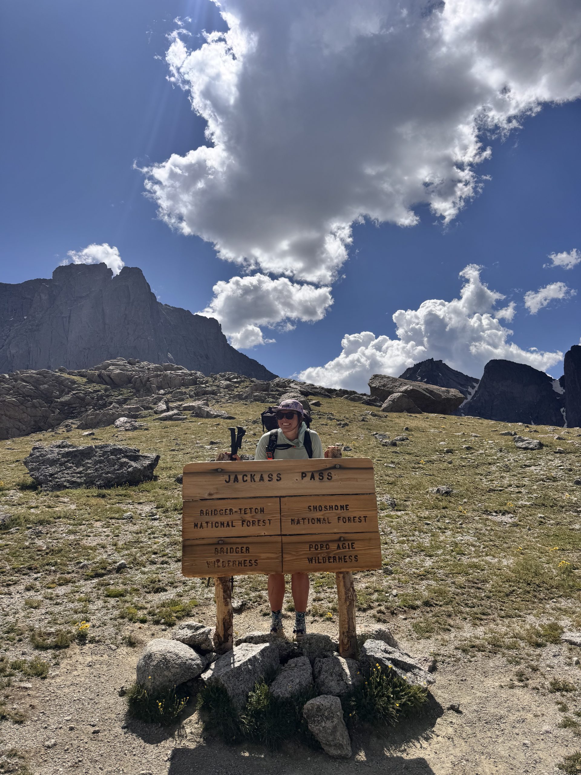
Day 71: 21.5 miles/ 2,500 ft gain
We awoke to another peaceful morning with a cool breeze and calm lake. Everything seemed to still be sleeping, including the mosquitos, when I grabbed the bear bags and started on breakfast. The chocolate chips that we got in Lander have added a lot of flavor to our boring oatmeal! Around 8:00am, we got on our backpacks and said our goodbyes to Abby. Sadness crept in as we walked away- it was wonderful having another badass woman to hike with.
We gradually descended for first 5 miles past Shaddow Lake and then along Washakie Creek. The trail was cruisy and we sped along through the wide-open valley, meeting back up with the CDT. Meadow turned to forest and flat ground turned to incline up toward a small, unnamed lake. We took a break on the grassy slope next to the lake to filter water and take in the sweeping views of the west side of the Cirque. From here, there was no shade along the trail until a mile from camp.
The sun continued to rise high and we carried on over the ridge, saying goodbye to the jagged peaks. We trekked the 5.5 miles to Raid Lake, passing 7 lakes along the way. The water in each looked so inviting and it was difficult not to stop and take a swim! We grabbed some more water and found a bit of shade off trail to take our break under. The heat was affecting our energy and excitement to continue on, but a snack and some water helped both tremendously.
We decided to do a shorter segment of 4.4 miles to the next creek. This was a tough part of my day- the heat, the rocky trail, the uninspiring views (compared to what we had seen yesterday) made for a slog. I tried to change my mindset around my circumstances, but my brain wanted to wallow. Once we finally made it to the creek, I ate a Honey Stinger gel and that seemed to solve everything! I crushed the next climb and few miles to Pipestone Lakes where we took our last break.
With only 2.5 miles left, we cut our break short and headed up the last small climb. The trail was a bit difficult to follow due to some blowdowns, but nothing too serious. Devin pulled ahead to find us a campsite while I meandered down the ridge and through the forest. Once North Fork Lake came into view, my pace quickened with the excitement to swim. We found a flat spot, set up quickly and hopped in! The nightly routine happened a bit earlier than it had the first few nights, but the mosquitoes were still an issue, so we headed to bed early. 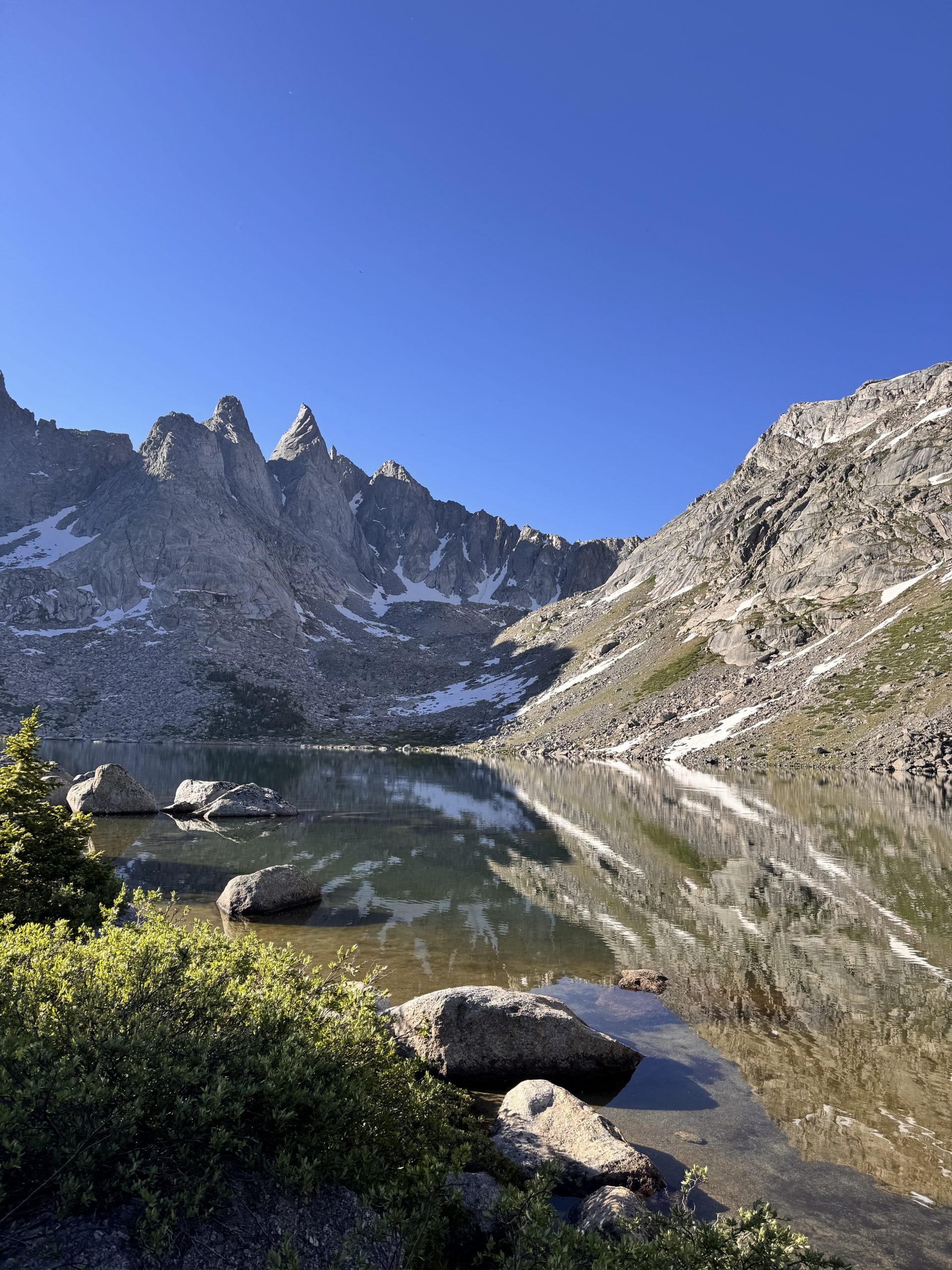
Day 72: 16.2 miles/ 4,000 ft gain
This day presented us with several challenges. The first was waking up to a blanket of frost over everything- our tent, clothes on the laundry line, shoes. This made everything slightly damp and very cold to put on. We opted to stay in bed and wait for the sun to defrost us. Getting a later start than we would’ve hoped, we set out around 7:30am and jumped right into a climb up Hat Pass.
The trail up the pass was moderately steep, but nothing too difficult. The challenge quickly turned from the hiking to the mosquitos. As soon as we entered the woods, they bit us at every the opportunity. Usually, walking deters them, but no matter how quickly we hiked, they still swarmed. It was difficult to concentrate on hiking up the trail when we had to constantly swat at our legs and arms. At the top, we couldn’t even stop for a break- it was brutal!
They followed us for the entire day, circling, letting us know they were there and hungry. Our excitement to be in such a beautiful place was threatened by their constant buzzing. After Hat Pass, the trail turned into a bit of a physical rollercoaster as it descended and ascended several times over small passes. The views as we approached the Titcomb Basin got progressively better. We charged on and took minimal breaks to ensure the swarming mosquitoes didn’t have time to bite.
Lester Pass was our final big climb of the day, and while it was gradual, westruggled due to our waning energy levels from not taking breaks. At the top, we tried to sit under the shade of a rock, but about a minute in, we called it. The mindset became: just get to camp and set up the tent. With a little over 3 miles left, we trudged down the descent toward Island Lake. As the lake came into view, we became giddy again. It was stunning and had a perfect swim beach!
We quickly set up the tent and got down to the lake. Shockingly, there were minimal mosquitoes down there. We took a quick, cold dip and enjoyed a snack down my the lake before heading up to cook dinner. Once back at the tent, the zipper to one of the doors became finicky. For the lives of us, we couldn’t get the zipper to connect and stay closed. Thousands of mosquitoes entered the tent. It was a nightmare. Finally, Devin got it to shut and we vowed not to touch it again. We killed hundreds of mosquitoes and the evidence of our crime is still all over the mesh of the tent! 
Day 73: 23.7 miles/ 3,300 ft gain
The alarm on my watch buzzed at 5:40am, but I snooozed it until 6:00am. The mosquitos were already knocking on the tent door and I wasn’t ready to face them. Eventually, I mustered up the strength to go get our bear bags and start the pack up process. By 6:30am, we started up the trail toward Titcomb Lakes. Our plan was to get to the junctions after the lakes, about 4 miles in, and eat breakfast before heading up the Knapsack Col.
The clouds started to build once we got to the outlet of the first lake. We tentatively pushed forward, knowing there was a chance we would get turned around. As we approached the inlet of the second lake, the clouds had become dark and thunderous. Continuing up to the Knapsack Col, 2,000ft higher, scrambling and traversing across boulder fields, didn’t feel like the right call. Disheartened, we started heading back down the trail. Our sluggish, disappointed walk soon became a run as the storm pushed into the valley. We were above treeline and needed to get out of there.
About 8 miles into the day, the rain slowed and lightening died down. We made it all the way back to Island Lake, worn out and hungry. Breakfast (Poptarts) was served overlooking the lake. As we ate, the storm turned into a cloudless sky. We had just hiked 8 pointless miles- miles that got us nowhere. Many emotions (mostly negative) filled our bodies. This detour to avoid the storm cost us time and added many miles to our day.
We channeled our frustration into walking as it was the only thing we could really do about it. Eventually the frustration eased, and the realization that we were in one of the most gorgeous basins set in. We expressed gratitude that we got to see those peaks, and pointed out that the mountains will always be there for us to come back to. With a more positive outlook, we continued on the official CDT toward Lower Jean Lake.
The trail traveled through meadows and past lakes and rivers. This route was still very scenic. About 12 miles in, at Lower Jean Lake, we took a snack break. We made a plan to take the Shannon Pass alternate as it would cut off a few miles and let us see the basin on the other side of the Col (a win-win)! The next 3 miles to the junction were slow and tedious. Snow had been replaced by mud (and of course, mosquitoes) and every step was cautiously placed to not sink in.
Eventually, we made it to the junction of Shannon Pass and split off. The pass itself had a mellow incline with a flat top. The meadow was blooming with wildflowers as we walked through. The views really started when we crested the ridge and descended into the valley to the north. A turquoise Peak Lake sat at the bottom of a circle of towering peaks. Stunned by the beauty, we took our time descending and traversing over to Cube Pass. We wanted to stay there forever.
Once to the top of Cube Pass, we said goodbye to the Stonehammer Valley and descended west into the next one over. The trail was through a boulder field, but was very easy to follow (thank you trail crews)! Though, once we got to the snow, there was no boot pack to follow. I stepped onto the snow and kicked my shoes in to create steps. About 10 feet in, I slipped. While frightening, the glisade wasn’t dangerous and I was able to stop myself before hitting rocks. Devin glisaded down to me and grabbed the trekking pole I dropped along the way. We opted to stay on the snow in the valley until we met back up with the dry trail.
The last 5 miles was on pleasant trail. The grade on the switchbacks was easy to cruise on and the ground was soft from the pine needles. Both Devin and I were pretty tired by this point, but also grateful that the day turned out to be so wonderful. We set up camp on the valley floor, in the pine trees at the edge of a large meadow. Peaks towered above us to the north. Once again, we quickly ran through our nighttime routine due to the mosquitoes, and this time, we got the added bonus of horse flies. 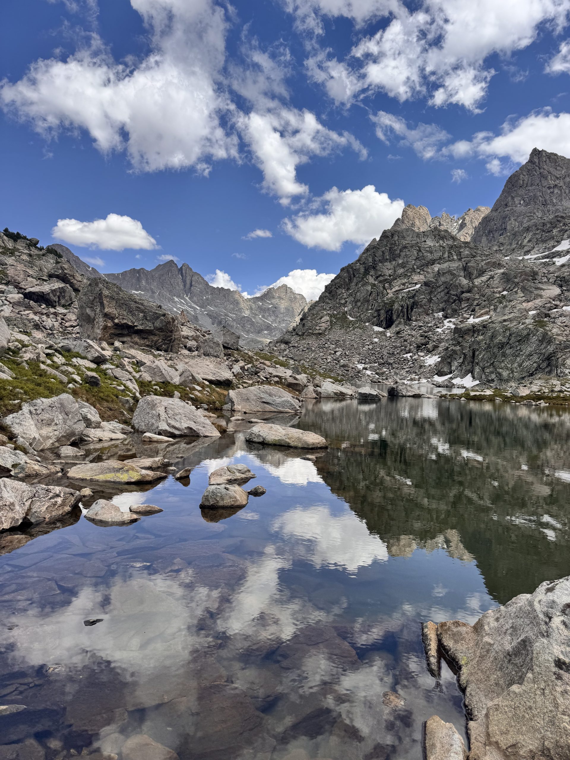
Day 74: 22.8 miles/ 3,300 ft gain
Minus the snafu with the tent door not closing at midnight, Devin and I slept great! I woke up before my alarm buzzed and eagerly popped up to grab the bear bags. The cool air deterred the mosquitoes from flying, so I was able to cook coffee with the door open- a luxury! We started walking at 7:00am and continued until 9:00am when we ate breakfast. In just 2 hours, we walked 7.2 miles! The trail had a perfect combination of a slight downslope, not too many rocks, bouncy ground and no sun. Plus, the valley we were walking through was magnificent. The perfect combination for crushing miles!
While eating breakfast near Upper Green River Lake, the mosquitoes came out in full force. At least we had a couple hour break from them. The next 4.5 miles of trail contoured the lake shores. As we neared the outlet of Lower Green River Lake, we came across fishers and paddle boarders and some day hikers. It was nice to see people after a few days seeing no one. We took a short break under a tree to rest before a long climb.
Swarmed by flies, we cut our break short and started the 7 mile, 2,500ft climb. We weren’t really looking forward to this part of the day as we had an easy morning with incredible views. At this point, we were hiking uphill in the exposed sagebrush and out of the Bridger Wilderness. My expectations were blow away when we entered the field of wildflowers. It continued for miles, splashing the hillside with brilliant shades of the rainbow. It was incredible, almost overwhelming in beauty. We walked through it for almost the entirety of the climb.
Once we reached Roaring Fork Creek, we filtered water and ate some snacks before the steepest part of the climb. Luckily, the clouds started to move in and our exposed climb became a lot more bearable. Devin and I hauled up it at an impressive speed. At the top of Gunsight Pass, we high-fived and took another short break before our last 4 miles to camp. It was only 1:45pm and we had already done 18 miles! Not bad.
The last push felt tedious as we were getting tired, but it was easy walking downhill. We arrived at our camp spot near the South Fork Fish Creek at 3:15pm. We set up camp quickly to avoid getting attacked by the flies (who had replaced the mosquitos). After a river bath, we settled in and enjoyed the afternoon! 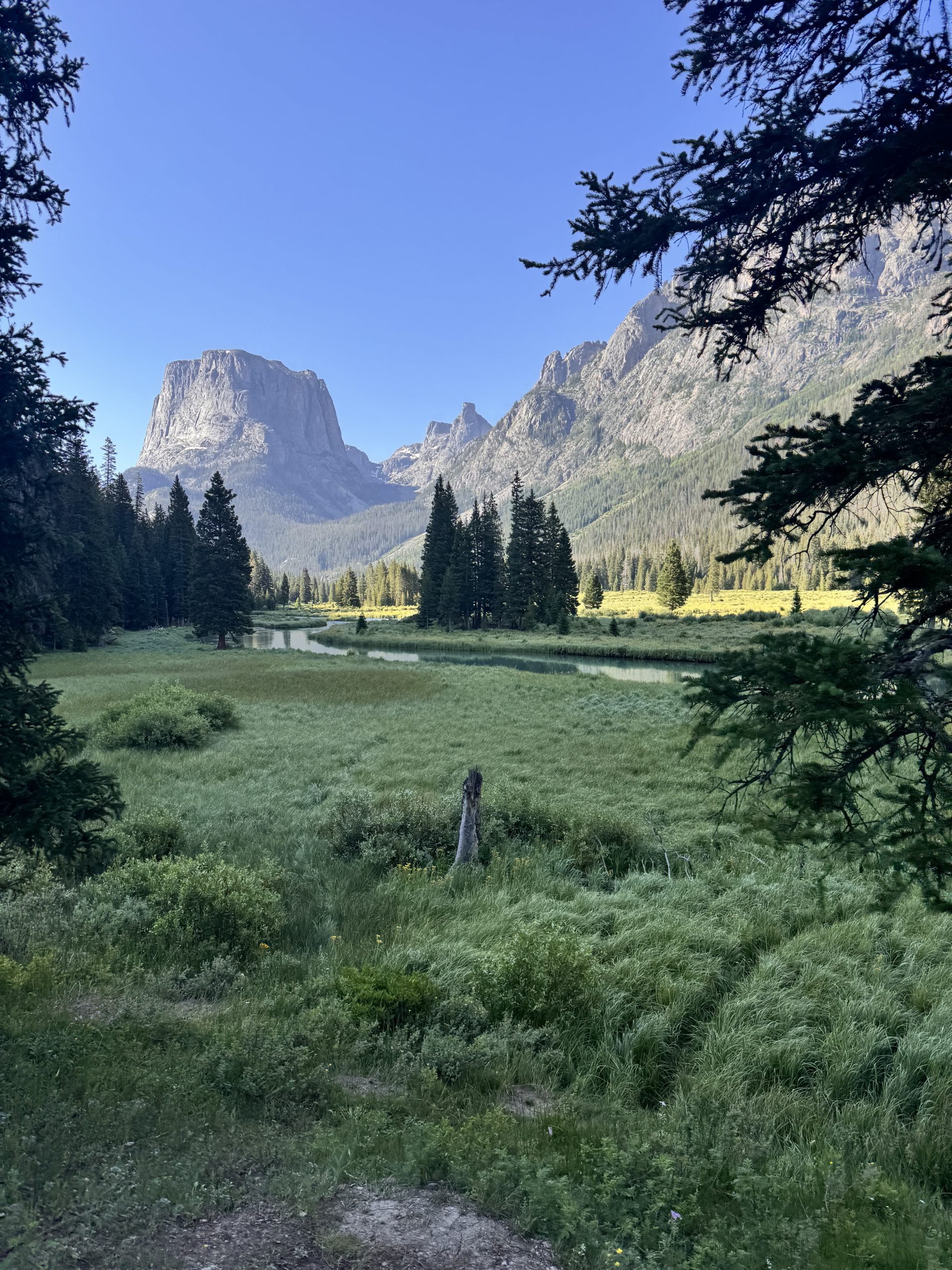
Day 75: 6.6 miles/ 1,000 ft gain
The air stung like ice when I woke up. My nose and fingers tingled as I trudged the 200 ft to our bear bags. It was difficult to untie the knot with my frozen hands. Warm coffee was a must this morning! We packed up camp slowly, warming our fingers on our mugs and hoping the sun peaked through the trees soon. By 7:00am, we were walking.
The cold extremities continued as we forged the creek, soaking our shoes and socks in the icy water. We headed into the forest on a faint trail that was easy to lose. The first mile was filled with missed turns and backtracking. There was a lot of deadfall to climb over as well. We walked in the shade of the trees until the forest opened up to an expansive field of sagebrush. The next few miles of trail cut through the field. We though the trail was flat, the ground was lumpy and the unevenness made it difficult to walk through.
Right around mile 2, my stomach revolted. I’ll spare you the details and just say that my condition made hiking the last thing I wanted to do. By the time we reached our break spot, I was feeling very weak. Devin quickly took action and came up with a plan to ensure that I could rest. We walked another mile and a half before setting up camp near Lake of the Woods. The spot was well-shaded and very peaceful overlooking the lily pad-filled lake. We spent the rest of the relaxing, and, I, recovering. 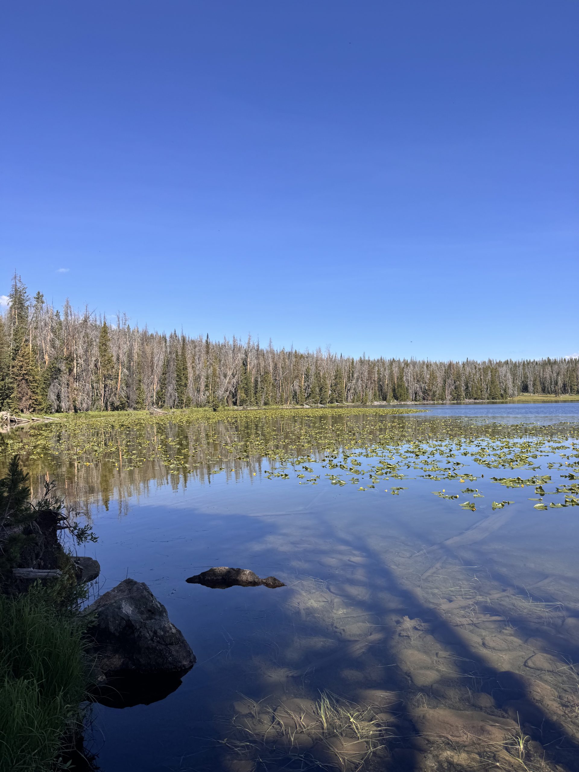
Day 76: 10 miles/ 700 ft gain
Without breakfast, it’s a quick morning from waking up to walking. Our plan was to meet our friend Bri somewhere on Union Pass Road, so our only job was to get as far as we could before 11am. The road was full of 4x4s and campers which kicked up a lot of dust in our faces. Though, other than that, the hiking was very easy.
For the first couple of miles, we were in the forest hiking out of Lake of the Woods. The mosquitoes were bad so we hiked quickly. We even saw a curious baby moose on the road who waited a while before running away. After mile 2, we were up on a grassy plateau which overloooked the mountain ranges to the south, west and north of us. At mile 6, we started descending into the valley and back into the trees. We stopped and chatted with some people from Forest Service for awhile before continuing down the busy road. Around mile 10, we spotted Bri! She scooped us up and brought us all the way to Driggs, ID. 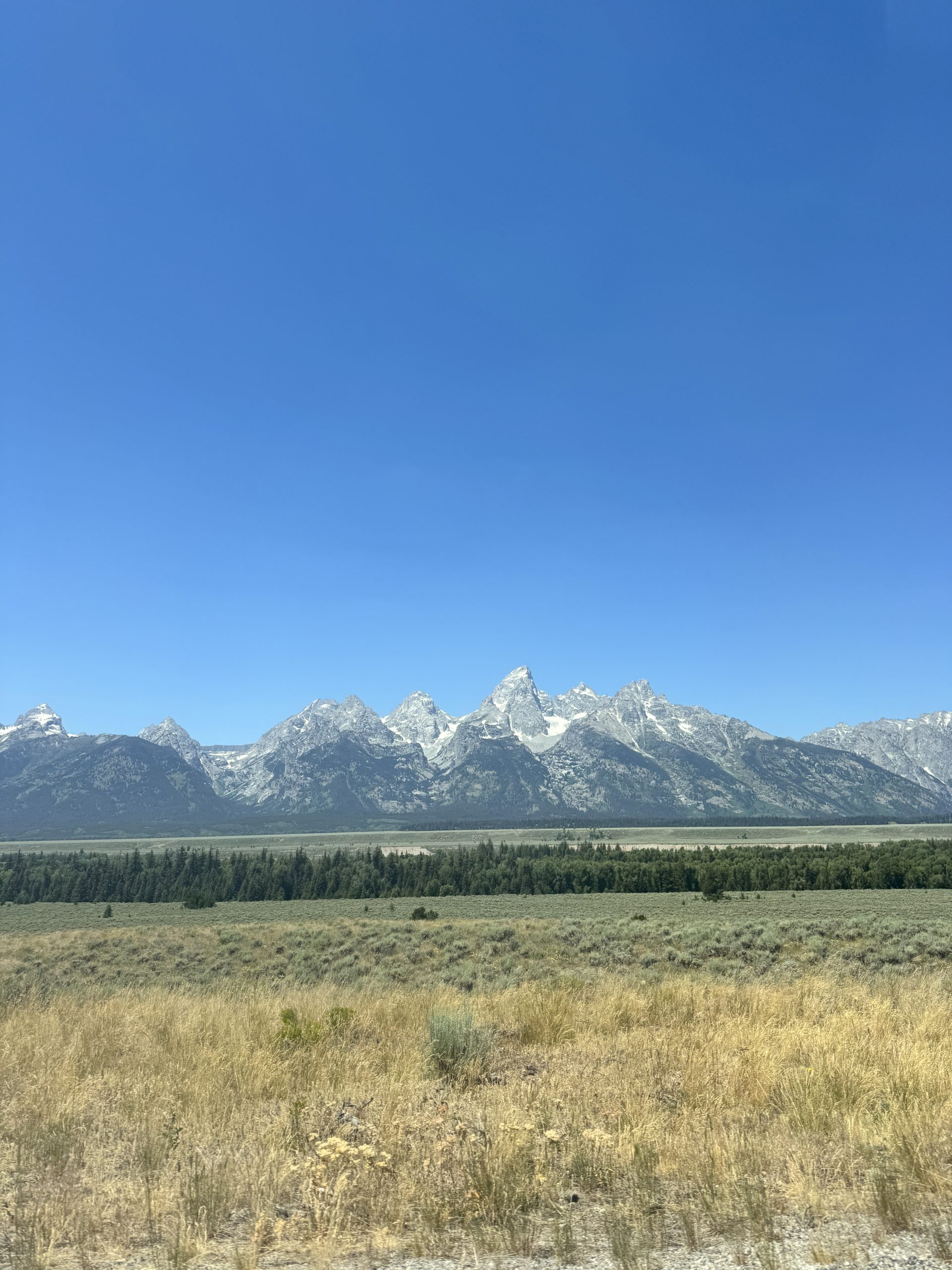
Teton Crest Trail
Day 77: 0 miles/ 0 ft gain
We spent a lovely zero day in Driggs hanging with Bri’s pup. Our usual town chores are made so much easier when we have a home base to work from. And Bri even lent us her car for the day- hello luxury! We checked off everything on our list and enjoyed the afternoon recovering.
Day 78: 18.3 miles/ 5,500 ft gain
Bri dropped us off at the top of Teton Pass before heading to work. We said our goodbyes and ran across the highway to the trailhead. thank you for everything, Bri! The first mile was steep! We gained about 1,600ft to get to the top of Mount Glory. The morning sunshine warmed the valley of Jackson Hole, but at least the climb was still mostly shaded.
Once at the top, we started the next 3 miles which became bit of a bushwhack until we reached the main trail. This set a bit of a negative tone for me as I kept tripping over dirt piles and rocks hidden beneath the foliage. It was a tough 3 miles and then about a mile climb after that. When we finally took a break as the trail leveled out, I cried.
I think it was a combination of still recovering from a potential case of giardia, being on my period, getting a blister from my new shoes, rolling my ankle 15 times and just being tired. It’s tough to get up and hike everyday. Obviously there are worse things in the world, but our bodies are really starting to feel the miles. And beyond that, our minds are feeling the lull of still having so much left until we get to Canada. After letting some emotions out, I ate a snack and put some music in. Usually, these two things remedy most of my problems.
We had a steep descent into the valley and began walking up the valley. The wildflowers continue to flourish and their presence helped lift my spirit. We made our way up the valley and had a short ascent up the ridge to the Grand Teton National Park boundary. From there, we walked through the alpine meadow and contoured the mountain up and over the first pass. We took a short break in the shade and then descended into a shallow, but steep valley. Horses blocked the trail for a bit, but that was an acceptable type of traffic!
As we ascended to Marion Lake, the clouds built up behind us. We found a spot amongst the pines to wait out the storm just as it started to hail. It was fast moving and we were back to sunny hiking in no time. The next 7 miles flew by. It was pretty flat, or had quick spurts of elevation gain, and we could see the trail for miles ahead of us. Knowing where we’re headed always gives us a boost!
We reached the Jedediah Smith Wilderness boundary and noticed some dark clouds in the valley to the east. We quickened our pace, hoping to get near a small lake to camp. Just as we were grabbing water from the outlet, the wind whipped through the basin and the large droplets started coming down. It was no fun setting up our tent in the wind and rain, but we managed without getting everything too wet. Exhausted from the long day, we tumbled into the tent and napped before making dinner. 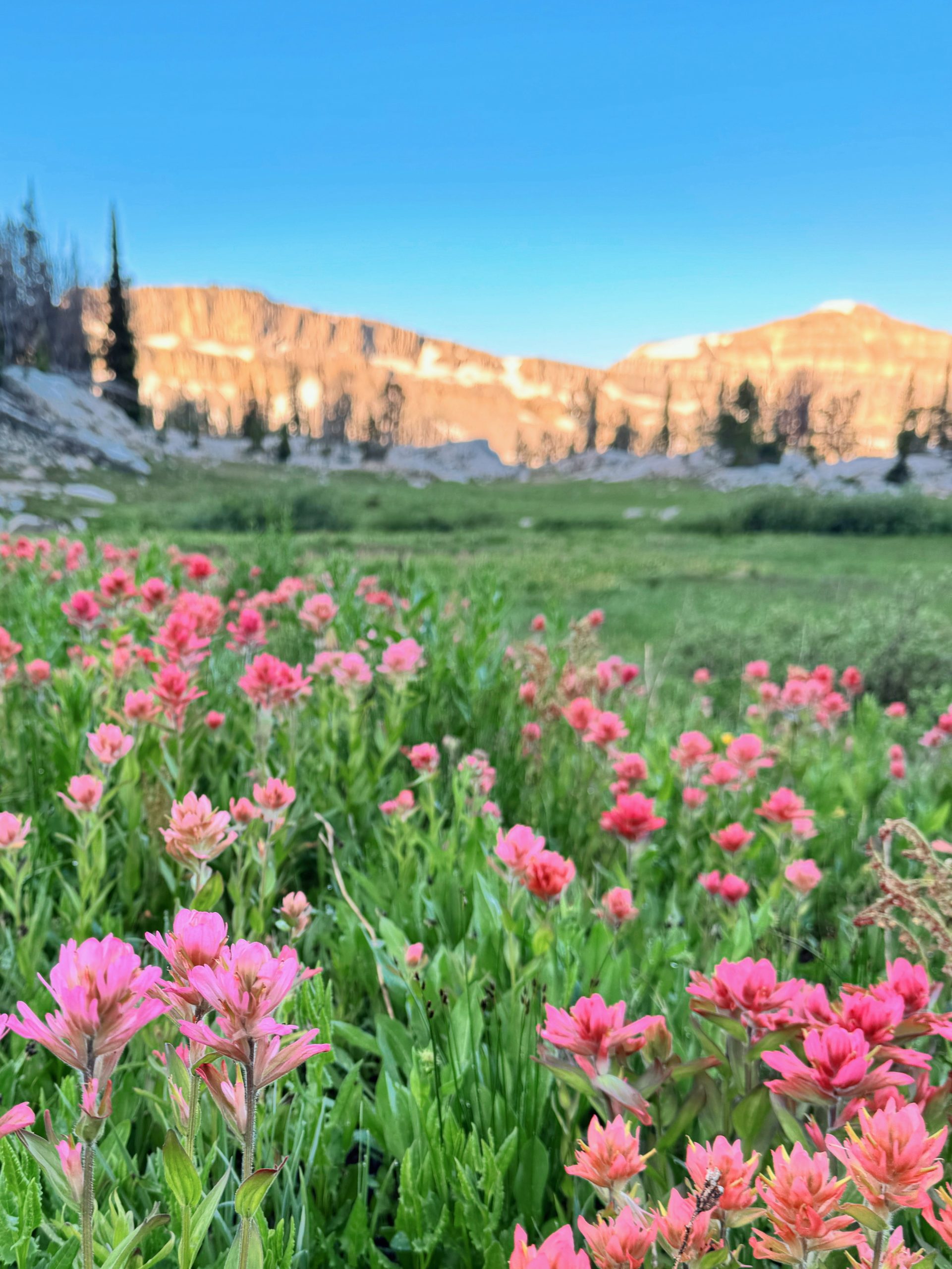
Day 79: 15 miles/ 1,600 ft gain
We awoke under the shadow of Buck Mountain after a night of intense lightning and wind. It was a fitful sleep, but we had a full day ahead of us, so I rose from my pad and sleepily put on my shoes. Our bear bags were expertly hung from the night before, and were easily accessed. I made my way back to our tent and started on some coffee and oatmeal. We were moving slowly this morning, but still managed to hop on trail by 7:00am.
3 miles and 1,600 feet later and we were at the top of Hurricane Pass. The climb was gentle and quick, passed sunset lake and through bouncy alpine meadows. Grand Teton loomed over us as we took a quick snack break and I did some blister care. The view was spectacular! Clouds rested in the valley under sharp peaks and steep cliffs. After snack, we started our long descent into Cascade Canyon, the view of the Grand slowly disappearing behind the canyon walls.
The trail remained cruisy as we ducked into treeline and winded down the canyon next to the river. About 8 miles into our day, we started to encounter the hordes of people. It was a slow trickle at first, but pretty soon, the trail became a highway. It was difficult to pass and to find a rhythm as we weaved in and out of our lane. While frustrating, I do endorse people visiting our National Parks, and they deserve to be there just as much as I do.
We made it the 5 miles to Jenny Lake and opted to take the ferry across. It was a lovely ride with fantastic views of the Grand Teton from the east side. We stopped at the visitor’s center before heading to the highway to see if we could hitch a ride up to Yellowstone. I had my doubts about us getting a such a long hitch, but it was not even a minute of having our thumbs out when a young woman pulled up and had us hop in! She didn’t even hesitate when we said we needed to get up to Grant Village in Yellowstone-she just reported that we saved her from a day of boredom.
The hitch flew by thanks to excellent conversation. Before we knew it, we were dropped off at the Grant’s Village Mercantile (thank you so so much Berkeley)! We grabbed some snacks and then walked down the road to to backcountry office. A seamless meeting with the ranger and $20 resulted in a campsite for the next night. Then, we sat near the deck of the visitor’s center to charge our phones. We got to sit in on a very full Ranger Talk as well, which was excellent! We then headed to Grant Campground for the night. It was quite luxurious to have a bear box, picnic table and potable water! 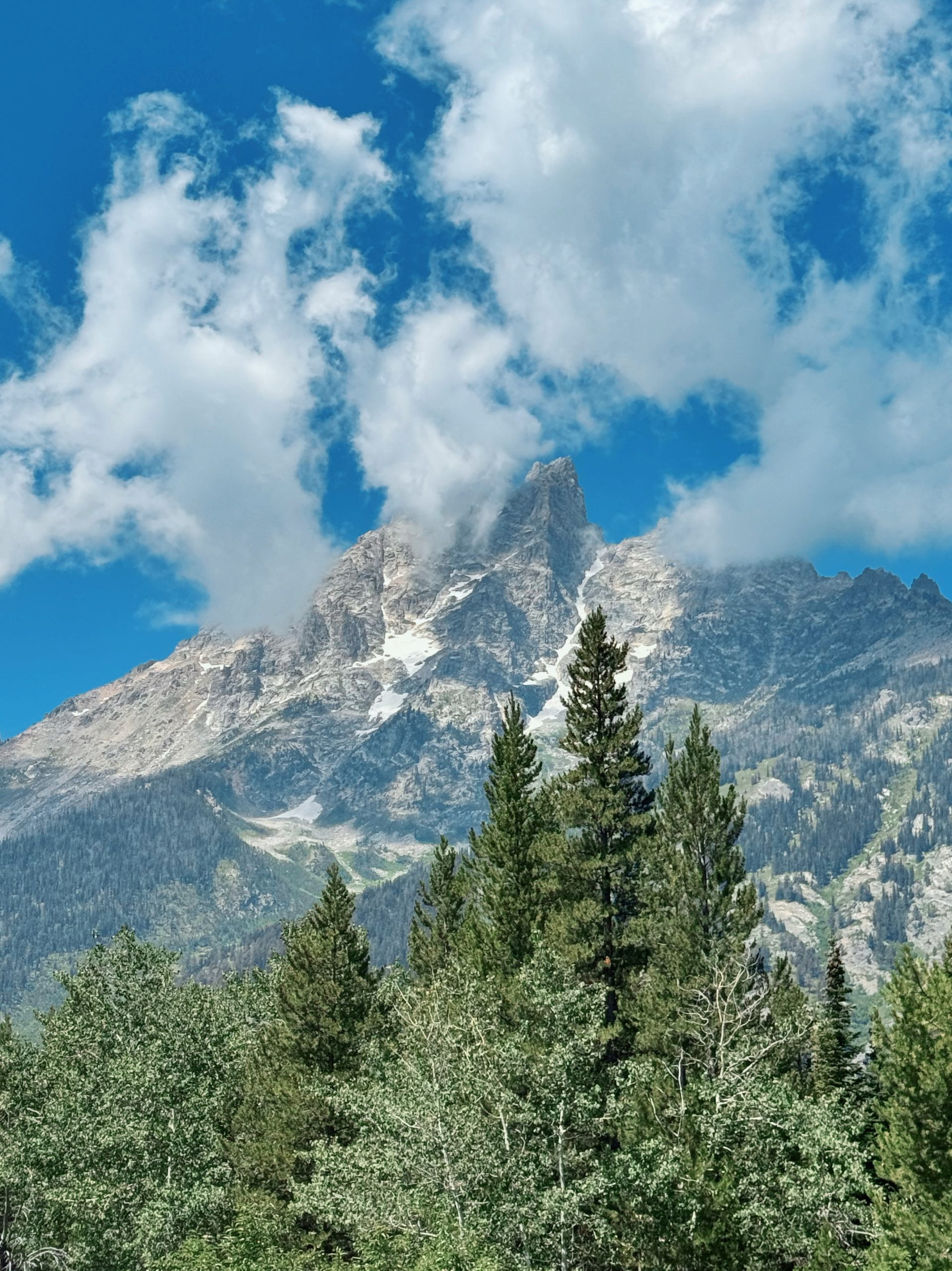
Yellowstone
Day 80: 22.2 miles/ 1,900 ft gain
A chilly morning greeted us. Frozen fingers made breakfast and packing up camp difficult, but having our stuff in the bear box (and not hung) helped with our efficiency. We set off on the road with Mellys and gloves on. A mile and a half later, we made it to the highway. Another CDT hiker had his thumb out and just as we crossed the road, we got picked up! Our hitching lucky streak continues. Thanks to a park worker, we drove the 5 miles down the highway to the CDT.
The trail was well maintained and mostly flat the 5 miles to Shoshone Lake. We took off our shoes to cross the wide outlet and then took a break on the shore. The lake was pristine- variants of clear and blue waters. Coupled with the birdsong, it was very peaceful. After a while, we continued another 8 miles through the Lodgepole Pines on slightly more varied trail. A well deserved snack break by the west end of the lake ensued.
The next 3.5 miles had us first sinking through marshland and then walking next to geysers in the Shoshone Geyser Basin. We smelled the pungent sulpher scent before we saw steam rising from the ground. Just as we rounded the corner, a geyser shot steam and hot water from the ground practically almost hitting Devin on the trail just a few feet away! It was awesome! After passing through the basin, we followed Shoshone Creek up the shallow canyon.
Our last 4 miles were a bit of a slog as it was hot and our feet began to ache. Though, once we crossed the Firehole River, we started getting excited. We decided to tack on a few bonus miles to see the Lonestar Geyser. It erupts nearly every 3 hours for about 20 minutes, rivaling Old Faithful in its height, and without the crowds. We made it the extra 1 mile to the geyser just as it began to erupt! Our timing was impeccable.
We spent the afternoon at the geyser, watching minor eruptions, and then one major one again. It was the perfect spot for dinner and to get some of our camp chores done before getting to camp. Once at camp, we were able to hang our bear bags right away and crawl into bed. 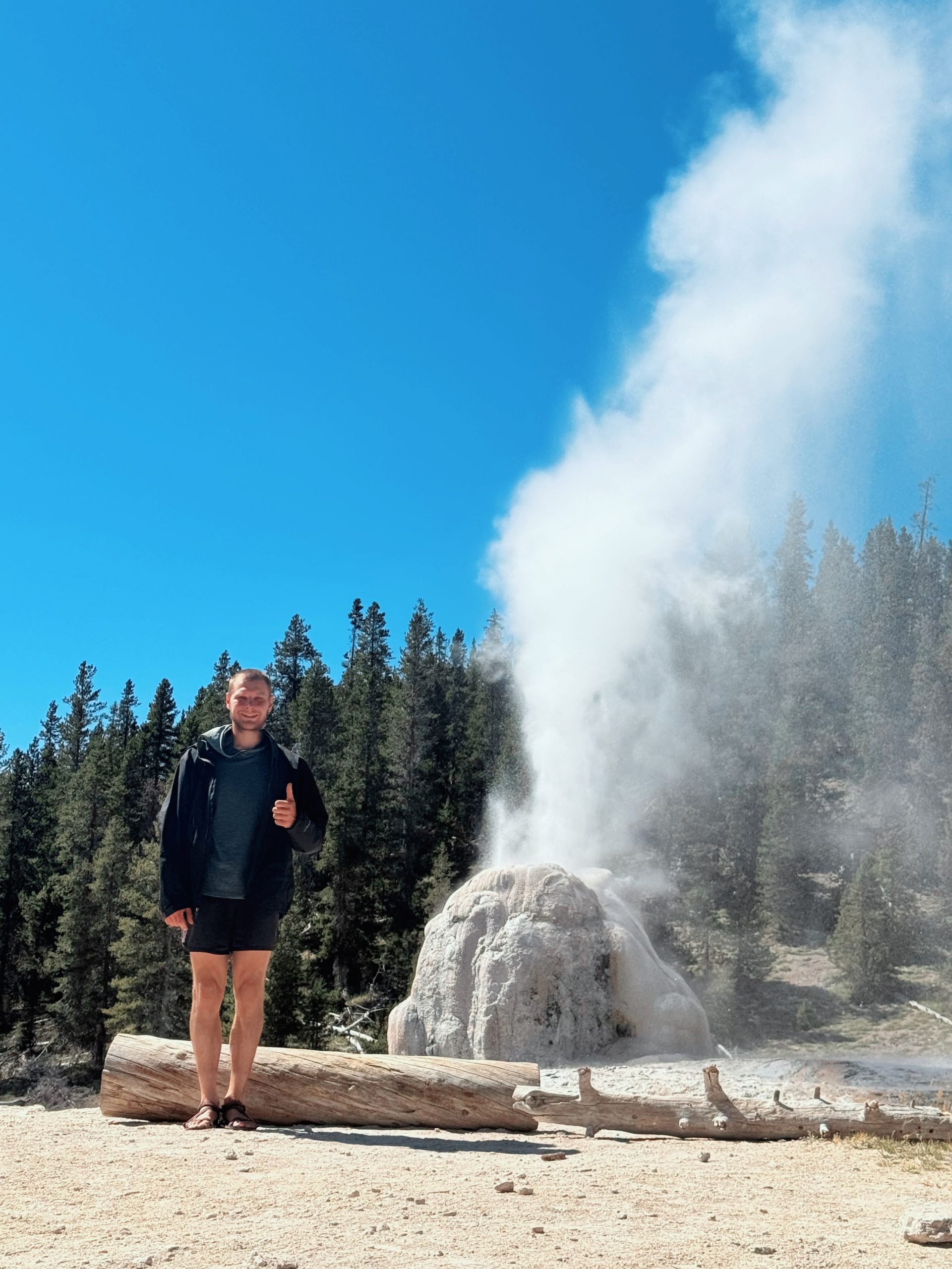
Day 81: 24.5 miles/ 2,200 ft gain
A 4:55am wake up call didn’t hurt too much as we were excited for the day ahead. We got moving under the fiery sunrise with just enough light to see our path. As the sun rose, we quickened our pace. At just over 4 miles, we hit Old Faithful with plenty of time before its next eruption. It went off as I was FaceTiming my mom (hi Linda)! After it died down, we followed the crowd into Old Faithful Inn.
It didsbf take much for us to feel luxurious- a hot shower and unlimited breakfast buffet did the trick! We loaded up our plates multiple times. That hiker hunger is a beast! After breakfast, we sorted our resupply package and headed out at about 8:45am. Passed the crowds and the geyser basins and into the woods we went. Our packs were felt devastatingly heavy on our climb up the ridge. Most of the trail that followed, however, was flat and cruisy.
We stopped at Summit Lake to filter water and cook dinner, even though it was only 12:30pm. This was our last water for the next 19 or so miles and we didn’t want to walk that far that afternoon. The next 5.8 miles to the border were in and out of the healthy forests into exposed burn areas. It was quick walking all the way up to the Idaho state line- bye Wyoming, you were cool!
We struggled for the next 4 miles as our packs began to weigh heavily on our bodies and minds. It was a bit rockier than the previous section which added to our ailments. We calmed the day a bit earlier than planned and found a flat spot amongst the never-ending Lodgepoles. 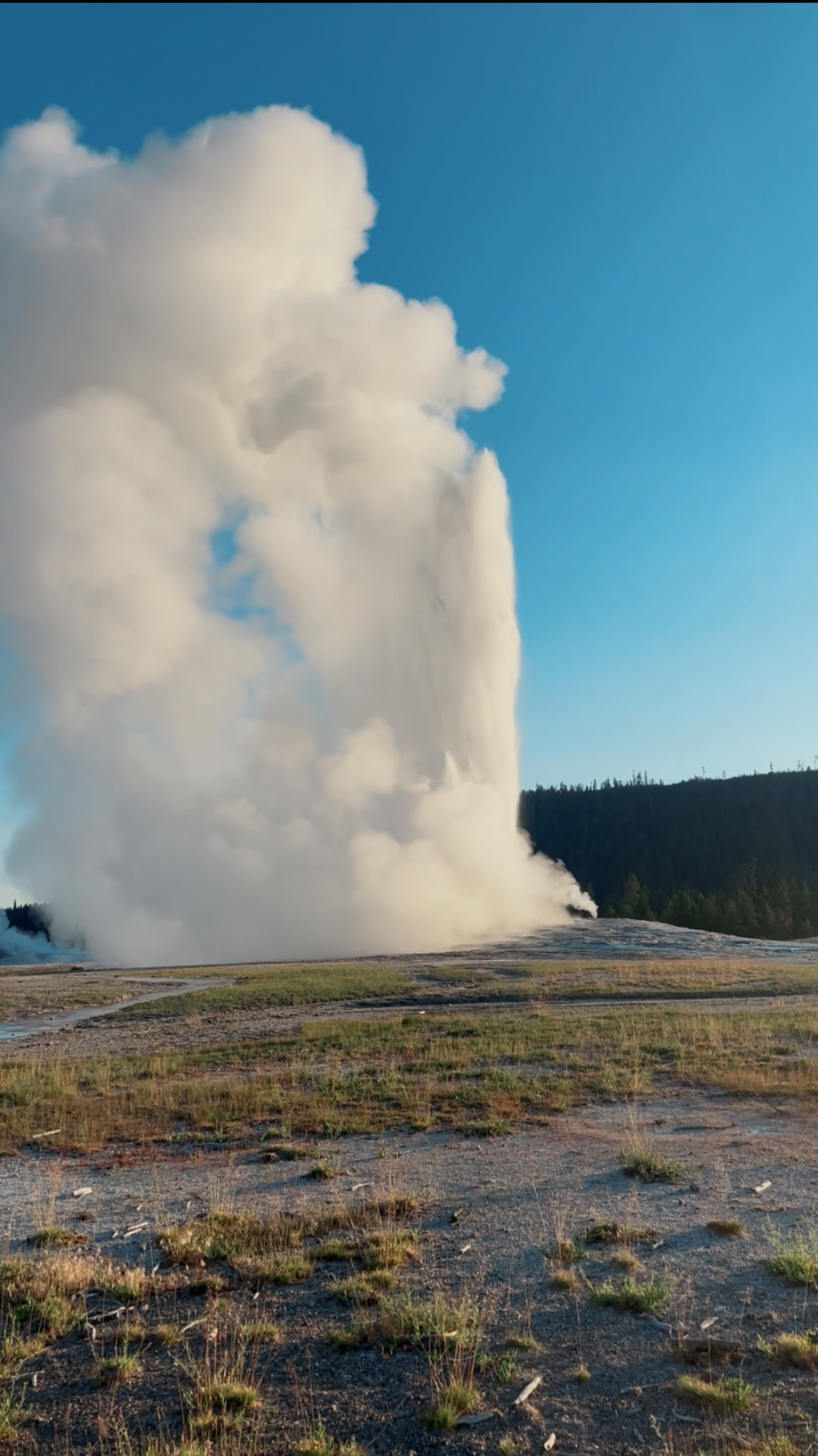


