
Welcome to our last week in New Mexico! We planned a couple of easier, shorter days to get to the border as we were planning to meet Devin’s mom on Cumbres Pass the morning of 5/21. Though, each day had their share of challenges. From the hot, unrelenting sun, to freezing nights, to trails that resembled creeks, to snow drifts and post-holing, New Mexico wanted to make our last week walking through memorable!
Cuba to Ghost Ranch
Day 26: 23.5 miles/ 3,600 ft gain
Fueled by a gas station breakfast, we headed out of Cuba around 7:00am. The air was cool this morning and we had a 6 mile walk on the highway before the trail junctioned off into the San Pedro Wilderness. We were hopeful for a hitch, but it wasn’t looking likely that early. To our surprise and gratitude, a pair of young men in their work truck pulled over and told us they knew where to drop us off. They must have picked up previous hikers as they pulled over right at the unmarked trail. Thanks for the ride guys!
With lots of elevation gain on the schedule, we knew today might be tough. Though, the days after looked pretty tame so we decided to push it this first day out of town. However, about 12 miles into our day, we decided that the miles and elevation didn’t seem that bad after all. The trail wound through the forest, along the creeks and past a lake. It was picturesque, relatively flat and a little cold. Wow, have we missed this mountain environment! Pine, Spruce and Aspen trees lined the trail and the rolling hills. The creeks were overflowing a bit and water was abundant. Were we still in New Mexico?
It was all type 1 fun up until we got to a section of mud and swamp where the snow most recently melted. That mile was a bit of a damper on our awesome day, but we tried to remain optimistic that our feet would dry over the remaining 10 miles. Our optimistism dwindled as we continued to trudge through the overflowing creeks and mushy grasslands for the next 4 miles. Our usual type 2 fun was back, but for the opposite reasons. We had too much water, too much shade and too much cold. Wet feet quickly prompted chattering teeth as the wind picked up and the “feels like” temp was in the high 20’s. What a stark contrast to the 80 degrees we had a few days ago!
Soon the trail crested the last peak and we headed down into the valley for 5 miles. The wind died down a bit and the sun started to thaw us out. We hiked down to a creek and set up camp in the nearby meadow. The forecast reported that it would drop into the low 30s that night. We suited up in all of our clothes and bundled up in our sleeping bags hoping not to freeze.
Day 27: 21.4 miles/ 2,200 ft gain
We froze! But only a little bit. The morning was chilly, though not the coldest of our hike. Devin made coffee and we broke camp by 8:00am. With an easy 5 miles all downhill, we sped down the trail with what felt like no effort at all. We had breakfast just after crossing highway 96 before starting our only uphill climb of the day. Around 8.5 miles in, we crested the top of the ridge and took the road a mile farther to the only reliable water source of the day. The trough water itself was green with algae, but the water from the pipe was cold and clear!
We took a break for lunch under a huge Ponderosa Pine tree with just under 11 miles until camp. The trail switchbacked down the steep slope until we reached the creek at the valley floor. We crisscrossed the creek like we were back in the Gila for about a mile before cutting through a recent burn area. The low elevation gave way to the heat and sun without much shade. As we reached the burn scare boundary, the junipers greeted us and we took our last break of the day under their shade.
The last few miles wound through the canyon on flat trail and eventually led to a gravel road. We turned east onto the road following the alternate as we had a resupply package at Ghost Ranch waiting for us the next day. About 2 or so miles down the road, we found some dispersed camping with a privy- score! The campsites lined the Chama River and the sound of the water lulled us into a restful sleep. 
Day 28: 22.7 miles/ 3,900 ft gain
Bright and early, we broke camp and hit the (literal) road by 6:45am. About a mile in, a white 4Runner pulled up and asked if we wanted a hitch. We climbed onto the back of the SUV and held onto the handle of the rooftop tent. I promise this was safe, mom! We hitched about 4 miles until we reached the trail-road junction and only had about 4 more miles to hike until getting to Ghost Ranch.
We wandered around a “cactus hell” (as some Far Out comments described it) until we found the jeep road that led us to the highway. Once we crossed the busy road, we passed a rundown museum and located the trail to Ghost Ranch. We crossed the valley floor and leisurely rolled into the National Natural Landmark around 9:00am. Devin grabbed the resupply package while I headed to the library to charge our devices. We read a book about Georgia O’Keefe, a famous painter who lived at Ghost Ranch, while we waited.
After about 2 hours, a bag of Cheetos and diet Dr. Pepper later, we said goodbye to the ranch. Originally, we were only planning on going 6 or so miles, but with reports of a muddy and poop-filled water source, we knew we needed to push on to the next one. With heavy packs, we started our ascent out of Box Canyon. The rock walls were stunning, yet yielded a very difficult and steep trail. We panted under the cloudless sky and slogged slowly 3,000 feet out of the canyon.
Eventually, we made it under a forest canopy and the trail evened out to a jeep road. We followed the road as it rolled over the hilltops until we came to the Harris Bear spring. This source had excellent water! After 14 tough miles this afternoon, we were ready to set up camp. We had an excellent view of the range to the west of us and enjoyed putting our feet up for the night. 
Ghost Ranch to Cumbres Pass, CO
Day 29: 13.3 miles/ 1,700 ft gain
This day was terrible. You know when you wake up and you’re just not feeling it? That was how I started this day. Terrible probably isn’t the right word. The trail was mellow and traversed the ridges through meadows and aspen forests. I saw a herd of elk having breakfast. That was quite lovely. We didn’t have heavy mileage and got to camp by 1:30pm. This had the makings of a great day, but my attitude toward hiking really challenged that.
From the first steps, I just wasn’t feeling it. Devin told me to leave a little before him since I was ready and camp was packed up. I walked slowly through the forest, trying to psych myself up for the day, but nothing was really working. I decided to take my pack off and wait for Devin. Except he never showed up. This felt like a story I had lived before, but luckily this time we both had service. It turns out he had taken a different road and was 2 miles ahead of me. For the record, this is why I don’t like hiking separately- it’s too easy to lose one another.
Once reconnected, Devin led the way, making sure to frequently look back to see if I was still behind him. My body wasn’t moving very quickly so we took an early break at around 4.5 miles to get some calories in. Food never fails to make me feel better (even if just a little bit) and the next 5 miles felt significantly better and were significantly faster. We had just around 4 miles left to the lake we planned to camp at. All was going well until Far Out showed us off trail. Unfortunately, while Far Out is mostly accurate, it isn’t always. So part of the route we had mapped on Far Out actually didn’t exist and the trail that did, did quite a lot of squiggling through the forest. This made for a longer and more frustrating trail experience.
Finally, we reached the lake. We were jazzed that we had the rest of the afternoon to relax. Once set up, we did a quick lake bath in the frigid water. On our way back to the tent, we saw a sign that read: no camping. Ugh! We really wished we would have seen the sign before we set up. It was already a tough day, and I thought it was over, but we needed to move the tent and hike farther down trail out of the no camping zone. It really wasn’t that bad, but it felt like the world was ending in that moment. We relocated to a spot near a creek, only a mile or so up the trail. The world didn’t end and hopefully I wake up with a better attitude tomorrow. 
Day 30: 23.9 miles/ 2,800 ft gain
Both Devin and I were up about an hour before the alarm due to the cold. Might as well start early! We broke camp by 6:30am and started a liesurely climb, then descent over 12.5 miles. A few miles in, we took a break for a Pop Tart breakfast and continued our stroll through the damp meadows. The trail weaved in and out of the pine forests as we dropped a few thousand feet.
We reached the Rio Vallecitos and took lunch before having to cross the river. Because Devin is very athletic, he was able to rock hop across. I wanted to avoid breaking my ankle, so I forded the river in my sandles. The water was up to my thighs and absolutely freezing. After my feet dried off, we started our long climb up to Hopewell Lake. It was fairly gradual and pleasant. About 6 miles into the climb, we came across what we believe to be a pack of wild horses! They weren’t tagged or branded and there wasn’t a fence for miles. We admired them from a distance, and then continued on as the storm clouds started to brew.
The moment we got to the lake, it began to snow. It was not an optimal time to stick your hands in a frigid lake, but we needed to filter water. Though we planned to camp at the lake, the campground was farther up the hill that we had passed through so we decided to continue on for another mile or so. Once across the highway and into the forest a ways, we found a flat spot to quickly set up as the snow was falling. With all of our clothes on and wrapped in the emergency blanket, we crossed our fingers that we wouldn’t freeze overnight (again). 
Day 31: 18.7 miles/ 2,600 ft gain
An inch of snow sat on the top of our tent, making the rain fly sag inwards. It was a chilly 16 degrees out and we both refused to unwrap ourselves from the warmth of our sleeping bags until the sun came out. Coffee and oatmeal helped defrost us and get our day going once the sun finally crested the mountaintop. The trail itself was mostly clear of snow, but was plenty muddy. Like the last few days, it was mostly mellow in terms of incline and meandered through meadows, forests and through valleys.
The weather was unpredictable to say the least. Between the wind, clouds, sun and snow showers, we experienced it all which made it quite difficult to layer. Jacket on, jacket off- we didn’t know anymore! 18 miles went quickly and we made it to the Langunitas Campground admist a sun-snow shower. We camped at the upper campground, made pot pie for dinner and watched a movie. Less than 20 miles to the Colorado border!

Day 32: 21.8 miles/ 2,500 ft gain
It was another chilly night, but this time under a cloudless sky. We shook the frost off the tent and our bodies, and were on the trail by 8:30am. The first 13 miles were cruisy and quick walking. Most of the day was spent rolling over the round mountains and traversing through the valleys. As we topped out on one of the 10,000 ft mountains, we got a glimpse of the Colorado peaks ahead- so exciting!
We knew the next 7 miles to the border could be challenging with the snow levels. Several comments on Far Out warned us that the soft snow drifts covered both the trail and downed trees. It was quite difficult to navigate and our pace slowed to a crawl. Both Devin and I broke through the snow over 100 times- each time we thanked the universe we didn’t break an ankle. The north-facing slopes were especially brutal as the sun spends less time shining on this side. It’s like New Mexico didn’t want us to leave and created the most miserable obstacle course it could muster up!
Despite the slow going, we made it to Dixie Creek, about .8 miles from the Colorado border. We filtered water for the night and set out to finish New Mexico. A short climb and traverse later, we were in our home state! There was a Colorado license plate to welcome us and a New Mexico plate to bid us farewell. It felt SO GOOD to walk through the gate, and Colorado welcomed us with one of the prettiest views we’ve seen so far! There were only 2.8 miles left until Cumbres pass, so we decided to do 2.4 of them to make the next day ridiculously easy. We pitched our tent on a ridge overlooking the valley and gleefully got into our sleeping bags. 1 state down, 4 to go! 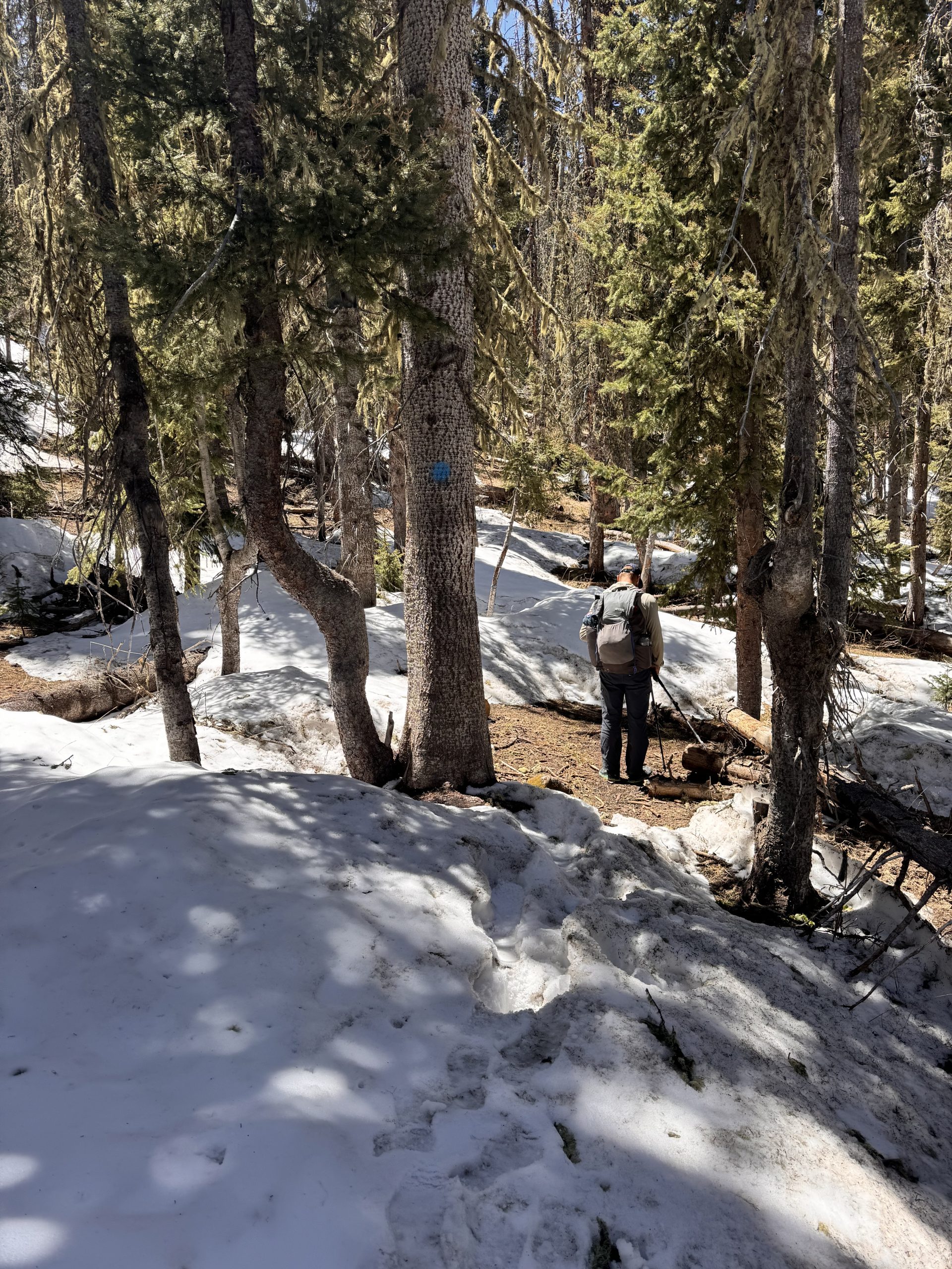
Day 33 + 34: .4 miles/ 0 gain
We let the sun cook us in our tent before rolling out of our sleeping bags at 9:00am. Once packed, we headed a very short .4 miles down the trail. We met Devin’s mom on Cumbres Pass for two days of much needed rest and relaxation as well as planning for the next section.


