
There is something called an “Alpine Boost” in the hiking and climbing community. It’s the motivation one gets when they get above tree line. The beauty of the now visable mountain peaks gives a boost of energy and stoke to continue on. This section was largely above treeline and Devin and I were blessed with the “Alpine Boost” often!
Frisco to I-70
Day 46: 1.2 miles/ 300 ft gain
With a great nights rest indoors, we woke up to dog kisses and a quick pack up! We kicked off our nearo day at a coffee shop where we could linger and charge our devices. After planning out our next section, we headed to the bus stop and back to the trailhead. With maximized rest in mind and wanted putting ourselves in a good position to head up into the snow, we Ubered past the neighborhoods and up to the White River National Forest. A quick walk into the forest and a quick search produced a wonderful campsite. We read in the shade and relaxed for the rest of the day.
Day 47: 12 miles/ 3,300 ft gain
The sun rays bursted through the Lodgepole pines bright and early. We have gotten surprising efficient at packing up, and without cooking breakfast, we were walking within 20 minutes of our eyes opening. The trail meandered along the creek and through the forest for the first 3.5 miles. Devin and I even passed by the sled dog place my friend used to work at!
Once the trail junctioned with the road, we hooked a left onto it and climbed up the valley. The choice to stay low was made to avoid snow in the high alpine. Though, to our delight, the snow fields above treeline were sparse. We hiked the road for about 4 miles with 2,000 ft of gain, which got surprisingly steep at the end! Once we crested the ridge and joined the trail again, 360 degree views of jagged, snow capped peaks greeted us!
We had a beautiful, cruisy walk along the ridge line for the next 3.5 miles. The trail transitioned from wide Jeep road to narrow, almost invisible trail. Through high alpine meadows and rocky traverses we walked, completely enamored by the views. We had planned in extra time through this section due to the snow, but with its surprising absence, we got much farther than anticipated. It was only noon when we decided to find a spot to camp. We dropped off of the high peaks and into the river valley via another Jeep road.
With the road being partially covered in snow, we knew no vehicles would venture up to us. So, we pitched our tent on a flat corner on the road. Devin hiked down to the closest creek and grabbed us water for the afternoon, dinner and for tomorrow morning. We scouted the route for the next day, excited about the lack of snow visible on the trail. We hoped the north slope wouldn’t hold too much snow after we crest the last peak in this long traverse. The light afternoon rains came through as we napped and enjoyed another relaxing afternoon in the mountains. This was our best campsite yet! 
Day 48: 13.1 miles/ 3,700 ft gain
We rose with the sun as it kissed the tops of the peaks to the west. Another big day in the alpine was upon us. We were excited and a bit antsy to see how much snow laid ahead. Starting with a 1,000ft climb to the top of an unnamed peak got our blood pumping. It was quite the workout! From there, the next 3 miles of trail were visible as it followed the ridge line of 4 more summits over 13,000ft. The trail was faint and sometimes nonexistent as it faded into the high alpine meadow. We followed cairns and our judgement when the snow fields covered the trail.
Our second summit was Geneva Peak which followed a talus path up its west face. The trail was well marked, though incredibly steep (a theme of the day). Coming down the north ridge was even steeper and at times narrow as we traversed the rocky spine. Descending required quick, agile steps as the trail turned from talus to scree. The saddle between Geneva and Sullivan Mountain was short and did not allow for adequate rest before climbing straight up toward the summit. Cairns marked the path up the very steep south face of Sullivan, and once we crested over summit, the slope mellowed significantly.
We took breakfast at the top of Sullivan Mountain and admired the 360 degree views. Since we are very familiar with this area in Colorado, it was easy to point out various peaks and ranges we’ve climbed before. The saddle from the north ridge of Sullivan was wide and gentle as we traversed over to Santa Fe Peak. About halfway up the climb, we junctioned with a road which wrapped us around the west side of the mountain and then past the summit to the north. We followed the road as it dropped down toward Morgan Peak.
This part of the trail was a “choose your own adventure” and our adventure consisted of scrambling around the west side of Morgan Peak rather than climbing over a massive cornice on the east side or dropping far down on a faint trail that eventually meets back up with our route. While slow, our chosen route turned out to be the best choice for us as it avoided significant elevation loss, a huge wall of snow and tricky traverse. Once we were back on trail, we dropped quickly into the valley where it met up with a rocky road. We filtered water at the last viable source as Peru Creek, farther down in the valley, is toxic due to heavy metals.
Once we had enough water for the next 4 miles, we followed the road down until it junctioned with another Forest Service road that headed up the valley. We encountered a bit of snow in the trees, but followed footprints which made it significantly easier than postholing! The road up the valley and along Peru Creek was hot and sunny, but had a relatively gentle incline. We junctioned with the Argintune Pass trail and followed that about .5 miles up until reaching a creek and our campsite. We set up camp at about 1:00pm and relaxed the rest of the day to prepare for a grueling climb up to the trail’s high point the next morning. 
Day 49: 11.4 miles/ 3,500 ft gain
The air was warm, even at 5:30am, as we packed up camp and started the 3,500ft climb up to Grays Peak. The first leg was about 1,800ft over 2 miles to the top of Argentine Pass. We could see how the trail was cut into the mountainside from miles away the day before. It was intimidating! The trail itself was steep, but manageable. The small snowfields that covered the trail were less than manageable. Some required us to trust our footing as we crept across the steep traverse while others had us scrambling around them. Nothing was too treacherous, but the exposure was enough to get the heart pumping!
Once we crested Argentine Pass, we loaded up on some snacks and water before tackling the 2.5 miles of ridge line. This was some engaging hiking/climbing! The trail followed the ridge over Mount Edwards and down its knife edge to the saddle between Grays Peak. This required slow and intentional movements. While no sections were above a class 2, the cornices that clung to the east ridge made for some spicy reroutes! The last 800ft of climbing were dedicated to going straight up the side of Grays Peak. This was tough work with a heavy backpack. At the top, we did a happy dance for completing the CDT high point!
The way down was a quick adventure on the talus and snowfields. We glissaded the longest of the fields all the way down until we met back up with the dirt trail. This was my top glissade experience ever: perfect snow texture, not too steep, nice and long and no rocks in the glissade track! We hustled down the dirt trail as storm clouds appeared to be rolling in.
The trail junctioned to a road at the trailhead and we hiked the 3.5 miles down to meet with I-70. From there, we were picked up by a friend and headed to a brewery in Georgetown (because we deserved a beer)! We chowed down and charged our devices before heading back to Herman Gulch Trailhead. Once there, we sorted through our resupply box and said our goodbyes to Izzy (thank you for EVERYTHING)! Randomly, there were outlets in a post at the far end of the parking lot so we opted to camp near the trailhead in order to keep charging. The traffic on I-70 lulled us to sleep. 
I-70 to Grand Lake
Day 50: 3.8 miles/ 1,800 ft gain
We woke up to a busy trailhead around 7:00am. Our plan was to start hiking around 8:00am, but Devin offered the idea to take another “nearo” since we had an extra day of food to get to Grand Lake. I love a nearo! We happily hung around the trailhead for the majority of the day to charge devices and check off to-do list items while we had service. At about 3:00pm, we packed up and started heading up the trail.
Right as we got to the end of the parking lot, a trail angel walked up to us with beers and ice cream cones! What a wonderful way to start our hike to camp. The trail oscillated from steep to gentle inclines as we climbed out of the valley and up to treeline. In the dense forest, we hit patchy snow, but there were many day hikers in the area forging the path. With about .5 miles left, we encountered a huge, very soft snowfield to cross before reaching our camp spot. We pitched the tent in an exposed, but beautiful spot on the ridge in the basin. 
Day 51: 11.8 miles/ 3,000 ft gain
It was a restless sleep between the wind gusts rocking the tent and the super bright moon shining through the mesh. I woke up with a headache and a worry for how the day would go. We started with a climb up to an unnamed summit at 13,200 ft and while Devin crushed it, I sluggishly took each step up to the top. It felt more brutal than it should have. My arms were feeling numb, a sign that the altitude was affecting me.
Though not feeling the best, it wasn’t enough for me not to continue, but I made sure to hydrate while we hiked the ridgeline. The snow clung onto the east faces of peaks we traversed by so the trail stayed relatively dry on the west side. That changed when we got to the top of the “horseshoe” where the trail followed an east ridge down and around a basin. Snow covered the trail and left us with no choice but to plunge step down its steep face. Eventually, we sat down and glissaded the ridge.
The trail dropped and traversed a rocky spine that was impassible on its top. So, we followed the trail through the snow which required us to traverse the steep snowfield. Luckily, the snow was soft and we were able to get great foot holds. We followed the trail as it horseshoed back around to face the south. Eventually, it became snow free around the next ridge. The forest canopied over the soft dirt track as we traversed along the southeast side of Vasquez Peak. This hiking was pleasant all the way to the creek we planned to camp near. We set up under the shade of some pines, took some river baths and enjoyed the sounds of nature for the afternoon. 
Day 52: 14.7 miles/ 3,600 ft gain
The wind shook the tent and us awake just before 6:00am. The pines rustled and swayed above us. We made a quick breakfast, packed up camp and then hit the road (trail) to summit Stanley Mountain. The 1,000ft climb in just over a mile was short and steep. Just before the summit, we took off our clothes to hike a few miles in honor of National Hike Naked Day and the Summer Solstice! It was a chilly 2 miles up on the ridge with our lack of coverage and the wind gusts.
Once at the wilderness boundary, we clothed and started the descent to Berthoud Pass. We passed many day hikers and were thankful we decided to get dressed earlier. Once at the pass, we unloaded our trash and took a snack break before heading up Mount Flora. The wind was starting to pick up significantly and we knew the summit was going to be interesting! Mount Flora is a popular day hike and there were many parties of hikers as we ascended the 3.2 miles and 1,800 ft to the summit.
The wind whipped through the saddle about 400 ft from the summit. We secured all of our loose items and trudged forward as the wind blew us sideways. I find the wind very overwhelming and the 70mph gusts were loud and disorienting. We crested the summit and immediately dropped off the east ridge to get low and out of the wind. The trail was faint as we descended through the meadow, but very maintained and easy to follow through the talus.
Past Breckenridge Peak, we hit a few snow patches on the north slope and in the trees. The snow held us on top or was shallow enough to not slow us down. We traversed across the basin and base of Witter Peak and then dropped far down into the next valley to the north. Fall Creek is another popular area for car camping and day hiking, and we encountered a lot of people as we filtered water and set up camp along the James Peak Trail. The wind was still active, but it was more of a peaceful breeze. 
Day 53: 18.8 miles/ 4,900 ft gain
For the first time since New Mexico, we were too warm during the night. The last month or so on trail had us bundled up with layers in our bags, but it was toasty at 10,400 ft. Summer is here. We did our usual, quick morning routine and started the day with huge climb up James Peak. As we climbed out of treeline, the wind picked up dramatically. It threatened to blow our hats off and blow us over as we traversed across the gentle ridge to the base of the steep ascent.
Snowfields greeted us and covered the switchbacks up the east face of the peak. We ascended straight up the snow which, thankfully, was frozen enough from the wind to hold us up. It was a slog to the summit, but we checked 3,000ft off of the day by 9:15am. It was too cold with the wind to sit for long so we kept moving down the steep north face, traversed around Haystack Mountain and over Roger’s Pass.
The trail followed the ridgeline for the next 8 miles with gentle slope to the west and cliffy drop offs to the east. The views were stunning as we peered over the edge to thawing lakes with spectacular hues of blue. Once we reached Rollins Pass, we took a long lunch break before our last few ascents. The trail wrapped around the arm of Skyscraper Peak and challenged us with a vertical snow wall to scale. Thankfully, it was relatively short and the snow was soft enough to create holds. We continued our traverse one High Lonesome trail with a few easy climbs up and over to Devil’s Thumb.
The trail then descended 2,800ft deep into the valley. We filtered some water as we hadn’t had access to any up on the ridge line. As we dropped to the valley floor, I randomly ran into a friend (shoutout Asa)! How wild that we ended up in the same spot at the same time. We continued down past Cabin Creek and through the Lodgepole Pines until finding a great campsite just off of the trail. The wind died down significantly during the day, so we weren’t afraid to be under the tree canopy for the night. 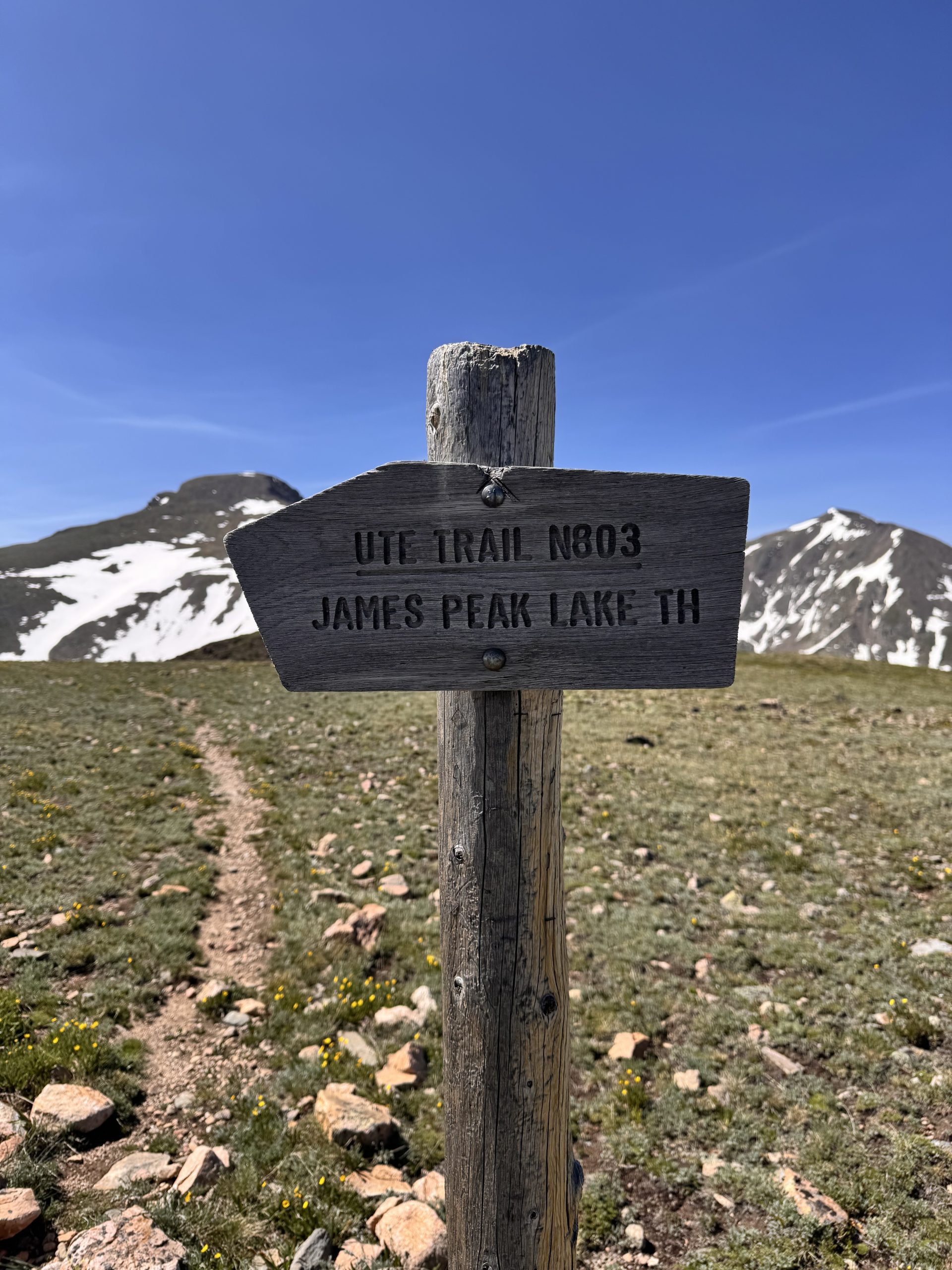
Day 54: 26.7 miles/ 3,000 ft gain
The chilly morning air and the long day ahead made it difficult to get out of our cozy sleeping bags. I made coffee while Devin slept a little longer. Though, we were still on the move by 7:00am. There were several comments on Far Out for this section about the lack of views but abundant wildlife. We kept our eyes peeled while we were hiking. While there was plenty of evidence of animals in the area, we didn’t see much. We have been a little unlucky with animal sightings, but there is still plenty of time to see some!
For the first 6 miles, the trail crossed through several areas of low alpine meadows, Lodgepole and Ponderosa Pine forests and marshy wetlands near creeks before we descended toward Monarch Lake. We encountered many day hikers and families fishing or swimming from Monarch Lake to the outlet of Lake Grandby. It was quite the sight after being nearly alone for the last several days!
The trail climbed up the ridge on the south end of the lake. It was exposed and brutal in the midday heat, but pretty short and had a great view from the top. The last 9 miles of the day traversed along the east edge of Lake Granby, the Colorado River and Shadow Mountain Lake. The lake breeze was a nice reprieve from the heat, but it was hard to watch all of the weekend boaters enjoying the water while we trudged on. I wished one of them would cut their engines and ask if we wanted a ride, but alas, we kept hiking.
We got to the trailhead at the edge of town and decided to camp at the Grand Lake Center. This was about another mile of road walk, but wasn’t too tough. Devin’s plan was to slack pack through Rocky Mountain the next day so we needed a spot he could leave early without having to pack up from. The Center is super generous to let hikers camp and use their facilities. We even got access to bikes to ride around town with! 


